Elbow Scar

Coastal Marsh, Saltings in Lancashire South Lakeland

England

Elbow Scar

Looking towards Moat Scar Near Sea Mill
Looking towards Moat Scar Credit: Michael Graham

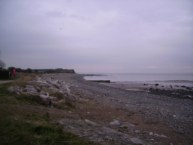
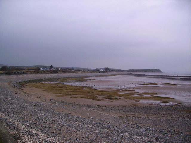
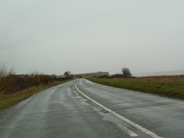
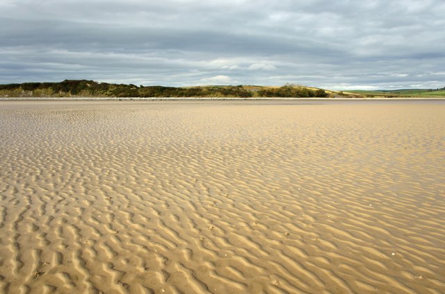
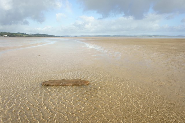
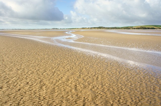
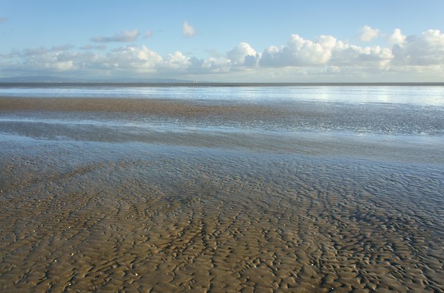
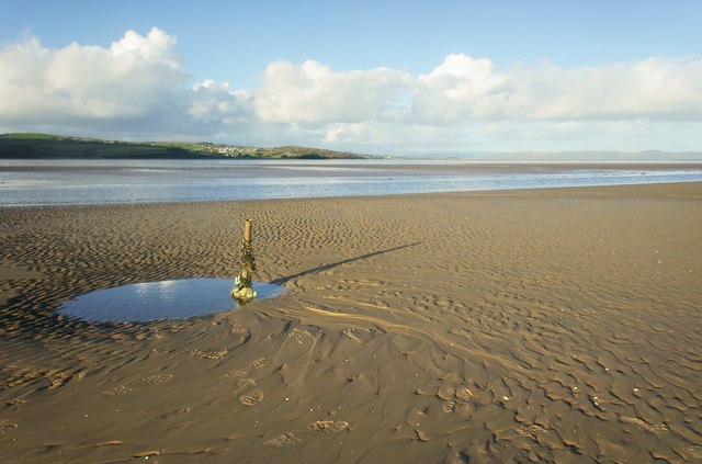
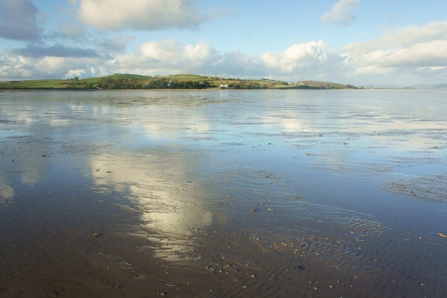
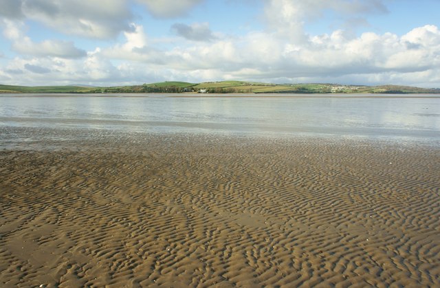
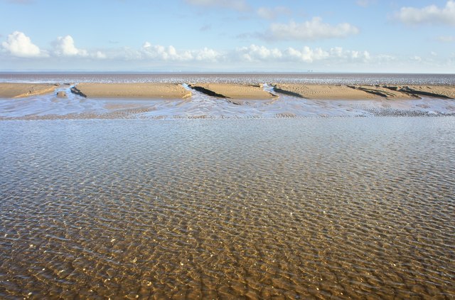
Elbow Scar is a coastal marsh area located in Lancashire, England, known for its unique saltings landscape. Situated along the Irish Sea coast, it spans approximately 2 miles in length and is characterized by its diverse flora and fauna.

The marshland of Elbow Scar is predominantly composed of saltmarsh, a type of wetland that is regularly flooded by seawater due to its proximity to the coast. This creates a distinctive habitat for a variety of plant and animal species that have adapted to survive in this saline environment. The area is home to a range of salt-tolerant plants, such as sea lavender, glasswort, and sea purslane, which thrive in the marshy soil.

The marshes of Elbow Scar also support a diverse range of birdlife, making it a popular destination for birdwatchers. Species such as curlews, oystercatchers, and redshanks can often be spotted wading in the shallow waters, feeding on the abundant invertebrates that inhabit the marshes. During the winter months, the area becomes an important haven for migrating birds, including brent geese and dunlins.

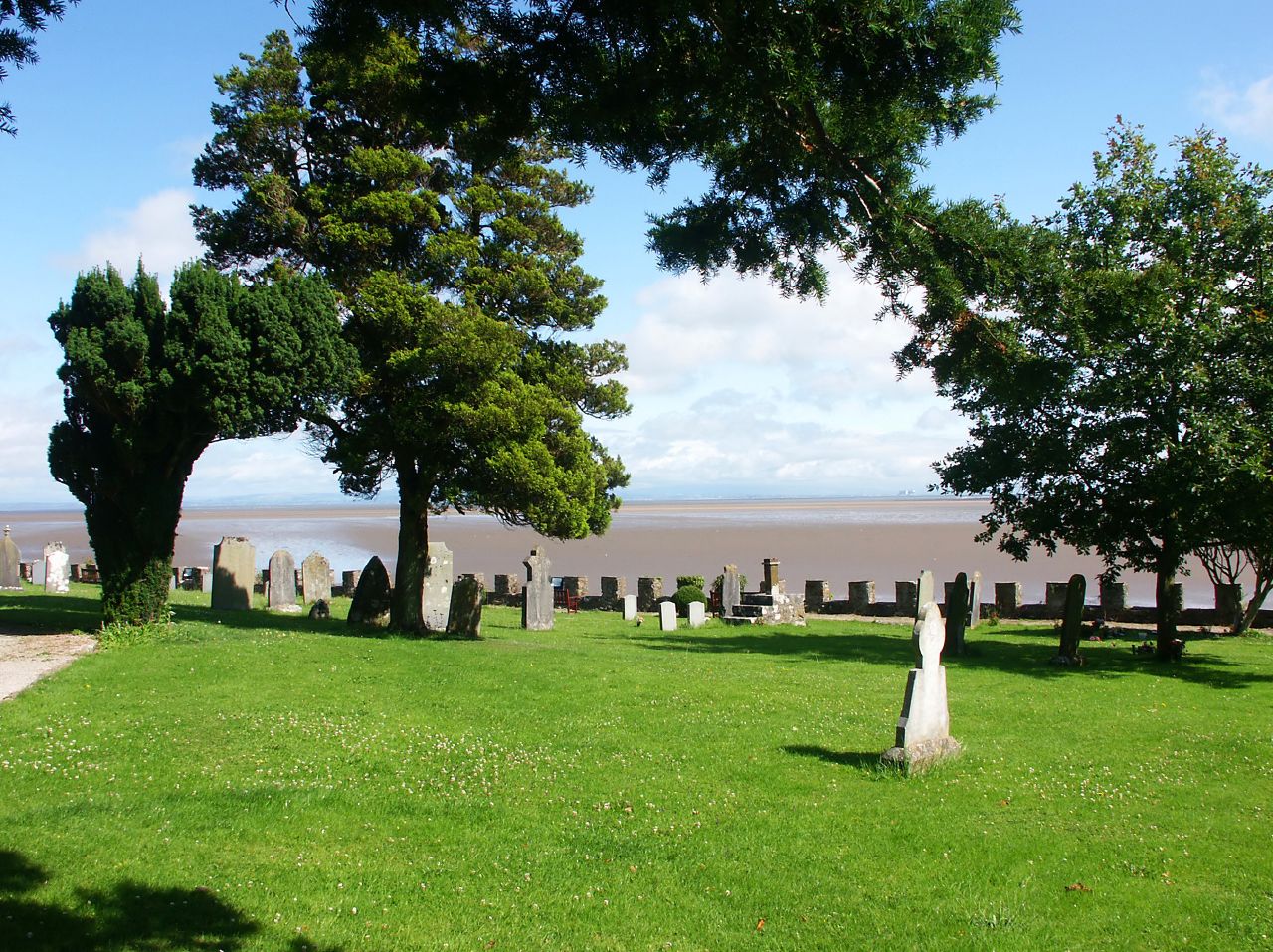
In addition to its ecological significance, Elbow Scar is also of historical interest. It is believed that the area was once a tidal creek, and remnants of an ancient salt-making industry can still be seen in the form of old salt pans and small channels. These historical features, combined with the stunning coastal views and rich biodiversity, make Elbow Scar a popular destination for nature enthusiasts and those seeking to explore Lancashire's natural beauty.

If you have any feedback on the listing, please let us know in the comments section below.

Elbow Scar Images

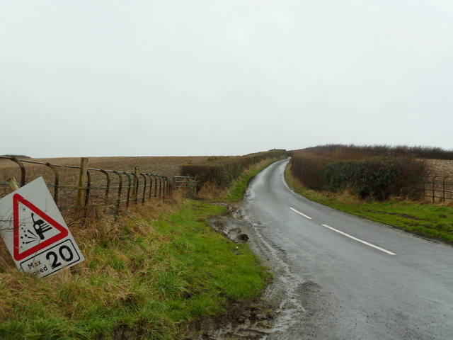
Images are sourced within 2km of 54.124569/-3.1008705 or Grid Reference SD2870. Thanks to Geograph Open Source API. All images are credited.

Looking towards Moat Scar Near Sea Mill
Looking towards Moat Scar
Near Sea Mill
Coast at Newbiggin Looking north east
Coast at Newbiggin
Looking north east
Coast Road the A5087 south of Newbiggin
Coast Road the A5087 north of Newbiggin
Riddings Lane off Coast Road
Sand flat in Morecambe Bay Out on the sands looking back to Moat Scar
Sand flat in Morecambe Bay
Out on the sands looking back to Moat Scar
Sand flat in Morecambe Bay Out on the sands looking north east towards the Lake District
Sand flat in Morecambe Bay
Out on the sands looking north east towards the Lake District
Drift Lumber in the intertidal zone
Sand Flat in the intertidal zone The village of Newbiggin can be seen left of centre
Sand Flat in the intertidal zone
The village of Newbiggin can be seen left of centre
Sand flat in the intertidal zone On the horizon seen 15 kilometres across Morecambe bay are the nuclear power stations at Heysham
Sand flat in the intertidal zone
On the horizon seen 15 kilometres across Morecambe bay are the nuclear power stations at Heysham
Metal post on a sand bank Above the metal post the village of Baycliff can be seen 2.5 kilometres away in the distance
Metal post on a sand bank
Above the metal post the village of Baycliff can be seen 2.5 kilometres away in the distance
Channel meandering through the sand
Sand flat in the intertidal zone St Cuthbert’s Church Aldingham is just left of the white building
Sand flat in the intertidal zone
St Cuthbert’s Church Aldingham is just left of the white building
Buoys on a sand flat The village of Newbiggin is seen above the pink buoy
Buoys on a sand flat
The village of Newbiggin is seen above the pink buoy
Buoy on a sand flat
Buoy on a sand flat
Sand flat in the intertidal zone St Cuthbert’s Church Aldingham is just to the left of the white building
Sand flat in the intertidal zone
St Cuthbert’s Church Aldingham is just to the left of the white building
Iron pipe The pipe is embedded in a concrete structure marked on the map as an Outflow
Iron pipe
The pipe is embedded in a concrete structure marked on the map as an Outflow
Sandbank in Morecambe Bay On the horizon seen 15 kilometres across Morecambe Bay are the nuclear power stations at Heysham.
Sandbank in Morecambe Bay
On the horizon seen 15 kilometres across Morecambe Bay are the nuclear power stations at Heysham.
Show me another place!

Elbow Scar is located at Grid Ref: SD2870 (Lat: 54.124569, Lng: -3.1008705)

Administrative County: Cumbria

District: South Lakeland

Police Authority: Cumbria

What 3 Words

///signed.return.propelled. Near Dalton in Furness, Cumbria

Nearby Locations

Elbow Scar

Related Wikis

Aldingham

Aldingham is a village and civil parish in the South Lakeland district of Cumbria, England. Historically in Lancashire, it is situated on the east coast...

Newbiggin, Furness

Newbiggin is a village on the A5087 road, in Furness, in the South Lakeland district, in the English county of Cumbria. Historically in Lancashire, nearby...

Baycliff

Baycliff is a seaside village in the South Lakeland District of Cumbria in England. Historically in Lancashire, it lies 3 miles (4.8 km) south of Ulverston...

Scales, Aldingham

Scales is a small village in Westmorland and Furness, Cumbria, England. The town of Ulverston is around 3.5 miles south of the village. The name Scales...

Nearby Amenities

Located within 500m of 54.124569,-3.1008705
Source: PGS
Lat/Long: 54.1216503/-3.1039548
Source: PGS
Lat/Long: 54.1224872/-3.1043399
Source: PGS
Lat/Long: 54.1227592/-3.1043255
Source: PGS
Lat/Long: 54.123074/-3.104079
Source: PGS
Lat/Long: 54.1233405/-3.1038728
Source: PGS
Lat/Long: 54.1236479/-3.1034394
Source: PGS
Lat/Long: 54.1238052/-3.1032216
Source: PGS
Lat/Long: 54.1239805/-3.103078
Source: PGS
Lat/Long: 54.1240911/-3.1029157
Source: PGS
Lat/Long: 54.124185/-3.1027828
Source: PGS
Lat/Long: 54.1243242/-3.1025745
Source: PGS
Lat/Long: 54.1244824/-3.102389
Source: PGS
Lat/Long: 54.1247806/-3.1020702
Source: PGS
Lat/Long: 54.1249779/-3.1018934
Source: PGS
Lat/Long: 54.1251554/-3.1017226
Source: PGS
Lat/Long: 54.1254213/-3.1015278
Source: PGS
Lat/Long: 54.1259161/-3.1012094
Source: PGS
Lat/Long: 54.1268016/-3.1009502
Source: PGS
Lat/Long: 54.1271121/-3.100912
Source: PGS
Lat/Long: 54.1273804/-3.1008919
Source: PGS
Lat/Long: 54.1276453/-3.1008115
Source: PGS
Lat/Long: 54.1278465/-3.1007914
Source: PGS
Lat/Long: 54.1280648/-3.100669
Source: PGS
Lat/Long: 54.1283295/-3.1003545
Source: PGS
Lat/Long: 54.1286104/-3.0997869
Source: PGS
Lat/Long: 54.1287949/-3.0994795
Bus Stop
Moat Farm
Bus: yes
Naptan AtcoCode: 090079010676
Naptan Bearing: N
Naptan CommonName: Moat Farm
Naptan Indicator: opp
Naptan Landmark: Moat Farm
Naptan NaptanCode: cumdgmdj
Naptan Street: B5087
Naptan Verified: no
Public Transport: platform
Source: naptan_import
Lat/Long: 54.1217735/-3.1056749
Bus Stop
Ladycroft Cottage (N bound)
Bus: yes
Naptan AtcoCode: 090079010683
Naptan Bearing: N
Naptan CommonName: Ladycroft Cottage (N bound)
Naptan Indicator: opp
Naptan Landmark: junction Aldingham Road End
Naptan NaptanCode: cumdgmdm
Naptan Street: B5087
Naptan Verified: no
Public Transport: platform
Source: naptan_import
Lat/Long: 54.1276308/-3.1022374
Bus Stop
Ladycroft Cottage (S bound)
Bus: yes
Local Ref: AT
Naptan AtcoCode: 090079010685
Naptan Bearing: S
Naptan CommonName: Ladycroft Cottage (S bound)
Naptan Indicator: at
Naptan Landmark: road end to Aldingham
Naptan NaptanCode: cumdgmdp
Naptan Street: B5087
Naptan Verified: no
Public Transport: platform
Source: naptan_import
Lat/Long: 54.1281644/-3.1017588
Barrier: stile
Lat/Long: 54.127926/-3.102036
The data included in this document is from www.openstreetmap.org. The data is made available under ODbL.

Have you been to Elbow Scar?

Leave your review of Elbow Scar below (or comments, questions and feedback).