Little Bank

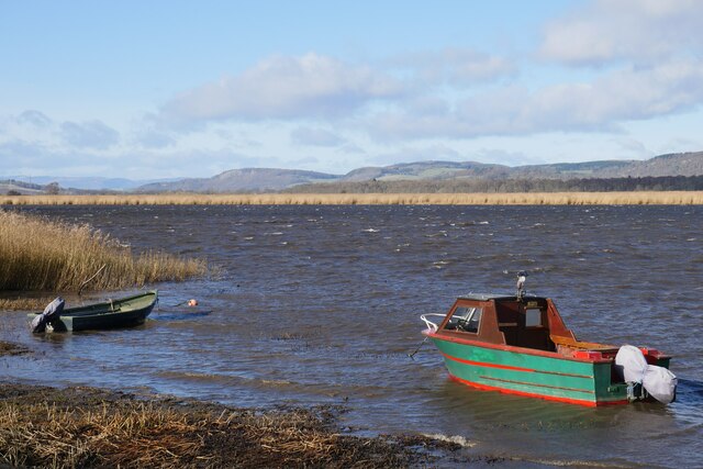
Coastal Marsh, Saltings in Fife

Scotland

Little Bank

Lindores Hill The foreground and the forestry are all in this grid square, but one has to admit that it's the view that catches the eye. On the left, in the distance, is the prominent hump of West Lomond. Ormiston Hill rises steeply from the town of Newburgh, and in the sunshine to the right is the estuary of the River Tay.
Lindores Hill Credit: Anne Burgess

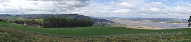
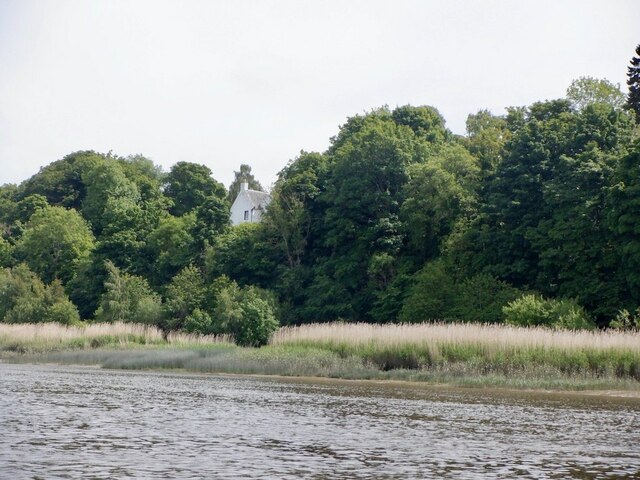
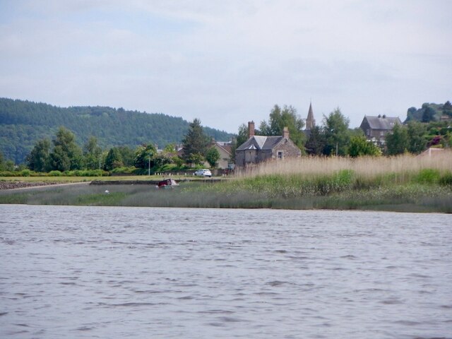
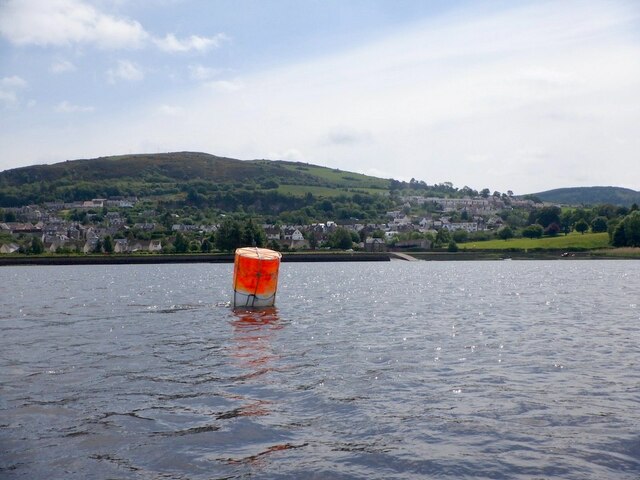
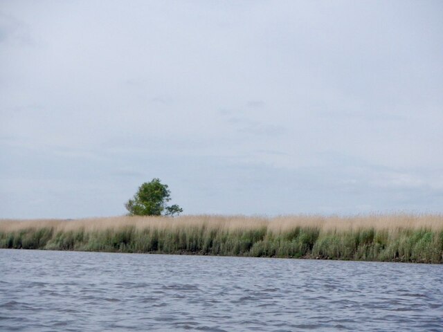
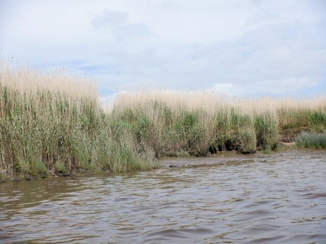
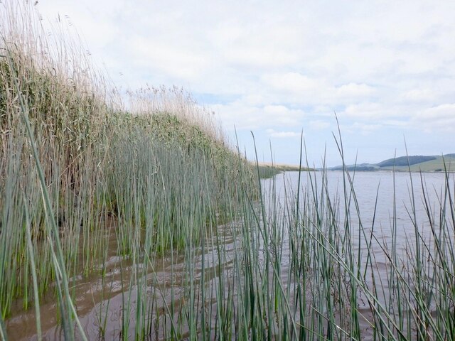
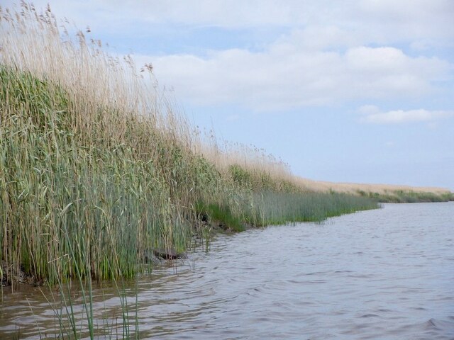
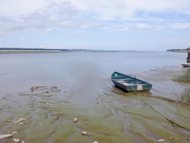
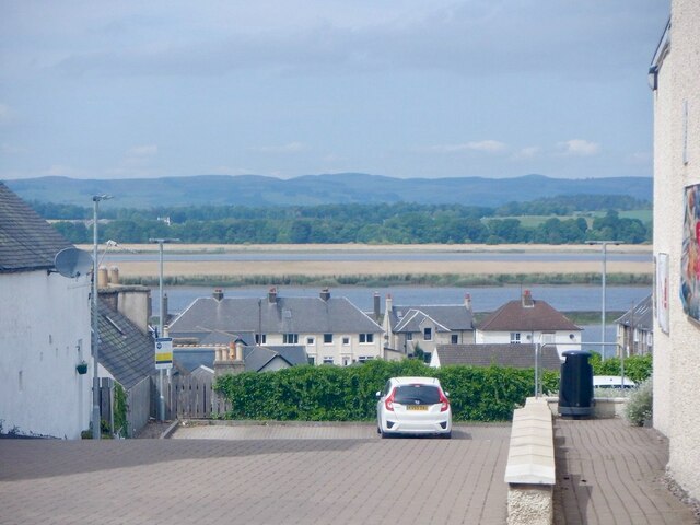
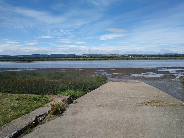
Little Bank is a small coastal marsh located in Fife, Scotland. Situated along the eastern coast of Scotland, it is a significant feature of the local landscape. The marsh stretches across an area characterized by low-lying, flat terrain and is known for its saltings, which are areas of land that are regularly flooded by the tide.

The coastal marsh is home to a diverse range of flora and fauna, making it an important habitat for wildlife. The vegetation in the area is largely composed of salt-tolerant plants, such as saltmarsh grasses and samphire. These plants provide food and shelter for a variety of bird species, including wading birds and waterfowl, which can be observed feeding and nesting in the area.

Little Bank is also known for its ecological importance. The marsh acts as a buffer zone, protecting the land from coastal erosion and providing a natural flood defense during storm surges. It helps to absorb excess water and filter out pollutants, improving water quality and preventing soil erosion.

The area is popular among nature enthusiasts and birdwatchers, who visit to observe the diverse range of bird species that inhabit the marsh. The coastal location also offers stunning views of the surrounding landscape and the nearby North Sea.

In summary, Little Bank in Fife is a coastal marsh characterized by its saltings and diverse range of flora and fauna. It serves as an important habitat for wildlife, provides ecological benefits, and attracts visitors who appreciate its natural beauty.

If you have any feedback on the listing, please let us know in the comments section below.

Little Bank Images

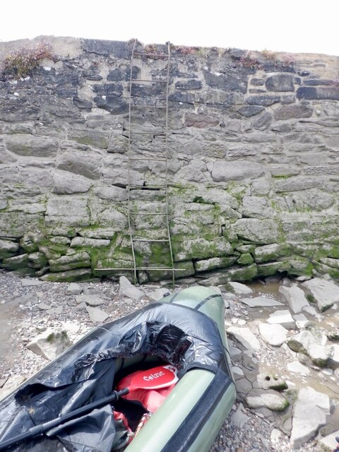
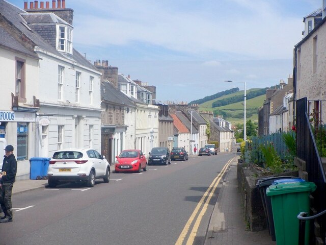
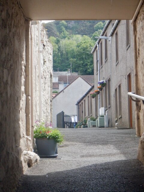
Images are sourced within 2km of 56.35992/-3.2290883 or Grid Reference NO2419. Thanks to Geograph Open Source API. All images are credited.

Lindores Hill The foreground and the forestry are all in this grid square, but one has to admit that it's the view that catches the eye. On the left, in the distance, is the prominent hump of West Lomond. Ormiston Hill rises steeply from the town of Newburgh, and in the sunshine to the right is the estuary of the River Tay.
Lindores Hill
The foreground and the forestry are all in this grid square, but one has to admit that it's the view that catches the eye. On the left, in the distance, is the prominent hump of West Lomond. Ormiston Hill rises steeply from the town of Newburgh, and in the sunshine to the right is the estuary of the River Tay.
Mugdrum House Near Newburgh
Mugdrum House
Near Newburgh
Newburgh seen from the South Deep Newburgh offers some escape routes off the water without too much interaction with the mud. Make sure you are on the right side of The Hard though. The ebb tide runs fast close to the shore here, unlike the slower flow by Mugdrum Island.
Newburgh seen from the South Deep
Newburgh offers some escape routes off the water without too much interaction with the mud. Make sure you are on the right side of The Hard though. The ebb tide runs fast close to the shore here, unlike the slower flow by Mugdrum Island.
Navigation marker off Newburgh One of a pair of bright orange marker barrels off Mugdrum Island.
Navigation marker off Newburgh
One of a pair of bright orange marker barrels off Mugdrum Island.
Mugdrum Island
Mugdrum Island
Reed beds, Mugdrum Island There is a sea wall around the centre of the island this is surrounded by  extensive reed beds.
Reed beds, Mugdrum Island
There is a sea wall around the centre of the island this is surrounded by extensive reed beds.
Reed beds, Mugdrum Island
Newburgh Harbour A relatively mud free corner enabled a clean exit off the river at around 2 hours before low water. I would not want to have got here much later. 
I had also just dropped my camera in the not so silvery Tay and was glad for a quick retrieval although it would have soon turned up as the tide fell.

The way out is by the metal ladder.
Newburgh Harbour
A relatively mud free corner enabled a clean exit off the river at around 2 hours before low water. I would not want to have got here much later. I had also just dropped my camera in the not so silvery Tay and was glad for a quick retrieval although it would have soon turned up as the tide fell. The way out is by the metal ladder.
Newburgh Harbour and the South Deep The mud was avoidable when taking out - just.
Newburgh Harbour and the South Deep
The mud was avoidable when taking out - just.
High Street, Newburgh
Reef Mog A close off Newburgh High Street.
Reef Mog
A close off Newburgh High Street.
Shop, Newburgh High Street Number plate designs of the time.  There was a current craze for three dimensional plates or 4D as they call them here.
Shop, Newburgh High Street
Number plate designs of the time. There was a current craze for three dimensional plates or 4D as they call them here.
Car park, Newburgh With a view over Mugdrum Island.
Car park, Newburgh
With a view over Mugdrum Island.
Ramp into the mud The River Tay at Newburgh at low tide. Small tufts of grass sticking out. Mugdrum Island is the much bigger bit of land in the middle of the river.
Ramp into the mud
The River Tay at Newburgh at low tide. Small tufts of grass sticking out. Mugdrum Island is the much bigger bit of land in the middle of the river.
Beginning of the Fife Coastal Path in Newburgh Gateway in the public park on the west side of Newburgh marking the beginning of the Fife Coastal Path.
Beginning of the Fife Coastal Path in Newburgh
Gateway in the public park on the west side of Newburgh marking the beginning of the Fife Coastal Path.
Newburgh War Memorial The war memorial on the west side of Newburgh, with the High Street to the right.
Newburgh War Memorial
The war memorial on the west side of Newburgh, with the High Street to the right.
A breezy day at Newburgh A strong westerly (courtesy of a dissipating 'Storm Otto') churns up the River Tay on a beautiful February morning.
A breezy day at Newburgh
A strong westerly (courtesy of a dissipating 'Storm Otto') churns up the River Tay on a beautiful February morning.
Show me another place!

Little Bank is located at Grid Ref: NO2419 (Lat: 56.35992, Lng: -3.2290883)

Unitary Authority: Perth and Kinross

Police Authority: Tayside

What 3 Words

///rather.endlessly.asteroid. Near Newburgh, Fife

Related Wikis

Lindores Abbey

Lindores Abbey was a Tironensian abbey on the outskirts of Newburgh in Fife, Scotland. Now a reduced ruin, it lies on the southern banks of the River Tay...

Lindores Abbey distillery

Lindores Abbey distillery is a Scotch whisky distillery in Newburgh in the Lowlands whisky region in Scotland and is directly opposite the Abbey. It started...

Newburgh, Fife

Newburgh is a royal burgh and parish in Fife, Scotland, at the south shore of the Firth of Tay. The town has a population of 2,171 (in 2011), which constitutes...

Clatchard Craig

The fort of Clatchard Craig was located on a hill of the same name by the Tay. A human presence on the site has been identified from the neolithic period...

Nearby Amenities

Located within 500m of 56.35992,-3.2290883
Created By: almien_coastlines
Lat/Long: 56.359498/-3.236329
Created By: almien_coastlines
Lat/Long: 56.359627/-3.235869
The data included in this document is from www.openstreetmap.org. The data is made available under ODbL.

Have you been to Little Bank?

Leave your review of Little Bank below (or comments, questions and feedback).