Croy Point

Coastal Marsh, Saltings in Fife

Scotland

Croy Point

Lindores Hill The foreground and the forestry are all in this grid square, but one has to admit that it's the view that catches the eye. On the left, in the distance, is the prominent hump of West Lomond. Ormiston Hill rises steeply from the town of Newburgh, and in the sunshine to the right is the estuary of the River Tay.
Lindores Hill Credit: Anne Burgess

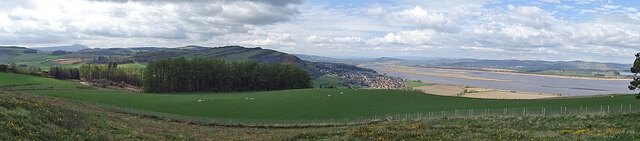
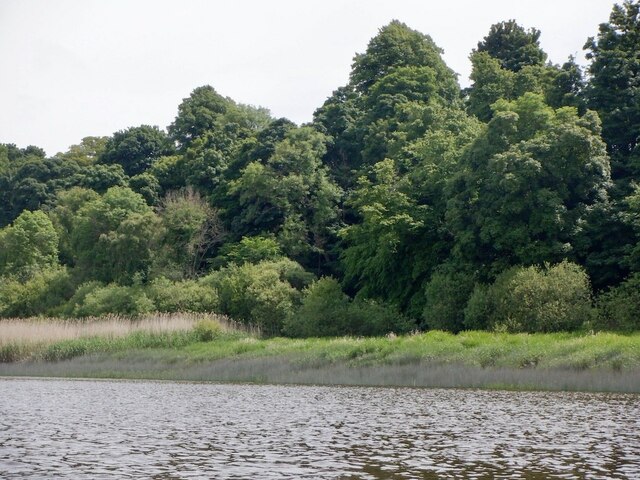
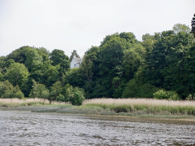
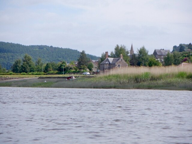
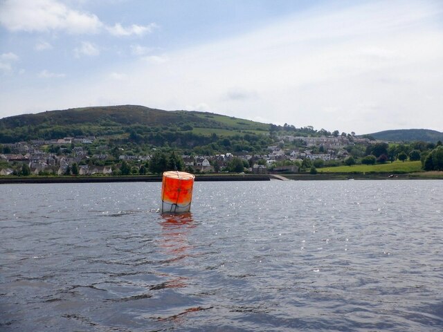
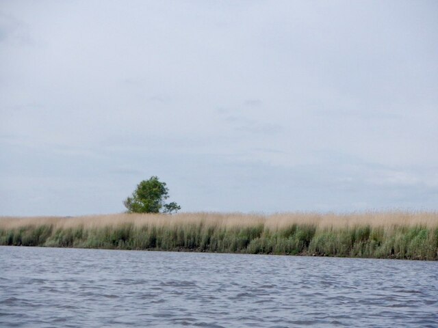
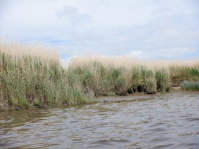
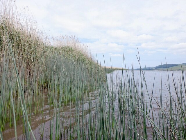
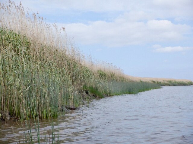
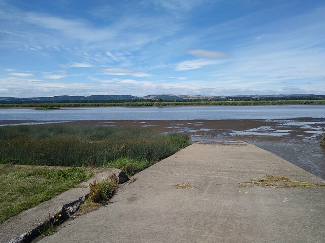
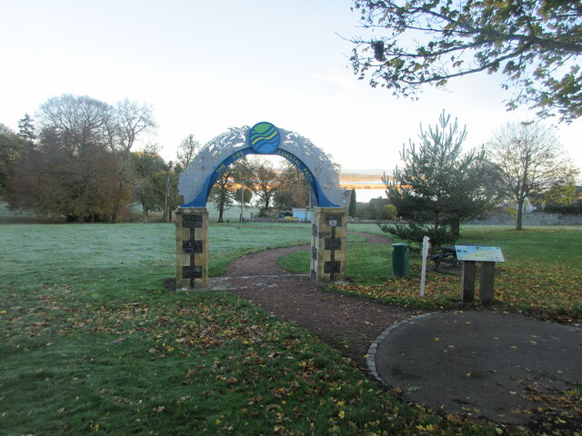
Croy Point is a coastal marshland located in Fife, Scotland. Situated on the northern shore of the Firth of Tay, it is known for its unique and diverse ecosystem. The area is characterized by its vast expanse of salt marshes and saltings.

The marshland at Croy Point is home to a wide variety of plant and animal species. The salt marshes are dominated by plants such as sea aster, sea lavender, and sea purslane, which are specially adapted to the high salt content of the soil. These plants provide crucial habitat and food sources for a range of bird species, including wading birds like redshanks and curlews.

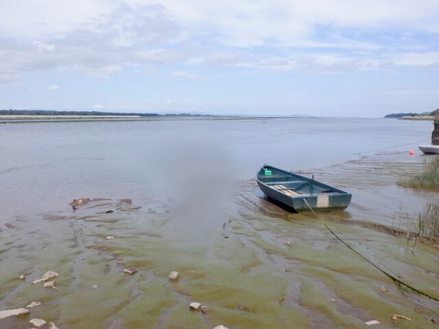
The intertidal mudflats found at Croy Point are also of great importance. They provide feeding grounds for migratory birds, as well as providing a habitat for various invertebrates and shellfish. These mudflats are known to support populations of shrimp, worms, and crabs.

Croy Point is also considered a significant site for birdwatching. During the winter months, visitors can observe large flocks of geese, swans, and ducks that use the marshland as a stopover on their migratory routes.

In addition to its ecological significance, Croy Point offers stunning views of the surrounding landscape. From the marshland, visitors can admire the expansive estuary, the Tay Rail Bridge, and the distant mountains.

Overall, Croy Point in Fife is a remarkable coastal marshland, rich in biodiversity and providing important habitat for various species. It is a haven for nature enthusiasts and a place of scenic beauty.

If you have any feedback on the listing, please let us know in the comments section below.

Croy Point Images

Images are sourced within 2km of 56.35526/-3.2323531 or Grid Reference NO2318. Thanks to Geograph Open Source API. All images are credited.

Lindores Hill The foreground and the forestry are all in this grid square, but one has to admit that it's the view that catches the eye. On the left, in the distance, is the prominent hump of West Lomond. Ormiston Hill rises steeply from the town of Newburgh, and in the sunshine to the right is the estuary of the River Tay.
Lindores Hill
The foreground and the forestry are all in this grid square, but one has to admit that it's the view that catches the eye. On the left, in the distance, is the prominent hump of West Lomond. Ormiston Hill rises steeply from the town of Newburgh, and in the sunshine to the right is the estuary of the River Tay.
South bank of the Firth of Tay Near Newburgh.
South bank of the Firth of Tay
Near Newburgh.
Mugdrum House Near Newburgh
Mugdrum House
Near Newburgh
Newburgh seen from the South Deep Newburgh offers some escape routes off the water without too much interaction with the mud. Make sure you are on the right side of The Hard though. The ebb tide runs fast close to the shore here, unlike the slower flow by Mugdrum Island.
Newburgh seen from the South Deep
Newburgh offers some escape routes off the water without too much interaction with the mud. Make sure you are on the right side of The Hard though. The ebb tide runs fast close to the shore here, unlike the slower flow by Mugdrum Island.
Navigation marker off Newburgh One of a pair of bright orange marker barrels off Mugdrum Island.
Navigation marker off Newburgh
One of a pair of bright orange marker barrels off Mugdrum Island.
Mugdrum Island
Mugdrum Island
Reed beds, Mugdrum Island There is a sea wall around the centre of the island this is surrounded by  extensive reed beds.
Reed beds, Mugdrum Island
There is a sea wall around the centre of the island this is surrounded by extensive reed beds.
Reed beds, Mugdrum Island
Newburgh Harbour A relatively mud free corner enabled a clean exit off the river at around 2 hours before low water. I would not want to have got here much later. 
I had also just dropped my camera in the not so silvery Tay and was glad for a quick retrieval although it would have soon turned up as the tide fell.

The way out is by the metal ladder.
Newburgh Harbour
A relatively mud free corner enabled a clean exit off the river at around 2 hours before low water. I would not want to have got here much later. I had also just dropped my camera in the not so silvery Tay and was glad for a quick retrieval although it would have soon turned up as the tide fell. The way out is by the metal ladder.
Newburgh Harbour and the South Deep The mud was avoidable when taking out - just.
Newburgh Harbour and the South Deep
The mud was avoidable when taking out - just.
High Street, Newburgh
Reef Mog A close off Newburgh High Street.
Reef Mog
A close off Newburgh High Street.
Shop, Newburgh High Street Number plate designs of the time.  There was a current craze for three dimensional plates or 4D as they call them here.
Shop, Newburgh High Street
Number plate designs of the time. There was a current craze for three dimensional plates or 4D as they call them here.
Car park, Newburgh With a view over Mugdrum Island.
Car park, Newburgh
With a view over Mugdrum Island.
Ramp into the mud The River Tay at Newburgh at low tide. Small tufts of grass sticking out. Mugdrum Island is the much bigger bit of land in the middle of the river.
Ramp into the mud
The River Tay at Newburgh at low tide. Small tufts of grass sticking out. Mugdrum Island is the much bigger bit of land in the middle of the river.
Beginning of the Fife Coastal Path in Newburgh Gateway in the public park on the west side of Newburgh marking the beginning of the Fife Coastal Path.
Beginning of the Fife Coastal Path in Newburgh
Gateway in the public park on the west side of Newburgh marking the beginning of the Fife Coastal Path.
Newburgh War Memorial The war memorial on the west side of Newburgh, with the High Street to the right.
Newburgh War Memorial
The war memorial on the west side of Newburgh, with the High Street to the right.
Show me another place!

Croy Point is located at Grid Ref: NO2318 (Lat: 56.35526, Lng: -3.2323531)

Unitary Authority: Fife

Police Authority: Fife

What 3 Words

///toxic.strides.lilac. Near Newburgh, Fife

Nearby Locations

Croy Point Newburgh

Related Wikis

Lindores Abbey

Lindores Abbey was a Tironensian abbey on the outskirts of Newburgh in Fife, Scotland. Now a reduced ruin, it lies on the southern banks of the River Tay...
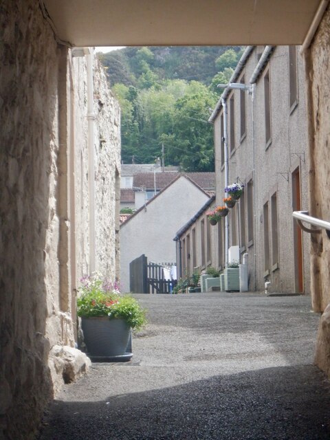
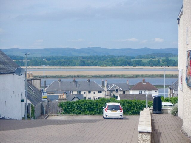
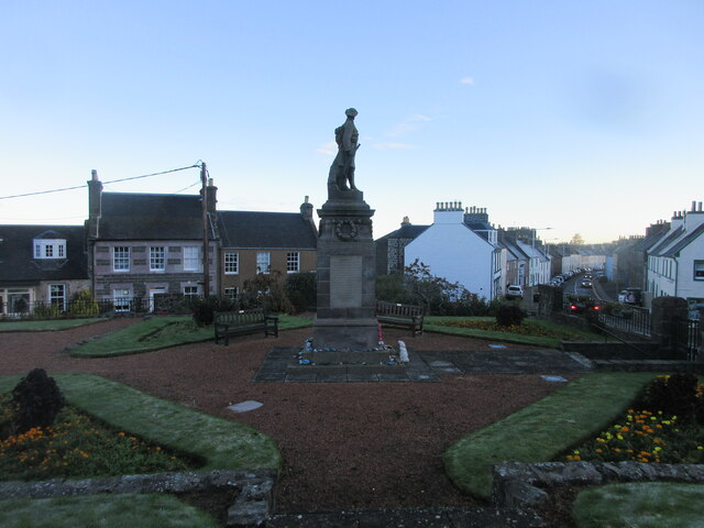
Newburgh, Fife

Newburgh is a royal burgh and parish in Fife, Scotland, at the south shore of the Firth of Tay. The town has a population of 2,171 (in 2011), which constitutes...

Lindores Abbey distillery

Lindores Abbey distillery is a Scotch whisky distillery in Newburgh in the Lowlands whisky region in Scotland and is directly opposite the Abbey. It started...

Clatchard Craig

The fort of Clatchard Craig was located on a hill of the same name by the Tay. A human presence on the site has been identified from the neolithic period...

Newburgh railway station

See also Parbold railway station which was originally named "Newburgh railway station". There have been several railway stations serving the town of Newburgh...

Mugdrum Island

Mugdrum Island lies in the Firth of Tay, offshore from the town of Newburgh, Fife, in the east of Scotland. == Geography == Mugdrum is low-lying and reedy...
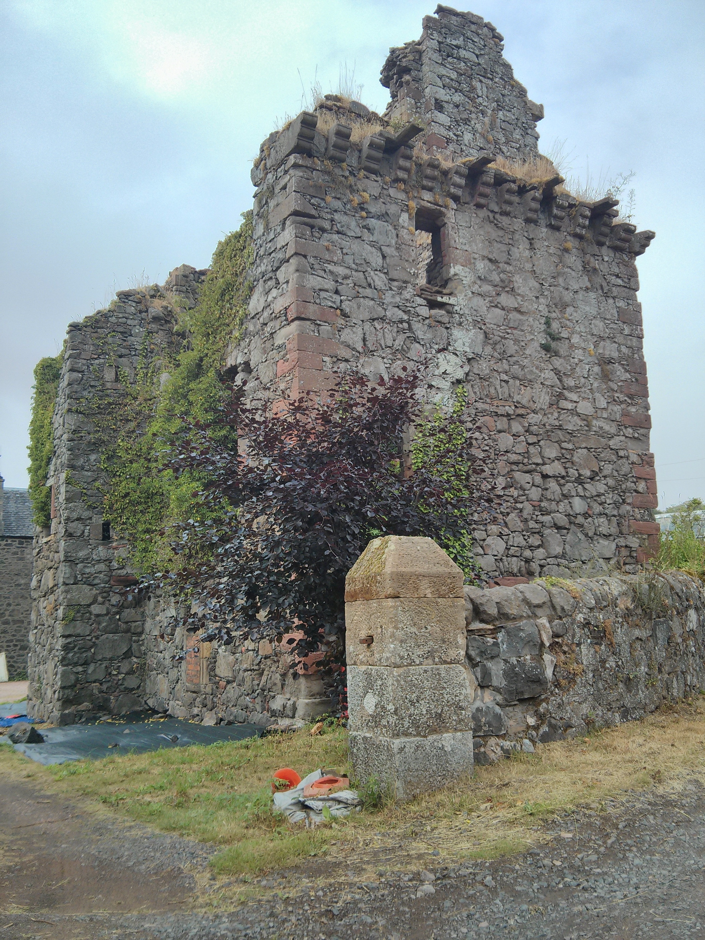
Denmylne Castle

Denmylne Castle is a ruined 16th-century tower house, about 1 mile (1.6 km) south east of Newburgh, Fife, Fife, Scotland, and 1 mile (1.6 km) north west...

Glenburnie railway station

Glenburnie railway station was a temporary terminus that served the area of Glenburnie, Fife, Scotland from 1847 to 1848 on the Edinburgh and Northern...

Nearby Amenities

Located within 500m of 56.35526,-3.2323531
Crossing
Crossing: traffic_signals
Kerb: flush
Tactile Paving: yes
Lat/Long: 56.350829/-3.2312317
Give Way
Direction: forward
Lat/Long: 56.3519541/-3.2355528
Give Way
Direction: backward
Lat/Long: 56.3520538/-3.2359005
Give Way
Direction: forward
Lat/Long: 56.3520129/-3.2366637
Entrance: staircase
Lat/Long: 56.3518885/-3.2357484
Entrance: staircase
Lat/Long: 56.3519023/-3.236122
Location: outdoor
Power: substation
Substation: minor_distribution
Lat/Long: 56.3530583/-3.2385179
Give Way
Direction: backward
Lat/Long: 56.3530218/-3.2318325
Give Way
Direction: forward
Lat/Long: 56.3528851/-3.2338778
Give Way
Direction: backward
Lat/Long: 56.3521406/-3.2281901
Give Way
Direction: forward
Lat/Long: 56.3516375/-3.2302836
Entrance: main
Lat/Long: 56.3509737/-3.2313816
Give Way
Direction: backward
Lat/Long: 56.3522127/-3.2334526
Bus Stop
Bus: yes
Public Transport: platform
Lat/Long: 56.3511174/-3.2346137
Post Box
Collection Times: Mo-Fr 09:00; Sa 07:00
Manufacturer: Carron Company Stirlingshire
Operator: Royal Mail
Post Box Mounting: pier
Post Box Type: lamp
Ref: KY14 338D
Royal Cypher: scottish_crown
Source: survey
Lat/Long: 56.3516252/-3.2304843
The data included in this document is from www.openstreetmap.org. The data is made available under ODbL.

Have you been to Croy Point?

Leave your review of Croy Point below (or comments, questions and feedback).