Crammond Foreshore
Coastal Marsh, Saltings in Midlothian
Scotland
Crammond Foreshore

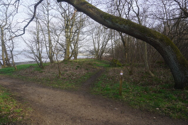
Crammond Foreshore, located in Midlothian, Scotland, is a captivating coastal marshland known for its unique blend of natural beauty and historical significance. Spanning approximately 1.5 kilometers along the southern banks of the Firth of Forth, this area is characterized by its vast stretch of sandy beaches, mudflats, and saltings.
One of the key features of Crammond Foreshore is its ever-changing landscape, which is greatly influenced by the tidal movements of the Firth of Forth. During low tide, a vast expanse of sandy beach is revealed, attracting locals and tourists alike for leisurely walks and various recreational activities. At high tide, the area transforms into a mesmerizing marshland, with tidal channels and salt marshes providing a unique habitat for various plant and animal species.
The foreshore's ecological significance cannot be overstated. It serves as an important feeding and breeding ground for a wide range of bird species, including oystercatchers, curlews, and herons. The mudflats, rich in nutrients, attract a variety of wading birds, while the salt marshes are home to unique flora and fauna that have adapted to the challenging saline environment.
Apart from its natural wonders, Crammond Foreshore also boasts a rich history. The remnants of the historic Crammond Island causeway, built in the 15th century to connect the mainland to the island, can still be seen during low tide. Additionally, the foreshore is dotted with World War II defenses, including concrete anti-tank blocks and pillboxes, serving as a reminder of the area's role in the defense of the Firth of Forth.
Overall, Crammond Foreshore offers visitors a captivating blend of natural beauty, diverse wildlife, and historical intrigue, making it a must-visit destination for nature enthusiasts, history buffs, and anyone seeking a tranquil escape by the coast.
If you have any feedback on the listing, please let us know in the comments section below.
Crammond Foreshore Images
Images are sourced within 2km of 55.986054/-3.2864122 or Grid Reference NT1977. Thanks to Geograph Open Source API. All images are credited.


Crammond Foreshore is located at Grid Ref: NT1977 (Lat: 55.986054, Lng: -3.2864122)
Unitary Authority: City of Edinburgh
Police Authority: Edinburgh
What 3 Words
///shelf.plants.transfers. Near Dalgety Bay, Fife
Nearby Locations
Related Wikis
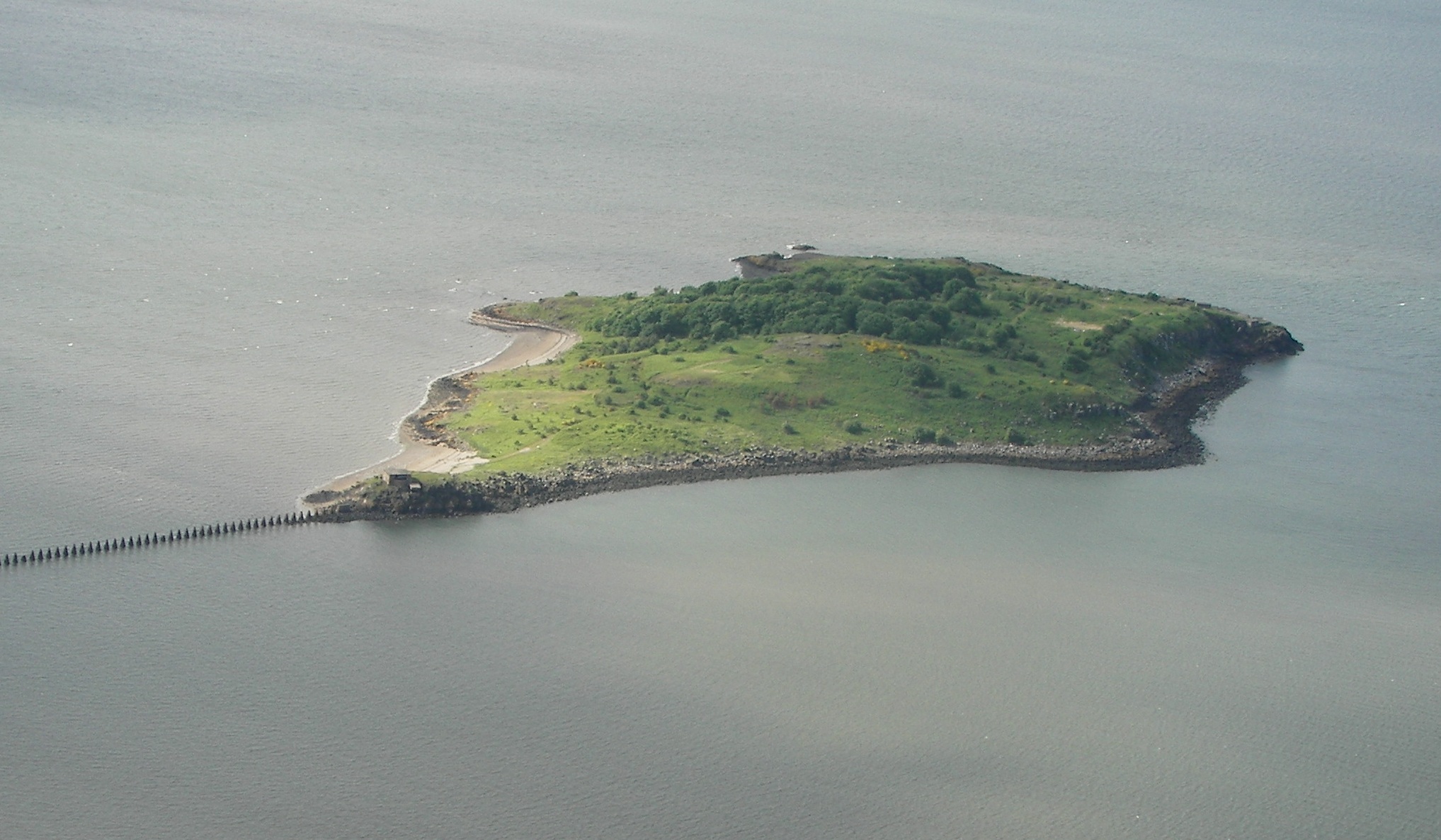
Cramond Island
Cramond Island (Scottish Gaelic: Eilean Chair Amain) is one of several islands in the Firth of Forth in eastern Scotland, near Edinburgh. It lies off the...

Cramond
Cramond Village (; Scottish Gaelic: Cair Amain) is a village and suburb in the north-west of Edinburgh, Scotland, at the mouth of the River Almond where...

Cramond Roman Fort
Cramond Roman Fort is a Roman-Era archaeological site at Cramond, Edinburgh, Scotland. The settlement may be the "Rumabo" listed in the 7th-century Ravenna...

River Almond, Lothian
The River Almond (Scottish Gaelic: Abhainn Amain) is a river in Lothian, Scotland. It is approximately 28 miles (45 km) long, rising at Hirst Hill in...

Cramond Kirk
Cramond Kirk is a church situated in the middle area Cramond parish, in the north west of Edinburgh, Scotland. Built on the site of an old Roman fort,...
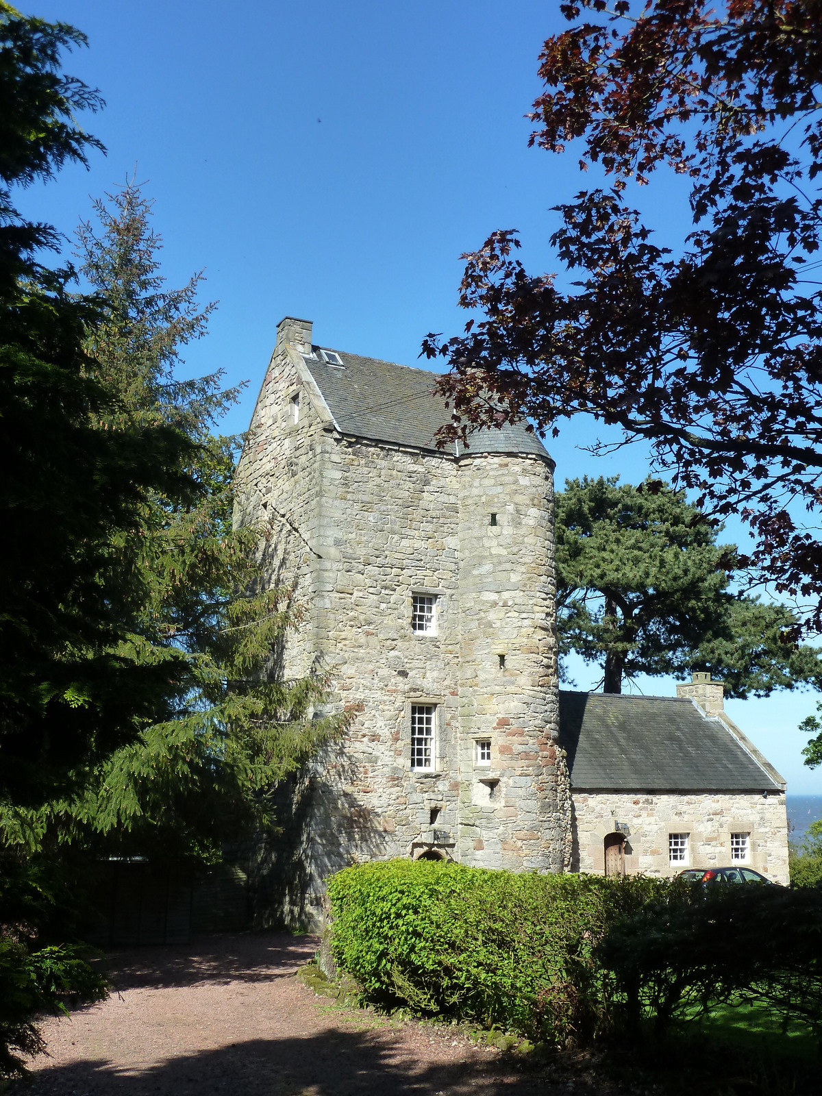
Cramond Tower
Cramond Tower is a fifteenth-century tower house in the village of Cramond to the north-west of Edinburgh, Scotland. == History == The area around the...

Lauriston Castle
Lauriston Castle is a 16th-century tower house with 19th-century extensions overlooking the Firth of Forth, in Edinburgh, Scotland. It lies on Cramond...

Granton Shrimp Bed
The Granton Shrimp Bed is a fossil-bearing deposit exposed on the southern shore of the Firth of Forth near Edinburgh, in Scotland. It is classified as...
Have you been to Crammond Foreshore?
Leave your review of Crammond Foreshore below (or comments, questions and feedback).