Crab Marsh

Coastal Marsh, Saltings in Cumberland Copeland

England

Crab Marsh

Borwick Rails looking towards Millom
Borwick Rails looking towards Millom Credit: Colin Pyle

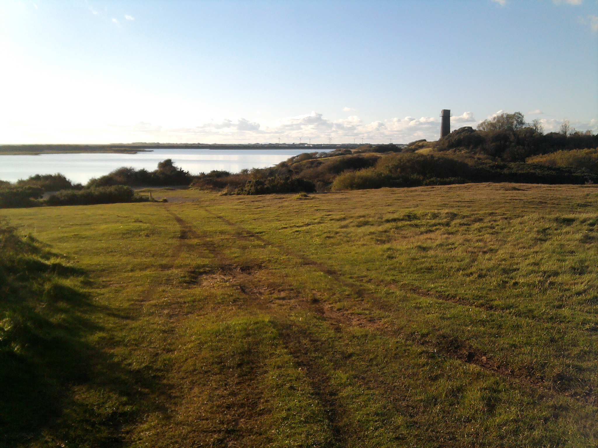
Crab Marsh, located in Cumberland, is a coastal marsh characterized by its vast expanse of salt marshes and saltings. This natural habitat is situated along the coastline, creating a unique ecosystem that supports a diverse range of flora and fauna.

The marsh is primarily composed of salt-tolerant plants, such as saltmarsh grasses and shrubs, which thrive in the brackish water environment. These plants play a vital role in stabilizing the marshland and preventing erosion. Their roots help trap sediment, allowing the marsh to gradually expand over time.

The saltings, or salt flats, found within Crab Marsh are a result of the marsh's constant interaction with the tides. As the seawater ebbs and flows, it leaves behind salt deposits on the marsh surface. This creates a distinctive landscape characterized by vast stretches of white, crystallized salt.

The marsh is home to a rich array of wildlife, including various species of birds, such as herons, egrets, and shorebirds, that rely on the marsh for nesting and foraging. Additionally, the marsh provides an important breeding ground for fish and shellfish, which in turn support the local fishing industry.

Crab Marsh is also of great ecological importance as it serves as a buffer zone against coastal erosion and storm surges. The marsh absorbs and dissipates the energy of incoming waves, protecting the adjacent land and human settlements from the destructive forces of the sea.

Overall, Crab Marsh is a vital ecosystem that supports a diverse range of plant and animal life, while also providing crucial ecological services to the surrounding area. Its unique combination of salt marshes and saltings make it a truly remarkable natural feature of Cumberland's coastal landscape.

If you have any feedback on the listing, please let us know in the comments section below.

Crab Marsh Images

Images are sourced within 2km of 54.20306/-3.2439857 or Grid Reference SD1879. Thanks to Geograph Open Source API. All images are credited.

Borwick Rails looking towards Millom
St Georges Road, Millom
Ordnance Survey Cut Mark This OS cut mark can be found on the office building east side of Mainsgate Road. It marks a point 6.514m above mean sea level.
Ordnance Survey Cut Mark
This OS cut mark can be found on the office building east side of Mainsgate Road. It marks a point 6.514m above mean sea level.
Hodbarrow lagoon and barrier This shows the remains of the inner barrier of hodbarrow ironworks lagoon and a substantial portion of the lagoon itself, which occupies the grid square identified here. The turbines at Kirksanton can be identified in the far distance to the left and the edge of Black Combe is also identifiable.
Hodbarrow lagoon and barrier
This shows the remains of the inner barrier of hodbarrow ironworks lagoon and a substantial portion of the lagoon itself, which occupies the grid square identified here. The turbines at Kirksanton can be identified in the far distance to the left and the edge of Black Combe is also identifiable.
Disused windmill at Hodbarrow This disused windmill is located on the Cumbria Coastal Way at Hodbarrow and is clearly marked in the grid square.
Disused windmill at Hodbarrow
This disused windmill is located on the Cumbria Coastal Way at Hodbarrow and is clearly marked in the grid square.
Rusty Buoy outside Youth Hostel Millom youth hostel is in this grid square and the buoy stands sentinel at the end of its garden. The photo looks across the estuary to the furness peninsula.
Rusty Buoy outside Youth Hostel
Millom youth hostel is in this grid square and the buoy stands sentinel at the end of its garden. The photo looks across the estuary to the furness peninsula.
Remains of  Pier  at Salterhouse Pool On the Duddon estuary, once an integral feature of Hodbarrow Iron Works.
Remains of Pier at Salterhouse Pool
On the Duddon estuary, once an integral feature of Hodbarrow Iron Works.
Hodbarrow sunset Sunset over the lagoon.
Hodbarrow sunset
Sunset over the lagoon.
Old lighthouse, Hodbarrow The old lighthouse from the days before the building of the outer sea wall.
Old lighthouse, Hodbarrow
The old lighthouse from the days before the building of the outer sea wall.
Millom church during a snow fall St Georges church can be seen from miles around.... in clear weather.
Millom church during a snow fall
St Georges church can be seen from miles around.... in clear weather.
View of Millom from the park Duddon estuary runs behind the town.
View of Millom from the park
Duddon estuary runs behind the town.
Hodbarrow reserve, looking to old lighthouse Broom bushes in full bloom - following the equally vivid display from the gorse.
Hodbarrow reserve, looking to old lighthouse
Broom bushes in full bloom - following the equally vivid display from the gorse.
Hodbarrow reserve, site of former iron mining and works The lagoon is the result of flooding of former mining area.
Hodbarrow reserve, site of former iron mining and works
The lagoon is the result of flooding of former mining area.
Near Hodbarrow Point, sea wall curving away in the distance
Near Hodbarrow Point
A lagoon at Hodbarrow The skyline is the far (eastern) side of the Duddon estuary.
A lagoon at Hodbarrow
The skyline is the far (eastern) side of the Duddon estuary.
St George's Church, Millom, catching the evening sun
View of Millom from the park
Show me another place!

Crab Marsh is located at Grid Ref: SD1879 (Lat: 54.20306, Lng: -3.2439857)

Administrative County: Cumbria

District: Copeland

Police Authority: Cumbria

What 3 Words

///audible.throw.flattered. Near Millom, Cumbria

Nearby Locations

Crab Marsh Borwick Rails

Related Wikis

Hodbarrow RSPB reserve

Hodbarrow RSPB Reserve is a nature reserve run by the Royal Society for the Protection of Birds (RSPB) on the edge of the Lake District National Park in...

Millom Rural District

Millom was a rural district in Cumberland in England from 1934 to 1974. It was formed by a County Review Order in 1934 by the merger of the Millom urban...

Millom

Millom is a town and civil parish on the north shore of the estuary of the River Duddon in southernmost Cumberland, Cumbria, England. It is situated just...

St George's Church, Millom

St George's Church is in the town of Millom, Cumbria, England. It is an active Anglican parish church in the deanery of Furness, the archdeaconry of Westmoreland...

Nearby Amenities

Located within 500m of 54.20306,-3.2439857
Source: PGS
Lat/Long: 54.1994004/-3.2452633
Source: PGS
Lat/Long: 54.1999665/-3.2452727
Source: PGS
Lat/Long: 54.2006605/-3.2453526
Source: PGS
Lat/Long: 54.2011585/-3.2446742
Source: PGS
Lat/Long: 54.2013862/-3.244255
Source: PGS
Lat/Long: 54.2016025/-3.2438088
Source: PGS
Lat/Long: 54.2018041/-3.2432836
Source: PGS
Lat/Long: 54.2020752/-3.2426589
Source: PGS
Lat/Long: 54.2023053/-3.2421426
Source: PGS
Lat/Long: 54.2026735/-3.2413904
Source: PGS
Lat/Long: 54.2029521/-3.2408081
Source: PGS
Lat/Long: 54.2030979/-3.2392288
Source: PGS
Lat/Long: 54.204259/-3.2401821
Source: PGS
Lat/Long: 54.204449/-3.24048
Source: PGS
Lat/Long: 54.2047659/-3.2410331
Source: PGS
Lat/Long: 54.2049456/-3.2412948
Source: PGS
Lat/Long: 54.2052546/-3.2416586
Source: PGS
Lat/Long: 54.2056698/-3.2421128
Source: PGS
Lat/Long: 54.2061029/-3.2426221
Source: PGS
Lat/Long: 54.2063425/-3.2428905
Source: PGS
Lat/Long: 54.2066831/-3.2432895
Source: PGS
Lat/Long: 54.2069941/-3.2436282
Source: PGS
Lat/Long: 54.2072981/-3.2439879
Material: wood
Power: pole
Lat/Long: 54.2033333/-3.2431392
Material: wood
Power: pole
Lat/Long: 54.2034054/-3.2445629
Material: wood
Power: pole
Lat/Long: 54.2034644/-3.245768
Power: pole
Lat/Long: 54.2035562/-3.2473599
Power: pole
Lat/Long: 54.2036349/-3.2487499
Power: pole
Lat/Long: 54.2037234/-3.250325
The data included in this document is from www.openstreetmap.org. The data is made available under ODbL.

Have you been to Crab Marsh?

Leave your review of Crab Marsh below (or comments, questions and feedback).