Borwick Rails Harbour

Coastal Marsh, Saltings in Cumberland Copeland

England

Borwick Rails Harbour

Borwick Rails looking towards Millom
Borwick Rails looking towards Millom Credit: Colin Pyle

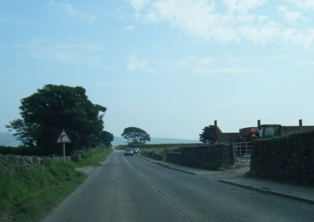
Borwick Rails Harbour, located in Cumberland, England, is a picturesque coastal marsh and saltings area that boasts stunning natural beauty and diverse ecosystems. Situated along the coast, it spans over a vast expanse of land, encompassing marshes, mudflats, and salt marshes.

The marshes of Borwick Rails Harbour are teeming with a wide range of plant and animal species, making it a haven for wildlife enthusiasts and nature lovers. The area is home to numerous rare and migratory bird species, including herons, curlews, and avocets. These birds are attracted to the abundance of food sources found in the marshes, such as fish, insects, and crustaceans.

The salt marshes in Borwick Rails Harbour are characterized by their unique vegetation, consisting of salt-tolerant plants like samphire and sea lavender. These marshes play a vital role in stabilizing the coastline, protecting it from erosion and providing a habitat for various marine creatures and wading birds.

Visitors to Borwick Rails Harbour can explore the area through a network of nature trails and footpaths that wind through the marshes, offering breathtaking views of the surrounding landscape. The tranquil atmosphere and the opportunity to observe wildlife in their natural habitat make it a popular destination for birdwatching, photography, and nature walks.

Moreover, the harbour serves as a gateway to the wider coastline, offering access to nearby beaches and coastal villages. Its strategic location also makes it a hub for various water-based activities, such as boating, fishing, and sailing.

Overall, Borwick Rails Harbour in Cumberland is a remarkable coastal marsh and saltings area that showcases the beauty of nature and provides a sanctuary for diverse flora and fauna.

If you have any feedback on the listing, please let us know in the comments section below.

Borwick Rails Harbour Images

Images are sourced within 2km of 54.211059/-3.2466948 or Grid Reference SD1880. Thanks to Geograph Open Source API. All images are credited.

Borwick Rails looking towards Millom
St Georges Road, Millom
Ordnance Survey Cut Mark This OS cut mark can be found on the office building east side of Mainsgate Road. It marks a point 6.514m above mean sea level.
Ordnance Survey Cut Mark
This OS cut mark can be found on the office building east side of Mainsgate Road. It marks a point 6.514m above mean sea level.
A5093 at Castle Farm
A5093 Salthouse Road at Millom boundary
Rusty Buoy outside Youth Hostel Millom youth hostel is in this grid square and the buoy stands sentinel at the end of its garden. The photo looks across the estuary to the furness peninsula.
Rusty Buoy outside Youth Hostel
Millom youth hostel is in this grid square and the buoy stands sentinel at the end of its garden. The photo looks across the estuary to the furness peninsula.
Remains of  Pier  at Salterhouse Pool On the Duddon estuary, once an integral feature of Hodbarrow Iron Works.
Remains of Pier at Salterhouse Pool
On the Duddon estuary, once an integral feature of Hodbarrow Iron Works.
Millom church during a snow fall St Georges church can be seen from miles around.... in clear weather.
Millom church during a snow fall
St Georges church can be seen from miles around.... in clear weather.
View of Millom from the park Duddon estuary runs behind the town.
View of Millom from the park
Duddon estuary runs behind the town.
Hodbarrow reserve, looking to old lighthouse Broom bushes in full bloom - following the equally vivid display from the gorse.
Hodbarrow reserve, looking to old lighthouse
Broom bushes in full bloom - following the equally vivid display from the gorse.
Hodbarrow reserve, site of former iron mining and works The lagoon is the result of flooding of former mining area.
Hodbarrow reserve, site of former iron mining and works
The lagoon is the result of flooding of former mining area.
A lagoon at Hodbarrow The skyline is the far (eastern) side of the Duddon estuary.
A lagoon at Hodbarrow
The skyline is the far (eastern) side of the Duddon estuary.
St George's Church, Millom, catching the evening sun
View of Millom from the park
Millom Park Overlooking the town centre.  Coniston fells left background.
Millom Park
Overlooking the town centre. Coniston fells left background.
Duddon estuary at Borwick Rails Millom was formerly an active port, but the dangerous channels meant a pilot service was required.  These days there is little activity on the water.  The nearby iron works and all the rail services closed down in the 1960s.
Duddon estuary at Borwick Rails
Millom was formerly an active port, but the dangerous channels meant a pilot service was required. These days there is little activity on the water. The nearby iron works and all the rail services closed down in the 1960s.
Site of Millom Steel Works Despite still looking derelict, Nature has reasserted itself, according to the interpretation boards on site.
Site of Millom Steel Works
Despite still looking derelict, Nature has reasserted itself, according to the interpretation boards on site.
Furnace slag heap, Millom steelworks site
Show me another place!

Borwick Rails Harbour is located at Grid Ref: SD1880 (Lat: 54.211059, Lng: -3.2466948)

Administrative County: Cumbria

District: Copeland

Police Authority: Cumbria

What 3 Words

///charcoal.mandates.refilled. Near Millom, Cumbria

Nearby Locations

Borwick Rails Harbour

Related Wikis

Millom School

Millom School is a coeducational secondary school and sixth form located in Millom in the English county of Cumbria. == The school today == It is a comprehensive...

Millom Rural District

Millom was a rural district in Cumberland in England from 1934 to 1974. It was formed by a County Review Order in 1934 by the merger of the Millom urban...

Millom

Millom is a town and civil parish on the north shore of the estuary of the River Duddon in southernmost Cumberland, Cumbria, England. It is situated just...

Millom railway station

Millom is a railway station on the Cumbrian Coast Line, which runs between Carlisle and Barrow-in-Furness. The station, situated 16 miles (26 km) north...

Nearby Amenities

Located within 500m of 54.211059,-3.2466948
Source: PGS
Lat/Long: 54.2069941/-3.2436282
Source: PGS
Lat/Long: 54.2072981/-3.2439879
Source: PGS
Lat/Long: 54.2076431/-3.2443825
Source: PGS
Lat/Long: 54.2079342/-3.2447563
Source: PGS
Lat/Long: 54.2082268/-3.2451004
Source: PGS
Lat/Long: 54.2084684/-3.2456239
Source: PGS
Lat/Long: 54.2086132/-3.2461114
Source: PGS
Lat/Long: 54.2086209/-3.2463688
Source: PGS
Lat/Long: 54.2091237/-3.2482897
Source: PGS
Lat/Long: 54.2095789/-3.2492377
Source: PGS
Lat/Long: 54.2099012/-3.2496224
Source: PGS
Lat/Long: 54.2112895/-3.2499098
Source: PGS
Lat/Long: 54.212668/-3.2493315
Source: PGS
Lat/Long: 54.2133737/-3.2493133
Source: PGS
Lat/Long: 54.2136368/-3.249452
"Plug" information panel
Tourism: information
Lat/Long: 54.2083897/-3.2520772
Power: pole
Lat/Long: 54.2077076/-3.2500772
Power: pole
Lat/Long: 54.2077272/-3.2493102
Power: pole
Lat/Long: 54.2077385/-3.2481844
The data included in this document is from www.openstreetmap.org. The data is made available under ODbL.

Have you been to Borwick Rails Harbour?

Leave your review of Borwick Rails Harbour below (or comments, questions and feedback).