Cùil an t-Salainn

Coastal Marsh, Saltings in Ross-shire

Scotland

Cùil an t-Salainn

Looking south along the A835 towards the Fannichs
Looking south along the A835 towards the Fannichs Credit: Peter Moore

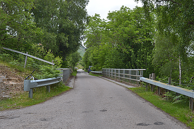
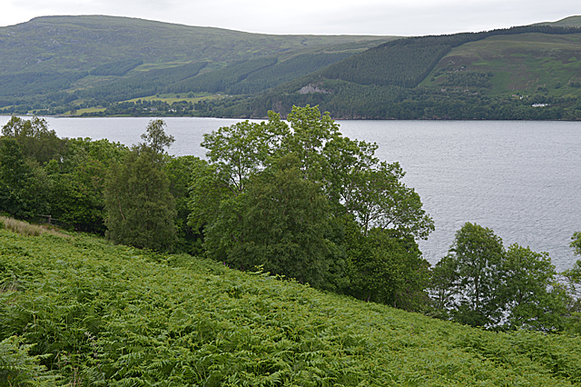
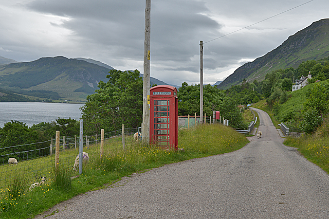
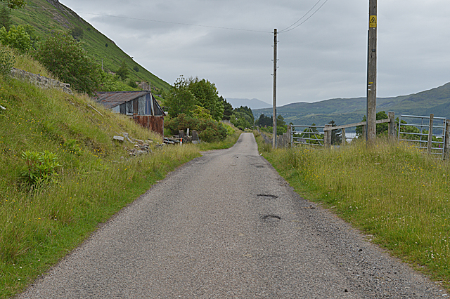
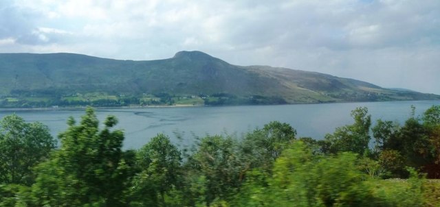
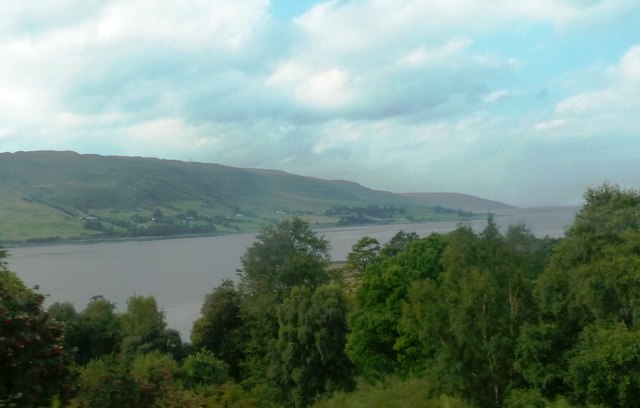
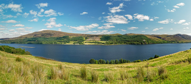
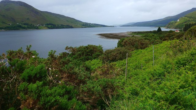
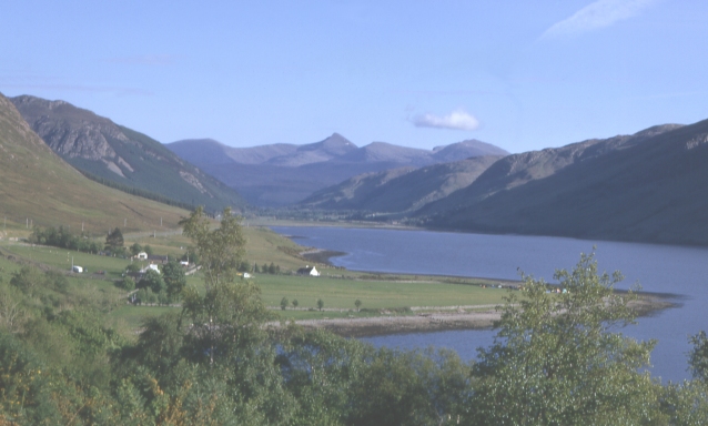
Cùil an t-Salainn, also referred to as Coastal Marsh or Saltings, is a picturesque location situated in Ross-shire, Scotland. It is a coastal area renowned for its stunning natural beauty and unique ecological characteristics.

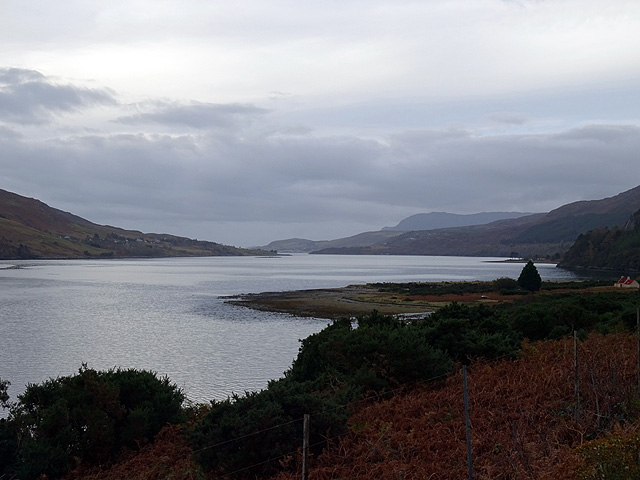
The marshy landscape of Cùil an t-Salainn is dominated by extensive mudflats, salt marshes, and tidal creeks. These habitats are a haven for a diverse range of flora and fauna, including numerous bird species, marine invertebrates, and plants that have adapted to the brackish environment. The area is particularly noted for its importance as a breeding and feeding ground for migratory birds, such as waders and waterfowl, which are attracted by the rich food sources provided by the marshes.

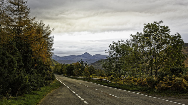
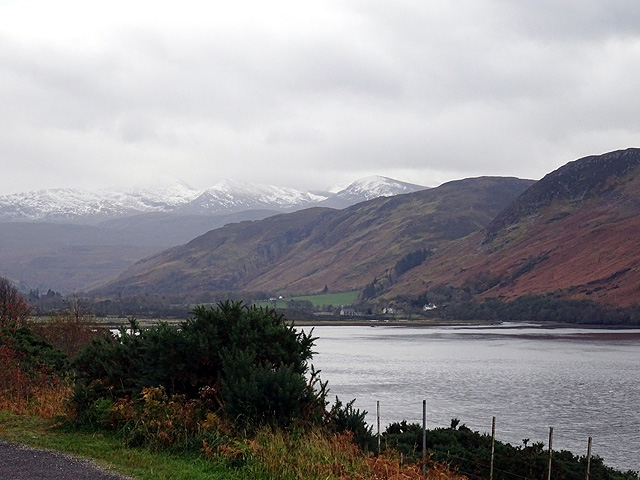
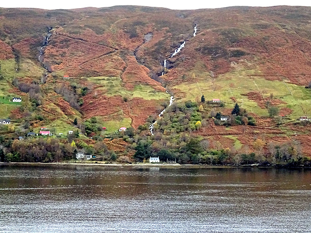
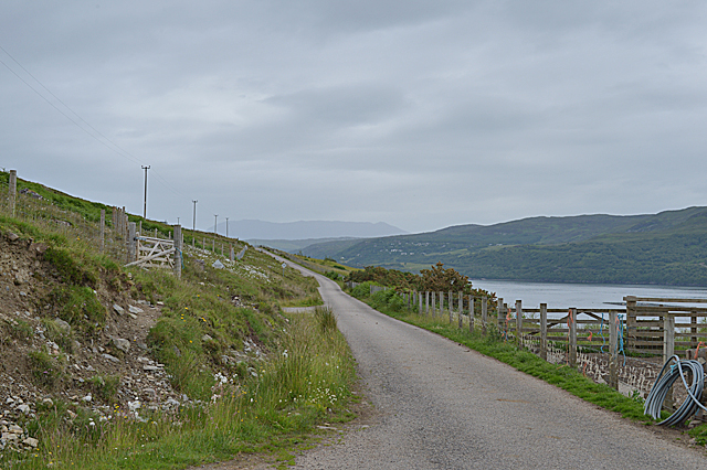
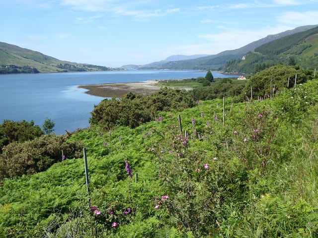
The surroundings of Cùil an t-Salainn offer visitors breathtaking panoramic views of the coastline, with its rugged cliffs and sandy beaches. The intertidal zone, where the land meets the sea, provides an ever-changing spectacle as the tides ebb and flow, revealing intricate patterns left behind by the receding waters.

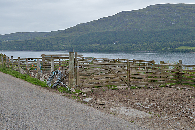
Nature enthusiasts and photographers are drawn to Cùil an t-Salainn for its abundance of wildlife and scenic vistas. The area is also a popular spot for leisure activities such as birdwatching, walking, and picnicking. Access to the site is facilitated by well-maintained footpaths and observation points strategically placed to maximize the viewing opportunities.

Cùil an t-Salainn exemplifies the delicate balance between land and sea, showcasing the fascinating ecosystem that thrives in this coastal marshland. Its unspoiled natural beauty and ecological significance make it a must-visit destination for those seeking a tranquil and immersive experience in the heart of Scotland's coastal wilderness.

If you have any feedback on the listing, please let us know in the comments section below.

Cùil an t-Salainn Images

Images are sourced within 2km of 57.851019/-5.0810643 or Grid Reference NH1788. Thanks to Geograph Open Source API. All images are credited.

Looking south along the A835 towards the Fannichs
Beside Loch Broom Viewed from the A 835 road to Ullapool.
Beside Loch Broom
Viewed from the A 835 road to Ullapool.
Looking up Loch Broom From the A835 road to Ullapool.
Looking up Loch Broom
From the A835 road to Ullapool.
Looking across Loch Broom towards Letters
Bridge over the Allt Corrach in Letters
Steep slopes below the road Dropping to trees and Loch Broom.
Steep slopes below the road
Dropping to trees and Loch Broom.
Sheep pens north of Ardindrean
The Logie road north of Ardindrean
Ardindrean phone box and post box
The Loggie road passing through Ardindrean
Loch Broom at Ardcharnich Taken from the A835.
Loch Broom at Ardcharnich
Taken from the A835.
Loch Broom Viewed from the A835.
Loch Broom
Viewed from the A835.
Loch Broom Looking across Loch Broom to Leckmelm from Rhiroy
Loch Broom
Looking across Loch Broom to Leckmelm from Rhiroy
Bracken-covered slopes of Loch Broom From the car park on the A835, looking towards Ullapool in the distance.
Bracken-covered slopes of Loch Broom
From the car park on the A835, looking towards Ullapool in the distance.
Letter box at Letters, Ross and Cromarty Looking across Loch Broom towards the north western slopes of Reidh Chreagan.

A postie's dream letter box: plenty of room for parcels!
Letter box at Letters, Ross and Cromarty
Looking across Loch Broom towards the north western slopes of Reidh Chreagan. A postie's dream letter box: plenty of room for parcels!
Sedum roofed house, Letters, Ross and Cromarty Looking towards Loch Broom.

The house was prefabricated and delivered to site in two sections.  Further details and photos of the interior are at <span class="nowrap"><a title="https://www.echoliving.co.uk/caberfeidh-yurt" rel="nofollow ugc noopener" href="https://www.echoliving.co.uk/caberfeidh-yurt">Link</a><img style="margin-left:2px;" alt="External link" title="External link - shift click to open in new window" src="https://s1.geograph.org.uk/img/external.png" width="10" height="10"/></span>.
Sedum roofed house, Letters, Ross and Cromarty
Looking towards Loch Broom. The house was prefabricated and delivered to site in two sections. Further details and photos of the interior are at LinkExternal link.
Dense undergrowth by the lay-by on the A835 The promontory of Rubh' an Olan in the distance.  The houses of Ullapool are just visible in the distance.
Dense undergrowth by the lay-by on the A835
The promontory of Rubh' an Olan in the distance. The houses of Ullapool are just visible in the distance.
A view towards An Teallach A view westwards towards An Teallach, taken from above Leckmelm
A view towards An Teallach
A view westwards towards An Teallach, taken from above Leckmelm
Show me another place!

Cùil an t-Salainn is located at Grid Ref: NH1788 (Lat: 57.851019, Lng: -5.0810643)

Unitary Authority: Highland

Police Authority: Highlands and Islands

What 3 Words

///incisions.requested.fruitcake. Near Ullapool, Highland

Related Wikis

Ardcharnich

Ardcharnich (; Scottish Gaelic: Àird Cheatharnaich) is a crofting township in the parish of Loch Broom, Wester Ross in the Highland, within the Scottish...

Letters, Wester Ross

Letters (Scottish Gaelic: An Leitir) is a village on the south west shore of Loch Broom, in Garve, Ross-shire, Scottish Highlands and is in the Scottish...

Ardindrean

Ardindrean (Scottish Gaelic: Àird an Dreaghainn) is a small hamlet, located on the west shore of Loch Broom in Garve, Ross-shire and is within the Highland...

Leckmelm

Leckmelm (Scottish Gaelic: Leac Mailm) is a small settlement on the eastern shore of Loch Broom, in Wester Ross in the Highland council area of Scotland...

Blarnalearoch

Blarnalearoch is a remote crofting township situated on the west shore of Loch Broom in Garve, Ross-shire, Scottish Highlands and is in the Scottish council...

Battle of Leckmelm

The Battle of Leckmelm was a Scottish clan battle that took place in 1586, in the Scottish Highlands. It was fought between the Clan Gunn against the Clan...

Rhiroy

Rhiroy is a remote crofting township situated on the west shore of Loch Broom in Garve, Ross-shire, Scottish Highlands and is in the Scottish council area...

Inverlael

Inverlael is a hamlet on the southern tip of Loch Broom in Ross-shire in the Highland council area in Scotland. It is located on the A835 main road 6 miles...

Nearby Amenities

Located within 500m of 57.851019,-5.0810643
Created By: almien_coastlines
Source: PGS
Lat/Long: 57.854542/-5.085696
Created By: almien_coastlines
Source: PGS
Lat/Long: 57.854417/-5.085447
Created By: almien_coastlines
Source: PGS
Lat/Long: 57.854294/-5.085201
Created By: almien_coastlines
Source: PGS
Lat/Long: 57.85417/-5.084953
Created By: almien_coastlines
Source: PGS
Lat/Long: 57.854046/-5.084706
Source: PGS
Lat/Long: 57.8536521/-5.0840758
Source: PGS
Lat/Long: 57.8533592/-5.0834447
Source: PGS
Lat/Long: 57.8528433/-5.0827444
Created By: almien_coastlines
Source: PGS
Lat/Long: 57.852798/-5.082713
Created By: almien_coastlines
Source: PGS
Lat/Long: 57.852295/-5.082203
Source: PGS
Lat/Long: 57.8520602/-5.0819024
Source: PGS
Lat/Long: 57.8516787/-5.0814419
Source: PGS
Lat/Long: 57.8512009/-5.0809665
Source: PGS
Lat/Long: 57.8508889/-5.0806115
Source: PGS
Lat/Long: 57.8502001/-5.0816105
Source: PGS
Lat/Long: 57.8497776/-5.082019
Source: PGS
Lat/Long: 57.8492809/-5.0829202
Source: PGS
Lat/Long: 57.8486149/-5.0832007
Source: PGS
Lat/Long: 57.8482453/-5.0834036
Source: PGS
Lat/Long: 57.8477852/-5.0838088
Source: PGS
Lat/Long: 57.8474287/-5.083521
Ardcharnich
Name Gd: Ard-Cheatharnaich
Place: hamlet
Lat/Long: 57.8494196/-5.0773051
Post Box
Ref: IV23 197
Source: survey
Lat/Long: 57.8490054/-5.0782521
Power: pole
Lat/Long: 57.8487136/-5.0764936
Power: pole
Lat/Long: 57.849677/-5.0770596
Power: pole
Lat/Long: 57.8506633/-5.0776228
Power: pole
Lat/Long: 57.851698/-5.0781995
Power: pole
Lat/Long: 57.8524744/-5.0786823
Power: pole
Lat/Long: 57.8527898/-5.0794467
Power: pole
Lat/Long: 57.8533407/-5.0809273
Power: pole
Lat/Long: 57.854805/-5.0832287
Power: pole
Lat/Long: 57.8477562/-5.0804292
Power: pole
Lat/Long: 57.8480844/-5.0799949
Power: pole
Lat/Long: 57.8484214/-5.0795241
Power: pole
Lat/Long: 57.8487756/-5.0795699
Power: pole
Lat/Long: 57.8493088/-5.0794658
Power: pole
Lat/Long: 57.8496369/-5.0793908
Power: pole
Lat/Long: 57.8501967/-5.0790502
Parking
Lat/Long: 57.8479685/-5.0778025
Power: pole
Lat/Long: 57.8495615/-5.0775573
Power: pole
Lat/Long: 57.8493534/-5.078419
Power: pole
Lat/Long: 57.852599/-5.0797803
Power: pole
Lat/Long: 57.8522926/-5.0803777
Power: pole
Lat/Long: 57.8524893/-5.0805195
Power: pole
Lat/Long: 57.8528443/-5.0809375
The data included in this document is from www.openstreetmap.org. The data is made available under ODbL.

Have you been to Cùil an t-Salainn?

Leave your review of Cùil an t-Salainn below (or comments, questions and feedback).