Back Bore

Coastal Marsh, Saltings in Wigtownshire

Scotland

Back Bore

Waves at Drummore nx140368 This is the coast road at Drummore leading to Back Bore and Cairngarroch Bay. The cottages in the mid shot are where we stayed for an excellent week in February 2004
Waves at Drummore nx140368 Credit: Dave Smethurst

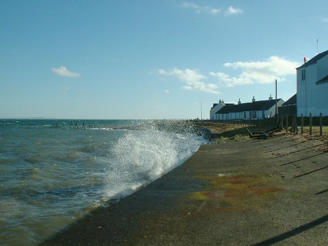
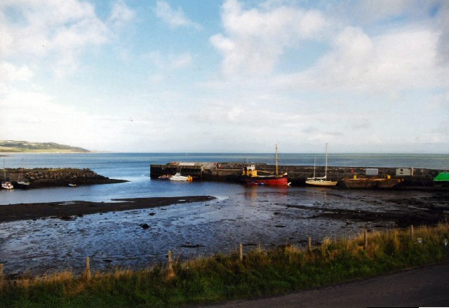
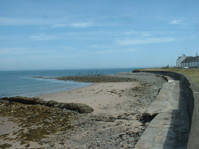
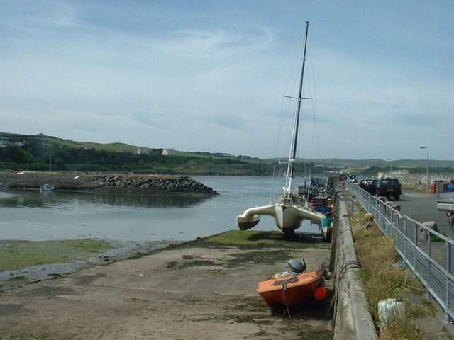
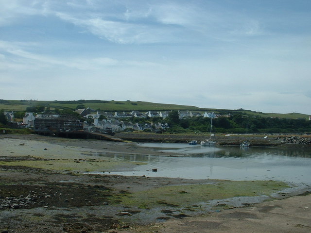
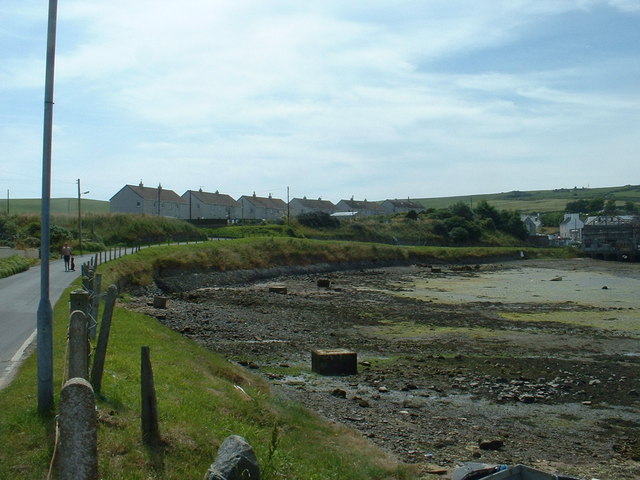
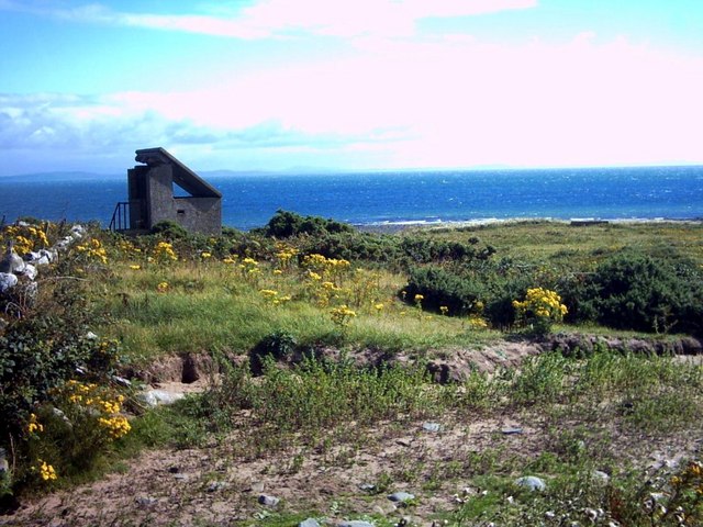
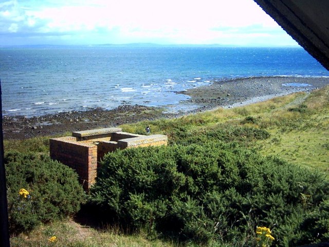
Back Bore is a coastal marsh located in Wigtownshire, Scotland. Situated on the southwestern coast of the country, it is known for its stunning views and diverse ecosystem. The marsh stretches over a vast area, encompassing both salt marshes and saltings.

The salt marshes of Back Bore are characterized by their unique vegetation, which thrives in the brackish water that occurs as a result of tidal influence. These plants, such as common saltmarsh grass and sea aster, play a crucial role in stabilizing the marsh and providing habitats for a variety of bird species. The area is a popular spot for birdwatching enthusiasts who flock to witness the impressive array of avian species that call Back Bore home, including wading birds like curlews and oystercatchers.

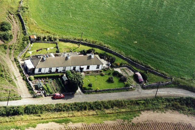
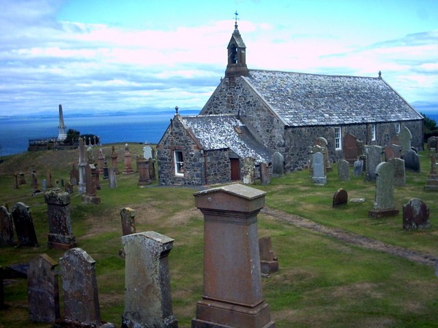
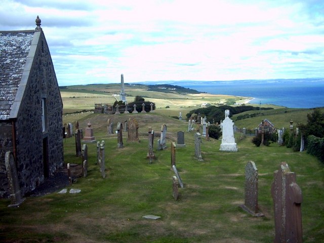
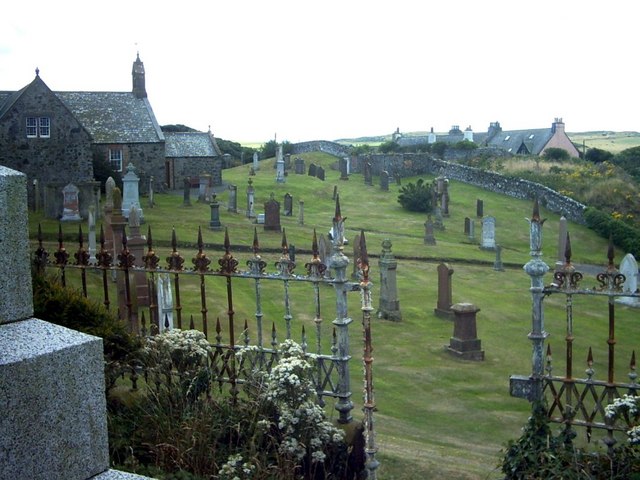
In addition to its ecological significance, Back Bore also boasts historical importance. The marsh has been inhabited by humans for centuries, and there are traces of ancient settlements and archaeological remains scattered throughout the area. This rich history adds another layer of fascination to Back Bore, enticing visitors to explore and learn more about the region's past.

Access to Back Bore is facilitated by well-maintained footpaths that wind through the marsh, allowing visitors to explore the area while minimizing disruption to the delicate ecosystem. The marsh offers a peaceful and serene environment, ideal for nature lovers seeking a tranquil escape. Back Bore's picturesque landscapes, diverse wildlife, and historical significance make it a must-visit destination for those looking to immerse themselves in the natural beauty of Scotland's southwestern coast.

If you have any feedback on the listing, please let us know in the comments section below.

Back Bore Images

Images are sourced within 2km of 54.691697/-4.8842378 or Grid Reference NX1436. Thanks to Geograph Open Source API. All images are credited.

Waves at Drummore nx140368 This is the coast road at Drummore leading to Back Bore and Cairngarroch Bay. The cottages in the mid shot are where we stayed for an excellent week in February 2004
Waves at Drummore nx140368
This is the coast road at Drummore leading to Back Bore and Cairngarroch Bay. The cottages in the mid shot are where we stayed for an excellent week in February 2004
Drummore Harbour The harbour was used by the M.O.D. in connection with their sea firing exercises, but was sold to the Drummore Harbour Trust in 2004. It is used by local skippers for sea angling and it is open to visiting boats.
Drummore Harbour
The harbour was used by the M.O.D. in connection with their sea firing exercises, but was sold to the Drummore Harbour Trust in 2004. It is used by local skippers for sea angling and it is open to visiting boats.
Welcome to Drummore Looking south east to the headland called Inchmore. The headland marks the northern side of Drummore Bay.
Welcome to Drummore
Looking south east to the headland called Inchmore. The headland marks the northern side of Drummore Bay.
Sea wall, near Drummore Looking north. The road is the A716.
Sea wall, near Drummore
Looking north. The road is the A716.
Groynes at Drummore Same shot as the first Geograph, showing what it's like when there is a calm sea and the tide is out.
Groynes at Drummore
Same shot as the first Geograph, showing what it's like when there is a calm sea and the tide is out.
Drummore Harbour Looking north west, along the breakwater at the southern end of the harbour.
Drummore Harbour
Looking north west, along the breakwater at the southern end of the harbour.
Drummore Harbour Looking west, towards the village.
Drummore Harbour
Looking west, towards the village.
Council houses at Drummore They may be council houses, but they have a superb outlook, north over the harbour and Luce Bay.
Council houses at Drummore
They may be council houses, but they have a superb outlook, north over the harbour and Luce Bay.
Cailiness Cottage The family of the farm worker who still lives in one of the cottages has lived and worked here for more than a century.
Cailiness Cottage
The family of the farm worker who still lives in one of the cottages has lived and worked here for more than a century.
Cairngarroch Farm Cairngarroch is a dairy farm.
Cairngarroch Farm
Cairngarroch is a dairy farm.
Cailiness Point The old military look-out at Cailiness (formerly 'Killiness') Point.  The distant hills across Luce Bay are around Whithorn.
Cailiness Point
The old military look-out at Cailiness (formerly 'Killiness') Point. The distant hills across Luce Bay are around Whithorn.
Cailiness Point An old military building which is now on farmland.  The distant hills across Luce Bay are around Whithorn.
Cailiness Point
An old military building which is now on farmland. The distant hills across Luce Bay are around Whithorn.
Kirkmaiden Parish Church Formerly known as 'Kirk Covenant' a church was built here in 1638.  Remodelled in 1839, this building is the parish church of Kirkmaiden.
Kirkmaiden Parish Church
Formerly known as 'Kirk Covenant' a church was built here in 1638. Remodelled in 1839, this building is the parish church of Kirkmaiden.
Kirkmaiden Parish Church
Kirkmaiden Parish Church The churchyard viewed from the McDouall monument.
Kirkmaiden Parish Church
The churchyard viewed from the McDouall monument.
Damnaglaur Damnaglaur is a hamlet about a mile above the village of Drummore.  The Galloway Hills are visible across Luce Bay.
Damnaglaur
Damnaglaur is a hamlet about a mile above the village of Drummore. The Galloway Hills are visible across Luce Bay.
Misty day at Drummore
Drummore harbour First developed in the 19th century as part of a local lime industry, the harbour was much later taken over by the Ministry of Defence to support the Luce Bay bombing range.  Since 2004 the harbour has been owned by a local trust hoping to develop it for leisure use.  Unfortunately, it dries, limiting its use to boats which can take the ground.
Drummore harbour
First developed in the 19th century as part of a local lime industry, the harbour was much later taken over by the Ministry of Defence to support the Luce Bay bombing range. Since 2004 the harbour has been owned by a local trust hoping to develop it for leisure use. Unfortunately, it dries, limiting its use to boats which can take the ground.
Show me another place!

Back Bore is located at Grid Ref: NX1436 (Lat: 54.691697, Lng: -4.8842378)

Unitary Authority: Dumfries and Galloway

Police Authority: Dumfries and Galloway

What 3 Words

///headset.monk.ratio. Near Drummore, Dumfries & Galloway

Nearby Locations

Cairngarroch Bay Back Bore

Related Wikis

Drummore

Drummore (drum-ORE; (from Gaelic An Druim Mòr meaning "the great ridge") is the southernmost village in Scotland, located at the southern end of the Rhins...

Kirkmaiden

Kirkmaiden is a parish in the Rhins of Galloway, the most southerly in Scotland; the present Church of Scotland parish has the same name as and is approximately...

Kirkmaiden (village)

Kirkmaiden (sometimes Maidenkirk; Scottish Gaelic: Cill M'Eudan) is a small settlement in Galloway, Scotland, located approximately 17 miles (27 km) south...

Cairngaan

Cairngaan, Wigtownshire, is the southmost settlement in Scotland. The hamlet of Cairngaan lies just north of the Mull of Galloway (which contains Scotland...

Port Logan

Port Logan, formerly Port Nessock, is a small village in the parish of Kirkmaiden in the Rhins of Galloway in Wigtownshire. The Gaelic name is Port Neasaig...

Mull of Galloway

The Mull of Galloway (Scottish Gaelic: Maol nan Gall, pronounced [mɯːlˠ̪ nəŋ ˈkaulˠ̪]; grid reference NX158303) is the southernmost point of Scotland....

Logan Botanic Garden

Logan Botanic Garden is a botanical garden near Port Logan on the Rhins of Galloway, at the south-western tip of Scotland. The Botanic Garden was established...

Ardwell

Ardwell (from Gaelic Àrd Bhaile meaning "high town", pronounced as "Ardwell") is a village in the Scottish unitary council area of Dumfries and Galloway...

Nearby Amenities

Located within 500m of 54.691697,-4.8842378
Source: PGS
Lat/Long: 54.6873355/-4.883824
Source: PGS
Lat/Long: 54.6891133/-4.8848051
Source: PGS
Lat/Long: 54.6909303/-4.8850733
Source: PGS
Lat/Long: 54.6914946/-4.8852986
Source: PGS
Lat/Long: 54.6917178/-4.8855883
Source: PGS
Lat/Long: 54.6919225/-4.8866504
Source: PGS
Lat/Long: 54.6928898/-4.8910063
Source: PGS
Lat/Long: 54.6922325/-4.8893219
Defibrillator
Defibrillator Location: Right hand side of front wall of Driftwood.
Emergency: defibrillator
Indoor: no
Lat/Long: 54.6916967/-4.889458
Bench
Backrest: yes
Lat/Long: 54.6919003/-4.8863501
Backrest: no
Leisure: picnic_table
Lat/Long: 54.6880946/-4.8850076
Leisure: picnic_table
Lat/Long: 54.6878155/-4.8847165
Leisure: picnic_table
Lat/Long: 54.6876068/-4.8847791
Generator Method: photovoltaic
Generator Output Electricity: yes
Generator Source: solar
Generator Type: solar_photovoltaic_panel
Location: roof
Power: generator
Lat/Long: 54.6890019/-4.8858312
Generator Method: photovoltaic
Generator Output Electricity: yes
Generator Source: solar
Generator Type: solar_photovoltaic_panel
Location: roof
Power: generator
Lat/Long: 54.6917279/-4.8870423
Generator Method: photovoltaic
Generator Output Electricity: yes
Generator Source: solar
Generator Type: solar_photovoltaic_panel
Location: roof
Power: generator
Lat/Long: 54.6917818/-4.8875994
The data included in this document is from www.openstreetmap.org. The data is made available under ODbL.

Have you been to Back Bore?

Leave your review of Back Bore below (or comments, questions and feedback).