Balgowan Point

Coastal Marsh, Saltings in Wigtownshire

Scotland

Balgowan Point

A small M.O.D. building close to Balgowan Point. This is a small M.O.D. building close to Balgowan Point on The Rhins Peninsula, Scotland.
A small M.O.D. building close to Balgowan Point. Credit: andy

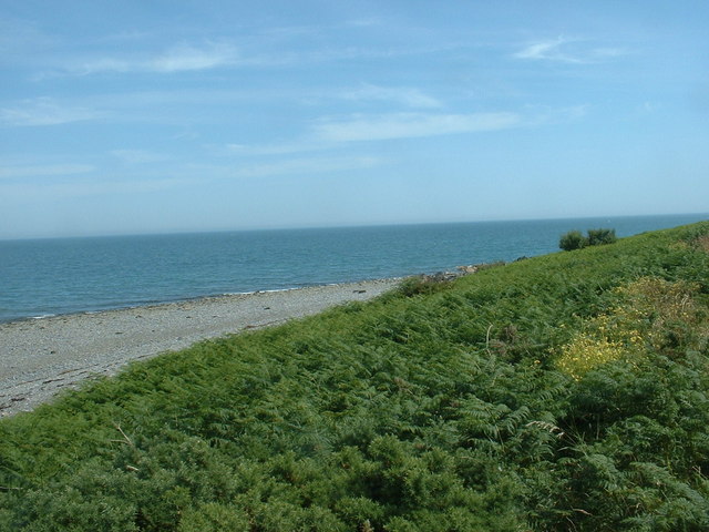
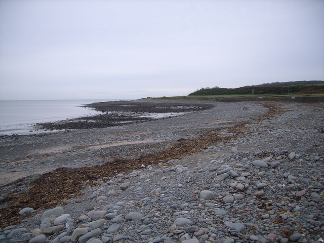
Balgowan Point, located in Wigtownshire, Scotland, is a prominent coastal marsh and saltings area that stretches along the southern banks of the River Cree. The point is situated on the eastern side of Wigtown Bay, which is a designated Special Area of Conservation due to its rich biodiversity.

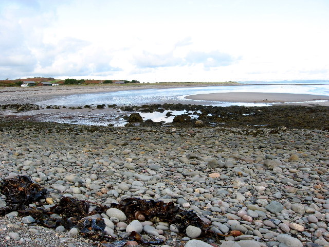
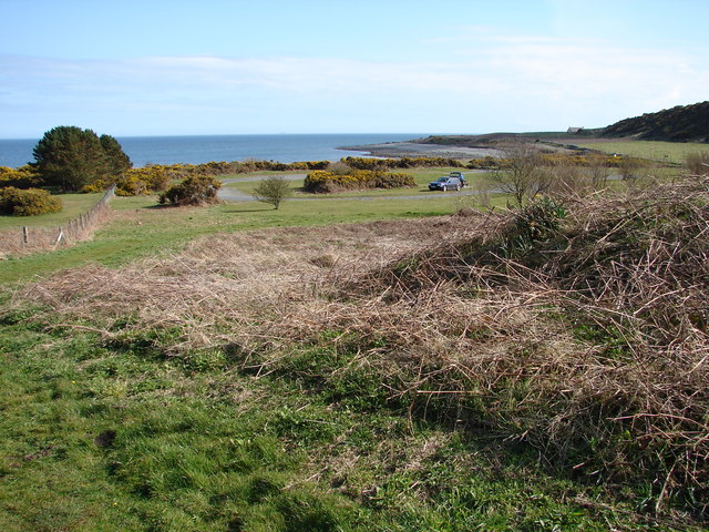
Balgowan Point is characterized by its extensive salt marshes, mudflats, and sandbanks, which are constantly shaped and influenced by the tides of the river and the sea. These dynamic tidal processes have resulted in the formation of a diverse range of habitats that support a multitude of plant and animal species.

The point is particularly renowned for its significant bird population, attracting both resident and migratory species throughout the year. The mudflats and sandbanks provide an abundant food source for wading birds such as oystercatchers, curlews, and redshanks, while the salt marshes offer ideal nesting sites for terns and gulls.

In addition to its avian inhabitants, Balgowan Point is home to various marine organisms. The intertidal zone is teeming with mollusks, crustaceans, and worms, which provide nourishment for fish and other marine species. The area also serves as a vital spawning ground for fish, including flounders and sea trout.

Balgowan Point offers visitors the opportunity to explore its diverse ecosystems through designated footpaths and observation points. Its scenic beauty and ecological importance make it a popular destination for nature enthusiasts, birdwatchers, and photographers. Conservation efforts have been put in place to protect and preserve this valuable coastal marsh and saltings area for future generations to enjoy and appreciate.

If you have any feedback on the listing, please let us know in the comments section below.

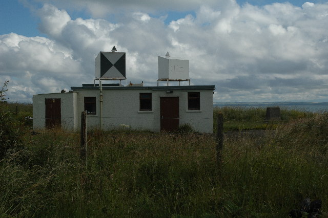
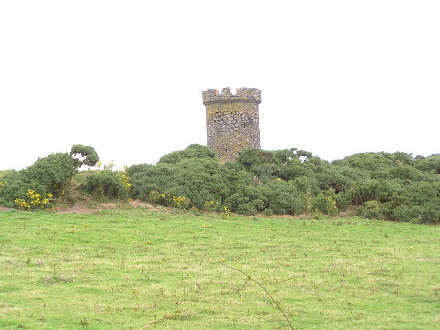
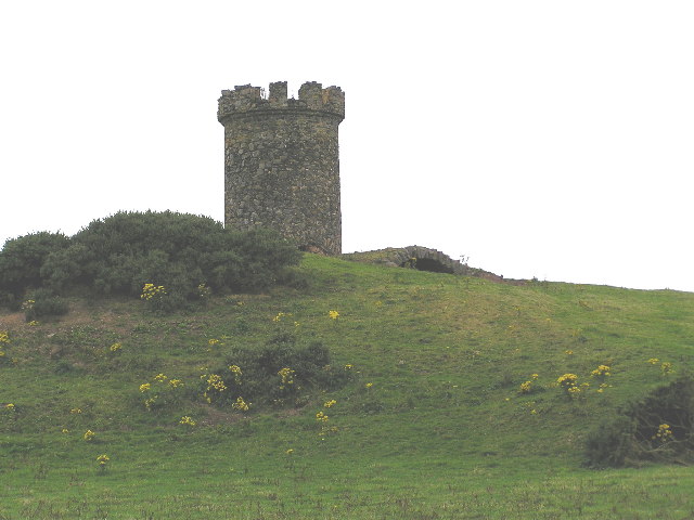
Balgowan Point Images

Images are sourced within 2km of 54.743013/-4.916588 or Grid Reference NX1242. Thanks to Geograph Open Source API. All images are credited.

A small M.O.D. building close to Balgowan Point. This is a small M.O.D. building close to Balgowan Point on The Rhins Peninsula, Scotland.
A small M.O.D. building close to Balgowan Point.
This is a small M.O.D. building close to Balgowan Point on The Rhins Peninsula, Scotland.
Logan Windmill This is all that is left of the windmill that was built shortly before 1684 by Patrick McDouall to lessen his estate's dependence on the nearby watermill which in summer was liable to failure.
Logan Windmill
This is all that is left of the windmill that was built shortly before 1684 by Patrick McDouall to lessen his estate's dependence on the nearby watermill which in summer was liable to failure.
Logan Windmill 2 Another view of Logan Windmill showing the curious vaulted structure at its base
Logan Windmill 2
Another view of Logan Windmill showing the curious vaulted structure at its base
New England Bay Scotland
Myroch Point Looking across Luce Bay, to The Machars peninsula, just visible through the haze.
Myroch Point
Looking across Luce Bay, to The Machars peninsula, just visible through the haze.
New England Bay, near Ardwell Looking north. This is a similar shot to the first geograph for the square [taken 2 years ago], but seems to show many more caravans. Is this because of the slightly higher elevation, or an increase in popularity?
New England Bay, near Ardwell
Looking north. This is a similar shot to the first geograph for the square [taken 2 years ago], but seems to show many more caravans. Is this because of the slightly higher elevation, or an increase in popularity?
Muddy road in the Rhinns West Myroch farm in the distance.
Muddy road in the Rhinns
West Myroch farm in the distance.
Disused track The twin hedges indicate where this mapped track went, but it's clearly not used much now.
Disused track
The twin hedges indicate where this mapped track went, but it's clearly not used much now.
The A716 near Terally Point Luce Bay to the left.
The A716 near Terally Point
Luce Bay to the left.
Minor road meets the A716 At Terally Bay - Luce Bay ahead.
Minor road meets the A716
At Terally Bay - Luce Bay ahead.
Approaching Terally Bay
Centre for wild boar  near Terally
Centre for wild boar near Terally
Self-explanatory! Wild boar compound.
Self-explanatory!
Wild boar compound.
Derelict cafe & snackbar I stopped for a much-needed coffee, but alas, it was all gone!
Derelict cafe & snackbar
I stopped for a much-needed coffee, but alas, it was all gone!
Terally Bay It was soooo cold here!
Terally Bay
It was soooo cold here!
Derelict cafe & snackbar (front view) No more snacks here then :(
Derelict cafe & snackbar (front view)
No more snacks here then :(
Balkelzie Bridge, Logan Toll Junction of the A716 and B7065 at Balkelzie Bridge.
Balkelzie Bridge, Logan Toll
Junction of the A716 and B7065 at Balkelzie Bridge.
New England Bay Picnic Area A picnic area set back from New England Bay just off the A716 on the east side of The Rhins.
New England Bay Picnic Area
A picnic area set back from New England Bay just off the A716 on the east side of The Rhins.
Show me another place!

Balgowan Point is located at Grid Ref: NX1242 (Lat: 54.743013, Lng: -4.916588)

Unitary Authority: Dumfries and Galloway

Police Authority: Dumfries and Galloway

What 3 Words

///sculpting.panoramic.teams. Near Drummore, Dumfries & Galloway

Related Wikis

Logan Botanic Garden

Logan Botanic Garden is a botanical garden near Port Logan on the Rhins of Galloway, at the south-western tip of Scotland. The Botanic Garden was established...

Port Logan

Port Logan, formerly Port Nessock, is a small village in the parish of Kirkmaiden in the Rhins of Galloway in Wigtownshire. The Gaelic name is Port Neasaig...

Ardwell

Ardwell (from Gaelic Àrd Bhaile meaning "high town", pronounced as "Ardwell") is a village in the Scottish unitary council area of Dumfries and Galloway...

Kirkmaiden

Kirkmaiden is a parish in the Rhins of Galloway, the most southerly in Scotland; the present Church of Scotland parish has the same name as and is approximately...

Related Videos

Scotland Tour 2022 | Beach Walks & Drone Fun Pt 2.

Day 6 Part 2 We take a walk along the opposite way of the coastline at New England Bay vlog also includes drone footage ...

Dumfries and Galloway in a Motorhome | Portpatrick, Mull of Galloway Lighthouse & New England Bay

Dumfries and Galloway Motorhome Road Trip On our final leg of our 8 day tour of Scotland, we leave our campsite at Culzean ...

Scotland Tour 2022 | Beach Walks And Drone Fun.

Day 6 Of our current Scotland Tour we take beach walks along the coast line at New England Bay and also have some drone fun.

Logan botanical gardens

Some early springtime footage from various parts of the beautiful and peaceful Logan botanic gardens in south-west Scotland.

Nearby Amenities

Located within 500m of 54.743013,-4.916588
Source: PGS
Lat/Long: 54.7391318/-4.9197907
Source: PGS
Lat/Long: 54.7396102/-4.9194538
Source: PGS
Lat/Long: 54.7399979/-4.9192339
Source: PGS
Lat/Long: 54.7403714/-4.9190332
Source: PGS
Lat/Long: 54.7407223/-4.9188288
Source: PGS
Lat/Long: 54.7428541/-4.9174155
Source: PGS
Lat/Long: 54.7429944/-4.9174128
Source: PGS
Lat/Long: 54.7434375/-4.9176966
Source: PGS
Lat/Long: 54.7437303/-4.9180843
Source: PGS
Lat/Long: 54.744051/-4.9185917
Source: PGS
Lat/Long: 54.744367/-4.9189889
Source: PGS
Lat/Long: 54.7446781/-4.9194598
Source: PGS
Lat/Long: 54.7449207/-4.9197429
Source: PGS
Lat/Long: 54.7453415/-4.9201763
Source: PGS
Lat/Long: 54.7456897/-4.92062
Source: PGS
Lat/Long: 54.745989/-4.9210691
Source: PGS
Lat/Long: 54.7464081/-4.9215707
New England Bay Caravan & Motorhome Club site
Addr Postcode: DG9 9NX
Tourism: caravan_site
Lat/Long: 54.7410343/-4.920332
Power: pole
Lat/Long: 54.7447565/-4.9226723
Power: pole
Lat/Long: 54.7443925/-4.9217507
Power: pole
Lat/Long: 54.744061/-4.9209048
Power: pole
Lat/Long: 54.7437138/-4.9200356
Power: pole
Lat/Long: 54.7433577/-4.9191587
Power: pole
Lat/Long: 54.7430172/-4.9183011
Power: pole
Lat/Long: 54.7432871/-4.92119
Power: pole
Lat/Long: 54.7425032/-4.9214811
Power: pole
Lat/Long: 54.7418289/-4.9217449
The data included in this document is from www.openstreetmap.org. The data is made available under ODbL.

Have you been to Balgowan Point?

Leave your review of Balgowan Point below (or comments, questions and feedback).