Rubh' a' Mhill Dheirg
Coastal Marsh, Saltings in Sutherland
Scotland
Rubh' a' Mhill Dheirg

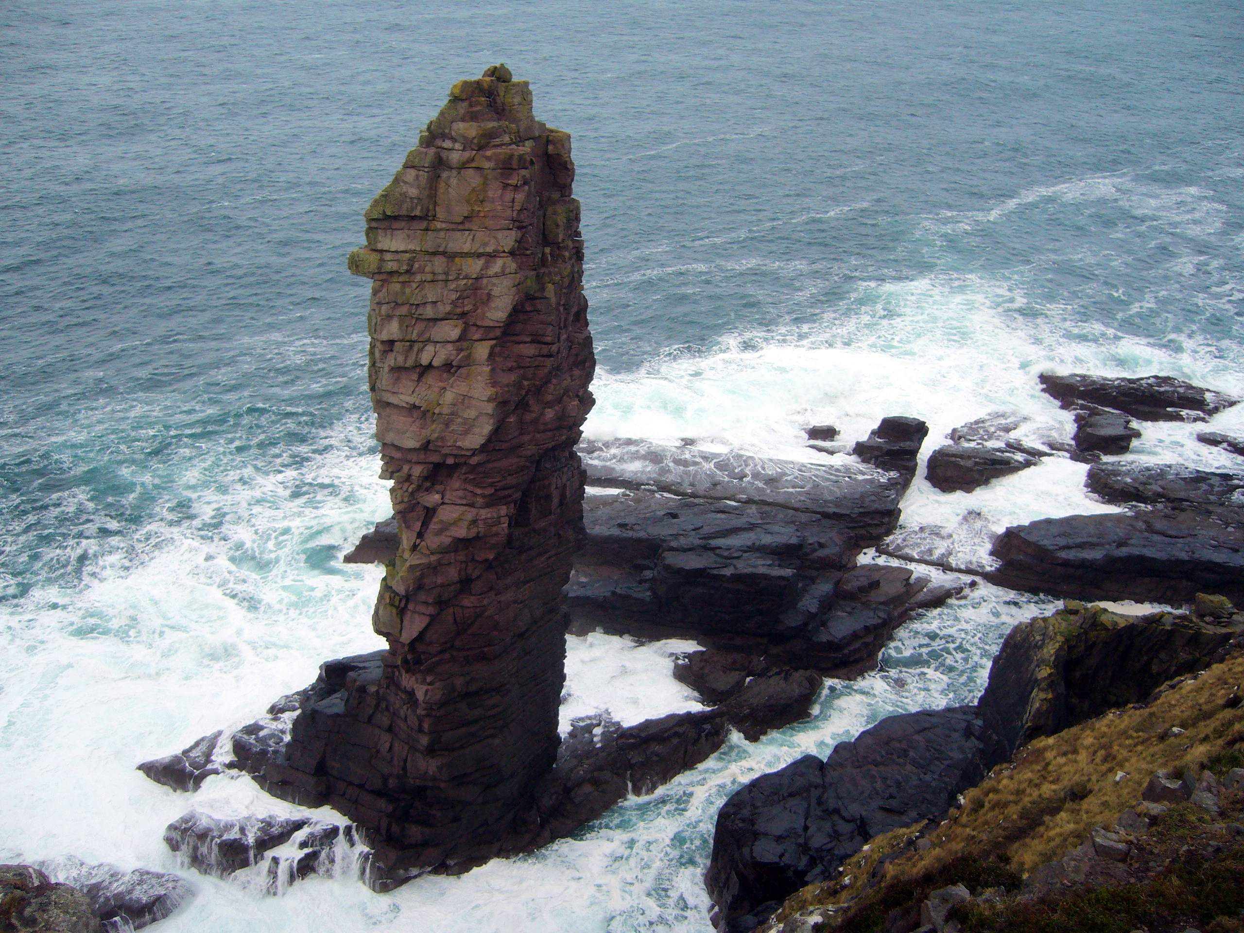
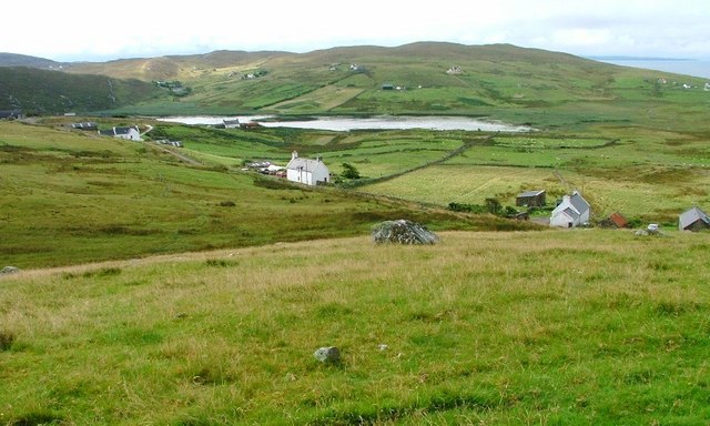
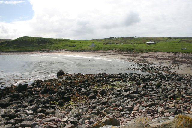
Rubh' a' Mhill Dheirg, also known as the Coastal Marsh or Saltings, is a coastal area located in Sutherland, Scotland. It is situated on the northernmost part of the Scottish mainland, overlooking the North Atlantic Ocean. Covering an expansive area of approximately 100 hectares, Rubh' a' Mhill Dheirg is characterized by its diverse and unique ecosystem.
The coastal marsh is primarily composed of salt marshes and saltings, which are low-lying areas regularly flooded by the tides. These marshes are home to a wide range of plant and animal species that have adapted to the harsh coastal conditions. Common vegetation includes salt-tolerant grasses, sedges, and herbs, alongside patches of reeds and rushes.
The rich biodiversity of Rubh' a' Mhill Dheirg makes it a haven for numerous bird species, both resident and migratory. Large flocks of waders, such as curlews, oystercatchers, and redshanks, can often be spotted foraging along the marshes during low tide. The area also serves as a breeding ground for various waterfowl, including ducks and geese.
Aside from its ecological significance, Rubh' a' Mhill Dheirg offers visitors breathtaking coastal views and opportunities for outdoor activities. The rugged coastline, with its rocky cliffs and sandy beaches, is a popular spot for hiking, birdwatching, and photography. The area is also known for its tranquility and solitude, providing a peaceful escape from the hustle and bustle of everyday life.
In summary, Rubh' a' Mhill Dheirg is a remarkable coastal marsh and salting area in Sutherland, Scotland. Its diverse ecosystem, abundant wildlife, and stunning natural beauty make it a must-visit destination for nature enthusiasts and those seeking a peaceful retreat by the sea.
If you have any feedback on the listing, please let us know in the comments section below.
Rubh' a' Mhill Dheirg Images
Images are sourced within 2km of 58.201395/-5.3536541 or Grid Reference NC0328. Thanks to Geograph Open Source API. All images are credited.


![Postbox on road GR postbox [Totag is Royal Mail location] on road near Loch Neil Bhain](https://s3.geograph.org.uk/geophotos/04/61/94/4619499_4f4615ef.jpg)


Rubh' a' Mhill Dheirg is located at Grid Ref: NC0328 (Lat: 58.201395, Lng: -5.3536541)
Unitary Authority: Highland
Police Authority: Highlands and Islands
What 3 Words
///describe.pads.adjuster. Near Clachtoll, Highland
Nearby Locations
Related Wikis
Stoer
Stoer (Scottish Gaelic: An Stòr) is a crofting township in the parish of Assynt, Sutherland, in the Highlands of Scotland and in the council area of Highland...

Clachtoll
Clachtoll (Scottish Gaelic: Clach Toll) is a coastal fishing and crofting village situated on the Bay of Clachtoll, in the ancient parish of Assynt, Sutherland...

Balchladich
Balchladich (Scottish Gaelic: Baile a' Chladaich) is a remote township in the Assynt district of Sutherland, Scottish Highlands and is in the Scottish...
Clashmore, Assynt
Clashmore (Scottish Gaelic: An Clais Mór) is a scattered township in Assynt, in Sutherland, in the Highland council area of Scotland. It is situated on...
Achnacarnin
Achnacarnin (Scottish Gaelic: Achadh nan Càrnan) is a village on the headland of Point of Stoer in Lairg, Sutherland, within the Scottish local authority...
Culkein
Culkein Stoer (Scottish Gaelic: An Cùl-cinn) is a remote former fishing village, centred on the Bay of Culkein, in Assynt in Sutherland, Scottish Highlands...

Clashnessie
Clashnessie (Scottish Gaelic: Clais an Easaidh) is a small crofting community on the North-West coast of Scotland; specifically in the Assynt area of Sutherland...
Achmelvich
Achmelvich (Gaelic: Achadh Mhealbhaich) is a settlement situated in the Highland region of Scotland. The name comes from the Gaelic "Achadh" - a plain...
Nearby Amenities
Located within 500m of 58.201395,-5.3536541Have you been to Rubh' a' Mhill Dheirg?
Leave your review of Rubh' a' Mhill Dheirg below (or comments, questions and feedback).