Bay of Stoer

Bay in Sutherland

Scotland

Bay of Stoer

Cattle Grid at Balchladich Tricky things to negotiate on foot! Especially when damp.
Cattle Grid at Balchladich Credit: Robert Struthers

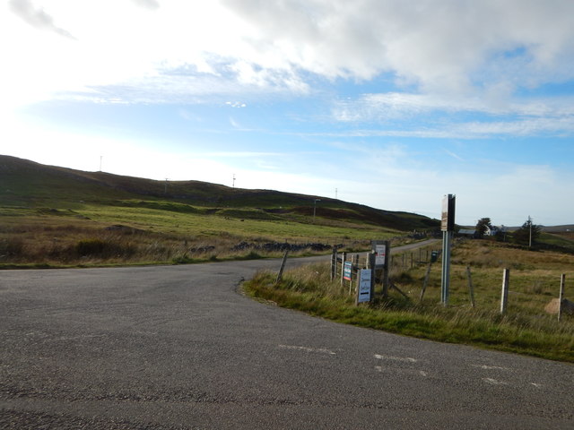
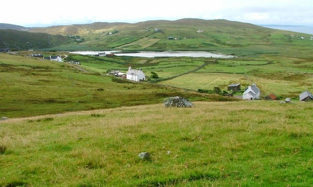
The Bay of Stoer is a picturesque coastal area located in the county of Sutherland, in the northern Highlands of Scotland. Situated on the northwestern coast, the bay is renowned for its stunning natural beauty and rugged landscapes.

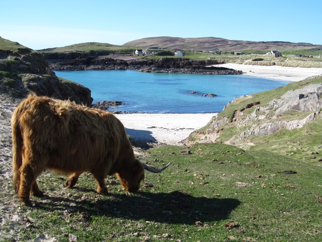
The bay is characterized by its dramatic cliffs and rocky shoreline, which provide a habitat for a diverse range of wildlife such as seabirds, seals, and even occasional sightings of dolphins and whales. The towering cliffs, rising up to 60 meters in some places, offer breathtaking views of the surrounding area and the open sea.

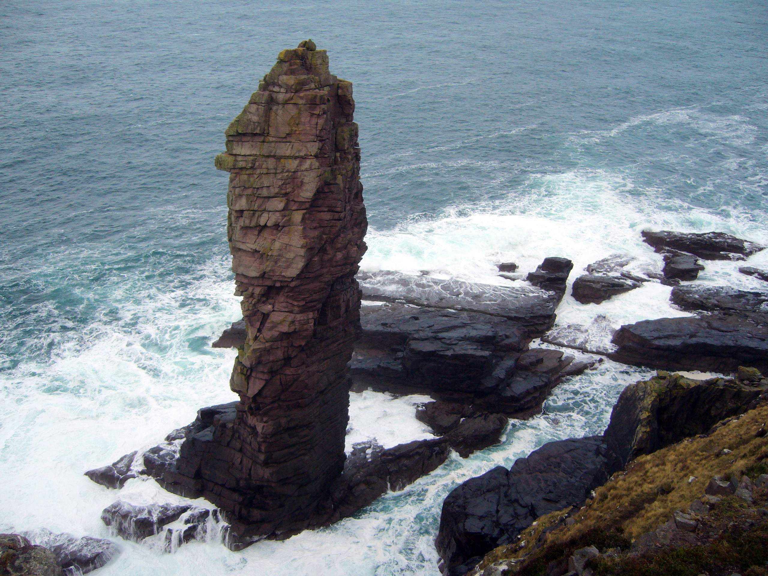
One of the main attractions in the Bay of Stoer is the Old Man of Stoer, a famous sea stack that stands isolated off the coast. This tall, narrow pinnacle of rock is a popular spot for rock climbers and hikers, who can enjoy the challenge of reaching its summit or simply marvel at its awe-inspiring beauty from the shore.

The bay also offers opportunities for outdoor activities such as fishing, kayaking, and birdwatching. The sandy beaches and crystal-clear waters provide a serene setting for a leisurely stroll or a relaxing picnic. The area is also a haven for geologists and nature enthusiasts, as it showcases a variety of geological formations and rare plant species.

With its untamed beauty and tranquil atmosphere, the Bay of Stoer is a must-visit destination for nature lovers and those seeking an escape from the hustle and bustle of everyday life.

If you have any feedback on the listing, please let us know in the comments section below.

Bay of Stoer Images

Images are sourced within 2km of 58.198377/-5.3460319 or Grid Reference NC0328. Thanks to Geograph Open Source API. All images are credited.
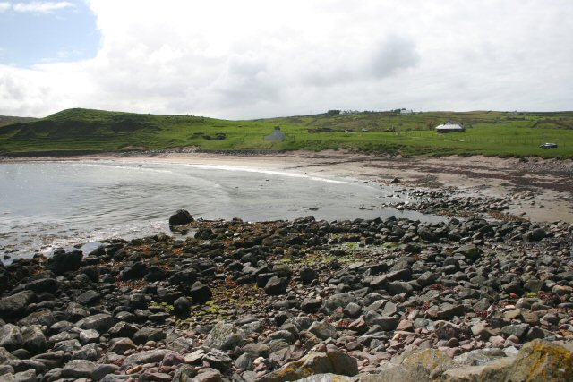
Cattle Grid at Balchladich Tricky things to negotiate on foot! Especially when damp.
Cattle Grid at Balchladich
Tricky things to negotiate on foot! Especially when damp.
Highland Road Road from Balchladich back towards the Stoer road.
Highland Road
Road from Balchladich back towards the Stoer road.
Clachtoll Clachtoll shop and postbox
Clachtoll
Clachtoll shop and postbox
Stoer Communications Local Telephone Box and Postbox with a view
Stoer Communications
Local Telephone Box and Postbox with a view
Beach at Clachtoll
Beach at Clachtoll
Path above Clachtoll
Bay of Stoer A lone sheep contentedly grazes on the sloping grassland to the bay.
Bay of Stoer
A lone sheep contentedly grazes on the sloping grassland to the bay.
Ruined kirk at Stoer
Rienachait - Road turning to Culkein The rural B869.
Rienachait - Road turning to Culkein
The rural B869.
Loch an Aigeil Shallow, reed fringed loch just behind the beach and grassland of Stoer Bay. A distinct line here between the knobbly Lewisian Gneiss left of picture and a smooth slope of Torridon series sandstones to the right.
Loch an Aigeil
Shallow, reed fringed loch just behind the beach and grassland of Stoer Bay. A distinct line here between the knobbly Lewisian Gneiss left of picture and a smooth slope of Torridon series sandstones to the right.
Low tide at Stoer The beautiful beach below the settlement of Stoer.
Low tide at Stoer
The beautiful beach below the settlement of Stoer.
Rocks and sand at Stoer The Bay of Stoer has a superb sandy beach backed by a ramp of pebbles, which are always interesting to sort through due to the variety of rock types and colours displayed. On the hillside is the small village of Stoer, whilst to the right of the photo there are outcrops of Lewisian Gneiss. Below and to the left of the houses the contours become smoother as the underlying rocks are sandstones and mudstones of the Torridon period.
Rocks and sand at Stoer
The Bay of Stoer has a superb sandy beach backed by a ramp of pebbles, which are always interesting to sort through due to the variety of rock types and colours displayed. On the hillside is the small village of Stoer, whilst to the right of the photo there are outcrops of Lewisian Gneiss. Below and to the left of the houses the contours become smoother as the underlying rocks are sandstones and mudstones of the Torridon period.
An Dun broch interior Since my last visit in 2009, much has changed here. A team of archaeologists have been at work clearing out the rubble. The dun is now much more accessible and one can better appreciate its dimensions and layout. One curious item is the dark grey-green stone seen right of centre which has a hollow bowl carved into it. The type of stone is a mystery to me, but one would assume that it had a use in grinding or mixing food.
An Dun broch interior
Since my last visit in 2009, much has changed here. A team of archaeologists have been at work clearing out the rubble. The dun is now much more accessible and one can better appreciate its dimensions and layout. One curious item is the dark grey-green stone seen right of centre which has a hollow bowl carved into it. The type of stone is a mystery to me, but one would assume that it had a use in grinding or mixing food.
An Dun entrance Hard to remember, but I believe that on my last visit in 2009 this entrance would have been blocked by fallen stones. Thanks to the work of archaeologists it now makes a fine way into the broch. This is from the interior looking out.
An Dun entrance
Hard to remember, but I believe that on my last visit in 2009 this entrance would have been blocked by fallen stones. Thanks to the work of archaeologists it now makes a fine way into the broch. This is from the interior looking out.
Bay of Clachtoll A view southwards across the bay towards the famous 'split rock'. In the distance are the mountains of [L-R] Cul Beag, Stac Polly and the Ben Mor Coigach range.
Bay of Clachtoll
A view southwards across the bay towards the famous 'split rock'. In the distance are the mountains of [L-R] Cul Beag, Stac Polly and the Ben Mor Coigach range.
Beach at Clachtoll One of the smaller beaches of Clachtoll Bay. The Torridon series of rocks here all dip in a uniform manner of about 25 degrees to the WNW.
Beach at Clachtoll
One of the smaller beaches of Clachtoll Bay. The Torridon series of rocks here all dip in a uniform manner of about 25 degrees to the WNW.
Fine beaches on a fine day When the NW Highlands are blessed with fine weather, there's no better place in Britain. On this late April day there were people sitting in the sun and a few brave souls paddling. The view is across the inner section of the Bay of Clachtoll.
Fine beaches on a fine day
When the NW Highlands are blessed with fine weather, there's no better place in Britain. On this late April day there were people sitting in the sun and a few brave souls paddling. The view is across the inner section of the Bay of Clachtoll.
Grazing with a view This highland cow is far more interested in fresh grass than the fine view over Clachtoll beach.
Grazing with a view
This highland cow is far more interested in fresh grass than the fine view over Clachtoll beach.
Show me another place!

Bay of Stoer is located at Grid Ref: NC0328 (Lat: 58.198377, Lng: -5.3460319)

Unitary Authority: Highland

Police Authority: Highlands and Islands

What 3 Words

///lotteries.limelight.lurching. Near Clachtoll, Highland

Related Wikis

Stoer

Stoer (Scottish Gaelic: An Stòr) is a crofting township in the parish of Assynt, Sutherland, in the Highlands of Scotland and in the council area of Highland...

Clachtoll

Clachtoll (Scottish Gaelic: Clach Toll) is a coastal fishing and crofting village situated on the Bay of Clachtoll, in the ancient parish of Assynt, Sutherland...

Balchladich

Balchladich (Scottish Gaelic: Baile a' Chladaich) is a remote township in the Assynt district of Sutherland, Scottish Highlands and is in the Scottish...

Clashmore, Assynt

Clashmore (Scottish Gaelic: An Clais Mór) is a scattered township in Assynt, in Sutherland, in the Highland council area of Scotland. It is situated on...

Achnacarnin

Achnacarnin (Scottish Gaelic: Achadh nan Càrnan) is a village on the headland of Point of Stoer in Lairg, Sutherland, within the Scottish local authority...

Achmelvich

Achmelvich (Gaelic: Achadh Mhealbhaich) is a settlement situated in the Highland region of Scotland. The name comes from the Gaelic "Achadh" - a plain...

Clashnessie

Clashnessie (Scottish Gaelic: Clais an Easaidh) is a small crofting community on the North-West coast of Scotland; specifically in the Assynt area of Sutherland...

Culkein

Culkein Stoer (Scottish Gaelic: An Cùl-cinn) is a remote former fishing village, centred on the Bay of Culkein, in Assynt in Sutherland, Scottish Highlands...

Nearby Amenities

Located within 500m of 58.198377,-5.3460319
Source: PGS
Lat/Long: 58.1993585/-5.3412477
Source: PGS
Lat/Long: 58.1990191/-5.3407474
Source: PGS
Lat/Long: 58.1986689/-5.3404079
Source: PGS
Lat/Long: 58.1983062/-5.3404572
Source: PGS
Lat/Long: 58.1980231/-5.3410331
Source: PGS
Lat/Long: 58.1978013/-5.3415162
Stoer Bay
Natural: bay
Source: OS_OpenData_StreetView
Lat/Long: 58.1983454/-5.3466676
Clachtoll Broch
Historic: archaeological_site
Lat/Long: 58.1955439/-5.3421857
The data included in this document is from www.openstreetmap.org. The data is made available under ODbL.

Have you been to Bay of Stoer?

Leave your review of Bay of Stoer below (or comments, questions and feedback).