Bear Craig

Coastal Marsh, Saltings in Buteshire

Scotland

Bear Craig

Colintraive, Kyles of Bute Viewed from the shore near Rhubodach Farm on Bute.
Colintraive, Kyles of Bute Credit: Thomas Nugent

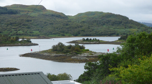
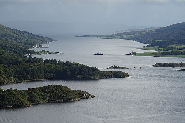
Bear Craig is a coastal marsh located in Buteshire, Scotland. It is known for its picturesque beauty and unique ecosystem. Situated along the coastline, it encompasses a vast expanse of salt marshes and saltings.

The marsh is characterized by its rich biodiversity, with a variety of plant and animal species thriving in this unique habitat. The salt marshes are dominated by salt-tolerant plants such as samphire, sea lavender, and cordgrass. These plants play a crucial role in stabilizing the soil and preventing erosion, while also providing food and shelter for numerous species.

The marsh is also an important feeding and nesting ground for several bird species, including wading birds like curlews, oystercatchers, and redshanks. These birds can often be spotted probing the muddy flats for food or flying gracefully over the marsh.

Bear Craig offers a tranquil environment for nature enthusiasts and provides opportunities for recreational activities such as birdwatching and hiking. The marsh is also of scientific interest, as it serves as a natural laboratory for studying the effects of saltwater intrusion and the dynamics of coastal ecosystems.

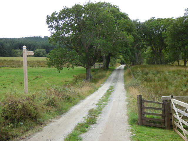
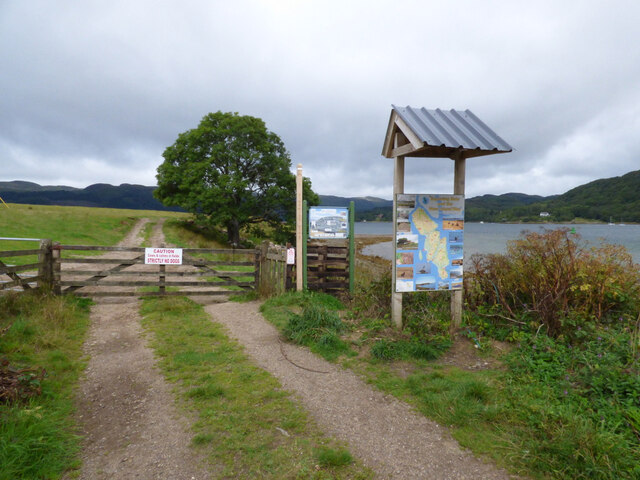
Visitors to Bear Craig can enjoy breathtaking views of the surrounding coastal landscape, with the waves crashing against the rocky cliffs and the salty air filling the atmosphere. The marsh is easily accessible, with footpaths and observation points allowing visitors to explore and appreciate the beauty of this coastal gem.

Overall, Bear Craig is a remarkable coastal marsh that offers a unique and diverse ecosystem, making it a must-visit destination for nature lovers and those seeking a peaceful retreat by the sea.

If you have any feedback on the listing, please let us know in the comments section below.

Bear Craig Images

Images are sourced within 2km of 55.92529/-5.1777811 or Grid Reference NS0174. Thanks to Geograph Open Source API. All images are credited.

Colintraive, Kyles of Bute Viewed from the shore near Rhubodach Farm on Bute.
Colintraive, Kyles of Bute
Viewed from the shore near Rhubodach Farm on Bute.
Way-marked route at Rhubodach Cottage Balnakailly Loop, leading to the West Island Way. See also <a href="https://www.geograph.org.uk/photo/6973981">NS0373 : Fingerpost route sign</a>.
Way-marked route at Rhubodach Cottage
Balnakailly Loop, leading to the West Island Way. See also NS0373 : Fingerpost route sign.
Fingerpost route sign Balnakailly Loop, leading to the West Island Way. See also <a href="https://www.geograph.org.uk/photo/6973976">NS0373 : Way-marked route at Rhubodach Cottage</a>.
Fingerpost route sign
Balnakailly Loop, leading to the West Island Way. See also NS0373 : Way-marked route at Rhubodach Cottage.
Bute Cycle Network sign Showing cycling time from Rhubodach ferry terminal (as opposed to distance) to various points around the island. Distances would be helpful too.
Bute Cycle Network sign
Showing cycling time from Rhubodach ferry terminal (as opposed to distance) to various points around the island. Distances would be helpful too.
Rhubodach ferry terminal At the north end of the A886 road on the isle of Bute. The same road continues from Colintraive on the other side of the Kyles of Bute.
Rhubodach ferry terminal
At the north end of the A886 road on the isle of Bute. The same road continues from Colintraive on the other side of the Kyles of Bute.
Balnakailly Forest Walk signs Near the ferry terminal at Rhubodach.
Balnakailly Forest Walk signs
Near the ferry terminal at Rhubodach.
Rhubha a Bhodaich A small headland just north of the Rhubodach ferry.
Rhubha a Bhodaich
A small headland just north of the Rhubodach ferry.
Rhubodach ferry terminal The ferry can be seen at Colintraive on the opposite bank.
Rhubodach ferry terminal
The ferry can be seen at Colintraive on the opposite bank.
Yacht in the Kyles of Bute Coming close to the ferry which is about to leave Rhubodach for Colintraive.
Yacht in the Kyles of Bute
Coming close to the ferry which is about to leave Rhubodach for Colintraive.
Ferry at Colintraive A Black of Dunoon lorry leaving the ferry Loch Dunvegan, having just made the crossing from Rhubodach in under five minutes.
Ferry at Colintraive
A Black of Dunoon lorry leaving the ferry Loch Dunvegan, having just made the crossing from Rhubodach in under five minutes.
The Kyles of Bute Looking towards the Isle of Bute and the Rhubodach ferry slipway from the B866 road at Glachavoil.
The Kyles of Bute
Looking towards the Isle of Bute and the Rhubodach ferry slipway from the B866 road at Glachavoil.
The Burnt Islands In the Kyles of Bute near Colintraive. Viewed from the B866 road at Glachavoil.
The Burnt Islands
In the Kyles of Bute near Colintraive. Viewed from the B866 road at Glachavoil.
Kyles of Bute The Isle of Bute ferry crossing the Kyles of Bute, seen from the viewpoint above Loch Riddon.
Kyles of Bute
The Isle of Bute ferry crossing the Kyles of Bute, seen from the viewpoint above Loch Riddon.
Houses at Colintraive From the ferry terminal
Houses at Colintraive
From the ferry terminal
Ferry terminal at Rhubodach For services to Colintraive.
Ferry terminal at Rhubodach
For services to Colintraive.
Caledonian MacBrayne and Claas CalMac are much-maligned by one thing or another at the moment, at least in this view there is some Claas!  The MV Loch Alainn brings a Claas self-propelled forage harvester across the Kyles of Bute from Colintraive to Rhubodach.

The MV Loch Alainn usually operates on the Barra to Eriskay route.

This photograph was taken during the Coronavirus (COVID-19) pandemic of 2020/21.
Caledonian MacBrayne and Claas
CalMac are much-maligned by one thing or another at the moment, at least in this view there is some Claas! The MV Loch Alainn brings a Claas self-propelled forage harvester across the Kyles of Bute from Colintraive to Rhubodach. The MV Loch Alainn usually operates on the Barra to Eriskay route. This photograph was taken during the Coronavirus (COVID-19) pandemic of 2020/21.
Rhubodach A roadside view of Rhubodach, the former home of the legendary film actor and director Richard Attenborough.  

This photograph was taken during the Coronavirus (COVID-19) pandemic of 2020/21.
Rhubodach
A roadside view of Rhubodach, the former home of the legendary film actor and director Richard Attenborough. This photograph was taken during the Coronavirus (COVID-19) pandemic of 2020/21.
Inside Balnakailly 'Operation Starfish' decoy control bunker Light pouring in and illuminating the rungs providing escape from the bunker operations room.  

The Bute At War site <span class="nowrap"><a title="http://www.bute-at-war.org/butewar.shtml" rel="nofollow ugc noopener" href="http://www.bute-at-war.org/butewar.shtml">Link</a><img style="margin-left:2px;" alt="External link" title="External link - shift click to open in new window" src="https://s1.geograph.org.uk/img/external.png" width="10" height="10"/></span> notes: 'At the north end of the Isle of Bute a decoy village was constructed and maintained by the Royal Navy. Wooden frames about 7' long by about 5 or 6' high with windows were erected between the field at the Bull Loch and round to Balnakailly Burn.  Six or seven Navy personnel based at Rhubodach House operated the electric generators. The 'village' was illuminated at night in an attempt to confuse enemy bombers, and hopefully to draw them away from Greenock or Clydebank.  No bombs fell on Rhubodach, although a German plane returning from the Greenock blitz jettisoned two bombs near the Greenan Loch.'

This photograph was taken during the Coronavirus (COVID-19) pandemic of 2020/21.
Inside Balnakailly 'Operation Starfish' decoy control bunker
Light pouring in and illuminating the rungs providing escape from the bunker operations room. The Bute At War site LinkExternal link notes: 'At the north end of the Isle of Bute a decoy village was constructed and maintained by the Royal Navy. Wooden frames about 7' long by about 5 or 6' high with windows were erected between the field at the Bull Loch and round to Balnakailly Burn. Six or seven Navy personnel based at Rhubodach House operated the electric generators. The 'village' was illuminated at night in an attempt to confuse enemy bombers, and hopefully to draw them away from Greenock or Clydebank. No bombs fell on Rhubodach, although a German plane returning from the Greenock blitz jettisoned two bombs near the Greenan Loch.' This photograph was taken during the Coronavirus (COVID-19) pandemic of 2020/21.
Show me another place!

Bear Craig is located at Grid Ref: NS0174 (Lat: 55.92529, Lng: -5.1777811)

Unitary Authority: Argyll and Bute

Police Authority: Argyll and West Dunbartonshire

What 3 Words

///bedspread.headache.poem. Near Port Bannatyne, Argyll & Bute

Related Wikis

Burnt Islands

The Burnt Islands (Scottish Gaelic: Na h-Eileanan Loisgte) are three small islands that lie in the Kyles of Bute, on the Cowal Peninsula, Argyll and Bute...
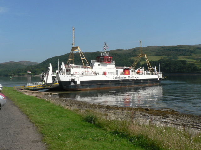
Kyles of Bute

The Kyles of Bute (Scottish Gaelic: Na Caoil Bhòdach) form a narrow sea channel that separates the northern end of the Isle of Bute from the Cowal peninsula...

Eilean Dubh, Kyles of Bute

This particular Eilean Dubh (Scottish Gaelic: Black Island) is sometimes known as Glen Caladh Island and lies just off the Cowal peninsula in the Kyles...

Colintraive

Colintraive (Scottish Gaelic: Caol an t-Snàimh) is a village in Argyll and Bute, Scotland. Once the site where cattle were swum across the narrows to the...

Rhubodach

Rhubodach is a small settlement on the north-eastern shore of the Isle of Bute, Argyll and Bute, Scotland. The name rhubodach may come from the Gaelic...
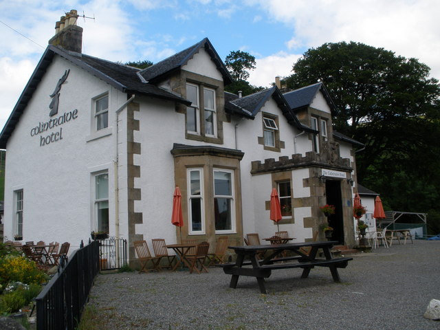
Colintraive Hotel

The Colintraive Hotel (also known as The Colintraive) is a hotel and pub in Colintraive, Argyll and Bute, Scotland. It was formerly a hunting lodge for...

Eilean Dearg, Loch Ruel

Eilean Dearg is a small island in Loch Ruel (or Loch Riddon) in Argyll, Scotland. The island was once home to a castle, which was destroyed by naval action...
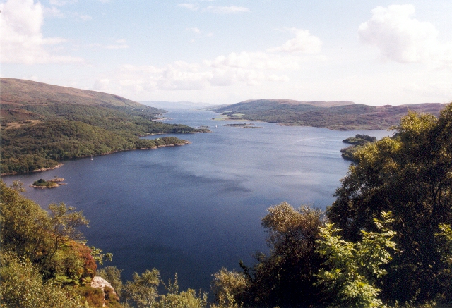
Loch Ruel

Loch Ruel or Loch Riddon; extends north from the Kyles of Bute and is a sea loch in Argyll and Bute, Scotland. == See also == River Ruel == References... ==

Nearby Amenities

Located within 500m of 55.92529,-5.1777811
Source: PGS
Lat/Long: 55.9288002/-5.1775606
Source: PGS
Lat/Long: 55.9290763/-5.1774234
Source: PGS
Lat/Long: 55.929157/-5.1772619
Source: PGS
Lat/Long: 55.9293086/-5.1771498
Source: PGS
Lat/Long: 55.9294799/-5.1767507
Source: PGS
Lat/Long: 55.9293686/-5.1766052
Source: PGS
Lat/Long: 55.9291659/-5.1764695
Source: PGS
Lat/Long: 55.9288663/-5.1766557
Source: PGS
Lat/Long: 55.9284371/-5.1770553
Source: PGS
Lat/Long: 55.9279986/-5.1775199
Source: PGS
Lat/Long: 55.9281342/-5.1780751
Source: PGS
Lat/Long: 55.9284077/-5.1781872
Source: PGS
Lat/Long: 55.9286303/-5.1780665
Source: PGS
Lat/Long: 55.9287382/-5.1777913
Source: PGS
Lat/Long: 55.9264063/-5.1740115
Source: PGS
Lat/Long: 55.9265377/-5.1743061
Source: PGS
Lat/Long: 55.9267745/-5.1743399
Source: PGS
Lat/Long: 55.9268521/-5.1746472
Source: PGS
Lat/Long: 55.9270783/-5.1747873
Source: PGS
Lat/Long: 55.9274243/-5.1746323
Source: PGS
Lat/Long: 55.9276443/-5.1745003
Source: PGS
Lat/Long: 55.9280265/-5.1746269
Source: PGS
Lat/Long: 55.9282008/-5.174246
Source: PGS
Lat/Long: 55.9280353/-5.1734606
Source: PGS
Lat/Long: 55.9282032/-5.1733356
Source: PGS
Lat/Long: 55.9281999/-5.1729076
Source: PGS
Lat/Long: 55.928028/-5.1725203
Source: PGS
Lat/Long: 55.9276584/-5.1723985
Source: PGS
Lat/Long: 55.9272422/-5.1729221
Source: PGS
Lat/Long: 55.9266119/-5.1730636
Source: PGS
Lat/Long: 55.92637/-5.1730025
Source: PGS
Lat/Long: 55.9262054/-5.1730862
Source: PGS
Lat/Long: 55.9249045/-5.173084
Source: PGS
Lat/Long: 55.925227/-5.1736505
Source: PGS
Lat/Long: 55.9262627/-5.1736039
Seamark Beacon Cardinal Category: north
Seamark Beacon Cardinal Colour: black;yellow
Seamark Beacon Cardinal Colour Pattern: horizontal
Seamark Beacon Cardinal Shape: pile
Seamark Topmark Colour: black
Seamark Topmark Shape: 2 cones up
Seamark Type: beacon_cardinal
Lat/Long: 55.9235946/-5.1718519
Note: Approximate location
Seamark Buoy Lateral Category: starboard
Seamark Buoy Lateral Colour: green
Seamark Buoy Lateral Shape: conical
Seamark Buoy Lateral System: iala-a
Seamark Type: buoy_lateral
Lat/Long: 55.9261408/-5.1771749
Note: Approximate location
Seamark Buoy Lateral Category: port
Seamark Buoy Lateral Colour: red
Seamark Buoy Lateral Shape: can
Seamark Buoy Lateral System: iala-a
Seamark Type: buoy_lateral
Lat/Long: 55.9280232/-5.1816055
The data included in this document is from www.openstreetmap.org. The data is made available under ODbL.

Have you been to Bear Craig?

Leave your review of Bear Craig below (or comments, questions and feedback).