Hopton, Lower

Settlement in Shropshire

England

Hopton, Lower

Milestone Milestone on what would have been the A5 near to Nesscliffe, Shropshire; for overall view see <a title="https://www.geograph.org.uk/photo/4930458" href="https://www.geograph.org.uk/photo/4930458">Link</a>
Milestone Credit: Keith Evans

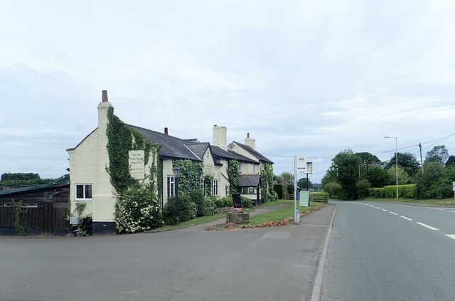
Hopton Lower is a small village located in the county of Shropshire, England. Situated in the West Midlands region, it is part of the larger parish of Hopton and Coton. The village is nestled in rural surroundings, with beautiful countryside and scenic views.

Hopton Lower is a close-knit community with a population of around 500 residents. The village is known for its peaceful atmosphere and friendly locals. It boasts a range of amenities, including a village hall, a pub, and a primary school, providing essential services for residents.

The village is well-connected to nearby towns and cities via road links, with the A49 passing through Hopton Lower, providing easy access to Shrewsbury, the county town of Shropshire. The village also benefits from good public transportation, with regular bus services connecting it to neighboring areas.

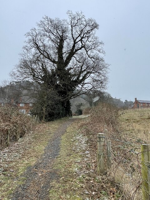
Hopton Lower offers a range of recreational activities, with several walking trails and footpaths in the surrounding countryside, allowing residents to enjoy the natural beauty of the area. The village is also within close proximity to several historical and cultural attractions, including Hopton Castle, a medieval fortification that dates back to the 12th century.

Overall, Hopton Lower is a picturesque village that offers a peaceful and idyllic lifestyle. With its strong sense of community and stunning rural surroundings, it is an attractive place to live for those seeking a quiet and close-knit community in the heart of Shropshire.

If you have any feedback on the listing, please let us know in the comments section below.

Hopton, Lower Images

Images are sourced within 2km of 52.783228/-2.9191801 or Grid Reference SJ3821. Thanks to Geograph Open Source API. All images are credited.

Milestone Milestone on what would have been the A5 near to Nesscliffe, Shropshire; for overall view see <a title="https://www.geograph.org.uk/photo/4930458" href="https://www.geograph.org.uk/photo/4930458">Link</a>
Milestone
Milestone on what would have been the A5 near to Nesscliffe, Shropshire; for overall view see Link
Holyhead 98 Milestone on what would have been the A5 near to Nesscliffe, Shropshire; for close up view see <a title="https://www.geograph.org.uk/photo/4930452" href="https://www.geograph.org.uk/photo/4930452">Link</a>
Holyhead 98
Milestone on what would have been the A5 near to Nesscliffe, Shropshire; for close up view see Link
Kynaston's Cave, Nesscliffe Reputedly the hideaway of the highwayman Humphrey Kynaston.
Kynaston's Cave, Nesscliffe
Reputedly the hideaway of the highwayman Humphrey Kynaston.
Ordnance Survey Flush Bracket 2765 This can be found on the wall of a house - a private dwelling - at The Prill. There is also a 'cancelled' Cut Mark at the same location which this bracket presumably supersedes.
For more detail see : <span class="nowrap"><a title="http://www.bench-marks.org.uk/bm2285" rel="nofollow ugc noopener" href="http://www.bench-marks.org.uk/bm2285">Link</a><img style="margin-left:2px;" alt="External link" title="External link - shift click to open in new window" src="https://s1.geograph.org.uk/img/external.png" width="10" height="10"/></span>
Ordnance Survey Flush Bracket 2765
This can be found on the wall of a house - a private dwelling - at The Prill. There is also a 'cancelled' Cut Mark at the same location which this bracket presumably supersedes. For more detail see : LinkExternal link
Road (the former A5) at The Prill Looking north-westward.
Road (the former A5) at The Prill
Looking north-westward.
Well Lane near Nesscliffe Looking south-westward.
Well Lane near Nesscliffe
Looking south-westward.
A5 north of Kinton
A5 north of Kinton
Woodland in Spring Nesscliffe Hill Country Park.
Woodland in Spring
Nesscliffe Hill Country Park.
Old Milestone by the former A5, Nesscliffe Metal plate attached to stone post by the UC road (was A5), in parish of GREAT NESS (SHREWSBURY AND ATCHAM District), 30m South East of the junction between the A5 and Well Lane, Nesscliffe, by North end of bus stop layby, on verge, by large tree, on South West side of road. Telford gabled iron plate, erected by the Holyhead Road turnpike trust in the 19th century. 

Inscription reads:-
HOLY-
HEAD
98 - M
SALOP
8M-6F

Grade II Listed. List Entry Number: 1175339 
<span class="nowrap"><a title="https://historicengland.org.uk/listing/the-list/list-entry/1175339" rel="nofollow ugc noopener" href="https://historicengland.org.uk/listing/the-list/list-entry/1175339">Link</a><img style="margin-left:2px;" alt="External link" title="External link - shift click to open in new window" src="https://s1.geograph.org.uk/img/external.png" width="10" height="10"/></span>

Milestone Society National ID: SA_HH098.
Old Milestone by the former A5, Nesscliffe
Metal plate attached to stone post by the UC road (was A5), in parish of GREAT NESS (SHREWSBURY AND ATCHAM District), 30m South East of the junction between the A5 and Well Lane, Nesscliffe, by North end of bus stop layby, on verge, by large tree, on South West side of road. Telford gabled iron plate, erected by the Holyhead Road turnpike trust in the 19th century. Inscription reads:- HOLY- HEAD 98 - M SALOP 8M-6F Grade II Listed. List Entry Number: 1175339 LinkExternal link Milestone Society National ID: SA_HH098.
Horse gallops Adjacent to the minor road from Great Ness to Horton.
Horse gallops
Adjacent to the minor road from Great Ness to Horton.
The Old Three Pigeons, Nesscliffe A bit off the beaten track since Nesscliffe acquired a by-pass.
The Old Three Pigeons, Nesscliffe
A bit off the beaten track since Nesscliffe acquired a by-pass.
Nesscliffe War Memorial
Steps up to Kynaston's Cave at Nesscliffe
Former sandstone quarry at Nesscliffe Hill
Subway at the Services
The Shropshire Way leading into the village of Nesscliffe A magnificently old, ivy clad oak tree guards the path into Nesscliffe
The Shropshire Way leading into the village of Nesscliffe
A magnificently old, ivy clad oak tree guards the path into Nesscliffe
A5 Southbound at Nesscliffe Services The A5 is a major trunk road which runs for about 181 miles from London, in England, to Holyhead, in Wales. For part of its route, it follows a section of the Roman route which later took the Anglo-Saxon name Watling Street.  At Oswestry, the A5 joins the A483 and becomes the bypass to the east of the town. It continues to multiplex with the A483 until it reaches Halton, where it diverges towards Llangollen and Holyhead.
A5 Southbound at Nesscliffe Services
The A5 is a major trunk road which runs for about 181 miles from London, in England, to Holyhead, in Wales. For part of its route, it follows a section of the Roman route which later took the Anglo-Saxon name Watling Street. At Oswestry, the A5 joins the A483 and becomes the bypass to the east of the town. It continues to multiplex with the A483 until it reaches Halton, where it diverges towards Llangollen and Holyhead.
Oak tree in pastureland north of Kinton Seemingly standing guard over a field full of contented, munching, recently shorn sheep.
Oak tree in pastureland north of Kinton
Seemingly standing guard over a field full of contented, munching, recently shorn sheep.
Show me another place!

Hopton, Lower is located at Grid Ref: SJ3821 (Lat: 52.783228, Lng: -2.9191801)

Unitary Authority: Shropshire

Police Authority: West Mercia

What 3 Words

///done.guests.hobble. Near Ruyton-XI-Towns, Shropshire

Related Wikis

Nesscliffe

Nesscliffe is a village in Shropshire, England, located north of the River Severn. The village comes under the Great Ness parish. The A5 road, which previously...

Ruyton-XI-Towns

Ruyton-XI-Towns ( "ry-tən eleven towns"), formally Ruyton of the Eleven Towns or simply Ruyton, is a village and civil parish next to the River Perry in...

Kinton, Shropshire

Kinton is a hamlet in Shropshire, England. It is part of the civil parish of Great Ness, and is situated to the west of the A5 road. Richard Mathews, the...

Nesscliffe Training Area

The Nesscliffe Training Area is a military training facility located near Nesscliffe in Shropshire. == History == The training area is located on and around...

Nearby Amenities

Located within 500m of 52.783228,-2.9191801
Access: no
Barrier: stile
Foot: designated
Lat/Long: 52.7831614/-2.9192687
The data included in this document is from www.openstreetmap.org. The data is made available under ODbL.

Have you been to Hopton, Lower?

Leave your review of Hopton, Lower below (or comments, questions and feedback).