Morbhach a' Choire

Coastal Marsh, Saltings in Ross-shire

Scotland

Morbhach a' Choire

End of the footpath from Tom na Gruagaich
End of the footpath from Tom na Gruagaich Credit: David Brown

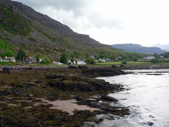
Morabhach a' Choire is a coastal marsh located in Ross-shire, Scotland. This diverse and ecologically important area is known for its rich salt marshes and saltings, which provide a unique habitat for a variety of plant and animal species.

The marsh is characterized by its flat, low-lying landscape, which is regularly inundated by the tides. This tidal influence creates a dynamic environment that supports a wide range of vegetation, including salt-tolerant plants like glasswort and sea lavender. These plants, in turn, provide food and shelter for a variety of bird species, such as wading birds, ducks, and geese.

Morabhach a' Choire is also an important breeding ground for many species of fish and invertebrates, which play a crucial role in the local ecosystem. The marsh's proximity to the sea also makes it a vital feeding and resting area for migratory birds, making it an essential stopover point for many species during their long journeys.

Overall, Morabhach a' Choire is a valuable and diverse coastal habitat that supports a wide range of plant and animal life, making it an important area for conservation and preservation efforts.

If you have any feedback on the listing, please let us know in the comments section below.

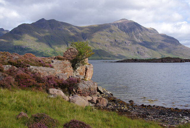
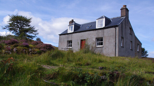
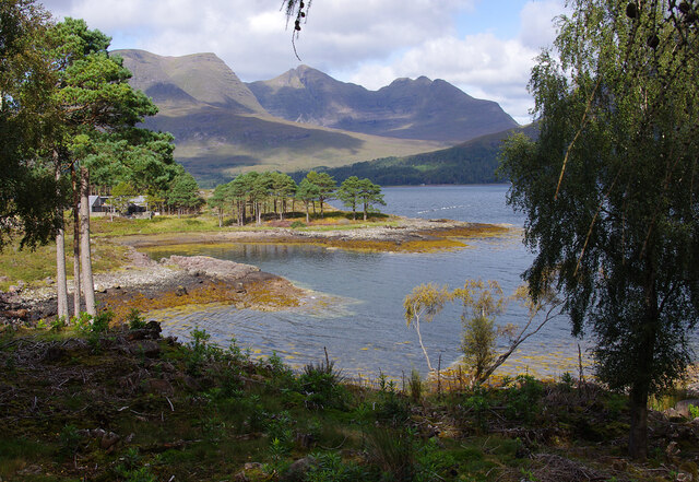
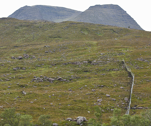
Morbhach a' Choire Images

Images are sourced within 2km of 57.552385/-5.561636 or Grid Reference NG8756. Thanks to Geograph Open Source API. All images are credited.

End of the footpath from Tom na Gruagaich
The path heads up towards Coire nan Laogh
Path up to Beinn Alligin
Typical Torridon Scenery Stunning scenery in Torridon looking to Sgurr Mor of Beinn Alligin and a waterfall on the Allt Toll a' Mhadaidh. Beinn Dearg can just be seen at the right of picture. A lovely day to be out in some of Scotland's finest scenery.
Typical Torridon Scenery
Stunning scenery in Torridon looking to Sgurr Mor of Beinn Alligin and a waterfall on the Allt Toll a' Mhadaidh. Beinn Dearg can just be seen at the right of picture. A lovely day to be out in some of Scotland's finest scenery.
Upper Loch Torridon Looking east from Port an Aird Mhòir, across Ob Gorm Mòr to Eilean Cnapach. Liathach is in the background.
Upper Loch Torridon
Looking east from Port an Aird Mhòir, across Ob Gorm Mòr to Eilean Cnapach. Liathach is in the background.
Cottage at Port an Aird Mhòir
Lùb Dubh-Àird Bay on the east side of Dubh-aird peninsula. Beinn Alligin forms the background.
Lùb Dubh-Àird
Bay on the east side of Dubh-aird peninsula. Beinn Alligin forms the background.
Horse grazing in a paddock A paddock, where a horse is grazing nonchalantly, shielded from Loch Torridon's elements by a swathe of gorse and bracken.  In the far distance, the hills encircling Loch Damh painting a rugged yet ominous beauty.
Horse grazing in a paddock
A paddock, where a horse is grazing nonchalantly, shielded from Loch Torridon's elements by a swathe of gorse and bracken. In the far distance, the hills encircling Loch Damh painting a rugged yet ominous beauty.
Rails to Sgùrr na Bana-Mhoraire From the MHWS mark, old rusty rails stretch across the pebbled shore, reaching out from the boathouse, their journey leading to Loch Torridon where the tide is at half-tide, a line marked, I estimate, by the ethereal northing. On the distant horizon, across the tranquil waters of Loch Torridon, stands Sgùrr na Bana-Mhoraire, the "peak of the lady," its name echoing the tale of a forlorn lady who was ordered to endure the summit's harsh embrace, surviving solely on seafood brought to her, a tragic consequence of her lord's merciless judgment for some transgression.

Source: Drummond, Peter. "Scottish Hill Names." Page 196. Scottish Mountaineering Trust. 1992.
Rails to Sgùrr na Bana-Mhoraire
From the MHWS mark, old rusty rails stretch across the pebbled shore, reaching out from the boathouse, their journey leading to Loch Torridon where the tide is at half-tide, a line marked, I estimate, by the ethereal northing. On the distant horizon, across the tranquil waters of Loch Torridon, stands Sgùrr na Bana-Mhoraire, the "peak of the lady," its name echoing the tale of a forlorn lady who was ordered to endure the summit's harsh embrace, surviving solely on seafood brought to her, a tragic consequence of her lord's merciless judgment for some transgression. Source: Drummond, Peter. "Scottish Hill Names." Page 196. Scottish Mountaineering Trust. 1992.
Half-tide at Loch Torridon On the pebble shore of Loch Torridon, Bladderwrack asserts its dominance as the tide gently recedes. In the distance horizon, across the tranquil waters, stands Sgùrr na Bana-Mhoraire, the "peak of the lady," its name echoing the tale of a forlorn lady who was ordered to endure the summit's harsh embrace, surviving solely on seafood brought to her, a tragic consequence of her lord's merciless judgment for some transgression.

Source: Drummond, Peter. "Scottish Hill Names." Page 196. Scottish Mountaineering Trust. 1992.
Half-tide at Loch Torridon
On the pebble shore of Loch Torridon, Bladderwrack asserts its dominance as the tide gently recedes. In the distance horizon, across the tranquil waters, stands Sgùrr na Bana-Mhoraire, the "peak of the lady," its name echoing the tale of a forlorn lady who was ordered to endure the summit's harsh embrace, surviving solely on seafood brought to her, a tragic consequence of her lord's merciless judgment for some transgression. Source: Drummond, Peter. "Scottish Hill Names." Page 196. Scottish Mountaineering Trust. 1992.
Allt Ghoibhle Allt Ghoibhle, a humble stream, tumbles down to Loch Torridon. Its waters dancing over rugged rocks, embraced by bracken with the occasional sprig of purple Bell heather. Higher up the brae of Liathach, Silver birch and Rowan trees become few and far between, and the hillside grows wilder and rockier.
Allt Ghoibhle
Allt Ghoibhle, a humble stream, tumbles down to Loch Torridon. Its waters dancing over rugged rocks, embraced by bracken with the occasional sprig of purple Bell heather. Higher up the brae of Liathach, Silver birch and Rowan trees become few and far between, and the hillside grows wilder and rockier.
Half-tide at Loch Torridon; a view to Beinn na h-Eaglaise On the pebble shore of Loch Torridon, Bladderwrack asserts its dominance as the tide gently recedes. In the distance horizon, across the tranquil waters, stands Beinn na h-Eaglaise, "the hill of the church," perhaps a reminder of the importance that the Christian religion played in the clansmen's lives.

Source: Drummond, Peter. "Scottish Hill Names." Page 194. Scottish Mountaineering Trust. 1992.
Half-tide at Loch Torridon; a view to Beinn na h-Eaglaise
On the pebble shore of Loch Torridon, Bladderwrack asserts its dominance as the tide gently recedes. In the distance horizon, across the tranquil waters, stands Beinn na h-Eaglaise, "the hill of the church," perhaps a reminder of the importance that the Christian religion played in the clansmen's lives. Source: Drummond, Peter. "Scottish Hill Names." Page 194. Scottish Mountaineering Trust. 1992.
Waterfall on the Abhainn Coire Mhic Nòbuil A well-known waterfall in this popular area, seen here in a comparatively tame state after a period of good weather. For a view of it in wetter conditions see <a href="https://www.geograph.org.uk/photo/697041">NG8657 : The Abhainn Coire Mhic Nobuil</a> taken 20 years before.
Waterfall on the Abhainn Coire Mhic Nòbuil
A well-known waterfall in this popular area, seen here in a comparatively tame state after a period of good weather. For a view of it in wetter conditions see NG8657 : The Abhainn Coire Mhic Nobuil taken 20 years before.
Footpath heading up Coire Mhic Nòbuil The lower part of the path including this part is within a large area fenced off to allow natural regeneration of woodland and other plants. At this point the path has been carefully reconstructed with stone. Beinn Dearg is visible in the background.
Footpath heading up Coire Mhic Nòbuil
The lower part of the path including this part is within a large area fenced off to allow natural regeneration of woodland and other plants. At this point the path has been carefully reconstructed with stone. Beinn Dearg is visible in the background.
Footpath heading up Coire Mhic Nòbuil The path has just left the fenced off area around the lower coire, and the carefully constructed stone surface has given way to loose rubble. This makes the surface significantly less pleasant than the relatively smooth dirt surface that was here the last time I was this way.

Beinn Dearg is the mountain ahead.
Footpath heading up Coire Mhic Nòbuil
The path has just left the fenced off area around the lower coire, and the carefully constructed stone surface has given way to loose rubble. This makes the surface significantly less pleasant than the relatively smooth dirt surface that was here the last time I was this way. Beinn Dearg is the mountain ahead.
Moorland around the Abhainn Coire Mhic Nòbuil With Sgùrr Mòr, the highest summit of Beinn Alligin, seen left of centre, and Na Rathanan, the Horns of Alligin, to its right.
Moorland around the Abhainn Coire Mhic Nòbuil
With Sgùrr Mòr, the highest summit of Beinn Alligin, seen left of centre, and Na Rathanan, the Horns of Alligin, to its right.
Moorland around the Abhainn Coire Mhic Nòbuil With Tom na Gruagaich, the second summit of Beinn Alligin, in the background.

The deer fence encloses a large area, and is to allow natural regeneration of the vegetation.
Moorland around the Abhainn Coire Mhic Nòbuil
With Tom na Gruagaich, the second summit of Beinn Alligin, in the background. The deer fence encloses a large area, and is to allow natural regeneration of the vegetation.
Rocks at Rubha nan Craobh with the mussel farm at Lùb Dhubh-Àird beyond
Show me another place!

Morbhach a' Choire is located at Grid Ref: NG8756 (Lat: 57.552385, Lng: -5.561636)

Unitary Authority: Highland

Police Authority: Highlands and Islands

What 3 Words

///kickers.skies.games. Near Kinlochewe, Highland

Nearby Locations

Morbhach a' Choire

Related Wikis

Torridon

Torridon (Scottish Gaelic: Toirbheartan) is a small village in the Northwest Highlands of Scotland. However the name is also applied to the area surrounding...

Torridon Hills

The Torridon Hills surround Torridon village in the Northwest Highlands of Scotland. The name is usually applied to the mountains to the north of Glen...

Annat, Highland

Annat (Scottish Gaelic: An Annaid) is a small village at the eastern end of Upper Loch Torridon in Wester Ross, in the Highland council area of Scotland...

Inveralligin

Inveralligin (Scottish Gaelic: Inbhir Àiliginn) is a remote crofting township which lies on the north shore of Loch Torridon in Wester Ross and is in the...

Nearby Amenities

Located within 500m of 57.552385,-5.561636
Source: PGS
Lat/Long: 57.5533243/-5.5682727
Source: PGS
Lat/Long: 57.553095/-5.5675038
Source: PGS
Lat/Long: 57.5528458/-5.5668058
Source: PGS
Lat/Long: 57.552764/-5.5664518
Source: PGS
Lat/Long: 57.5527607/-5.5656668
Source: PGS
Lat/Long: 57.5526733/-5.5645735
Source: PGS
Lat/Long: 57.5526889/-5.5640069
Source: PGS
Lat/Long: 57.5527685/-5.5633182
Source: PGS
Lat/Long: 57.5527692/-5.5628536
Source: PGS
Lat/Long: 57.5527531/-5.5622714
Source: PGS
Lat/Long: 57.5528546/-5.5617614
Source: PGS
Lat/Long: 57.5528077/-5.5616405
Source: PGS
Lat/Long: 57.5529334/-5.559851
Source: PGS
Lat/Long: 57.5528528/-5.5596526
Source: PGS
Lat/Long: 57.5533577/-5.5594172
Source: PGS
Lat/Long: 57.5530395/-5.5589523
Source: PGS
Lat/Long: 57.5533101/-5.5581758
Source: PGS
Lat/Long: 57.5527747/-5.5569531
Source: PGS
Lat/Long: 57.5529259/-5.5565338
Source: PGS
Lat/Long: 57.5529066/-5.5560937
Source: PGS
Lat/Long: 57.5529034/-5.555273
Created By: Merkaartor 0.12
Lat/Long: 57.5535877/-5.5588894
Created By: Merkaartor 0.12
Lat/Long: 57.5547089/-5.562717
Created By: Merkaartor 0.12
Lat/Long: 57.555093/-5.5635746
Morbhach a' Choire
Place: locality
Lat/Long: 57.5520086/-5.5609788
Coire
Place: hamlet
Lat/Long: 57.5551718/-5.5672013
Information: guidepost
Tourism: information
Lat/Long: 57.5547252/-5.5605654
The data included in this document is from www.openstreetmap.org. The data is made available under ODbL.

Have you been to Morbhach a' Choire?

Leave your review of Morbhach a' Choire below (or comments, questions and feedback).