Sibbernock Point

Coastal Marsh, Saltings in Pembrokeshire

Wales

Sibbernock Point

Sewage pumping station and tramway The tramway leads down to the remains of a brickworks. The finished bricks could be transshipped by sea.
Sewage pumping station and tramway Credit: Marion Phillips

Sibbernock Point is a beautiful coastal marsh and saltings located in Pembrokeshire, Wales. Situated on the western coast of the country, this peaceful and unspoiled area offers stunning views of the rugged cliffs and the vast expanse of the Atlantic Ocean.

The marsh at Sibbernock Point is a unique ecosystem that is home to a diverse range of plant and animal species. It is characterized by its lush vegetation, including reeds, grasses, and salt-tolerant plants. These plants provide an important habitat for various birds, insects, and small mammals.

The saltings, or salt marshes, are found at the edge of the marsh and are influenced by the tides. These areas are inundated with saltwater during high tide, creating a dynamic environment that supports a variety of marine life. The saltings are also rich in nutrients, attracting a wide range of bird species, including waders and waterfowl.

Sibbernock Point is a popular spot for birdwatching enthusiasts, as it provides an excellent vantage point to observe a wide variety of coastal and migratory birds. Visitors can often spot species such as curlews, oystercatchers, herons, and even the occasional seal or porpoise.

The area is also known for its scenic walking trails, offering visitors the opportunity to explore the marsh and its surroundings. With its picturesque landscapes, abundant wildlife, and tranquil atmosphere, Sibbernock Point is a must-visit destination for nature lovers and those seeking a peaceful retreat on the Pembrokeshire coast.

If you have any feedback on the listing, please let us know in the comments section below.

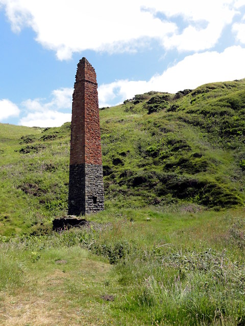
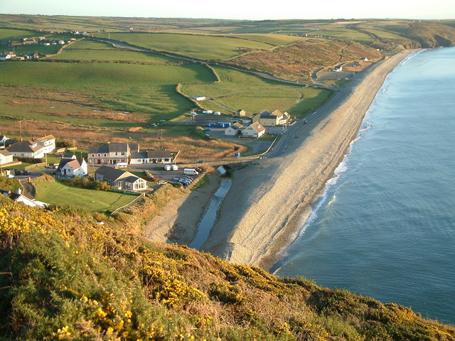
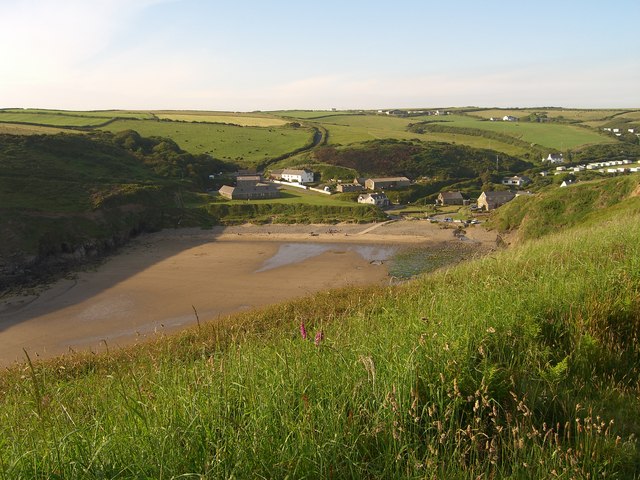
Sibbernock Point Images

Images are sourced within 2km of 51.848858/-5.1215141 or Grid Reference SM8521. Thanks to Geograph Open Source API. All images are credited.

Sewage pumping station and tramway The tramway leads down to the remains of a brickworks. The finished bricks could be transshipped by sea.
Sewage pumping station and tramway
The tramway leads down to the remains of a brickworks. The finished bricks could be transshipped by sea.
The Coastline at Trefrane Cliff The dark partially vegetated slope in the foreground gives away the fact that this was the location of mining activity. It is the end of the spoil heap from Trefrane Cliff Anthracite Mine.
The Coastline at Trefrane Cliff
The dark partially vegetated slope in the foreground gives away the fact that this was the location of mining activity. It is the end of the spoil heap from Trefrane Cliff Anthracite Mine.
Old Mine Chimney Just the foundations of an engine house are still here under the vegetation in front of the chimney. This used to be the site of the Trefrane Anthracite Mine.
Old Mine Chimney
Just the foundations of an engine house are still here under the vegetation in front of the chimney. This used to be the site of the Trefrane Anthracite Mine.
Ger / Near Glofa Trefane Colliery Llwybr yr arfordir ger hen Lofa Trefrane. Yn ymestyn i ffwrdd yn y pellter mae ehangder traeth euraidd y Niwgwl.

Coastal path near the former Trefrane Colliery. Stretching away in the distance is the golden beach of Newgale Sands.
Ger / Near Glofa Trefane Colliery
Llwybr yr arfordir ger hen Lofa Trefrane. Yn ymestyn i ffwrdd yn y pellter mae ehangder traeth euraidd y Niwgwl. Coastal path near the former Trefrane Colliery. Stretching away in the distance is the golden beach of Newgale Sands.
Newgale shore Looking westwards from the northern end of Newgale Sands.
Newgale shore
Looking westwards from the northern end of Newgale Sands.
Newgale Sands
Newgale Sands
Newgale Sands Looking towards the beach from Newgale Hill.
Newgale Sands
Looking towards the beach from Newgale Hill.
A487 between Newgale and Penycwm There are bilingual "Araf/Slow" road markings on A487 as you travel uphill towards the sharp bend ahead, by the entrance to Newgale Farm, heading for Penycwm.
A487 between Newgale and Penycwm
There are bilingual "Araf/Slow" road markings on A487 as you travel uphill towards the sharp bend ahead, by the entrance to Newgale Farm, heading for Penycwm.
Shingle beach at Newgale Sands
Newgale Sands
Newgale Sands
Cave on Newgale beach
Newgale beach
Newgale beach
Kite surfing at Newgale Sands
Newgale Sands A magnificent beach backed by a shingle bank.
Newgale Sands
A magnificent beach backed by a shingle bank.
Newgale Sands The full length of these glorious sands can be seen from the heights to the north on the Pembrokeshire Coast Path.
Newgale Sands
The full length of these glorious sands can be seen from the heights to the north on the Pembrokeshire Coast Path.
Newgale village Showing the beach, the shingle bank and the levels behind.
Newgale village
Showing the beach, the shingle bank and the levels behind.
Pembrokeshire Coast Path above Cwm Bach The Pembrokeshire Coast Path is a strenuous 186mile (299 km) long national trail, much of it along the cliff top. Newgale Sands can be seen in the distance.
Pembrokeshire Coast Path above Cwm Bach
The Pembrokeshire Coast Path is a strenuous 186mile (299 km) long national trail, much of it along the cliff top. Newgale Sands can be seen in the distance.
Evening light at Newgale An autumn evening with the sun already below the horizon. The coast towards St Davids is silhouetted against the sky.
Evening light at Newgale
An autumn evening with the sun already below the horizon. The coast towards St Davids is silhouetted against the sky.
Show me another place!

Sibbernock Point is located at Grid Ref: SM8521 (Lat: 51.848858, Lng: -5.1215141)

Unitary Authority: Pembrokeshire

Police Authority: Dyfed Powys

What 3 Words

///ended.dividers.hints. Near Broad Haven, Pembrokeshire

Related Wikis

Newgale, Pembrokeshire

Newgale (Welsh: Niwgwl) is a village with an almost two-mile (3 km) stretch of beach in the parish of Roch, Pembrokeshire, West Wales. The beach is situated...

Nolton Haven

Nolton Haven is a hamlet halfway along the coast of St Bride's Bay in Pembrokeshire, Wales. It is included within the Pembrokeshire Coast National Park...

Penycwm

Penycwm (Welsh for "Head of the valley") is a small settlement on the A487 road near Newgale, Pembrokeshire, Wales. It is part of the community (formerly...

Brawdy

Brawdy (Welsh: Breudeth) is a village and community in Pembrokeshire, Wales. == Etymology == The Welsh language name appears to be an archaic form of...

Related Videos

Newgale, Wales, UK

travel #travelvlog #PSEUDODRIVEOn my way to the furthest west-end of Wales from Cardiff, I stopped made a pitstop at Newgale ...

Nearby Amenities

Located within 500m of 51.848858,-5.1215141
Access: yes
Parking: surface
Lat/Long: 51.846607/-5.1180584
Source: OS_Opendata_Vectormap_District
Lat/Long: 51.8453574/-5.1178903
Source: OS_Opendata_Vectormap_District
Lat/Long: 51.8454828/-5.1180812
Source: OS_Opendata_Vectormap_District
Lat/Long: 51.8455411/-5.1180617
Source: OS_Opendata_Vectormap_District
Lat/Long: 51.8456364/-5.1180791
Source: OS_Opendata_Vectormap_District
Lat/Long: 51.8457155/-5.1181191
Source: OS_Opendata_Vectormap_District
Lat/Long: 51.8458331/-5.1181395
Source: OS_Opendata_Vectormap_District
Lat/Long: 51.8459818/-5.1181611
Source: OS_Opendata_Vectormap_District
Lat/Long: 51.8461696/-5.118268
Source: OS_Opendata_Vectormap_District
Lat/Long: 51.8463411/-5.1183281
Source: OS_Opendata_Vectormap_District
Lat/Long: 51.8464936/-5.1184396
Source: OS_Opendata_Vectormap_District
Lat/Long: 51.8466767/-5.118714
Source: OS_Opendata_Vectormap_District
Lat/Long: 51.8468253/-5.1189003
Source: OS_Opendata_Vectormap_District
Lat/Long: 51.8469773/-5.1190287
Source: OS_Opendata_Vectormap_District
Lat/Long: 51.8472423/-5.1192424
Source: OS_Opendata_Vectormap_District
Lat/Long: 51.8473944/-5.119371
Source: OS_Opendata_Vectormap_District
Lat/Long: 51.8475239/-5.1194651
Source: OS_Opendata_Vectormap_District
Lat/Long: 51.8477976/-5.1196702
Source: OS_Opendata_Vectormap_District
Lat/Long: 51.8479498/-5.1198372
Source: OS_Opendata_Vectormap_District
Lat/Long: 51.8482604/-5.1200011
Source: OS_Opendata_Vectormap_District
Lat/Long: 51.8483326/-5.1202874
Source: OS_Opendata_Vectormap_District
Lat/Long: 51.8484561/-5.1203814
Source: OS_Opendata_Vectormap_District
Lat/Long: 51.848665/-5.1205409
Source: OS_Opendata_Vectormap_District
Lat/Long: 51.8487999/-5.1206471
Source: OS_Opendata_Vectormap_District
Lat/Long: 51.8490047/-5.1208042
Source: OS_Opendata_Vectormap_District
Lat/Long: 51.849119/-5.1208928
Source: OS_Opendata_Vectormap_District
Lat/Long: 51.8492552/-5.1210044
Source: OS_Opendata_Vectormap_District
Lat/Long: 51.8493419/-5.121077
Source: OS_Opendata_Vectormap_District
Lat/Long: 51.849462/-5.1211745
Source: OS_Opendata_Vectormap_District
Lat/Long: 51.8496559/-5.1213288
Source: OS_Opendata_Vectormap_District
Lat/Long: 51.8498629/-5.1214967
Source: OS_Opendata_Vectormap_District
Lat/Long: 51.8499593/-5.1215743
Source: OS_Opendata_Vectormap_District
Lat/Long: 51.8501371/-5.1217124
Source: OS_Opendata_Vectormap_District
Lat/Long: 51.8502342/-5.1217878
Source: OS_Opendata_Vectormap_District
Lat/Long: 51.850357/-5.1218876
Source: OS_Opendata_Vectormap_District
Lat/Long: 51.8505655/-5.1220572
Source: OS_Opendata_Vectormap_District
Lat/Long: 51.8506724/-5.1221394
Source: OS_Opendata_Vectormap_District
Lat/Long: 51.8509006/-5.1223128
Source: OS_Opendata_Vectormap_District
Lat/Long: 51.8511693/-5.122524
Source: OS_Opendata_Vectormap_District
Lat/Long: 51.8512861/-5.1226165
Source: OS_Opendata_Vectormap_District
Lat/Long: 51.851545/-5.1228151
Source: OS_Opendata_Vectormap_District
Lat/Long: 51.8517184/-5.122946
Source: OS_Opendata_Vectormap_District
Lat/Long: 51.8519008/-5.1230878
Source: OS_Opendata_Vectormap_District
Lat/Long: 51.8524699/-5.1235446
Source: OS_Opendata_Vectormap_District
Lat/Long: 51.8529022/-5.1238902
Recycling
Lat/Long: 51.8465155/-5.1182143
The data included in this document is from www.openstreetmap.org. The data is made available under ODbL.

Have you been to Sibbernock Point?

Leave your review of Sibbernock Point below (or comments, questions and feedback).