Beauworth

Settlement in Hampshire Winchester

England

Beauworth

Refurbished barn on Holden Lane Earlier (and opposite direction) see <a title="https://www.geograph.org.uk/photo/3914644" href="https://www.geograph.org.uk/photo/3914644">Link</a> .
Refurbished barn on Holden Lane Credit: Peter Facey

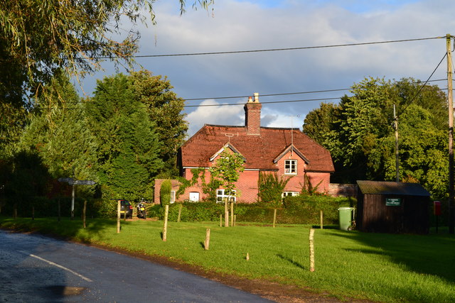
Beauworth is a small village situated in the county of Hampshire, England. It is located approximately 12 miles southeast of Winchester and 10 miles northwest of Petersfield. The village is nestled in the picturesque South Downs National Park, surrounded by rolling hills and beautiful countryside.

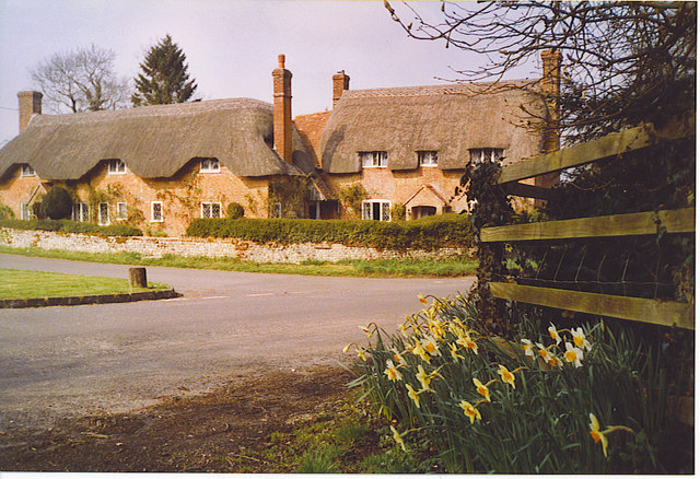
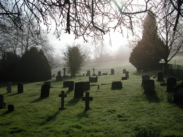
With a population of around 250 residents, Beauworth has a close-knit community feel. The village is known for its quaint charm and traditional English character, with many of the buildings dating back several centuries. One notable landmark is the 12th-century All Saints Church, which stands at the heart of the village and is a testament to its rich history.

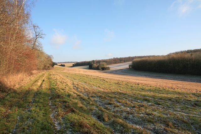
The surrounding area offers stunning natural beauty, making it an ideal destination for outdoor enthusiasts. There are numerous walking and cycling trails that meander through the nearby hills, providing breathtaking views of the countryside. Additionally, the village is close to several nature reserves and country parks, offering opportunities for wildlife spotting and peaceful picnics.

While Beauworth is predominantly residential, there are a few amenities within close proximity. The nearest town, Bishop's Waltham, is just a short drive away and offers a wider range of services, including shops, restaurants, and leisure facilities. The village also benefits from good transport links, with regular bus services connecting it to neighboring towns and villages, as well as easy access to major roads such as the A272 and A32.

In summary, Beauworth is a charming village nestled in the scenic Hampshire countryside. With its rich history, stunning natural surroundings, and a strong sense of community, it offers a tranquil and idyllic place to live or visit.

If you have any feedback on the listing, please let us know in the comments section below.

Beauworth Images

Images are sourced within 2km of 51.03065/-1.178532 or Grid Reference SU5726. Thanks to Geograph Open Source API. All images are credited.

Refurbished barn on Holden Lane Earlier (and opposite direction) see <a title="https://www.geograph.org.uk/photo/3914644" href="https://www.geograph.org.uk/photo/3914644">Link</a> .
Refurbished barn on Holden Lane
Earlier (and opposite direction) see Link .
Anti-Gypsy trenching on Holden Farm This recently-dug trench is not for drainage, as evidenced by the fact that there are bunds on both sides of it and there is nothing flowing into it. It is an example of the works that farmers find themselves forced to do to prevent unlawful occupation of their land by so-called travellers. It is a pity that lawyers are incapable of realising the trouble that they cause.
Anti-Gypsy trenching on Holden Farm
This recently-dug trench is not for drainage, as evidenced by the fact that there are bunds on both sides of it and there is nothing flowing into it. It is an example of the works that farmers find themselves forced to do to prevent unlawful occupation of their land by so-called travellers. It is a pity that lawyers are incapable of realising the trouble that they cause.
Muck being spread on Holden Farm Using the curious, red 5-wheeled vehicle, which has only one central wheel at its front.
Muck being spread on Holden Farm
Using the curious, red 5-wheeled vehicle, which has only one central wheel at its front.
Muck spreading on Holden Farm Showing a curious, red, 5-wheeled vehicle that is capable of quite aq turn of speed.
Muck spreading on Holden Farm
Showing a curious, red, 5-wheeled vehicle that is capable of quite aq turn of speed.
Wheatfield and Millbarrow Plantation
Bungalow on Kilmeston Road, New Cheriton
Kilmeston Road next to Kilmeston Manor The manor is behind the wall
Kilmeston Road next to Kilmeston Manor
The manor is behind the wall
House on the road to Kilmeston
Cottages by College Down Farm
Thatched cottages by the green at Beauworth
Long field near Kilmeston
Houses by the green at Kilmeston
Evening light on field at Kilmeston
Evening shadows and sheep south of Kilmeston
A272 The A272 is a very rural A road, which follows an east to west route from near Heathfield to Winchester, passing through the Sussex countryside. It runs 86 miles from Sutton Scotney to Five Ashes <a href="https://www.geograph.org.uk/photo/6669405">TQ5523 : A267, A272 junction</a>.
<span class="nowrap"><a title="http://www.sabre-roads.org.uk/wiki/index.php?title=A272" rel="nofollow ugc noopener" href="http://www.sabre-roads.org.uk/wiki/index.php?title=A272">Link</a><img style="margin-left:2px;" alt="External link" title="External link - shift click to open in new window" src="https://s1.geograph.org.uk/img/external.png" width="10" height="10"/></span> 
Wikipedia: <span class="nowrap"><a title="http://en.wikipedia.org/wiki/A272_road" rel="nofollow ugc noopener" href="http://en.wikipedia.org/wiki/A272_road">Link</a><img style="margin-left:2px;" alt="External link" title="External link - shift click to open in new window" src="https://s1.geograph.org.uk/img/external.png" width="10" height="10"/></span>
A272
The A272 is a very rural A road, which follows an east to west route from near Heathfield to Winchester, passing through the Sussex countryside. It runs 86 miles from Sutton Scotney to Five Ashes TQ5523 : A267, A272 junction. LinkExternal link Wikipedia: LinkExternal link
A272, Durden Cross The A272 is a very rural A road, which follows an east to west route from near Heathfield to Winchester, passing through the Sussex countryside. It runs 86 miles from Sutton Scotney to Five Ashes <a href="https://www.geograph.org.uk/photo/6669405">TQ5523 : A267, A272 junction</a>.
<span class="nowrap"><a title="http://www.sabre-roads.org.uk/wiki/index.php?title=A272" rel="nofollow ugc noopener" href="http://www.sabre-roads.org.uk/wiki/index.php?title=A272">Link</a><img style="margin-left:2px;" alt="External link" title="External link - shift click to open in new window" src="https://s1.geograph.org.uk/img/external.png" width="10" height="10"/></span> 
Wikipedia: <span class="nowrap"><a title="http://en.wikipedia.org/wiki/A272_road" rel="nofollow ugc noopener" href="http://en.wikipedia.org/wiki/A272_road">Link</a><img style="margin-left:2px;" alt="External link" title="External link - shift click to open in new window" src="https://s1.geograph.org.uk/img/external.png" width="10" height="10"/></span>
A272, Durden Cross
The A272 is a very rural A road, which follows an east to west route from near Heathfield to Winchester, passing through the Sussex countryside. It runs 86 miles from Sutton Scotney to Five Ashes TQ5523 : A267, A272 junction. LinkExternal link Wikipedia: LinkExternal link
College Down Farm Cottages Grade II listed, late 18th century.
College Down Farm Cottages
Grade II listed, late 18th century.
Kilmeston Road Heading towards Cheriton.
Kilmeston Road
Heading towards Cheriton.
Show me another place!

Beauworth is located at Grid Ref: SU5726 (Lat: 51.03065, Lng: -1.178532)

Administrative County: Hampshire

District: Winchester

Police Authority: Hampshire

What 3 Words

///parsnip.upholding.pills. Near New Alresford, Hampshire

Related Wikis

Beauworth

Beauworth () is a village and civil parish in the City of Winchester district of Hampshire, England, about eight miles east of Winchester. As of 2013...

Kilmeston

Kilmeston is a small village and civil parish in the City of Winchester district of Hampshire, England. Historically the village has been known as Chelmestune...
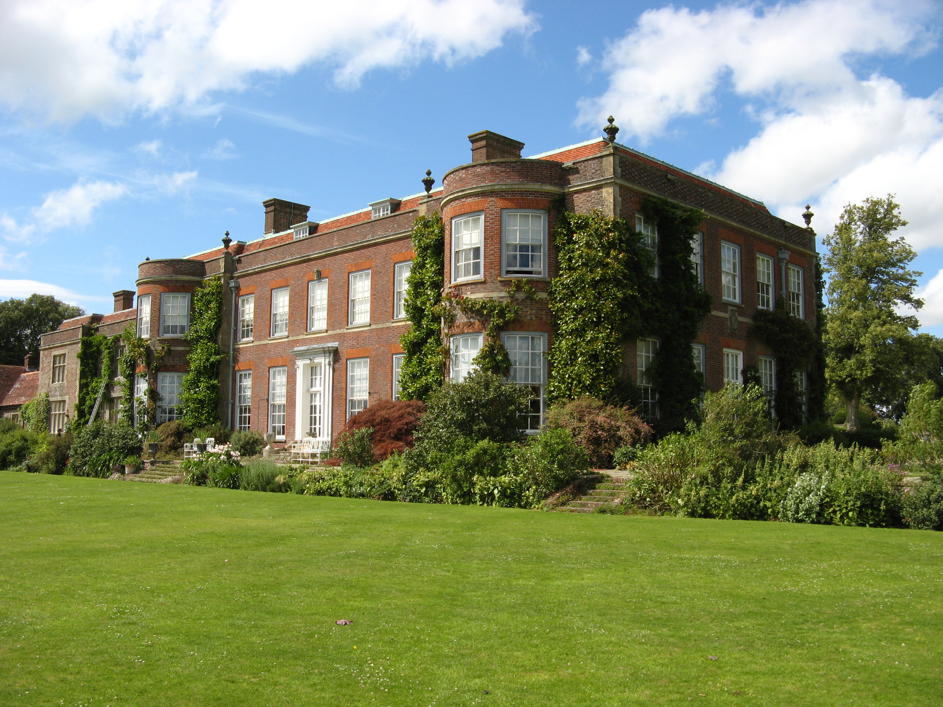
Hinton Ampner

Hinton Ampner is a village and country house estate with gardens and former civil parish, now in the parish of Bramdean and Hinton Ampner, in the Winchester...

Cheriton, Hampshire

Cheriton is a village and civil parish near Alresford in Hampshire, England. The settlement is close to the site of the 1644 Battle of Cheriton, fought...

Preshaw

Preshaw (variously named Presshawe, Presthawe, and Preishawe in old documents) is a manor to the north of Corhampton in the United Kingdom. In the 19th...
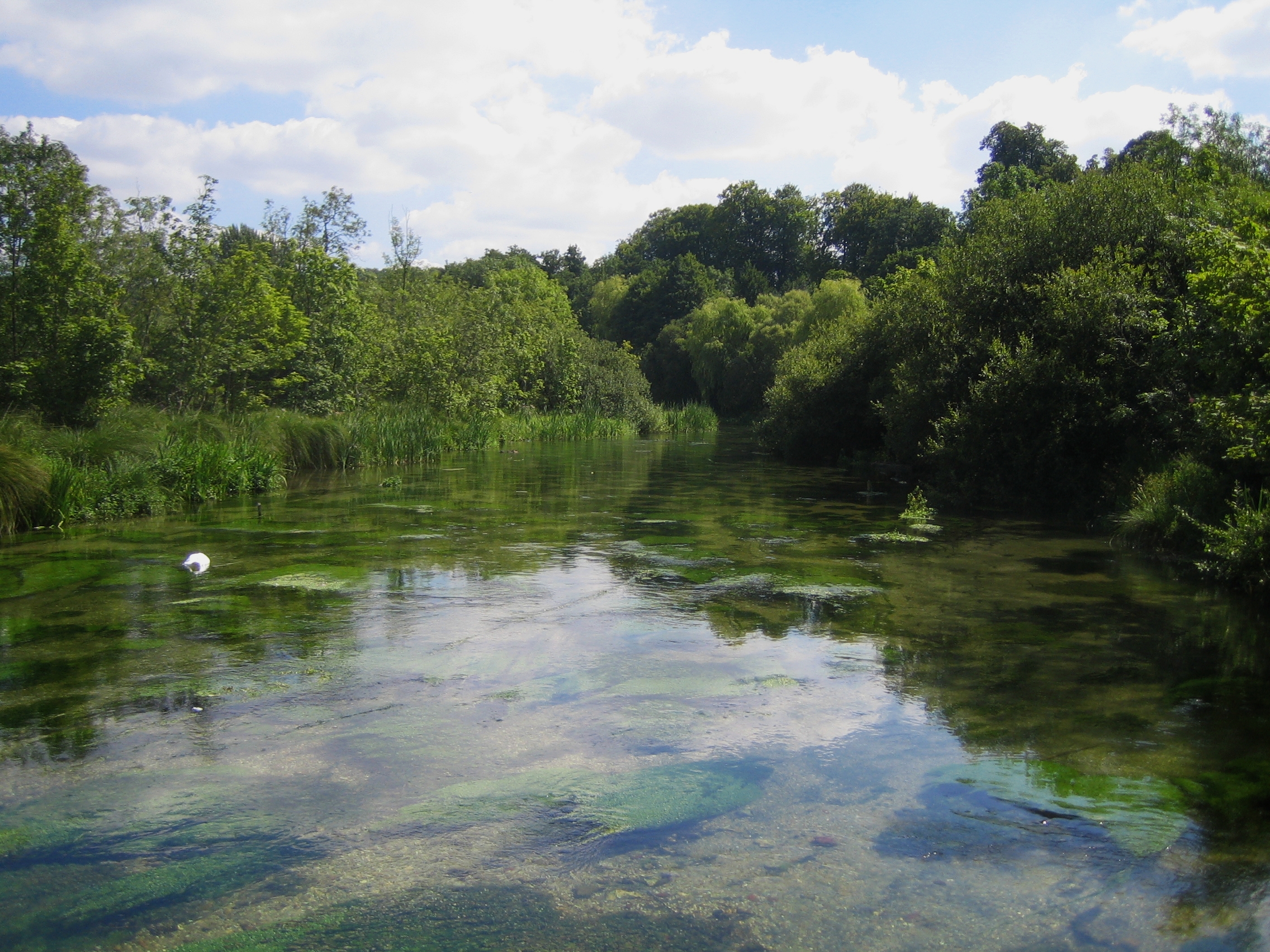
Itchen Way

The Itchen Way is a 31.80-mile (51.18 km) long-distance footpath following the River Itchen in Hampshire, England, from its source near Hinton Ampner House...

Bramdean

Bramdean is a village and former civil parish, now in the parish of Bramdean and Hinton Ampner, in the Winchester district, in the county of Hampshire...

Betty Mundy's Bottom

Betty Mundy's Bottom is a wooded valley in the South Downs of Hampshire. There are a variety of folk tales about the name, which goes back centuries....

Related Videos

WALKS IN HAMPSHIRE at CHERITON (SOUTH DOWNS NATIONAL PARK) [4K]

This is another video in my series “Walks in Hampshire” accompanied by my Whippet (Logan). In this episode I visit the pretty ...

#23 Rob's Hampshire Pub Walks: South Downs, Kilmeston & Beauworth the Millbarrow Walk 5 Miles approx

A unique pub , with a few surprises on one of my circular Hampshire walks high on the South Downs. Starts and finishes at The ...

Cheriton in The South Downs National Park, Hampshire. A gentle walk around the village and church.

We went for a gentle walk around the peaceful Hampshire village of Cheriton, in the heart of the Hampshire South Downs.

I had too much coffee! Autumn Walk at Hinton Ampner National Trust - Last Country Walk in 2020

I was so glad we went for a walk at National Trust's Hinton Ampner and didn't let the terriblely bad weather stopped us. I really ...

Nearby Amenities

Located within 500m of 51.03065,-1.178532
Barrier: stile
Lat/Long: 51.0315541/-1.1755021
Barrier: stile
Lat/Long: 51.0305731/-1.1716956
Barrier: stile
Lat/Long: 51.0317648/-1.1745709
Bench
Lat/Long: 51.0309793/-1.1784231
Post Box
Operator: Royal Mail
Ref: SO24 129
Lat/Long: 51.0308741/-1.1786028
Beauworth
Is In: Hampshire, England, UK
Place: hamlet
Lat/Long: 51.030917/-1.1783979
Barrier: stile
Lat/Long: 51.0313127/-1.1777907
Barrier: stile
Lat/Long: 51.031185/-1.174804
Give Way
Lat/Long: 51.0309941/-1.1782664
Power: pole
Lat/Long: 51.0286702/-1.184802
Power: pole
Lat/Long: 51.0288009/-1.1835247
Power: pole
Lat/Long: 51.0289448/-1.1822335
Power: pole
Lat/Long: 51.0290814/-1.1809282
Power: pole
Lat/Long: 51.0291614/-1.1802526
The data included in this document is from www.openstreetmap.org. The data is made available under ODbL.

Have you been to Beauworth?

Leave your review of Beauworth below (or comments, questions and feedback).