An Corran

Coastal Marsh, Saltings in Inverness-shire

Scotland

An Corran

A87 near Sconser
A87 near Sconser Credit: Steven Brown

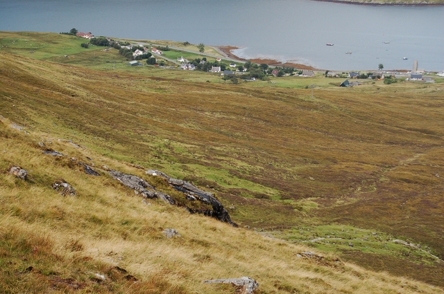
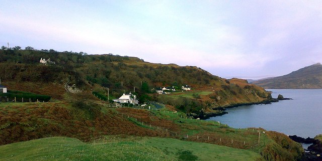
An Corran is a coastal marsh and saltings located in Inverness-shire, Scotland. It is situated along the eastern coast of the country, near the village of Ardersier. The area is characterized by its unique ecological features and rich biodiversity.

The marshland of An Corran is home to a variety of plant species, including saltmarsh grasses, sea lavender, and thrift. These plants are specially adapted to the saline conditions of the area, thriving in the brackish water and sandy soil. The marsh also serves as an important habitat for numerous bird species, such as redshanks, dunlins, and curlews, which rely on the marsh for breeding and feeding.

The saltings, which are the areas of land periodically flooded by tidal waters, provide a crucial feeding ground for wading birds and waterfowl. During low tide, the exposed mudflats attract a diverse array of bird species, including oystercatchers, herons, and sandpipers, as they search for food.

An Corran is not only valuable for its ecological significance but also for its contribution to the local economy. The area is popular among birdwatchers and nature enthusiasts who come to observe the diverse wildlife. Additionally, the marshland plays a role in flood prevention, absorbing excess water during high tides and storms.

Efforts have been made to preserve and protect An Corran, including its designation as a Site of Special Scientific Interest (SSSI). Conservation organizations and local authorities work together to manage the area, ensuring the delicate balance of its ecosystems is maintained.

In summary, An Corran in Inverness-shire is a coastal marsh and saltings characterized by its unique plant life, abundant bird species, and ecological significance. It serves as an important habitat, a feeding ground for birds, and a popular destination for nature enthusiasts.

If you have any feedback on the listing, please let us know in the comments section below.
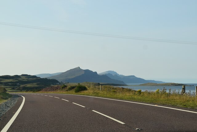
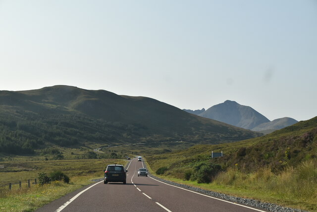
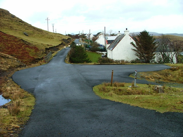
An Corran Images

Images are sourced within 2km of 57.317346/-6.1029614 or Grid Reference NG5332. Thanks to Geograph Open Source API. All images are credited.

A87 near Sconser
A87 near Sconser
A87 at Sconser
A87 at Sconser
A87 south of Sconser The A87 runs 99 miles from Invergarry to Uig on the Isle of Skye <a href="https://www.geograph.org.uk/photo/7374675">NG3863 : End of the A87, Uig</a>.
<span class="nowrap"><a title="https://www.sabre-roads.org.uk/wiki/index.php?title=A87" rel="nofollow ugc noopener" href="https://www.sabre-roads.org.uk/wiki/index.php?title=A87">Link</a><img style="margin-left:2px;" alt="External link" title="External link - shift click to open in new window" src="https://s1.geograph.org.uk/img/external.png" width="10" height="10"/></span>
A87 south of Sconser
The A87 runs 99 miles from Invergarry to Uig on the Isle of Skye NG3863 : End of the A87, Uig. LinkExternal link
Entering Sconser, A87 The A87 runs 99 miles from Invergarry to Uig on the Isle of Skye <a href="https://www.geograph.org.uk/photo/7374675">NG3863 : End of the A87, Uig</a>.
<span class="nowrap"><a title="https://www.sabre-roads.org.uk/wiki/index.php?title=A87" rel="nofollow ugc noopener" href="https://www.sabre-roads.org.uk/wiki/index.php?title=A87">Link</a><img style="margin-left:2px;" alt="External link" title="External link - shift click to open in new window" src="https://s1.geograph.org.uk/img/external.png" width="10" height="10"/></span>
Entering Sconser, A87
The A87 runs 99 miles from Invergarry to Uig on the Isle of Skye NG3863 : End of the A87, Uig. LinkExternal link
A87, Sconser The A87 runs 99 miles from Invergarry to Uig on the Isle of Skye <a href="https://www.geograph.org.uk/photo/7374675">NG3863 : End of the A87, Uig</a>.
<span class="nowrap"><a title="https://www.sabre-roads.org.uk/wiki/index.php?title=A87" rel="nofollow ugc noopener" href="https://www.sabre-roads.org.uk/wiki/index.php?title=A87">Link</a><img style="margin-left:2px;" alt="External link" title="External link - shift click to open in new window" src="https://s1.geograph.org.uk/img/external.png" width="10" height="10"/></span>
A87, Sconser
The A87 runs 99 miles from Invergarry to Uig on the Isle of Skye NG3863 : End of the A87, Uig. LinkExternal link
A87 to Kyle The A87 runs 99 miles from Invergarry to Uig on the Isle of Skye <a href="https://www.geograph.org.uk/photo/7374675">NG3863 : End of the A87, Uig</a>.
<span class="nowrap"><a title="https://www.sabre-roads.org.uk/wiki/index.php?title=A87" rel="nofollow ugc noopener" href="https://www.sabre-roads.org.uk/wiki/index.php?title=A87">Link</a><img style="margin-left:2px;" alt="External link" title="External link - shift click to open in new window" src="https://s1.geograph.org.uk/img/external.png" width="10" height="10"/></span>
A87 to Kyle
The A87 runs 99 miles from Invergarry to Uig on the Isle of Skye NG3863 : End of the A87, Uig. LinkExternal link
Sconser Pier and Ferry
A87, southbound The A87 runs 99 miles from Invergarry to Uig on the Isle of Skye <a href="https://www.geograph.org.uk/photo/7374675">NG3863 : End of the A87, Uig</a>.
<span class="nowrap"><a title="https://www.sabre-roads.org.uk/wiki/index.php?title=A87" rel="nofollow ugc noopener" href="https://www.sabre-roads.org.uk/wiki/index.php?title=A87">Link</a><img style="margin-left:2px;" alt="External link" title="External link - shift click to open in new window" src="https://s1.geograph.org.uk/img/external.png" width="10" height="10"/></span>
A87, southbound
The A87 runs 99 miles from Invergarry to Uig on the Isle of Skye NG3863 : End of the A87, Uig. LinkExternal link
Pier, slipway and ferry at Sconser The ferry waiting to travel to Raasay as it was on the morning of 23 August 1995 when to make the crossing to the island with three people in the car, we paid £16.50. There was room for three cars, a coal lorry and very little more. Little has changed in the view since that time: the current ferry is larger and so of course will be the cost involved!
The location at the far shore of Loch Sligachan is not of course the island of Raasay but ground which rises to Ben Lee.
Pier, slipway and ferry at Sconser
The ferry waiting to travel to Raasay as it was on the morning of 23 August 1995 when to make the crossing to the island with three people in the car, we paid £16.50. There was room for three cars, a coal lorry and very little more. Little has changed in the view since that time: the current ferry is larger and so of course will be the cost involved! The location at the far shore of Loch Sligachan is not of course the island of Raasay but ground which rises to Ben Lee.
Washing aggregate at Sconser Quarry Gravel, quarried at crushed at Sconser, is being washed by the red plant and dropped into piles by the two conveyers. The mechanical shovel on the left is both filling the hopper with fresh aggregate and, in this picture, removing the washed gravel ready for it to be mixed with bitumen to make asphalt.
With luck, some of it will be used to fill the winter potholes on Skye's roads.
Washing aggregate at Sconser Quarry
Gravel, quarried at crushed at Sconser, is being washed by the red plant and dropped into piles by the two conveyers. The mechanical shovel on the left is both filling the hopper with fresh aggregate and, in this picture, removing the washed gravel ready for it to be mixed with bitumen to make asphalt. With luck, some of it will be used to fill the winter potholes on Skye's roads.
Sconser Ferry Terminal Viewed from on board the MV Hallaig, just before departure for Raasay.  The hill in the background is Glamaig.
Sconser Ferry Terminal
Viewed from on board the MV Hallaig, just before departure for Raasay. The hill in the background is Glamaig.
Loch Sligachan from Sconser Looking west across the loch to the slopes of An Leitir under Ben Lee.
Loch Sligachan from Sconser
Looking west across the loch to the slopes of An Leitir under Ben Lee.
Loch Sligachan and Corran Ghlas The north shore of the loch, with steep wooded valleys on the slopes above.
Loch Sligachan and Corran Ghlas
The north shore of the loch, with steep wooded valleys on the slopes above.
Sconser Ferry Terminal Ramp access to the waiting room. The ferry serves the Isle of Raasay, visible in the distance.
Sconser Ferry Terminal
Ramp access to the waiting room. The ferry serves the Isle of Raasay, visible in the distance.
Moorings at Sconser Looking over Loch Sligachan from the Sconser/Raasay ferry terminal to the eastern end of Ben Lee.
Moorings at Sconser
Looking over Loch Sligachan from the Sconser/Raasay ferry terminal to the eastern end of Ben Lee.
Sconser Ferry Terminal plaque Marking its official opening in 2013.
Sconser Ferry Terminal plaque
Marking its official opening in 2013.
Pier at Sconser/Sgonnsair Adjacent to the Raasay ferry terminal on Loch Sligachan.
Pier at Sconser/Sgonnsair
Adjacent to the Raasay ferry terminal on Loch Sligachan.
The Raasay ferry, 'Hallaig' Arriving at Sconser/Sgonnsair. Apparently the world’s first sea-going, roll-on/roll-off, vehicle and passenger diesel electric hybrid ship - and very smooth and quiet it is.
The Raasay ferry, 'Hallaig'
Arriving at Sconser/Sgonnsair. Apparently the world’s first sea-going, roll-on/roll-off, vehicle and passenger diesel electric hybrid ship - and very smooth and quiet it is.
Show me another place!

An Corran is located at Grid Ref: NG5332 (Lat: 57.317346, Lng: -6.1029614)

Unitary Authority: Highland

Police Authority: Highlands and Islands

What 3 Words

///hairspray.surging.corded. Near Portree, Highland

Related Wikis

Sconser

Sconser (Scottish Gaelic: Sgonnsair) is a small crofting township on the island of Skye, in Scotland, situated on the south shore of Loch Sligachan. The...

Peinachorran

Peinchorran (Scottish Gaelic: Peighinn a' Chorrain; Peinachorrain on Ordnance Survey maps) is a remote settlement, lying at the end of the B883 road, on...

Gedintailor

Gedintailor (Scottish Gaelic: Gead an t-Sailleir) is a crofting village, lying on the shores of the Narrows of Raasay on the east coast of the island of...

Glamaig

Glamaig (Scottish Gaelic: Glàmaig) is the northernmost of the Red Hills on the Isle of Skye in Scotland. It lies immediately east of Sligachan. It is one...

Inverarish

Inverarish (Scottish Gaelic: Inbhir Àrais) is a village that is the main settlement of the Isle of Raasay, in the civil parish of Portree, in the council...

Ollach

Ollach (in Scottish Gaelic, An t-Olach) is a remote settlement, made up of Lower Ollach and Upper Ollach, lying on B883 road, south of Portree, Isle of...

Isle of Raasay distillery

Isle of Raasay distillery is a Scotch whisky distillery on the Inner Hebridean Isle of Raasay in Northwest Scotland. The distillery is owned by R&B Distillers...

Beinn Dearg Mhor (Sligachan)

Beinn Dearg Mhor (731 m), is a mountain in the Red Cuillin mountains of the Isle of Skye. It is located between Loch Ainort and the settlement of Sligachan...

Nearby Amenities

Located within 500m of 57.317346,-6.1029614
Power: pole
Lat/Long: 57.3134073/-6.1061507
Power: pole
Lat/Long: 57.3134392/-6.1043617
Power: pole
Lat/Long: 57.3132929/-6.1032486
Sconser Lodge
Addr Postcode: IV48 8TD
Addr Street: A87
Email: skye@sconserlodge.co.uk
Operator: Lisa and Craig McMath
Phone: +44 1478 650333
Tourism: hotel
Website: https://sconserlodge.co.uk/
Lat/Long: 57.3137814/-6.1007823
Sconser Lodge
Addr Postcode: IV48 8TD
Addr Street: A87
Phone: +44 1478 650 333
Tourism: hotel
Website: https://sconserlodge.co.uk/
Lat/Long: 57.3140774/-6.1010431
Location Transition: yes
Power: pole
Lat/Long: 57.3146414/-6.1051154
Power: pole
Lat/Long: 57.3139925/-6.1042437
Power: pole
Lat/Long: 57.3136405/-6.1037207
Power: pole
Lat/Long: 57.3134406/-6.1026129
Location Transition: yes
Power: pole
Lat/Long: 57.3189185/-6.1055473
Power: pole
Lat/Long: 57.319547/-6.1060408
Power: pole
Lat/Long: 57.3201191/-6.1067274
Power: pole
Lat/Long: 57.3207911/-6.1074945
Power: pole
Lat/Long: 57.3205171/-6.1076689
Power: pole
Lat/Long: 57.3198942/-6.10669
An Corran
Place: locality
Lat/Long: 57.3171023/-6.1027658
Rubh' an Tòrra Mhòir
Natural: cape
Lat/Long: 57.3187273/-6.105271
Sgeir Dhubh
Natural: rock
Lat/Long: 57.3183942/-6.1086345
Tòrr Beag
Ele: 34
Natural: hill
Lat/Long: 57.3211546/-6.1034095
Power: pole
Lat/Long: 57.3147688/-6.1048293
Power: pole
Lat/Long: 57.3143175/-6.1040621
Power: pole
Lat/Long: 57.3138819/-6.103312
The data included in this document is from www.openstreetmap.org. The data is made available under ODbL.

Have you been to An Corran?

Leave your review of An Corran below (or comments, questions and feedback).