An Corran

Coastal Marsh, Saltings in Inverness-shire

Scotland

An Corran

"I like that boulder, that is a nice boulder" In the rugged embrace of nature's grip, a massive boulder stands proud, defying the raging sea below. It conjures thoughts of an ass named Donkey, complimenting Shrek's house, saying, "I like that boulder, that is a nice boulder." Perched perilously atop the ancient sea cliffs, it hints at an enduring existence since the glacier's ancient retreat. Gazing into the horizon, Staffin Island and the Òb nan Ròn harbour emerge, distant yet ever-present.
"I like that boulder, that is a nice boulder" Credit: Mick Garratt

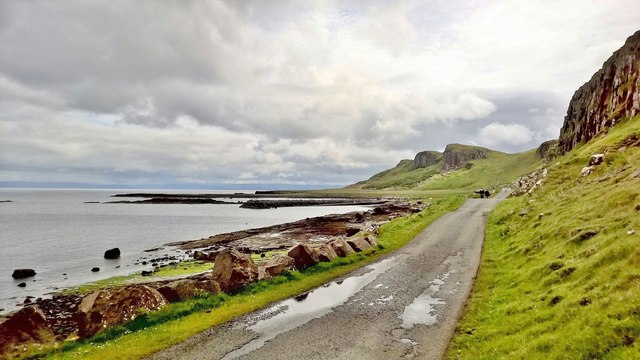
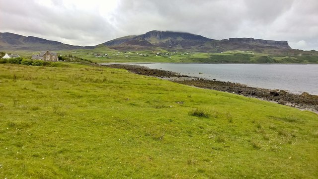
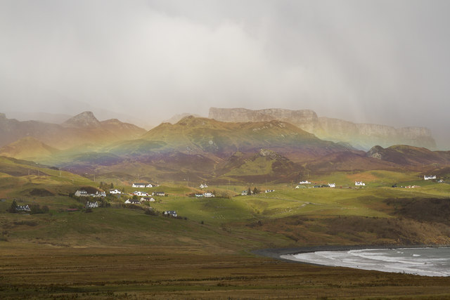
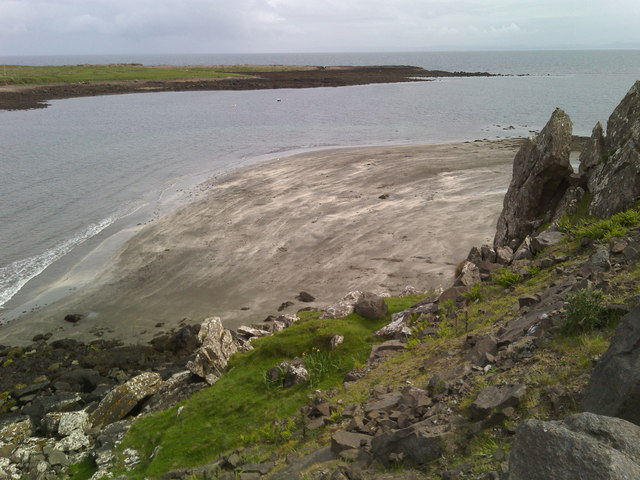
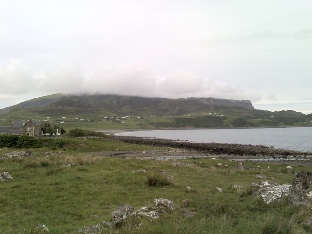
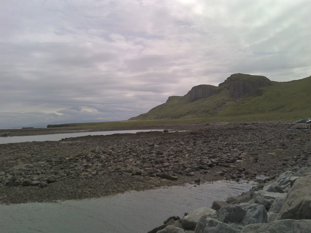
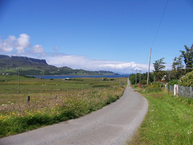
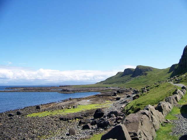
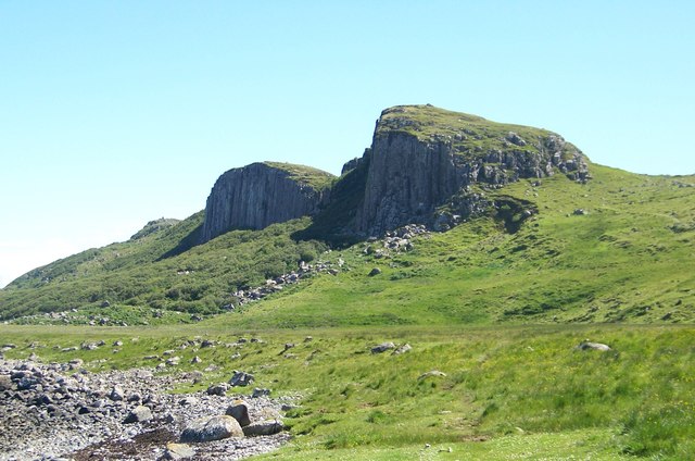
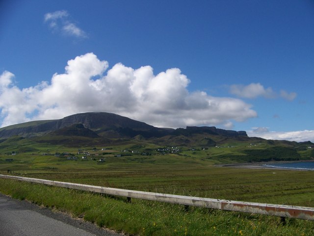
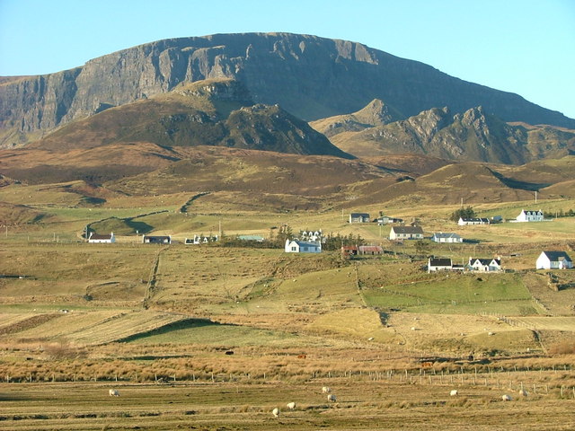
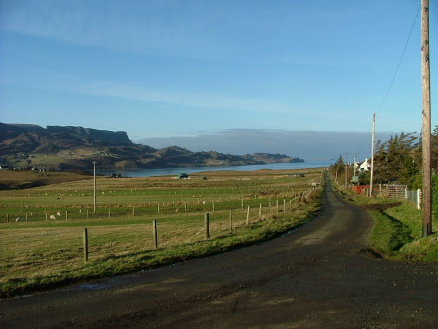
An Corran is a coastal marsh located in Inverness-shire, Scotland. Situated near the town of Beauly, it is a unique and important natural habitat known for its extensive saltings.

The marsh is characterized by its flat, low-lying landscape, which is prone to regular flooding from the nearby river. The area is covered with a diverse range of salt-tolerant plants, such as sea aster, sea lavender, and thrift, which thrive in the brackish conditions. These plants provide essential feeding and nesting grounds for a variety of bird species, including wading birds like curlews, oystercatchers, and redshanks.

An Corran is also home to a wide range of aquatic species, such as fish and invertebrates, that rely on the marsh's nutrient-rich waters. The marsh acts as a natural filtration system, helping to improve water quality and maintain a delicate balance within the ecosystem.

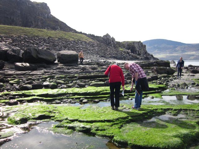
In addition to its ecological significance, An Corran also has historical and cultural importance. The site has been used by local communities for centuries, with evidence of prehistoric settlements and archaeological remnants found in the area. It is believed that the marsh was once a valuable resource, providing fish, shellfish, and other natural resources to the people living nearby.

Today, An Corran is a designated nature reserve, managed by conservation organizations and protected by law. Visitors can explore the marsh via a network of trails and footpaths, providing an opportunity to observe the diverse range of flora and fauna that call this coastal marsh their home.

If you have any feedback on the listing, please let us know in the comments section below.
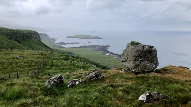
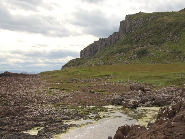
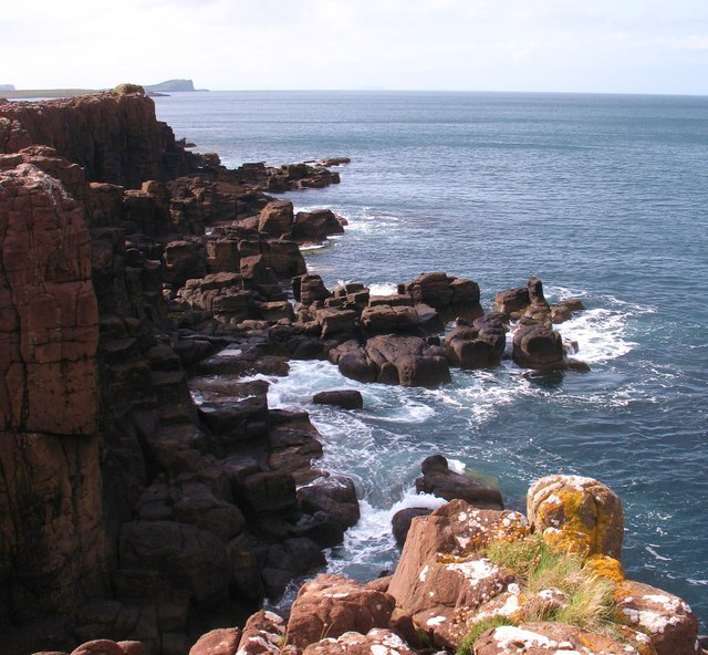
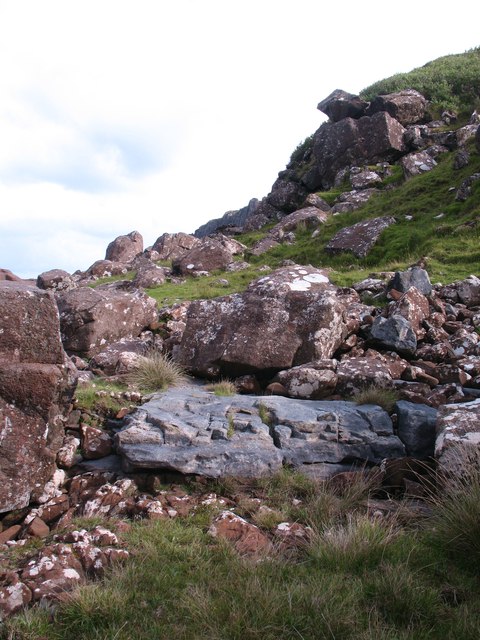
An Corran Images

Images are sourced within 2km of 57.637126/-6.2052748 or Grid Reference NG4968. Thanks to Geograph Open Source API. All images are credited.

"I like that boulder, that is a nice boulder" In the rugged embrace of nature's grip, a massive boulder stands proud, defying the raging sea below. It conjures thoughts of an ass named Donkey, complimenting Shrek's house, saying, "I like that boulder, that is a nice boulder." Perched perilously atop the ancient sea cliffs, it hints at an enduring existence since the glacier's ancient retreat. Gazing into the horizon, Staffin Island and the Òb nan Ròn harbour emerge, distant yet ever-present.
"I like that boulder, that is a nice boulder"
In the rugged embrace of nature's grip, a massive boulder stands proud, defying the raging sea below. It conjures thoughts of an ass named Donkey, complimenting Shrek's house, saying, "I like that boulder, that is a nice boulder." Perched perilously atop the ancient sea cliffs, it hints at an enduring existence since the glacier's ancient retreat. Gazing into the horizon, Staffin Island and the Òb nan Ròn harbour emerge, distant yet ever-present.
Coastline east of Garrafad Raised beach below the northern end of the famous Kilt Rock.
Coastline east of Garrafad
Raised beach below the northern end of the famous Kilt Rock.
Rocky coastline A coastline of low cliffs and jointed strata south of Rubha Garbhaig.
Rocky coastline
A coastline of low cliffs and jointed strata south of Rubha Garbhaig.
Rocks of different ages The large grey slab is an exposure of Jurassic rock which underlies this area, whilst the boulders above are at least 100 million years younger, being dolerite blocks which have fallen from the nearby cliffs.
Rocks of different ages
The large grey slab is an exposure of Jurassic rock which underlies this area, whilst the boulders above are at least 100 million years younger, being dolerite blocks which have fallen from the nearby cliffs.
Looking down coast towards Staffin slipway
Across Staffin Bay
Across Staffin Bay
Dinosaur footprints Use this photo with reference to the beach & background to locate the footprints
Dinosaur footprints
Use this photo with reference to the beach & background to locate the footprints
Stenscholl view with a rainbow As we drove up to the Quiraing this rainbow appeared over Stenscholl.
Stenscholl view with a rainbow
As we drove up to the Quiraing this rainbow appeared over Stenscholl.
Uphill track Leading from Staffin jetty towards Staffin village.
Uphill track
Leading from Staffin jetty towards Staffin village.
Beach north of Staffin With Staffin Island in the background.
Beach north of Staffin
With Staffin Island in the background.
Cloud on the Quiraing Looking across Staffin Bay to the Quiraing with Quiraing Lodge in the foreground.
Cloud on the Quiraing
Looking across Staffin Bay to the Quiraing with Quiraing Lodge in the foreground.
Sgeir Bhan seen from Staffin slipway Looking south towards Kilt Rock.
Sgeir Bhan seen from Staffin slipway
Looking south towards Kilt Rock.
Crofting Township of Garafad
Walking from the car park to the Staffin Community Slipway
Cliffs east of Garrafad
Looking from Staffin Bay towards the crofts with the Quiraing in the background
A855 at Stenscholl
A855 at Stenscholl
Staffin Bay at Glashvin
Show me another place!

An Corran is located at Grid Ref: NG4968 (Lat: 57.637126, Lng: -6.2052748)

Unitary Authority: Highland

Police Authority: Highlands and Islands

What 3 Words

///photocopy.called.shunted. Near Uig, Highland

Related Wikis

Staffin Island

Staffin Island (possibly also known as Stenscholl Island) is an uninhabited islet off the east coast of the Trotternish peninsula of Skye in Scotland....

Staffin

Staffin (Scottish Gaelic: Stafain) is a district with the Gaelic name An Taobh Sear, which translates as "the East Side", on the northeast coast of the...

Brogaig

Brogaig (Scottish Gaelic: Brògaig), Norse for Burgh Bay, is a small coastal village, on the northwest coast of the Trotternish peninsula, close to Staffin...

Garafad

Garafad or Garafad, (Scottish Gaelic: An Garradh Fada) is a linear crofting settlement on the east coast of the Trotternish Peninsula of Skye in the...

Related Videos

A beach on the Isle of Skye | Staffin | ชายหาดหนึ่งที่เกาะสกาย สกอตแลนด์ | Nok Scots Life

Thanks for your support. You can also see me at Facebook: https://www.facebook.com/Scots-Life-106010517539648/ ...

North Sky Pods

sharing experience of Staying in a Pod at Isle of Sky.

Nearby Amenities

Located within 500m of 57.637126,-6.2052748
Source: PGS
Lat/Long: 57.6344754/-6.1986883
Source: PGS
Lat/Long: 57.634544/-6.1987554
Source: PGS
Lat/Long: 57.6342628/-6.1990841
Source: PGS
Lat/Long: 57.6344242/-6.2003822
Created By: dmgroom_coastlines
Source: PGS
Lat/Long: 57.63474/-6.20076
Source: PGS
Lat/Long: 57.6349785/-6.2011156
Source: PGS
Lat/Long: 57.6357139/-6.2019809
Created By: dmgroom_coastlines
Source: PGS
Lat/Long: 57.6358/-6.20211
Source: PGS
Lat/Long: 57.6361684/-6.2027963
Created By: dmgroom_coastlines
Source: PGS
Lat/Long: 57.63646/-6.20326
Created By: dmgroom_coastlines
Source: PGS
Lat/Long: 57.63698/-6.20346
Created By: dmgroom_coastlines
Source: PGS
Lat/Long: 57.637/-6.20441
Source: PGS
Lat/Long: 57.6369882/-6.2047738
Source: PGS
Lat/Long: 57.637172/-6.2057179
Source: PGS
Lat/Long: 57.6372638/-6.2063617
Created By: dmgroom_coastlines
Source: PGS
Lat/Long: 57.63744/-6.20676
Created By: dmgroom_coastlines
Source: PGS
Lat/Long: 57.63719/-6.20726
Created By: dmgroom_coastlines
Source: PGS
Lat/Long: 57.63696/-6.20823
Created By: dmgroom_coastlines
Source: PGS
Lat/Long: 57.63671/-6.20873
Created By: dmgroom_coastlines
Source: PGS
Lat/Long: 57.63646/-6.20923
Created By: dmgroom_coastlines
Source: PGS
Lat/Long: 57.63636/-6.21019
Created By: dmgroom_coastlines
Source: PGS
Lat/Long: 57.63586/-6.21047
Created By: dmgroom_coastlines
Source: PGS
Lat/Long: 57.63561/-6.21072
Passing Place
Passing Place: right
Lat/Long: 57.6369039/-6.2068954
Staffin Dinosaur Footprints
Historic: archaeological_site
Lat/Long: 57.6368926/-6.2045432
Passing Place
Passing Place: left
Lat/Long: 57.6345758/-6.2022506
Power: pole
Lat/Long: 57.6335132/-6.2082809
Power: pole
Lat/Long: 57.6331393/-6.2078723
Parking
Capacity: 20
Fee: no
Parking: surface
Surface: asphalt
Lat/Long: 57.6363535/-6.2043263
Passing Place
Passing Place: right
Lat/Long: 57.6367178/-6.2050808
Passing Place
Passing Place: left
Lat/Long: 57.6354462/-6.2031971
Passing Place
Passing Place: right
Lat/Long: 57.6346027/-6.2121932
Passing Place
Passing Place: right
Lat/Long: 57.6357715/-6.2093925
Passing Place
Passing Place: right
Lat/Long: 57.6363001/-6.2082524
Passing Place
Passing Place: right
Lat/Long: 57.6336902/-6.2006879
The data included in this document is from www.openstreetmap.org. The data is made available under ODbL.

Have you been to An Corran?

Leave your review of An Corran below (or comments, questions and feedback).