Rubha Bàn

Coastal Feature, Headland, Point in Inverness-shire

Scotland

Rubha Bàn

"I like that boulder, that is a nice boulder" In the rugged embrace of nature's grip, a massive boulder stands proud, defying the raging sea below. It conjures thoughts of an ass named Donkey, complimenting Shrek's house, saying, "I like that boulder, that is a nice boulder." Perched perilously atop the ancient sea cliffs, it hints at an enduring existence since the glacier's ancient retreat. Gazing into the horizon, Staffin Island and the Òb nan Ròn harbour emerge, distant yet ever-present.
"I like that boulder, that is a nice boulder" Credit: Mick Garratt

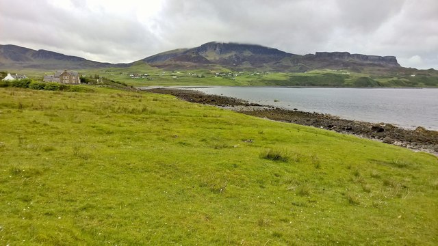
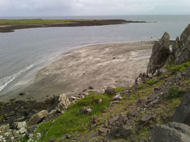
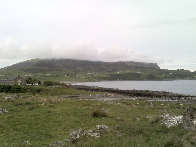
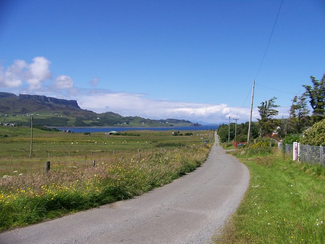
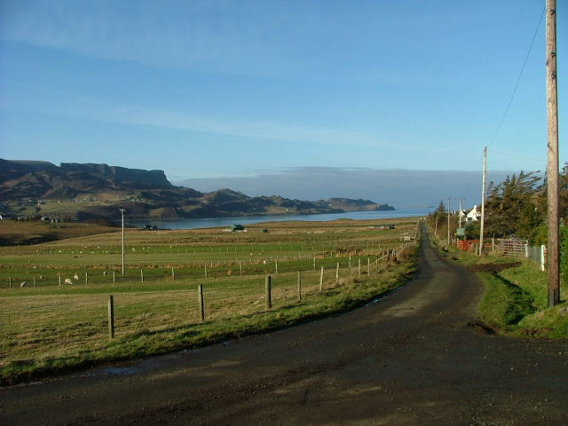
Rubha Bàn is a stunning coastal feature located in Inverness-shire, Scotland. Positioned on the western coast, it is a headland that juts out into the North Atlantic Ocean, offering breathtaking views and a unique experience for visitors.

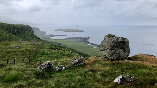
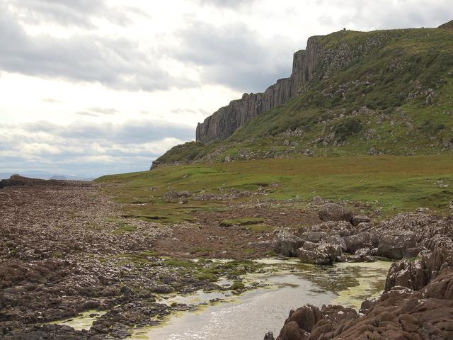
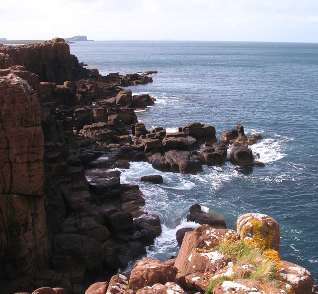
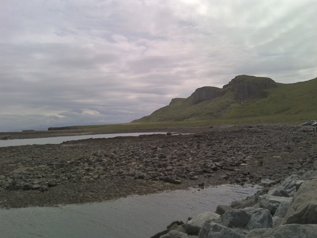
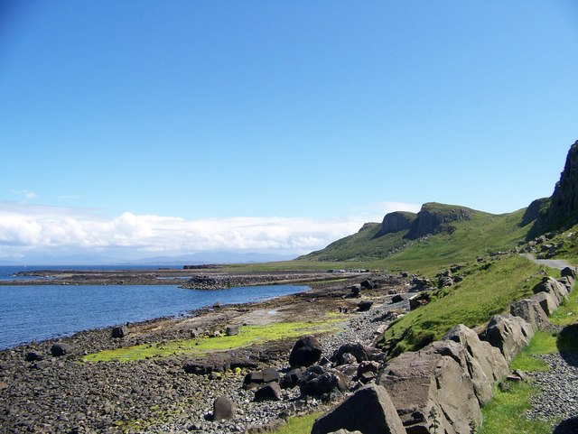
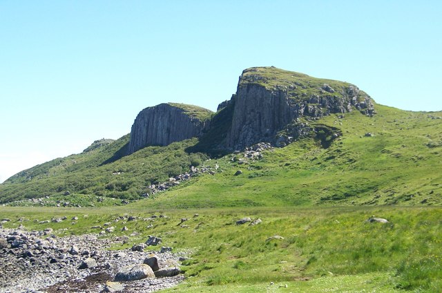
The name Rubha Bàn translates to "White Point" in English, which accurately describes the headland's appearance. Its defining feature is the rugged cliffs that stretch along its coastline, composed of white limestone that contrasts beautifully with the deep blue waters below. These cliffs provide nesting sites for various seabirds, including guillemots, razorbills, and puffins, making it a popular spot for birdwatching enthusiasts.

Rubha Bàn boasts a diverse array of flora and fauna, with the headland being home to several species of heather, wildflowers, and grasses. The surrounding waters are teeming with marine life, and visitors may be lucky enough to spot seals, dolphins, or even whales in the distance.

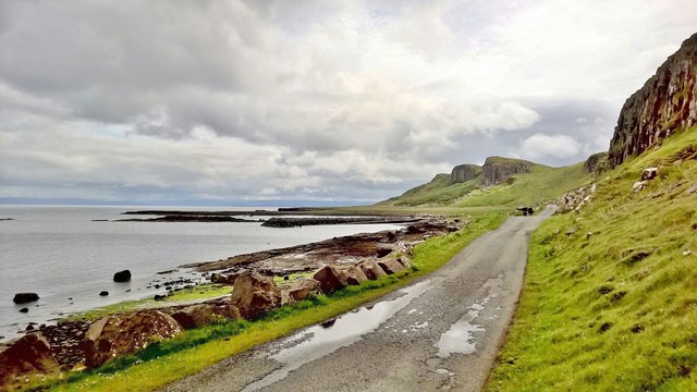
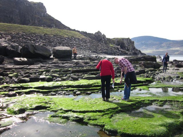
Accessible via a coastal path, Rubha Bàn offers visitors the opportunity to explore its rugged terrain and immerse themselves in the natural beauty of the Scottish coast. The headland also features a lighthouse, which was built in 1869 to guide ships navigating the treacherous waters. While the lighthouse is no longer operational, it serves as a reminder of the area's maritime history.

Overall, Rubha Bàn is a must-visit destination for nature lovers and those seeking tranquility amidst stunning coastal scenery. Its combination of dramatic cliffs, diverse wildlife, and historical significance make it a truly remarkable place to visit in Inverness-shire.

If you have any feedback on the listing, please let us know in the comments section below.
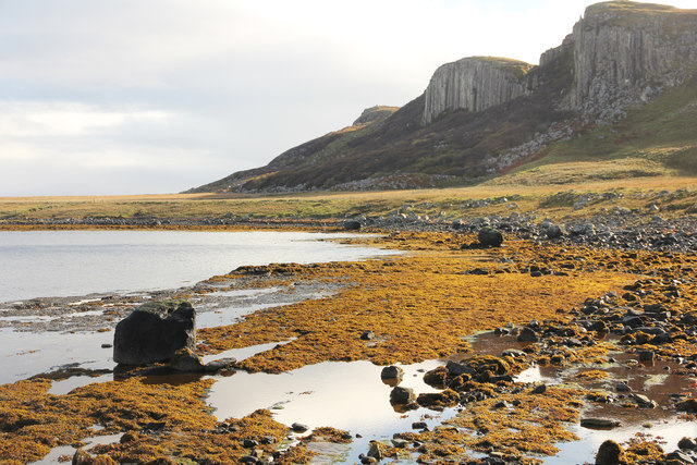
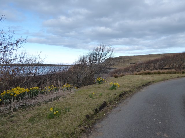
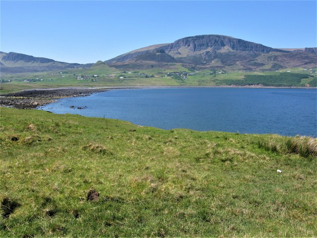
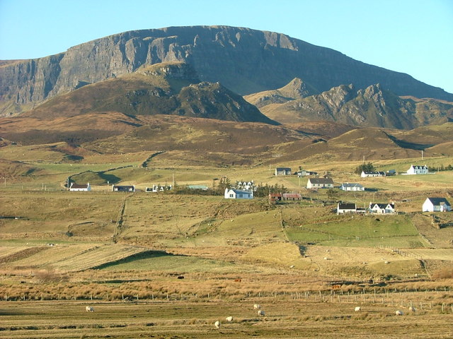
Rubha Bàn Images

Images are sourced within 2km of 57.640539/-6.2000188 or Grid Reference NG4968. Thanks to Geograph Open Source API. All images are credited.

"I like that boulder, that is a nice boulder" In the rugged embrace of nature's grip, a massive boulder stands proud, defying the raging sea below. It conjures thoughts of an ass named Donkey, complimenting Shrek's house, saying, "I like that boulder, that is a nice boulder." Perched perilously atop the ancient sea cliffs, it hints at an enduring existence since the glacier's ancient retreat. Gazing into the horizon, Staffin Island and the Òb nan Ròn harbour emerge, distant yet ever-present.
"I like that boulder, that is a nice boulder"
In the rugged embrace of nature's grip, a massive boulder stands proud, defying the raging sea below. It conjures thoughts of an ass named Donkey, complimenting Shrek's house, saying, "I like that boulder, that is a nice boulder." Perched perilously atop the ancient sea cliffs, it hints at an enduring existence since the glacier's ancient retreat. Gazing into the horizon, Staffin Island and the Òb nan Ròn harbour emerge, distant yet ever-present.
Coastline east of Garrafad Raised beach below the northern end of the famous Kilt Rock.
Coastline east of Garrafad
Raised beach below the northern end of the famous Kilt Rock.
Rocky coastline A coastline of low cliffs and jointed strata south of Rubha Garbhaig.
Rocky coastline
A coastline of low cliffs and jointed strata south of Rubha Garbhaig.
Looking down coast towards Staffin slipway
Across Staffin Bay
Across Staffin Bay
Dinosaur footprints Use this photo with reference to the beach & background to locate the footprints
Dinosaur footprints
Use this photo with reference to the beach & background to locate the footprints
Uphill track Leading from Staffin jetty towards Staffin village.
Uphill track
Leading from Staffin jetty towards Staffin village.
Beach north of Staffin With Staffin Island in the background.
Beach north of Staffin
With Staffin Island in the background.
Cloud on the Quiraing Looking across Staffin Bay to the Quiraing with Quiraing Lodge in the foreground.
Cloud on the Quiraing
Looking across Staffin Bay to the Quiraing with Quiraing Lodge in the foreground.
Sgeir Bhan seen from Staffin slipway Looking south towards Kilt Rock.
Sgeir Bhan seen from Staffin slipway
Looking south towards Kilt Rock.
Crofting Township of Garafad
Walking from the car park to the Staffin Community Slipway
Cliffs east of Garrafad
Staffin Bay at Glashvin
Breun Phort Breun Phort from Staffin slipway
Breun Phort
Breun Phort from Staffin slipway
Daffodils at Quiraing Lodge
Staffin Bay, Isle of Skye Staffin Bay is on the north-east coast of the Trotternish Peninsula on the Isle of Skye. Meall na Suiramach is the hill in the background.
Staffin Bay, Isle of Skye
Staffin Bay is on the north-east coast of the Trotternish Peninsula on the Isle of Skye. Meall na Suiramach is the hill in the background.
Ob nan Ròn Staffin harbour. A small fishing boat is moored at the pier.
Ob nan Ròn
Staffin harbour. A small fishing boat is moored at the pier.
Show me another place!

Rubha Bàn is located at Grid Ref: NG4968 (Lat: 57.640539, Lng: -6.2000188)

Unitary Authority: Highland

Police Authority: Highlands and Islands

What 3 Words

///shipwreck.static.montage. Near Uig, Highland

Related Wikis

Staffin Island

Staffin Island (possibly also known as Stenscholl Island) is an uninhabited islet off the east coast of the Trotternish peninsula of Skye in Scotland....

Brogaig

Brogaig (Scottish Gaelic: Brògaig), Norse for Burgh Bay, is a small coastal village, on the northwest coast of the Trotternish peninsula, close to Staffin...

Staffin

Staffin (Scottish Gaelic: Stafain) is a district with the Gaelic name An Taobh Sear, which translates as "the East Side", on the northeast coast of the...

Garafad

Garafad or Garafad, (Scottish Gaelic: An Garradh Fada) is a linear crofting settlement on the east coast of the Trotternish Peninsula of Skye in the...

Nearby Amenities

Located within 500m of 57.640539,-6.2000188
Created By: dmgroom_coastlines
Source: PGS
Lat/Long: 57.63646/-6.20326
Created By: dmgroom_coastlines
Source: PGS
Lat/Long: 57.63698/-6.20346
Created By: dmgroom_coastlines
Source: PGS
Lat/Long: 57.637/-6.20441
Source: PGS
Lat/Long: 57.6369882/-6.2047738
Staffin Dinosaur Footprints
Historic: archaeological_site
Lat/Long: 57.6368926/-6.2045432
The data included in this document is from www.openstreetmap.org. The data is made available under ODbL.

Have you been to Rubha Bàn?

Leave your review of Rubha Bàn below (or comments, questions and feedback).