Herne, Lower

Settlement in Kent Canterbury

England

Herne, Lower

Herne Bay Railway Station Herne Bay railway station is on the North Kent line. Train services are provided by Southeastern.
The station opened in 1863. Most of the station buildings date from 1926.
Herne Bay Railway Station Credit: JThomas

Herne is a picturesque village located in the district of Herne Bay, in the county of Kent, England. Situated on the southeastern coast of the country, Herne is nestled between the larger towns of Canterbury and Whitstable, and is just a short distance from the bustling city of London.

The village is known for its idyllic rural setting, with rolling hills, lush green fields, and charming country lanes. It is surrounded by natural beauty, including the nearby Herne Bay Downs and Blean Woods, which offer fantastic opportunities for outdoor activities such as walking, cycling, and birdwatching.

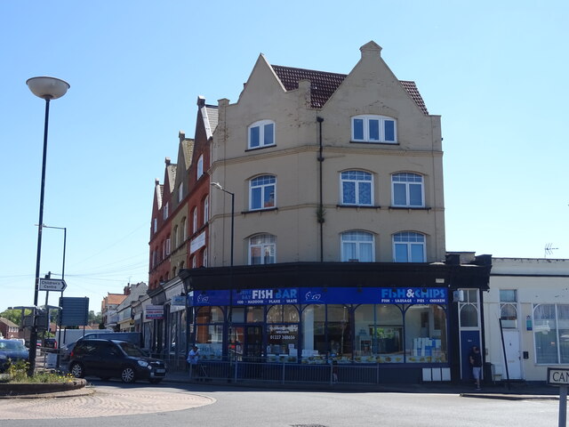
Herne boasts a rich history, with evidence of human habitation dating back to the Stone Age. It is home to several historic buildings, including the beautiful St Martin's Church, which dates back to the 12th century. The village also has a strong sense of community, with a range of local amenities including shops, pubs, and a primary school.

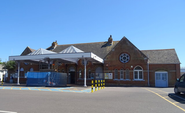
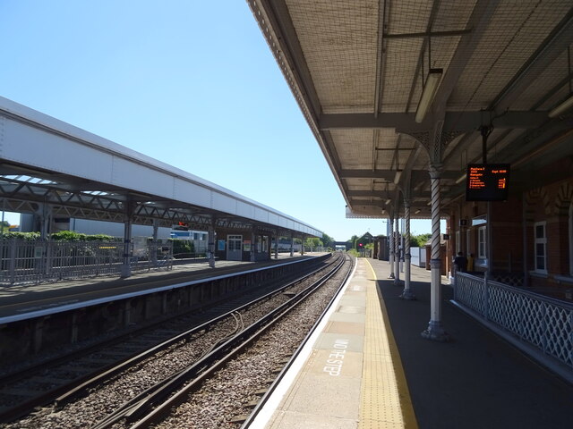
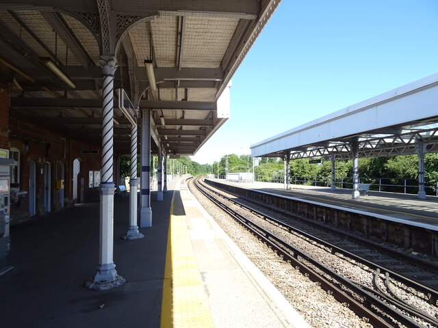
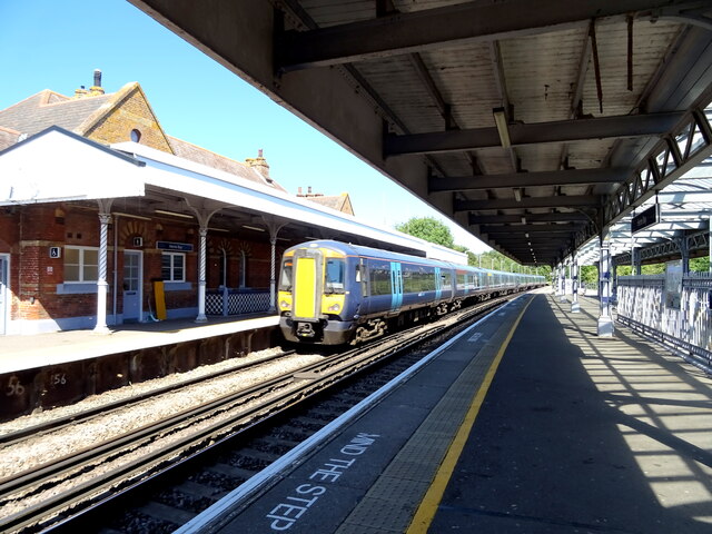
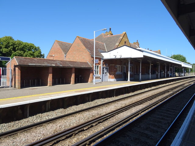
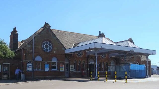
The village is well-connected, with excellent transport links. The nearby A299 provides easy access to the M2 motorway, connecting Herne to London and the rest of the country. Additionally, Herne Bay railway station, just a short distance away, offers regular train services to London, making it an ideal location for commuters.

Herne is a charming and peaceful village that offers a wonderful blend of natural beauty, historical significance, and modern convenience. Whether you are seeking a tranquil place to call home or a delightful destination for a day trip, Herne is sure to captivate visitors with its timeless charm.

If you have any feedback on the listing, please let us know in the comments section below.
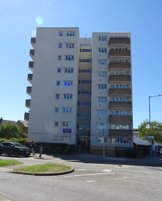
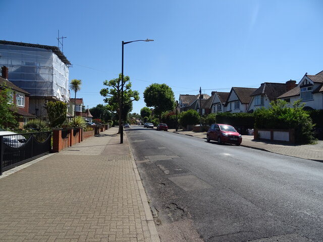
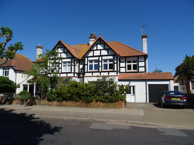
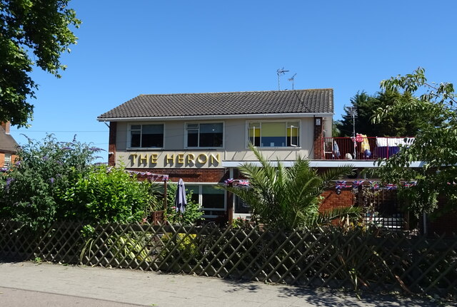
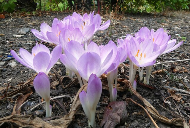
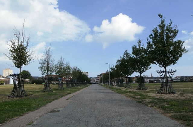
Herne, Lower Images

Images are sourced within 2km of 51.35124/1.1293156 or Grid Reference TR1866. Thanks to Geograph Open Source API. All images are credited.

Herne Bay Railway Station Herne Bay railway station is on the North Kent line. Train services are provided by Southeastern.
The station opened in 1863. Most of the station buildings date from 1926.
Herne Bay Railway Station
Herne Bay railway station is on the North Kent line. Train services are provided by Southeastern. The station opened in 1863. Most of the station buildings date from 1926.
Platform 2, Herne Bay Railway Station The line towards Whitstable.
Platform 2, Herne Bay Railway Station
The line towards Whitstable.
Platform 2, Herne Bay Railway Station The line towards Margate.
Platform 2, Herne Bay Railway Station
The line towards Margate.
Herne Bay Railway Station Herne Bay railway station is on the North Kent line. Train services are provided by Southeastern.
The station opened in 1863. Most of the station buildings date from 1926.
Herne Bay Railway Station
Herne Bay railway station is on the North Kent line. Train services are provided by Southeastern. The station opened in 1863. Most of the station buildings date from 1926.
George VI postbox, Herne Bay Railway Station Postbox No. CT6 49.
See <a href="https://www.geograph.org.uk/photo/7224149">TR1767 : Herne Bay Railway Station</a> forc context.
George VI postbox, Herne Bay Railway Station
Postbox No. CT6 49. See TR1767 : Herne Bay Railway Station forc context.
Herne Bay Railway Station Showing position of Postbox No. CT6 49.
See <a href="https://www.geograph.org.uk/photo/7224148">TR1767 : George VI postbox, Herne Bay Railway Station</a> for postbox.
Herne Bay Railway Station
Showing position of Postbox No. CT6 49. See TR1767 : George VI postbox, Herne Bay Railway Station for postbox.
Herne Bay Fish Bar
Herne Bay Fish Bar
Flats on Canterbury Road, Herne Bay
Mickleburgh Hill, Herne Bay
Margaret Court, Herne Bay Block of flats.
Margaret Court, Herne Bay
Block of flats.
Station Road, Herne Bay
Houses on Station Road, Herne Bay
The Heron public house, Herne Bay On Station Road.
See <a href="https://www.geograph.org.uk/photo/7224548">TR1767 : Sign for the Heron public house, Herne Bay</a> for sign.
The Heron public house, Herne Bay
Sign for the Heron public house, Herne Bay See <a href="https://www.geograph.org.uk/photo/7224546">TR1767 : The Heron public house, Herne Bay</a> for public house.
Sign for the Heron public house, Herne Bay
Herne Bay Memorial Park A mural by the south west entrance to Station Chine, near Spenser Road.
Herne Bay Memorial Park
A mural by the south west entrance to Station Chine, near Spenser Road.
Autumn crocus, Herne Bay Memorial Park Colchicum autumnale, commonly known as autumn crocus, meadow saffron, or naked ladies.
Autumn crocus, Herne Bay Memorial Park
Colchicum autumnale, commonly known as autumn crocus, meadow saffron, or naked ladies.
The Avenue of Remembrance,  Herne Bay Looking towards the memorial gates in Herne Bay Memorial Park. The Avenue of Remembrance and the memorial gates were added in 1945.
The Avenue of Remembrance, Herne Bay
Looking towards the memorial gates in Herne Bay Memorial Park. The Avenue of Remembrance and the memorial gates were added in 1945.
Show me another place!

Herne, Lower is located at Grid Ref: TR1866 (Lat: 51.35124, Lng: 1.1293156)

Administrative County: Kent

District: Canterbury

Police Authority: Kent

What 3 Words

///inner.invest.laying. Near Herne Bay, Kent

Nearby Locations

Lower Herne Herne, Lower

Related Wikis

Herne and Broomfield

Herne and Broomfield is a civil parish and electoral ward within the City of Canterbury. The parish is situated to the north of Canterbury in Kent. The...

Herne, Kent

Herne is a village in South East England, divided by the Thanet Way from the seaside resort of Herne Bay. Administratively it is in the civil parish of...
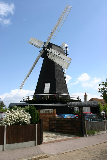
Herne Windmill

Herne Windmill is a Grade I listed smock mill in Herne, Kent, England, that was built in 1789. == History == Herne Windmill was built by John Holman in...

Curtis Wood

Curtis Wood is a 5.3-hectare (13-acre) Local Nature Reserve in Herne in Kent. It is owned and managed by Canterbury City Council.This wood has diverse...

Related Videos

Adventures in Herne Bay Kent + seafront walking tour

Welcome to Herne Bay everybody! This beautiful seaside town on the south coast has been popular since the Victorian era with ...

Herne Bay Town and Pier, Walking History Tour Guide Using Old Postcards Kent UK

Herne Bay town and pier, Kent, UK, A walking history tour guide of Herne Bay using old postcards. Would really appreciate it if ...

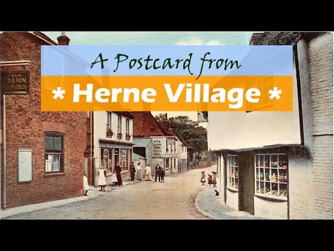
Herne Village a Walking History Tour Guide Using Old Postcards Kent UK

Herne Village, Kent, UK, A walking history tour guide of Herne Village using old postcards. I have a fascination for old postcards, ...

Herne Village Part 2, Kent, UK, A walking history tour guide of Herne Village using old postcards.

I have a fascination for old postcards, this video of Herne (part 2) where I used to live may interest you. All the black and white ...

Nearby Amenities

Located within 500m of 51.35124,1.1293156
Crossing
Crossing: traffic_signals
Crossing Markings: yes
Crossing Signals: yes
Crossing Ref: pelican
Lat/Long: 51.3531522/1.1319137
Post Office
Herne Village Stores Post Office
Addr City: Herne Bay
Addr Country: GB
Addr County: Kent
Addr Housenumber: 18
Addr Postcode: CT6 7HQ
Addr Street: Herne Street
Addr Village: Herne
Collection Times: Mo-Fr 17:05; Sa 11:45
Fhrs Id: 1172530
Operator: Post Office
Ref Pol Id: 717
Source Addr: FHRS Open Data
Lat/Long: 51.3503921/1.1327752
Post Box
Brand: Royal Mail
Brand Wikidata: Q638098
Brand Wikipedia: en:Royal Mail
Collection Times: Mo-Fr 09:00; Sa 07:00
Operator: Royal Mail
Operator Wikidata: Q638098
Post Box Mounting: brick_pillar
Post Box Type: wall
Postal Code: CT6
Ref: CT6 248
Royal Cypher: EIIR
Royal Cypher Wikidata: Q33102113
Lat/Long: 51.3545754/1.1309769
Post Box
Brand: Royal Mail
Brand Wikidata: Q638098
Brand Wikipedia: en:Royal Mail
Collection Times: Mo-Fr 09:00; Sa 07:00
Operator: Royal Mail
Operator Wikidata: Q638098
Post Box Mounting: metal_post
Post Box Type: lamp
Postal Code: CT6
Ref: CT6 381
Royal Cypher: EIIR
Royal Cypher Wikidata: Q33102113
Lat/Long: 51.352518/1.128274
Herne
Is In: Kent, England, UK
Place: village
Source: Kent, England, UK
Wikidata: Q2158183
Lat/Long: 51.3503509/1.1337922
Crossing
Crossing: uncontrolled
Crossing Ref: zebra
Source: survey
Lat/Long: 51.3512032/1.1350875
Place Of Worship
Catholic Church of St John Fisher & St Thomas More
Denomination: catholic
Religion: christian
Lat/Long: 51.3489052/1.1330754
Crossing
Crossing: uncontrolled
Crossing Ref: zebra
Lat/Long: 51.3503812/1.132889
Pub
The Smugglers Inn
Addr City: Herne Bay
Addr Country: GB
Addr County: Kent
Addr Housenumber: 1
Addr Postcode: CT6 7AN
Addr Street: School Lane
Addr Village: Herne
Brewery: Shepherd Neame
Fhrs Id: 1102367
Source Addr: FHRS Open Data
Lat/Long: 51.3504157/1.1332155
Pub
The Butcher's Arms
Addr City: Herne Bay
Addr Country: GB
Addr County: Kent
Addr Housenumber: 29A
Addr Postcode: CT6 7HL
Addr Street: Herne Street
Addr Village: Herne
Contact Phone: +44 1227 371000
Contact Website: http://www.micropub.co.uk/
Fhrs Id: 1102693
Micropub: yes
Opening Hours: Tu-Fr 17:30-20:00
Source Addr: FHRS Open Data
Lat/Long: 51.3503252/1.1333586
Bus Stop
Strode Park
Bus: yes
Local Ref: opp
Naptan AtcoCode: 2400A049060A
Naptan Bearing: SE
Naptan BusStopType: MKD
Naptan CommonName: Strode Park
Naptan Indicator: opp
Naptan Landmark: Stode Park
Naptan NaptanCode: kntgajwj
Naptan PlusbusZoneRef: HRNEBAY
Naptan RevisionNumber: 5
Naptan Status: act
Naptan Street: Canterbury Road
Naptan Verified: no
Public Transport: platform
Ref: kntgajwj
Source: naptan_import
Source Date: 2018-06-14
Lat/Long: 51.3537029/1.1315181
Bus Stop
Strode Park
Bus: yes
Local Ref: adj
Naptan AtcoCode: 2400A049070A
Naptan Bearing: NW
Naptan BusStopType: MKD
Naptan CommonName: Strode Park
Naptan Indicator: adj
Naptan Landmark: Strode Park
Naptan NaptanCode: kntgajwm
Naptan PlusbusZoneRef: HRNEBAY
Naptan RevisionNumber: 2
Naptan Status: act
Naptan Street: Canterbury Road
Naptan Verified: no
Public Transport: platform
Ref: kntgajwm
Source: naptan_import
Source Date: 2018-06-14
Lat/Long: 51.3534291/1.1315733
Bus Stop
Church
Local Ref: opp
Naptan AtcoCode: 2400A049080A
Naptan Bearing: SE
Naptan BusStopType: MKD
Naptan CommonName: Church
Naptan Indicator: opp
Naptan Landmark: Church
Naptan NaptanCode: kntgajwp
Naptan RevisionNumber: 2
Naptan Status: act
Naptan Street: Herne Street
Naptan Verified: no
Public Transport: platform
Ref: kntgajwp
Source: naptan_import
Source Date: 2018-06-14
Lat/Long: 51.350119/1.1335156
Bus Stop
Church
Bench: yes
Bin: yes
Local Ref: adj
Naptan AtcoCode: 2400A049090A
Naptan Bearing: N
Naptan BusStopType: MKD
Naptan CommonName: Church
Naptan Indicator: adj
Naptan Landmark: Church
Naptan NaptanCode: kntgajwt
Naptan RevisionNumber: 2
Naptan Status: act
Naptan Street: Herne Street
Naptan Verified: no
Public Transport: platform
Ref: kntgajwt
Shelter: yes
Source: naptan_import
Source Date: 2018-06-14
Lat/Long: 51.3497804/1.1335773
Post Box
Brand: Royal Mail
Brand Wikidata: Q638098
Brand Wikipedia: en:Royal Mail
Collection Times: Mo-Fr 17:15; Sa 11:45
Operator: Royal Mail
Operator Wikidata: Q638098
Post Box Mounting: building
Post Box Type: wall
Ref: CT6 186
Royal Cypher: EIIR
Royal Cypher Wikidata: Q33102113
Lat/Long: 51.3504235/1.1328201
footpath
Hiking: yes
Information: guidepost
Tourism: information
Lat/Long: 51.3499746/1.1318644
Barrier: stile
Foot: yes
Material: wood
Stile: stepover
Lat/Long: 51.3489213/1.1293034
Barrier: kissing_gate
Foot: yes
Source: survey
Lat/Long: 51.3494316/1.1306933
Lower Herne
Place: suburb
Lat/Long: 51.3533334/1.1293774
Generator Method: photovoltaic
Generator Orientation: 162
Generator Output Electricity: yes
Generator Solar Modules: 15
Generator Source: solar
Generator Type: solar_photovoltaic_panel
Location: roof
Power: generator
Lat/Long: 51.3554759/1.1316254
Generator Method: photovoltaic
Generator Orientation: 294
Generator Output Electricity: yes
Generator Source: solar
Generator Type: solar_photovoltaic_panel
Location: roof
Power: generator
Lat/Long: 51.3539327/1.1291255
Generator Method: photovoltaic
Generator Orientation: 114
Generator Output Electricity: yes
Generator Solar Modules: 8
Generator Source: solar
Generator Type: solar_photovoltaic_panel
Location: roof
Power: generator
Lat/Long: 51.3539076/1.1291993
Generator Method: photovoltaic
Generator Orientation: 96
Generator Output Electricity: yes
Generator Source: solar
Generator Type: solar_photovoltaic_panel
Location: roof
Power: generator
Lat/Long: 51.3501788/1.1348668
Generator Method: photovoltaic
Generator Orientation: 96
Generator Output Electricity: yes
Generator Source: solar
Generator Type: solar_photovoltaic_panel
Location: roof
Power: generator
Lat/Long: 51.3514754/1.136456
Generator Method: photovoltaic
Generator Orientation: 96
Generator Output Electricity: yes
Generator Solar Modules: 14
Generator Source: solar
Generator Type: solar_photovoltaic_panel
Location: roof
Power: generator
Lat/Long: 51.3545276/1.1320448
Generator Method: photovoltaic
Generator Output Electricity: yes
Generator Source: solar
Generator Type: solar_photovoltaic_panel
Location: roof
Power: generator
Lat/Long: 51.3515089/1.1331139
Mini Roundabout
Lat/Long: 51.3502445/1.1331888
Place Of Worship
St. Martins
Denomination: anglican
Religion: christian
Website: https://www.st-martins-herne.co.uk/StMartins/
Wikidata: Q17529469
Lat/Long: 51.3498227/1.1330056
Barrier: cycle_barrier
Lat/Long: 51.3537588/1.1339812
Crossing
Lat/Long: 51.3503387/1.133289
Generator Method: photovoltaic
Generator Output Electricity: yes
Generator Source: solar
Generator Type: solar_photovoltaic_panel
Location: roof
Power: generator
Lat/Long: 51.3532384/1.1305095
Generator Method: photovoltaic
Generator Output Electricity: yes
Generator Source: solar
Generator Type: solar_photovoltaic_panel
Location: roof
Power: generator
Lat/Long: 51.3539763/1.1306933
Generator Method: photovoltaic
Generator Output Electricity: yes
Generator Source: solar
Generator Type: solar_photovoltaic_panel
Location: roof
Power: generator
Lat/Long: 51.3535818/1.1303003
Generator Method: photovoltaic
Generator Output Electricity: yes
Generator Source: solar
Generator Type: solar_photovoltaic_panel
Location: roof
Power: generator
Lat/Long: 51.3535684/1.1303647
Generator Method: photovoltaic
Generator Output Electricity: yes
Generator Source: solar
Generator Type: solar_photovoltaic_panel
Location: roof
Power: generator
Lat/Long: 51.351642/1.1336745
The data included in this document is from www.openstreetmap.org. The data is made available under ODbL.

Have you been to Herne, Lower?

Leave your review of Herne, Lower below (or comments, questions and feedback).