Creag an Fhithich

Coastal Marsh, Saltings in Ross-shire

Scotland

Creag an Fhithich

Loch Brunabhal and Loch na Gillean
Loch Brunabhal and Loch na Gillean Credit: Alan Reid

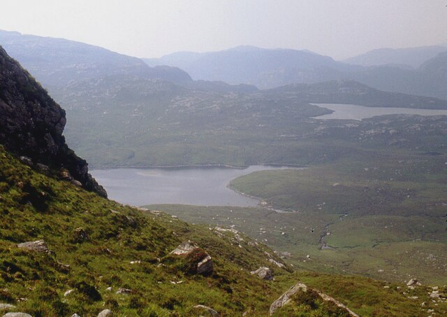
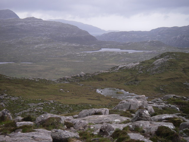
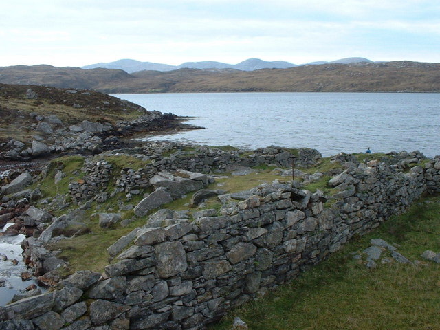
Creag an Fhithich, located in Ross-shire, Scotland, is a stunning coastal marsh and saltings area that offers a unique and diverse natural environment. Stretching across a vast expanse, this area is a haven for various flora and fauna.

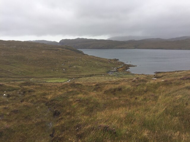
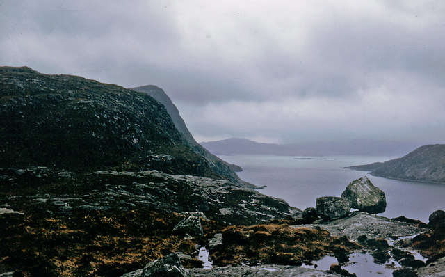
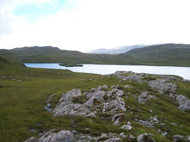
The marsh is situated adjacent to the shoreline, with a mixture of saltwater and freshwater habitats. The intertidal zone is characterized by extensive mudflats and salt marshes, providing a vital feeding ground for wading birds, such as curlews, oystercatchers, and redshanks. These birds can be observed probing the muddy substrate for invertebrates and small fish.

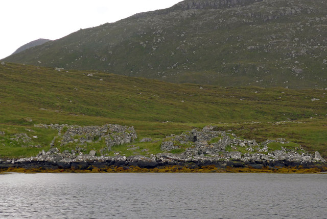
The saltings, or salt marshes, are home to a wide variety of halophytic plants, which are specifically adapted to survive in high salt concentrations. Species like sea aster, sea lavender, and glasswort thrive in this environment, creating a vibrant and colorful landscape. Additionally, the saltings support a rich invertebrate community, attracting numerous bird species that rely on these organisms for food.

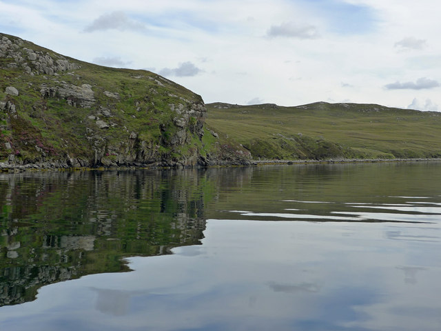
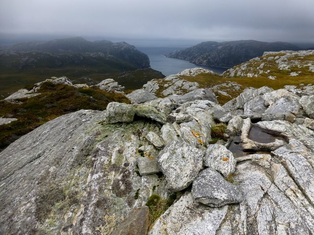
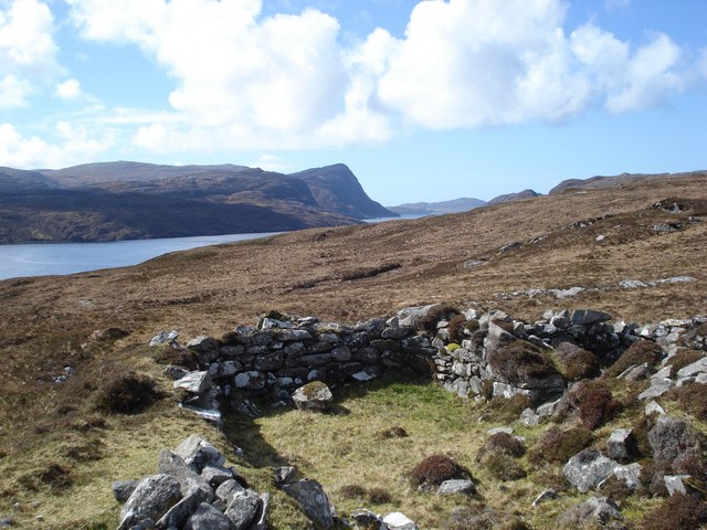
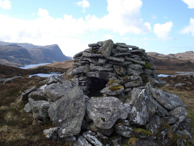
Creag an Fhithich also boasts stunning views of the surrounding coastal scenery, with rocky cliffs and sandy beaches adding to its charm. These coastal features provide nesting sites for seabirds, including fulmars and guillemots, which can be observed during the breeding season.

Visitors to Creag an Fhithich can enjoy leisurely walks along well-maintained trails, taking in the breathtaking scenery and observing the diverse wildlife. The area is also a popular spot for birdwatching enthusiasts, who can witness the annual migration of various bird species.

Overall, Creag an Fhithich is a remarkable coastal marsh and saltings area that offers a fascinating glimpse into the natural world, making it a must-visit destination for nature lovers and bird enthusiasts alike.

If you have any feedback on the listing, please let us know in the comments section below.

Creag an Fhithich Images

Images are sourced within 2km of 58.045991/-6.9854683 or Grid Reference NB0517. Thanks to Geograph Open Source API. All images are credited.

Loch Brunabhal and Loch na Gillean
Old Shielings at Dirascal Abandoned shielings at Dirascal between Cravadale and Loch Reasort (water in background).
Old Shielings at Dirascal
Abandoned shielings at Dirascal between Cravadale and Loch Reasort (water in background).
Creag an Fhithich The coastline of Loch Resort becomes less rugged on its northern side as you venture further up the loch, and beyond this point evidence appears sporadically of shielings, lazybeds and once used buildings.
Creag an Fhithich
The coastline of Loch Resort becomes less rugged on its northern side as you venture further up the loch, and beyond this point evidence appears sporadically of shielings, lazybeds and once used buildings.
The derelict houses at Dirascal This would have been a very harsh environment to make a living.
The derelict houses at Dirascal
This would have been a very harsh environment to make a living.
Sneathabhal Mor Third HuMP around the north of Loch Resort via an Alan Holmes RIB trip. Just a brilliant trip.
Name: Sneathabhal Mor
Hill number: 4949
Height: 175m / 574ft
Area: 24A: Lewis and Nearby Islands
Class: Hu,1
Grid ref: NB043177 (est)
Drop: 114m
Col: 61m  NB054178
Sneathabhal Mor
Third HuMP around the north of Loch Resort via an Alan Holmes RIB trip. Just a brilliant trip. Name: Sneathabhal Mor Hill number: 4949 Height: 175m / 574ft Area: 24A: Lewis and Nearby Islands Class: Hu,1 Grid ref: NB043177 (est) Drop: 114m Col: 61m NB054178
Abhainn Bhearraraigh Meanders in the middle stretch of a river on Harris that flows north into Loch Reasort.
Abhainn Bhearraraigh
Meanders in the middle stretch of a river on Harris that flows north into Loch Reasort.
Abhainn Bhearraraigh View upstream into Gleann Bhearraraigh.
Abhainn Bhearraraigh
View upstream into Gleann Bhearraraigh.
Loch na Gillean Western corner of Loch na Gillean on Harris.
Loch na Gillean
Western corner of Loch na Gillean on Harris.
Across the lower valley of the Abhainn Bhearraraigh This rocky valley contains the Abhainn Bhearraraigh that flows north into Loch Reasort between the photographer and the crags in the middle ground.
Across the lower valley of the Abhainn Bhearraraigh
This rocky valley contains the Abhainn Bhearraraigh that flows north into Loch Reasort between the photographer and the crags in the middle ground.
Southwest slopes of Corcasmol Rocky outcrops and wet peat on the slopes of Corcasmol. (The photograph also shows some of the adjacent square <a href="https://www.geograph.org.uk/gridref/NB0518">NB0518</a> - the loch in the western corner is the southern corner of Loch Bodabhat where the Abhainn Sgianuillt flows out)
Southwest slopes of Corcasmol
Rocky outcrops and wet peat on the slopes of Corcasmol. (The photograph also shows some of the adjacent square NB0518 - the loch in the western corner is the southern corner of Loch Bodabhat where the Abhainn Sgianuillt flows out)
Loch Reasort from north shore Looking down Loch Reasort from the north shore after a 13 mile cycle/walk from Uig
Loch Reasort from north shore
Looking down Loch Reasort from the north shore after a 13 mile cycle/walk from Uig
Boulder on North Shore of Loch Reasort Reached this point after a 13 mile cycle/walk from Uig. While sitting here the bay was circled by a golden eagle.
Boulder on North Shore of Loch Reasort
Reached this point after a 13 mile cycle/walk from Uig. While sitting here the bay was circled by a golden eagle.
Mullach an Ron View towards Scarp from Mullach an Ron.
Mullach an Ron
View towards Scarp from Mullach an Ron.
South side of Loch Resort Very rough terrain.  We had hoped to walk to Taran Mor, the symmetrical hill in the distance, but gave up at Taran Beag.  We had started from Kinlochresort.
South side of Loch Resort
Very rough terrain. We had hoped to walk to Taran Mor, the symmetrical hill in the distance, but gave up at Taran Beag. We had started from Kinlochresort.
Loch Bodabhat
Loch Bodabhat
Shielings above Loch Resort A view of the shielings shown on the map at this location
Shielings above Loch Resort
A view of the shielings shown on the map at this location
Beehive cairn at NB 06572 17806 This cairn is similar but smaller to the ones on the Airigh a' Chlair Mhoir  <a href="https://www.geograph.org.uk/gridref/NB120160">NB120160</a>, and is likely to be associated with the nearby shielings. Might they be smokehouses or drying houses for fish meat or grain?
Beehive cairn at NB 06572 17806
This cairn is similar but smaller to the ones on the Airigh a' Chlair Mhoir NB120160, and is likely to be associated with the nearby shielings. Might they be smokehouses or drying houses for fish meat or grain?
Dirascal on shore of Loch Reasort How isolated can you get!
Dirascal on shore of Loch Reasort
How isolated can you get!
Show me another place!

Creag an Fhithich is located at Grid Ref: NB0517 (Lat: 58.045991, Lng: -6.9854683)

Unitary Authority: Na h-Eileanan an Iar

Police Authority: Highlands and Islands

What 3 Words

///gracing.protrude.brightens. Near Tarbert, Na h-Eileanan Siar

Related Wikis

Uladail

Uladail is a location near Amhuinnsuidhe, on Harris in the Outer Hebrides, Scotland. Sron Ulladail is a sheer cliff which at 370 metres (1,210 ft) is one...

Tiorga Mor

Tiorga Mor (679 m) is a mountain in Harris, in the Outer Hebrides of Scotland. The most westerly peak of the high mountains of Harris, it is a very rugged...

Oireabhal

Oireabhal (662 m) is a mountain in Harris, in the Outer Hebrides of Scotland. The peak is the highest point on a complex ridge that runs from north to...

Chliostair Hydro-Electric Scheme

Chliostair Hydro-Electric Scheme is a small scheme promoted by the North of Scotland Hydro-Electric Board on Harris, Outer Hebrides. It consists of a single...

Nearby Amenities

Located within 500m of 58.045991,-6.9854683
Created By: dmgroom_coastlines
Lat/Long: 58.04203/-6.98896
Created By: dmgroom_coastlines
Lat/Long: 58.04227/-6.98798
Created By: dmgroom_coastlines
Lat/Long: 58.0425/-6.98652
Created By: dmgroom_coastlines
Lat/Long: 58.0425/-6.98604
Created By: dmgroom_coastlines
Lat/Long: 58.04235/-6.9846
The data included in this document is from www.openstreetmap.org. The data is made available under ODbL.

Have you been to Creag an Fhithich?

Leave your review of Creag an Fhithich below (or comments, questions and feedback).