Goat's Point

Coastal Marsh, Saltings in Cornwall

England

Goat's Point

Lower Town Quay The smaller of the two quays on St Martin’s. The larger quay at Higher Town is the one used for freight deliveries, but is inaccessible at a low tide.

The island behind is the uninhabited Tean (pronounced tea-an).
Lower Town Quay Credit: David Lally

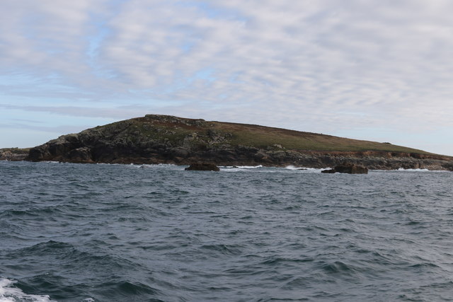
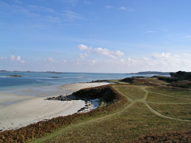
Goat's Point is a captivating coastal area located in Cornwall, England, known for its stunning coastal marsh and saltings. Situated near the town of Falmouth, Goat's Point offers visitors a unique experience of natural beauty and diverse wildlife.

The coastal marsh at Goat's Point is a fascinating ecosystem characterized by its rich biodiversity. It is home to a variety of plant species, including sea lavender, sea aster, and sea purslane. These plants thrive in the saltwater environment, creating a vibrant and colorful landscape. The marsh is a haven for numerous bird species, such as terns, gulls, and herons, making it a popular spot for birdwatchers.

Adjacent to the marsh, the saltings at Goat's Point provide a distinct habitat for various marine creatures. These intertidal mudflats are influenced by the tides, resulting in a dynamic environment that supports a range of organisms. Visitors can spot crabs, shrimp, and small fish in the shallow pools left behind by the receding tide.

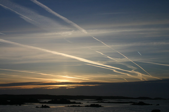
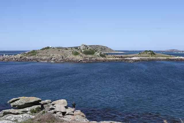
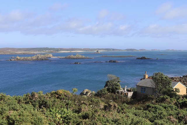
Goat's Point is also known for its picturesque coastal views. From the elevated cliffs, visitors can enjoy breathtaking vistas of the azure waters of the English Channel and the rugged coastline. The scenic beauty of the area attracts hikers and nature enthusiasts who embark on coastal walks along the South West Coast Path, which passes through Goat's Point.

Overall, Goat's Point in Cornwall offers a captivating blend of coastal marsh, saltings, and stunning vistas, making it a must-visit destination for nature lovers and those seeking tranquility in a picturesque setting.

If you have any feedback on the listing, please let us know in the comments section below.
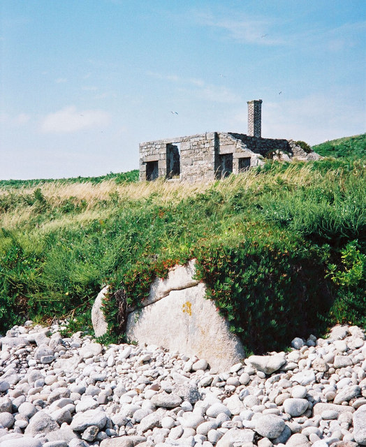
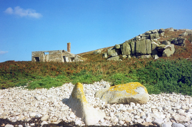
Goat's Point Images

Images are sourced within 2km of 49.9666/-6.3049669 or Grid Reference SV9116. Thanks to Geograph Open Source API. All images are credited.

Lower Town Quay The smaller of the two quays on St Martin’s. The larger quay at Higher Town is the one used for freight deliveries, but is inaccessible at a low tide.

The island behind is the uninhabited Tean (pronounced tea-an).
Lower Town Quay
The smaller of the two quays on St Martin’s. The larger quay at Higher Town is the one used for freight deliveries, but is inaccessible at a low tide. The island behind is the uninhabited Tean (pronounced tea-an).
Great Bay panorama On of the most beautiful spots on the islands.
Great Bay panorama
On of the most beautiful spots on the islands.
The north end of St Helen's From a boat trip around the north of the Isles of Scilly
The north end of St Helen's
From a boat trip around the north of the Isles of Scilly
Sunrise on Tresco A super sunrise from our hotel bedroom at the Island Hotel.
Sunrise on Tresco
A super sunrise from our hotel bedroom at the Island Hotel.
Northwethel from Merchant's Point A perfect spot for fishing.
Northwethel from Merchant's Point
A perfect spot for fishing.
The south end of Northwethel From a boat between Tresco and Northwethel
The south end of Northwethel
From a boat between Tresco and Northwethel
Middle Ledge Just off Old Grimsby Harbour
Middle Ledge
Just off Old Grimsby Harbour
Tide Rock on Long Ledge Just off Old Grimsby Harbour
Tide Rock on Long Ledge
Just off Old Grimsby Harbour
Blockhouse, Tresco Grade II listed. Listing number 1219196. Fortification probably dating from 1548-52.
Blockhouse, Tresco
Grade II listed. Listing number 1219196. Fortification probably dating from 1548-52.
Island Sea Safaris At Long Point Quay, Old Grimsby Harbour, Tresco.
Island Sea Safaris
At Long Point Quay, Old Grimsby Harbour, Tresco.
Towards Foreman's Island and Long Ledge From behind the Sea Garden Cottages, Old Grimsby.
Towards Foreman's Island and Long Ledge
From behind the Sea Garden Cottages, Old Grimsby.
Northwethel Island Between Tresco and St Martin's, Isles of Scilly.
Northwethel Island
Between Tresco and St Martin's, Isles of Scilly.
The Pest House, St Helen's An 18th century quarantine station for plague victims from passing ships who were isolated on this small island to await their fate. <span class="nowrap"><a title="https://en.wikipedia.org/wiki/St_Helen%27s,_Isles_of_Scilly" rel="nofollow ugc noopener" href="https://en.wikipedia.org/wiki/St_Helen%27s,_Isles_of_Scilly">Link</a><img style="margin-left:2px;" alt="External link" title="External link - shift click to open in new window" src="https://s1.geograph.org.uk/img/external.png" width="10" height="10"/></span>
The Pest House, St Helen's
An 18th century quarantine station for plague victims from passing ships who were isolated on this small island to await their fate. LinkExternal link
St Helen's Pest House The small quarantine shelter where sailors infected with the plague were marooned. A small graveyard is nearby which kind of tells its own story.
St Helen's Pest House
The small quarantine shelter where sailors infected with the plague were marooned. A small graveyard is nearby which kind of tells its own story.
Old Grimsby Harbour and the Blockhouse In the distance can be seen St Martin's (to the left) and Nornour <a href="https://www.geograph.org.uk/gridref/SV9414">SV9414</a>.
Old Grimsby Harbour and the Blockhouse
In the distance can be seen St Martin's (to the left) and Nornour SV9414.
The Old Blockhouse, Tresco Built to defend Old Grimsby Harbour.
The Old Blockhouse, Tresco
Built to defend Old Grimsby Harbour.
Footpath to Rushy Point from near the Old Blockhouse Tresco
Tresco Blockhouse Point 1990
Show me another place!

Goat's Point is located at Grid Ref: SV9116 (Lat: 49.9666, Lng: -6.3049669)

Division: Isles of Scilly

Unitary Authority: Isles of Scilly

Police Authority: Devon and Cornwall

What 3 Words

///inched.confirms.forgives. Near St Martin's, Isles of Scilly

Related Wikis

Lower Town, Isles of Scilly

Lower Town (Cornish: Trewoles) is the westernmost settlement on the island of St Martin's in the Isles of Scilly, England. One of the island's two quays...

Teän

Teän ( TEE-ən, sometimes written Tean without the diaeresis; Cornish: Enys Tian) is an uninhabited island to the north of the Isles of Scilly archipelago...

Middle Town, St Martin's

Middle Town (Cornish: Tregres) is a small settlement on the island of St Martin's in the Isles of Scilly, England. It is situated slightly inland, approximately...

St Martin's, Isles of Scilly

St Martin's (Cornish: Brechiek, lit. 'dappled island') is the northernmost populated island of the Isles of Scilly, England, United Kingdom. It has an...

Nearby Amenities

Located within 500m of 49.9666,-6.3049669
Tinkler's Hill
Natural: peak
Lat/Long: 49.9677439/-6.3002919
Source: PGS
Lat/Long: 49.9661686/-6.3042959
Source: PGS
Lat/Long: 49.9657891/-6.3045393
Source: PGS
Lat/Long: 49.9654151/-6.3048506
Source: PGS
Lat/Long: 49.96522/-6.304899
Source: PGS
Lat/Long: 49.9649343/-6.3048956
Source: PGS
Lat/Long: 49.9643146/-6.3012896
Source: PGS
Lat/Long: 49.9642804/-6.3030544
Source: PGS
Lat/Long: 49.9639079/-6.3036985
Source: PGS
Lat/Long: 49.9643212/-6.2996593
Lower Town
Name Kw: Trewoles
Place: village
Wikidata: Q6693875
Lat/Long: 49.9658215/-6.3019184
Information: map
Tourism: information
Lat/Long: 49.9657121/-6.3040211
Pub
Seven Stones
Addr Country: GB
Addr Hamlet: St Mary's
Addr Housename: Seven Stones Inn
Addr Postcode: TR25 0QW
Addr State: Isles Of Scilly
Addr Suburb: Lower Town
Email: sevenstonesinn@gmail.com
Fhrs Id: 780844
Phone: +44 1720 423777
Website: https://www.visitislesofscilly.com/food-drink/places-eat-drink/st-martins/seven-stones-inn
Lat/Long: 49.9663992/-6.3010705
Ferry Terminal
Leisure: slipway
Lat/Long: 49.9660741/-6.3051119
Great Hill
Natural: peak
Note: tentative location only
Source: Bing
Lat/Long: 49.9691828/-6.3105644
Teän Sound
Natural: bay
Lat/Long: 49.9677949/-6.3060304
Natural: peak
Lat/Long: 49.9654045/-6.3093498
Bar
Lat/Long: 49.9659705/-6.3034894
Vending Machine
Karma St Martin's
Addr Country: GB
Addr Hamlet: St Mary's
Addr Housename: Seven Stones Inn
Addr Postcode: TR25 0QW
Addr State: Isles Of Scilly
Addr Suburb: Lower Town
Fhrs Id: 776323
Vending: electronics
Lat/Long: 49.9662017/-6.3034921
Seamark Beacon Special Purpose Colour: yellow
Seamark Beacon Special Purpose Shape: pile
Seamark Type: beacon_special_purpose
Lat/Long: 49.9644449/-6.3012815
Seamark Beacon Special Purpose Colour: black
Seamark Beacon Special Purpose Shape: pile
Seamark Type: beacon_special_purpose
Lat/Long: 49.9645761/-6.3031697
The data included in this document is from www.openstreetmap.org. The data is made available under ODbL.

Have you been to Goat's Point?

Leave your review of Goat's Point below (or comments, questions and feedback).