Strom

Coastal Marsh, Saltings in Inverness-shire

Scotland

Strom

Navigation light, Gasaigh
Navigation light, Gasaigh Credit: Alpin Stewart

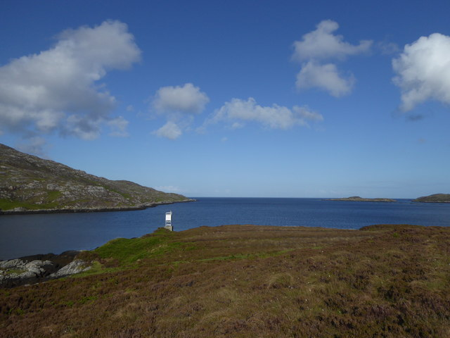
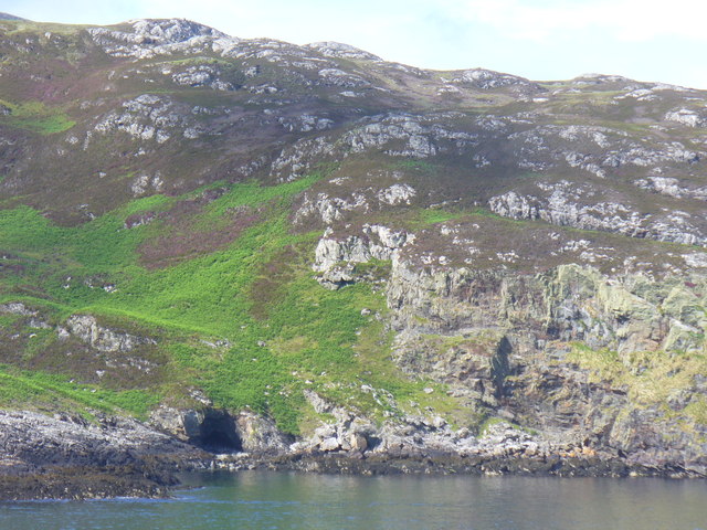
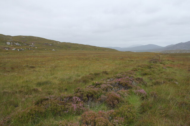
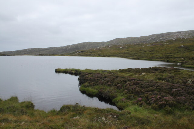
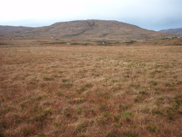
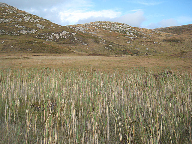
Strom is a coastal marsh located in Inverness-shire, Scotland. It is characterized by its vast expanse of salt marshes and saltings, which are flooded by the tides of the nearby sea. The area is rich in biodiversity, with a variety of plant and animal species thriving in the unique coastal environment.

The marshes at Strom provide important habitat for a range of bird species, including waders and waterfowl. The mudflats and creeks are also home to a variety of marine life, such as crabs, fish, and shellfish. The salt marsh vegetation includes species such as samphire, sea lavender, and sea purslane, which are adapted to the saline conditions.

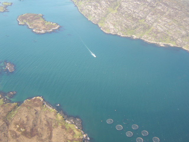
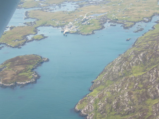
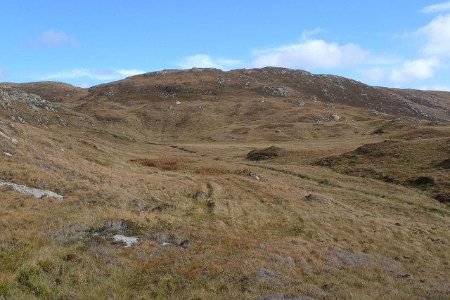
In addition to its ecological importance, Strom is also a popular destination for birdwatchers, nature enthusiasts, and hikers. The coastal paths offer stunning views of the surrounding landscape, with the sea on one side and the rugged hills of Inverness-shire on the other.

Overall, Strom is a unique and diverse coastal marsh that plays a vital role in supporting a wide range of plant and animal life, making it a valuable natural resource in Inverness-shire.

If you have any feedback on the listing, please let us know in the comments section below.

Strom Images

Images are sourced within 2km of 57.137585/-7.3070034 or Grid Reference NF7917. Thanks to Geograph Open Source API. All images are credited.
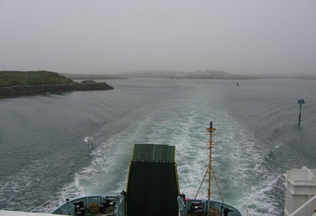
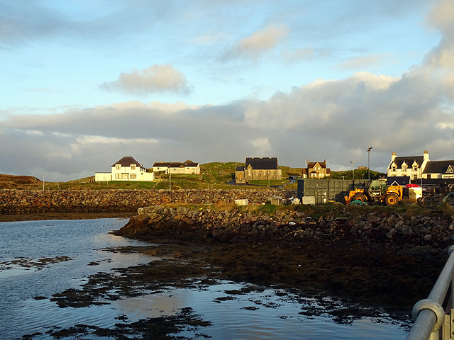
Navigation light, Gasaigh
Coastline Below Beinn Ruigh Choinnich Rocky shore on the north of the sea loch, Loch Baghasdail / Loch Boisdale. Risen sea levels have created a "drowned landscape".
Coastline Below Beinn Ruigh Choinnich
Rocky shore on the north of the sea loch, Loch Baghasdail / Loch Boisdale. Risen sea levels have created a "drowned landscape".
Steaming out of Loch Baghasdail Not sure if 'steaming' is quite the right expression to describe the movement of a diesel powered car ferry. Taken from the deck of MV 'Lord of the Isles' having just passed the small island of Gasaigh [centre left]. Lochboisdale port can be seen in the distance.
Steaming out of Loch Baghasdail
Not sure if 'steaming' is quite the right expression to describe the movement of a diesel powered car ferry. Taken from the deck of MV 'Lord of the Isles' having just passed the small island of Gasaigh [centre left]. Lochboisdale port can be seen in the distance.
Moorland to the west of the path from South to North Glendale Boggy moorland punctuated with the line of an old fence to the right. On the map it is marked as Gàradh Ur "garden wall".
Moorland to the west of the path from South to North Glendale
Boggy moorland punctuated with the line of an old fence to the right. On the map it is marked as Gàradh Ur "garden wall".
Lochan above South Glendale Lochan near the top of the path between North and South Glendale
Lochan above South Glendale
Lochan near the top of the path between North and South Glendale
Passing Gasaigh Out in Loch Baghasdail on the ferry to Oban, passing the small island of Gasaigh.
Passing Gasaigh
Out in Loch Baghasdail on the ferry to Oban, passing the small island of Gasaigh.
Sunset over South Uist from the CalMac ferry from Oban
Sunset over South Uist
from the CalMac ferry from Oban
Gleann dail bho Tuath path A lot of the path is very boggy, but this is one of the good bits.
Gleann dail bho Tuath path
A lot of the path is very boggy, but this is one of the good bits.
Gleann dail bho Tuath path The path in this section is like more like walking up twin streams.
Gleann dail bho Tuath path
The path in this section is like more like walking up twin streams.
View across Gleann Dail bho Tuath Looking towards Marabhal the grassy hill in the background.
View across Gleann Dail bho Tuath
Looking towards Marabhal the grassy hill in the background.
Loch Baghasdail The island to the upper left is Gasaigh.  To the lower right is a fish farm, off An Camas.
Loch Baghasdail
The island to the upper left is Gasaigh. To the lower right is a fish farm, off An Camas.
Loch Baghasdail Gasaigh is on the left - the white-washed buildings of Lochboisdale, with the ferry-point, are in the centre-distance.
Loch Baghasdail
Gasaigh is on the left - the white-washed buildings of Lochboisdale, with the ferry-point, are in the centre-distance.
Gleann dail bho Tuath The path here follows the 20m contour to avoid the wettest ground. This is the view from the path looking towards Beinn Bheag.
Gleann dail bho Tuath
The path here follows the 20m contour to avoid the wettest ground. This is the view from the path looking towards Beinn Bheag.
Gleann dail bho Tuath Looking through the reeds which fringe a particularly marshy stretch of the Gleann dail bho Tuath path.
Gleann dail bho Tuath
Looking through the reeds which fringe a particularly marshy stretch of the Gleann dail bho Tuath path.
The Oban ferry loading ramp at Lochboisdale
A bus at Lochboisdale Operated by D A Travel Ltd., South Uist.
A bus at Lochboisdale
Operated by D A Travel Ltd., South Uist.
Welcome to the Outer Hebrides A sign greeting visitors landing at Lochboisdale.
Welcome to the Outer Hebrides
A sign greeting visitors landing at Lochboisdale.
Buildings on the south side of Lochboisdale Caught in the early morning sunshine whilst waiting for the Oban ferry. The building in the centre of the view is marked as 'a place of worship' by the OS. That on the far left is marked as being a police station.
Buildings on the south side of Lochboisdale
Caught in the early morning sunshine whilst waiting for the Oban ferry. The building in the centre of the view is marked as 'a place of worship' by the OS. That on the far left is marked as being a police station.
Show me another place!

Strom is located at Grid Ref: NF7917 (Lat: 57.137585, Lng: -7.3070034)

Unitary Authority: Na h-Eileanan an Iar

Police Authority: Highlands and Islands

What 3 Words

///highways.harder.hazelnuts. Near Lochboisdale, Na h-Eileanan Siar

Related Wikis

Eileanan Iasgaich

Na h-Eileanan Iasgaich comprise a small uninhabited archipelago in Loch Boisdale, in the south east of the island of South Uist, in the Outer Hebrides...
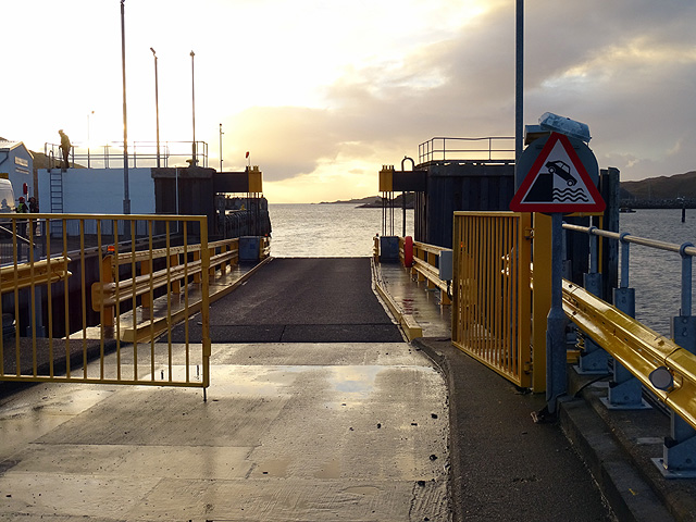
Lochboisdale

Lochboisdale (Scottish Gaelic: Loch Baghasdail [ɫ̪ɔx ˈbɤːs̪t̪ɪl]) is the main village and port on the island of South Uist, Outer Hebrides, Scotland. Lochboisdale...

Papar

The Papar (Icelandic pronunciation: [ˈpʰaːpar̥]; from Latin papa, via Old Irish, meaning "father" or "pope") were, according to early Icelandic sagas,...

Easaval

Easaval (Scottish Gaelic: Easabhal) is one of the smallest hills on the island of South Uist in the Outer Hebrides of Scotland, with a height of 243 metres...

Nearby Amenities

Located within 500m of 57.137585,-7.3070034
(3 pitches - booking advisable)
Operator: South Uist Hostel
Tourism: caravan_site
Lat/Long: 57.1361938/-7.306992
South Uist Hostel
Alt Name: Gleanndal Hostel
Rooms: 1
Tourism: hostel
Website: https://www.southuisthostel.co.uk/
Lat/Long: 57.1361925/-7.3068023
Operator: South Uist Hostem
Tourism: camp_site
Website: https://www.southuisthostel.co.uk/
Lat/Long: 57.1364915/-7.3063832
Meeting Place
Tourism: artwork
Lat/Long: 57.1365795/-7.3079416
Gleann Dail bho Tuath
Alt Name Gd: Ceann a Tuath Ghlinn Dail;Taobh a Tuath Ghleann Dail
Name En: North Glendale
Name Gd: Gleann Dail bho Tuath
Place: hamlet
Lat/Long: 57.1365654/-7.3069811
Power: pole
Lat/Long: 57.1368103/-7.3053969
Power: pole
Lat/Long: 57.1364123/-7.3056625
Power: pole
Lat/Long: 57.1373096/-7.3052011
Power: pole
Lat/Long: 57.1376109/-7.3050898
Power: pole
Lat/Long: 57.1357383/-7.3068909
Power: pole
Lat/Long: 57.1351903/-7.3066307
Power: pole
Lat/Long: 57.1345114/-7.3062901
Power: pole
Lat/Long: 57.1364552/-7.3072208
Power: pole
Lat/Long: 57.1366395/-7.3063005
Barrier: stile
Lat/Long: 57.136571/-7.3043236
Generator Method: wind_turbine
Generator Output Electricity: small_installation
Generator Source: wind
Generator Type: horizontal_axis
Power: generator
Lat/Long: 57.1361323/-7.3037515
Power: pole
Lat/Long: 57.1335949/-7.3054056
Power: pole
Lat/Long: 57.1340796/-7.3057006
Power: pole
Lat/Long: 57.1362672/-7.3081951
Power: pole
Lat/Long: 57.1360765/-7.3092411
Power: pole
Lat/Long: 57.1352979/-7.3141281
Power: pole
Lat/Long: 57.1354187/-7.3132859
Power: pole
Lat/Long: 57.1355526/-7.3126019
Power: pole
Lat/Long: 57.1357869/-7.3106922
Power: pole
Lat/Long: 57.1356239/-7.3117919
Barrier: stile
Lat/Long: 57.1355164/-7.3028456
Power: pole
Lat/Long: 57.1389107/-7.3002643
Power: pole
Lat/Long: 57.1384799/-7.3012084
Power: pole
Lat/Long: 57.1380578/-7.3022921
Power: pole
Lat/Long: 57.1375732/-7.303491
Power: pole
Lat/Long: 57.1372602/-7.3042742
Generator Method: photovoltaic
Generator Output Electricity: yes
Generator Source: solar
Generator Type: solar_photovoltaic_panel
Power: generator
Lat/Long: 57.1356936/-7.3060584
Power: pole
Lat/Long: 57.1343853/-7.3050908
Power: pole
Lat/Long: 57.1344639/-7.3059639
Passing Place
Lat/Long: 57.1365126/-7.3080939
The data included in this document is from www.openstreetmap.org. The data is made available under ODbL.

Have you been to Strom?

Leave your review of Strom below (or comments, questions and feedback).