Strom

Coastal Marsh, Saltings in Inverness-shire

Scotland

Strom

The Manse of the Free Presbyterian Church, Bayhead, North Uist The church is on the left and the Manse to the right.
The Manse of the Free Presbyterian Church, Bayhead, North Uist Credit: Julian Paren

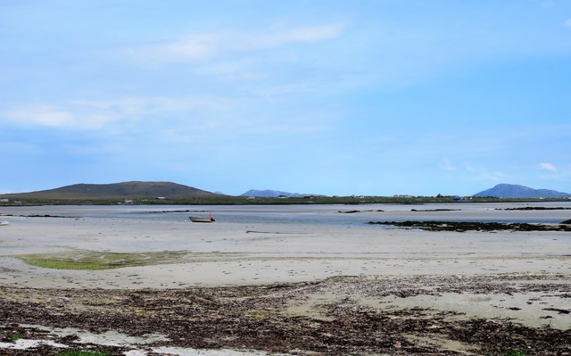
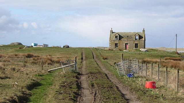
Strom is a coastal marsh located in Inverness-shire, Scotland. It is situated on the eastern coast of the country, near the town of Inverness. Known for its unique ecosystem and stunning natural beauty, Strom is a popular destination for nature lovers and birdwatchers.

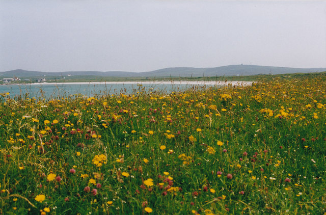
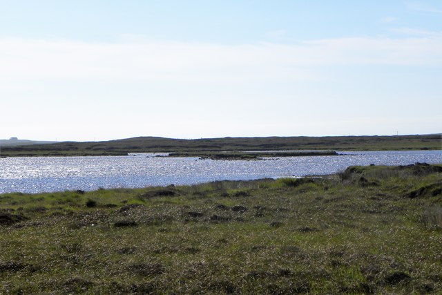
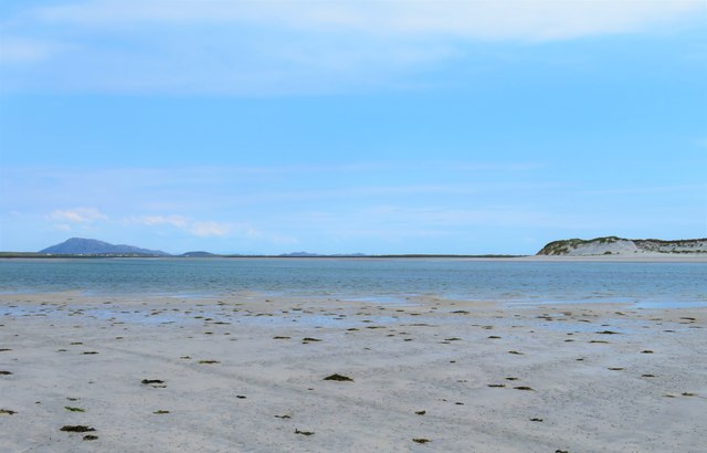
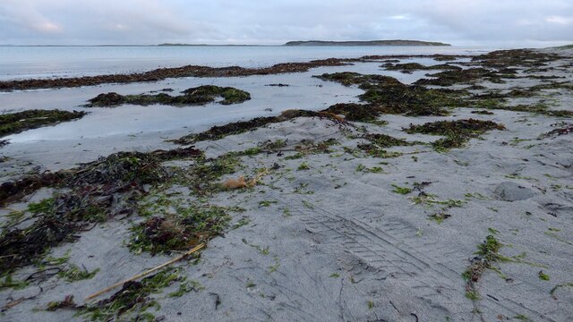
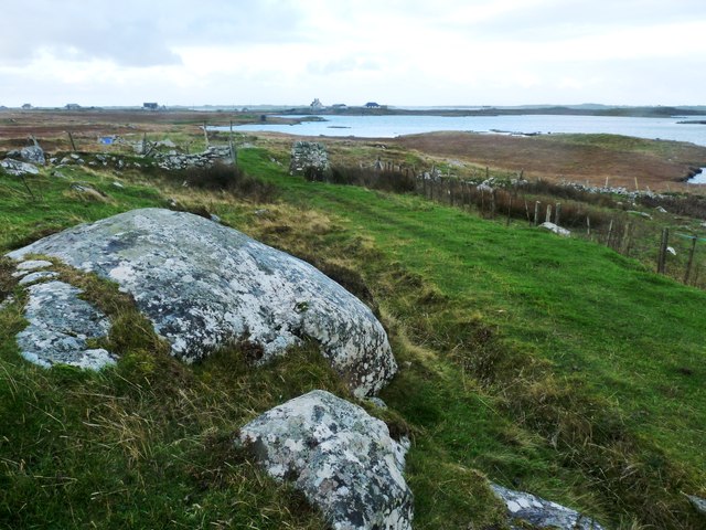
The marsh is characterized by its vast expanses of saltmarshes and saltings, which are formed by the interaction of tidal currents and the River Ness. These dynamic environments are constantly changing due to the ebb and flow of the tides, creating a diverse habitat for a wide range of plant and animal species.

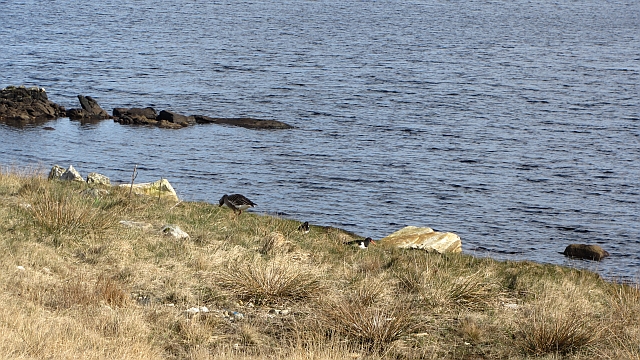
The vegetation of Strom is predominantly salt-tolerant, with plants such as sea lavender, sea aster, and thrift thriving in the saline conditions. These plants provide crucial feeding grounds and shelter for various bird species, including wading birds like curlews, oystercatchers, and redshanks. The marsh is also a haven for migratory birds, with species such as the pink-footed goose and the whooper swan making regular stopovers during their journeys.

In addition to its rich birdlife, Strom is also home to numerous invertebrates, such as marsh fritillary butterflies and rare moth species. The marsh is carefully managed to preserve its delicate balance and protect its unique biodiversity.

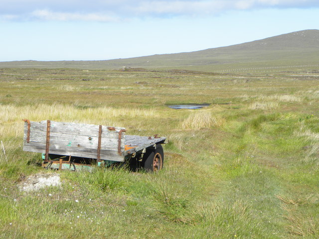
Visitors to Strom can explore the area through designated footpaths and observation points, providing an opportunity to appreciate the incredible natural beauty and observe the diverse wildlife that inhabits this coastal marsh.

If you have any feedback on the listing, please let us know in the comments section below.

Strom Images

Images are sourced within 2km of 57.578413/-7.4146706 or Grid Reference NF7667. Thanks to Geograph Open Source API. All images are credited.
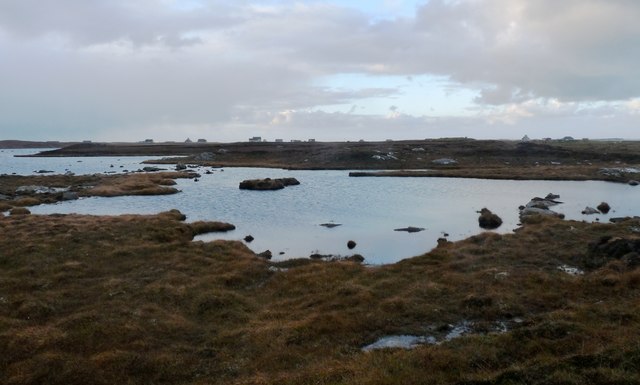
The Manse of the Free Presbyterian Church, Bayhead, North Uist The church is on the left and the Manse to the right.
The Manse of the Free Presbyterian Church, Bayhead, North Uist
The church is on the left and the Manse to the right.
North Uist School This is a fine new school, but there has been controversy and pain associated with its build.  There was previously a small secondary school here, which closed in 2012, with all pupils being transferred to Sgoil Lionacleit in Benbecula.  

This new school is a primary school and is now the sole primary school in North Uist, with all the previous smaller schools closed and pupils bussed daily from their homes.
North Uist School
This is a fine new school, but there has been controversy and pain associated with its build. There was previously a small secondary school here, which closed in 2012, with all pupils being transferred to Sgoil Lionacleit in Benbecula. This new school is a primary school and is now the sole primary school in North Uist, with all the previous smaller schools closed and pupils bussed daily from their homes.
Old Milestone by the A865, Bayhead, North Uist Granite slab by the A865, in parish of North Uist (North Uist District), Bayhead, in passing place East of 'SLOW' on road.

Surveyed

Milestone Society National ID: WI_NUCW04
Old Milestone by the A865, Bayhead, North Uist
Granite slab by the A865, in parish of North Uist (North Uist District), Bayhead, in passing place East of 'SLOW' on road. Surveyed Milestone Society National ID: WI_NUCW04
Floral machair The machair is a wonderful grassland ecosystem, that is fast getting quite rare as farming pratcises change. It houses a wide range of flowering plants and in summer is a wonderful sight.
Floral machair
The machair is a wonderful grassland ecosystem, that is fast getting quite rare as farming pratcises change. It houses a wide range of flowering plants and in summer is a wonderful sight.
Old trailer on the moor The Committee Road runs past this point with several tracks leading off either side giving access to peat diggings. One would guess that this old trailer was once used to transport the peats.
Old trailer on the moor
The Committee Road runs past this point with several tracks leading off either side giving access to peat diggings. One would guess that this old trailer was once used to transport the peats.
Loch Bruist One of the innumerable small lochs that dot the North Uist landscape.
Loch Bruist
One of the innumerable small lochs that dot the North Uist landscape.
Loch Ardheisgeir Tidal, freshwater or brackish? I suspect it is the last of these three, and like other near sea level lochs around the Uists [Loch Bi on South Uist is a good example] it might be invaded by seawater on high spring tides.
Loch Ardheisgeir
Tidal, freshwater or brackish? I suspect it is the last of these three, and like other near sea level lochs around the Uists [Loch Bi on South Uist is a good example] it might be invaded by seawater on high spring tides.
Miles of sand - Caolas Phaibell Looking out across the tidal flats between 'mainland' North Uist and the island of Kirkibost, which is off picture to the right.
Miles of sand - Caolas Phaibell
Looking out across the tidal flats between 'mainland' North Uist and the island of Kirkibost, which is off picture to the right.
Sand and sea channels Oitir Mhor Large areas of sand between 'mainland' North Uist and the sandy island of Kirkibost, the dunes on that island being visible to the right.
Sand and sea channels Oitir Mhor
Large areas of sand between 'mainland' North Uist and the sandy island of Kirkibost, the dunes on that island being visible to the right.
Shoreline at Sgeir a' Chotain As one heads south westwards along this beach, so white sand tends to give way to pebble and seaweed. The northern end of Kirkibost Island is to the left, whilst to the south the view is towards the big hills of South Uist, the low island of Benbecula hardly showing at all.
Shoreline at Sgeir a' Chotain
As one heads south westwards along this beach, so white sand tends to give way to pebble and seaweed. The northern end of Kirkibost Island is to the left, whilst to the south the view is towards the big hills of South Uist, the low island of Benbecula hardly showing at all.
Vehicle graveyard One of many little out of the way corners on the Uists where old and unwanted vehicles come to die. Is there no scrap yard on the Western isles?
Vehicle graveyard
One of many little out of the way corners on the Uists where old and unwanted vehicles come to die. Is there no scrap yard on the Western isles?
Sand, sea and Kirkibost Island
Westford Inn Substantial stone house at Claddach on the west coast of North Uist - an inn and a B&B.
Westford Inn
Substantial stone house at Claddach on the west coast of North Uist - an inn and a B&B.
Loch nan Athan
Loch nan Athan
Moor track by Loch Dubhasairidh An access route over wet boggy ground to the peat cuttings
Moor track by Loch Dubhasairidh
An access route over wet boggy ground to the peat cuttings
Abandoned house, Cladach a' Chaolais Old housing stock on the west side of North Uist.
Abandoned house, Cladach a' Chaolais
Old housing stock on the west side of North Uist.
New road surface, A865 Newly resurfaced single track road.
New road surface, A865
Newly resurfaced single track road.
Loch Ardheisker A loch which is accessible to the higher tides. A greylag goose and some oystercatchers feed by the shore.
Loch Ardheisker
A loch which is accessible to the higher tides. A greylag goose and some oystercatchers feed by the shore.
Show me another place!

Strom is located at Grid Ref: NF7667 (Lat: 57.578413, Lng: -7.4146706)

Unitary Authority: Na h-Eileanan an Iar

Police Authority: Highlands and Islands

What 3 Words

///unicorns.tone.deeply. Near Balivanich, Na h-Eileanan Siar

Related Wikis

Ardheisker

Ardheisker (Scottish Gaelic: Àird Heillsgeir) is a settlement on North Uist, in the Outer Hebrides, Scotland. Ardheisker is within the parish of North...

Kirkibost

Kirkibost (Scottish Gaelic: Eilean Chirceaboist) is a low-lying island west of North Uist in the Outer Hebrides of Scotland. == Geography == Kirkibost...

RRH Benbecula

Remote Radar Head Benbecula or RRH Benbecula, is an air defence radar station operated by the Royal Air Force. It is located at Cleitreabhal a'Deas, 17...

North Uist

North Uist (Scottish Gaelic: Uibhist a Tuath; Scots: North Uise) is an island and community in the Outer Hebrides of Scotland. == Etymology == In Donald...

Nearby Amenities

Located within 500m of 57.578413,-7.4146706
Passing Place
Lat/Long: 57.5817963/-7.417045
Bus Stop
Claddach Kyles
Bus: yes
Naptan AtcoCode: 6010731609
Naptan Bearing: NW
Naptan BusStopType: CUS
Naptan CommonName: Claddach Kyles
Naptan Indicator: Committee road end
Naptan Landmark: Road junction
Naptan NaptanCode: 94723547
Naptan Street: A865
Naptan Verified: no
Public Transport: platform
Source: naptan_import
Lat/Long: 57.5784109/-7.4089244
Passing Place
Lat/Long: 57.5792972/-7.4129568
Àird Heisgeir
Name En: Ardheisker
Name Gd: Àird Heisgeir
Natural: cape
Source Name: OS OpenData StreetView
Wikidata: Q4788034
Wikipedia: en:Ardheisker
Lat/Long: 57.5786677/-7.4190116
Passing Place
Lat/Long: 57.5776195/-7.4078272
Passing Place
Lat/Long: 57.5792911/-7.4118514
Power: pole
Lat/Long: 57.5763177/-7.4082118
Power: pole
Lat/Long: 57.5772495/-7.4095494
Power: pole
Lat/Long: 57.576731/-7.4089316
Power: pole
Lat/Long: 57.5777665/-7.41028
Power: pole
Lat/Long: 57.5784188/-7.4112093
Power: pole
Lat/Long: 57.578223/-7.411776
Power: pole
Lat/Long: 57.5780415/-7.412289
Power: pole
Lat/Long: 57.5774554/-7.4131647
Power: pole
Lat/Long: 57.5787183/-7.411674
Power: pole
Lat/Long: 57.578871/-7.4099523
Power: pole
Lat/Long: 57.5790711/-7.4094258
Power: pole
Lat/Long: 57.5793836/-7.4085798
Power: pole
Lat/Long: 57.5790798/-7.4128638
Passing Place
Lat/Long: 57.5799653/-7.4151787
Power: pole
Lat/Long: 57.5791359/-7.4157351
Power: pole
Lat/Long: 57.5793721/-7.4153322
Power: pole
Lat/Long: 57.5791748/-7.4166429
Power: pole
Lat/Long: 57.5796327/-7.4171909
Power: pole
Lat/Long: 57.5791226/-7.4136462
Power: pole
Lat/Long: 57.5796764/-7.4078147
Power: pole
Lat/Long: 57.5799266/-7.4074285
Power: pole
Lat/Long: 57.5802228/-7.4070154
Power: pole
Lat/Long: 57.5803572/-7.4180674
Power: pole
Lat/Long: 57.5809166/-7.4187782
Power: pole
Lat/Long: 57.5816126/-7.4196017
Passing Place
Lat/Long: 57.5808989/-7.4161558
Power: pole
Lat/Long: 57.5753383/-7.4090701
Barrier: cattle_grid
Lat/Long: 57.5795983/-7.4079064
Passing Place
Lat/Long: 57.5796728/-7.4072657
The data included in this document is from www.openstreetmap.org. The data is made available under ODbL.

Have you been to Strom?

Leave your review of Strom below (or comments, questions and feedback).