Agony Point
Coastal Feature, Headland, Point in Yorkshire Scarborough
England
Agony Point

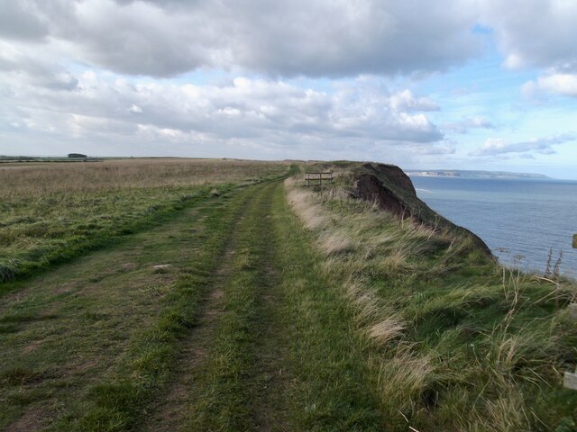
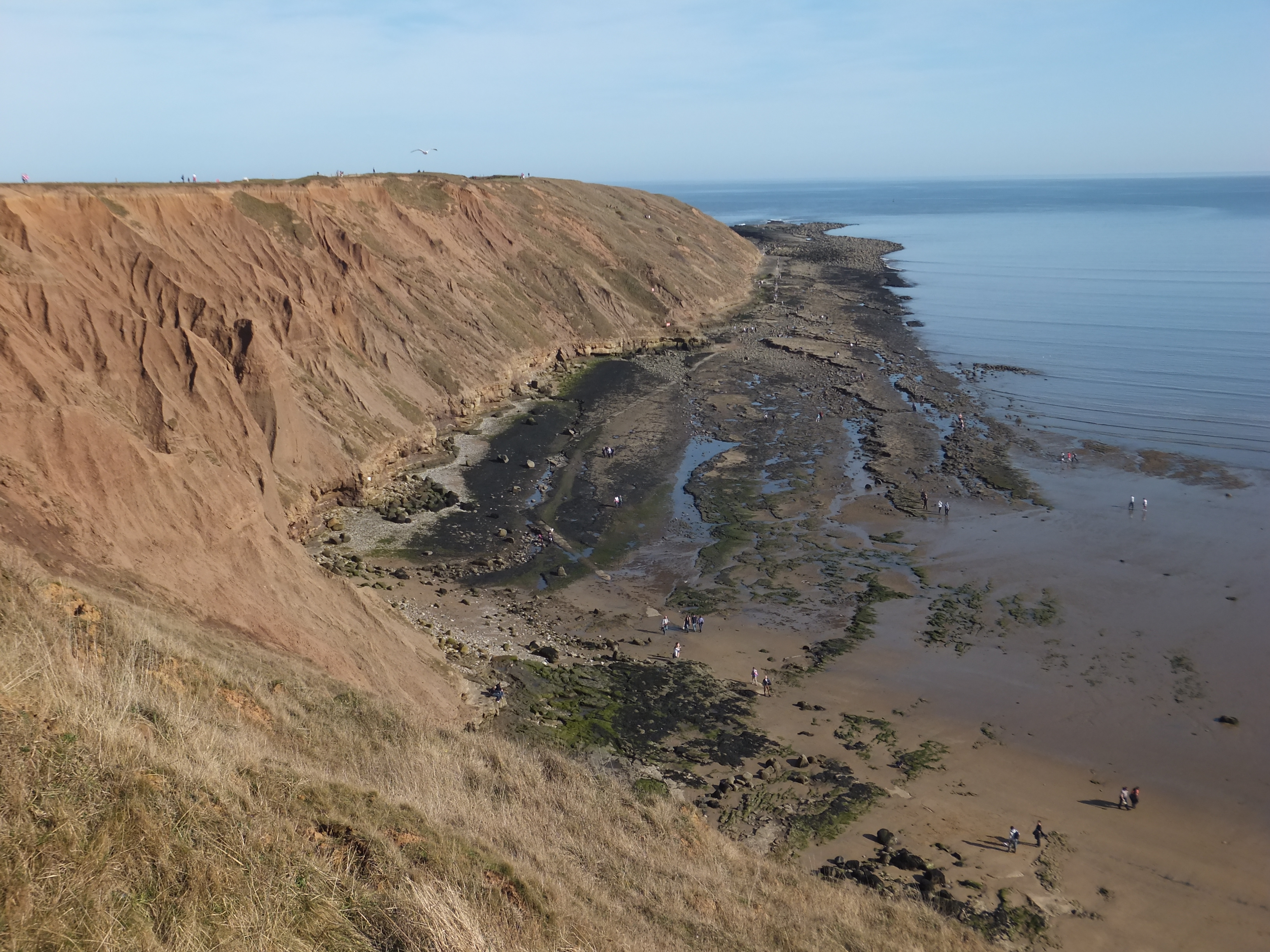
Agony Point is a prominent coastal feature located in Yorkshire, England. It is situated on the east coast, specifically in the region of Scarborough, and is known for being a picturesque headland and point. The point juts out into the North Sea, offering breathtaking views of the surrounding coastline.
The name "Agony Point" is said to derive from the treacherous currents and rough seas that can be experienced in the area, making it a challenging spot for sailors and fishermen. The headland is known for its rugged cliffs, which provide nesting sites for various seabird species, including gulls and kittiwakes.
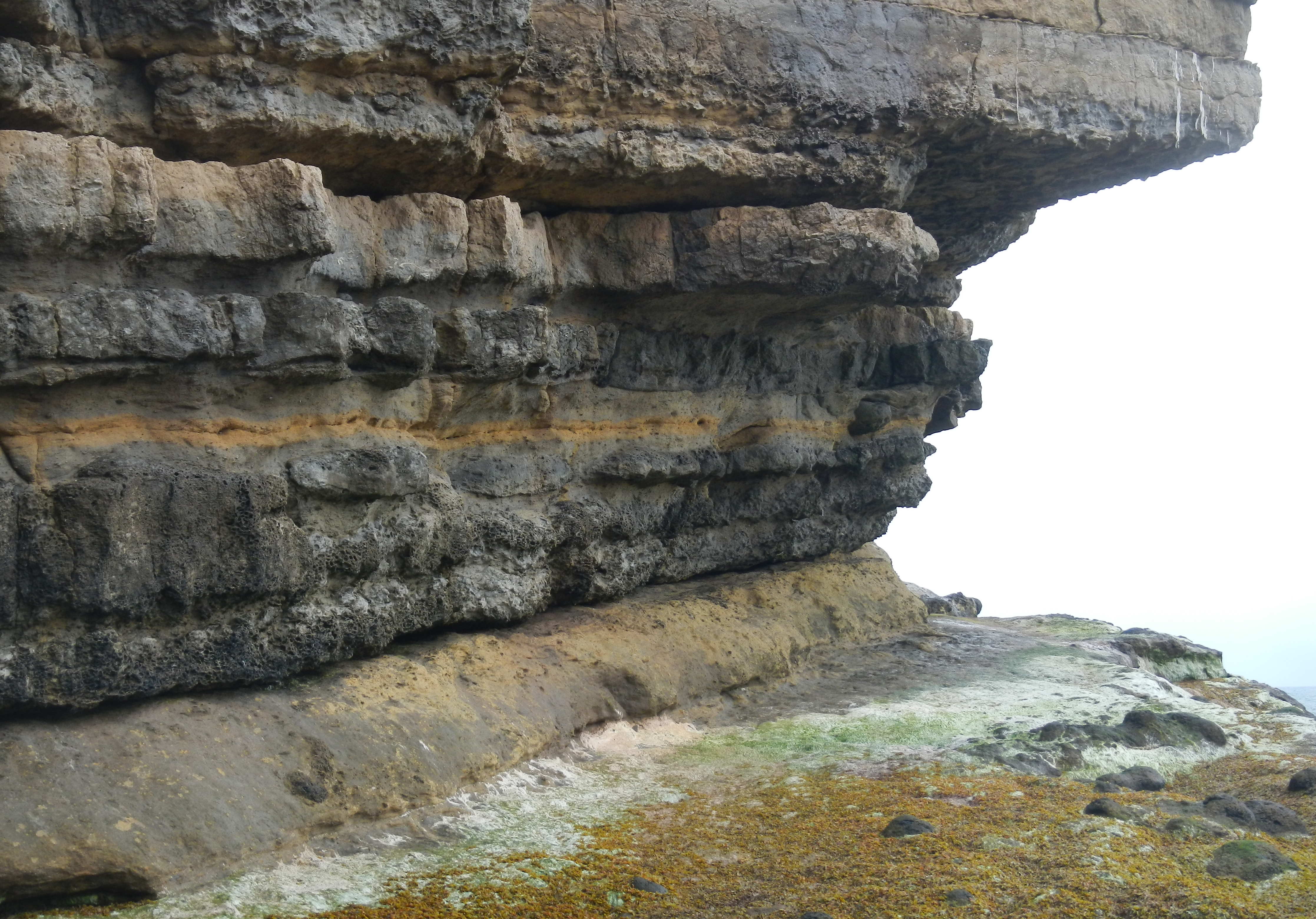
The point itself is composed of a mixture of sedimentary rocks, such as sandstone and limestone, which have been shaped by erosion over time. This geological formation adds to the unique charm of Agony Point, attracting geologists and nature enthusiasts alike.
Agony Point is a popular destination for visitors and locals alike, who come to enjoy the stunning coastal scenery and explore the nearby beaches and walking trails. The area is also known for its rich biodiversity, with a variety of plant and animal species inhabiting the surrounding cliffs and rock pools.
Overall, Agony Point is a captivating coastal feature that offers both natural beauty and a sense of adventure. Whether it's watching the waves crash against the cliffs or spotting seabirds soaring overhead, this headland is a must-visit location for anyone seeking a truly memorable coastal experience in Yorkshire.
If you have any feedback on the listing, please let us know in the comments section below.
Agony Point Images
Images are sourced within 2km of 54.217376/-0.27212845 or Grid Reference TA1281. Thanks to Geograph Open Source API. All images are credited.


Agony Point is located at Grid Ref: TA1281 (Lat: 54.217376, Lng: -0.27212845)
Division: North Riding
Administrative County: North Yorkshire
District: Scarborough
Police Authority: North Yorkshire
What 3 Words
///window.trinkets.burglars. Near Filey, North Yorkshire
Nearby Locations
Related Wikis
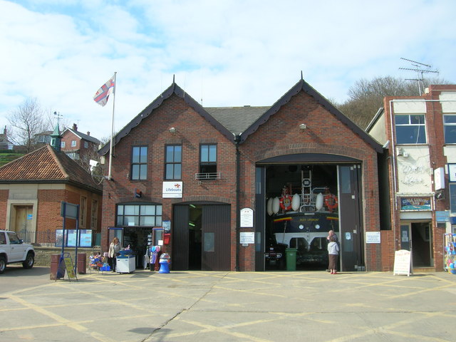
Filey Lifeboat Station
Filey Lifeboat Station is a Royal National Lifeboat Institution (RNLI) lifeboat station located in the town of Filey, North Yorkshire, England. It is one...
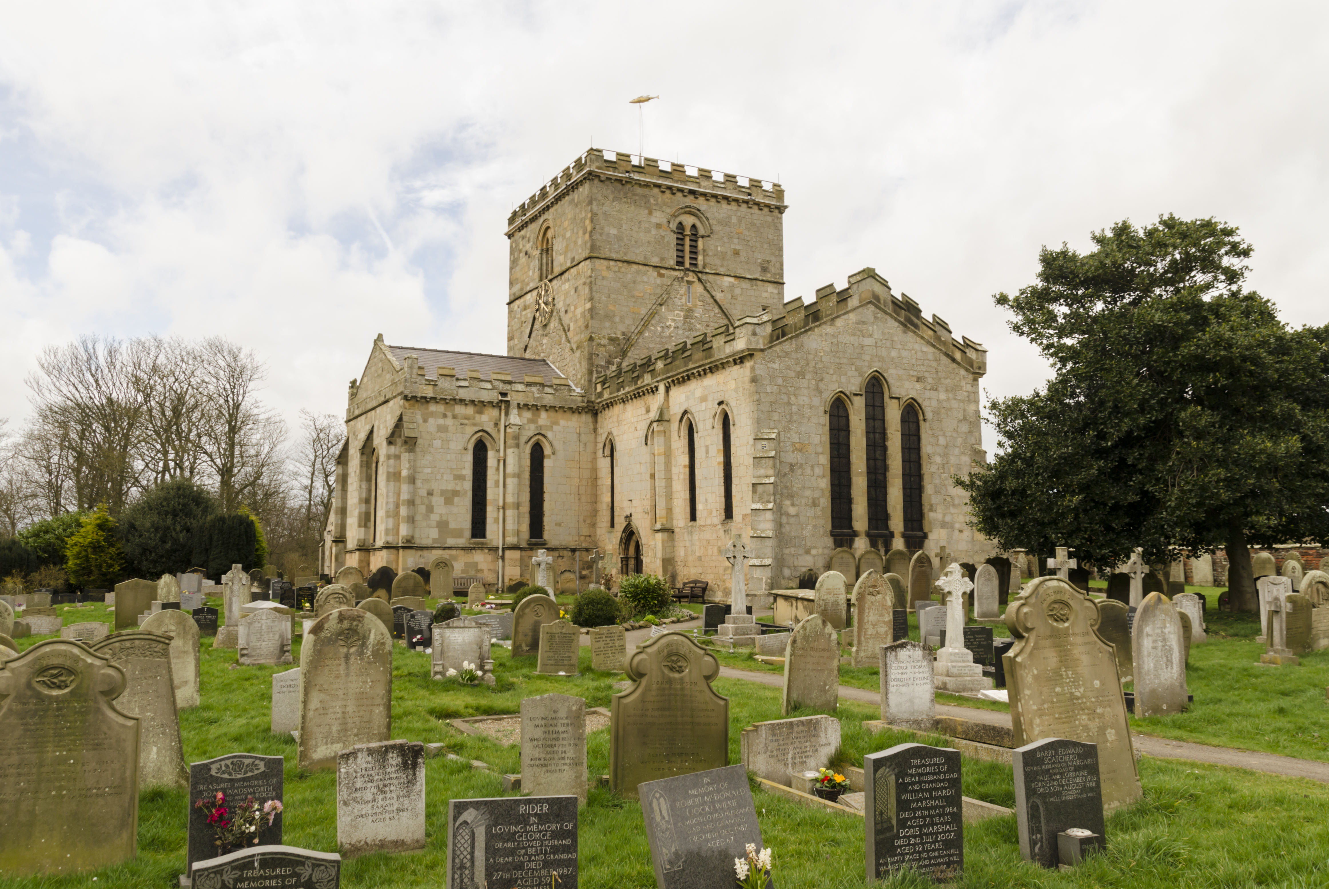
Church of St Oswald, Filey
The Church of St Oswald, Filey, is a parish church in the North Yorkshire town of Filey, England. The church dates from the 12th and 13th centuries, with...
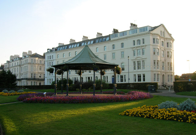
Filey
Filey () is a seaside town and civil parish in North Yorkshire, England. It is located between Scarborough and Bridlington on Filey Bay. Although it was...
Filey Brigg
Filey Brigg is a long narrow peninsula situated about a mile north of Filey, North Yorkshire. Its steep cliffs are 20 metres high and consist of a variety...

Filey railway station
Filey railway station is a Grade II* listed station opened in 1846 on the Hull to Scarborough Line, which serves the seaside town of Filey in North Yorkshire...

Filey School
Filey School (named Ebor Academy Filey for a time) is a secondary school located in Filey, North Yorkshire, England. It is the only secondary school in...
Passage Beds
The Passage Beds is a member of the Corallian Oolite Formation, a geologic formation in England. The subtidal to marine sandstone preserves fossils of...

Primrose Valley
Primrose Valley is a coastal village south of Filey, North Yorkshire, England. It was historically part of the East Riding of Yorkshire until 1974 and...
Nearby Amenities
Located within 500m of 54.217376,-0.27212845Have you been to Agony Point?
Leave your review of Agony Point below (or comments, questions and feedback).