Keldhowe Point

Coastal Feature, Headland, Point in Yorkshire Scarborough

England

Keldhowe Point

Sandsend Alum Quarries Extract from the Historic England Research Records:

Summary : The remains of three post medieval alum quarries at Sandsend. Alum was principally used in the textile industry as a fixing agent for clothing dyes. It was also used by tanners to produce supple leather. After the shale had been quarried it was then heaped into large mounds, fired and left to smoulder for up to nine months. The shale was then tipped into leaching tanks where it was left to soak in water. The solution, containing aluminium sulphate was then drained off and ran along stone or wooden conduits known as liquor troughs to the alum house. Here the water was boiled away from the solution in evaporating pans. An alkali, derived from human urine or burnt kelp, was added to cause precipitation of the alum crystals. The crystals were then bagged and transported for sale. The burnt shale left in the leaching pits was either disposed of nearby to form enormous shale tips or thrown in to the sea. Quarrying at Sandsend moved from south to north along the coastal cliffs. The earliest quarry was Gaytrees, opened in 1733, followed by Ness End and finally Deep Grove. The quarry probably contains significant archaeological remains of buildings, pits, cisterns and parts of the wooden liquor trough also survive within a rock cut channel. From 1811 to 1933 cementstone was also mined within the quarries. The Middlesborough to Whitby railway was being constructed through the disused alum quarries by 1874.

More information : NZ 859138. Alum quarries at Sandsend Ness in operation from c1613 - 1880. Remains clearly visible. The alum house was on the site of Sandsend station at NZ 860 129 (NZ 81 SE 496).

The monument includes remains of the alum quarries and associated features on the coastal cliffs north of Sandsend. As well as the quarries, the monument also includes structures used for initial processing and transport of the alum. There are three discrete quarries within the monument, extending northwards along the coast for 1km. The earliest quarry, which was working from 1733, was the closest to Sandsend at Gaytrees. The other two, at Ness End and Deep Grove, were excavated later as the extraction progressed along the coast. The quarries were cut into the east and north east-facing coastal cliffs where alum bearing shales were exposed. Once the cliffs were cut back, processing of the alum was carried out on the enlarging quarry floors. The first stage of processing was calcination, remains of which survive as areas of burnt shale, particularly on the sea edge of the central quarry. The next stage was steeping which occurred in stone lined pits, some of which survive throughout the quarry floor. A mid-19th century map shows steeping pits located in the Deep Grove quarry. In the later use of the site the raw liquor thus produced was stored and then sent to the nearby alum house by timber channels known as liquor troughs, part of which survive within a stone tunnel. Remains of other structures such as workshops, offices, stores and a laboratory survive on the quarry floor. Remains of other structures are thought to survive below ground level.

At the northern quarry, Deep Grove, cement stone was also extracted from mines and processed at a mill south of Sandsend. Cement stone was mined from 1811 to 1933 and overlapped the last 50 or so years of alum production. A now disused railway line was built through the length of the monument after the quarries went out of use. This was the Middlesborough to Whitby line which was completed in 1883 and closed in 1958. Embankments, cuttings and supporting walls associated with the railway still survive within the monument.

A number of features are excluded from the scheduling; these are the surface of the old railway line and the trail markers; although the ground beneath these features is included.

The remains of post medieval alum quarry is visible as earthworks on air photographs, centred at NZ 8582 1376.

The remains of three post medieval alum quarries at Sandsend. Alum was principally used in the textile industry as a fixing agent for clothing dyes. It was also used by tanners to produce supple leather. Quarrying at Sandsend moved from south to north along the coastal cliffs. The earliest quarry was Gaytrees, opened in 1733, the next Ness End and the last Deep Grove; Deep Grove closed before 1874. The quarry probably contains significant archaeological remains of buildings, pits, cisterns and parts of the wooden liquor trough also survive within a rock cut channel. From 1811 to 1933 cementstone was also mined within the quarries. The Middlesborough to Whitby railway was being constructed through the disused alum quarries by 1874.

Heritagegateway.org.uk. (2012). Heritage Gateway - Results. [online] Available at: <span class="nowrap"><a title="https://www.heritagegateway.org.uk/Gateway/Results_Single.aspx?uid=1118514&resourceID=19191" rel="nofollow ugc noopener" href="https://www.heritagegateway.org.uk/Gateway/Results_Single.aspx?uid=1118514&resourceID=19191">Link</a><img style="margin-left:2px;" alt="External link" title="External link - shift click to open in new window" src="https://s1.geograph.org.uk/img/external.png" width="10" height="10"/></span> [Accessed 11 Dec. 2021].
Sandsend Alum Quarries Credit: Mick Garratt

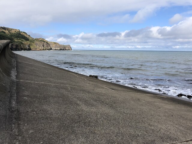
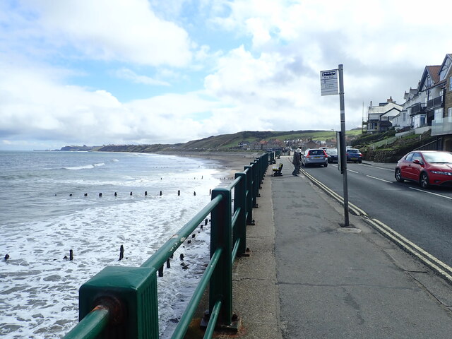
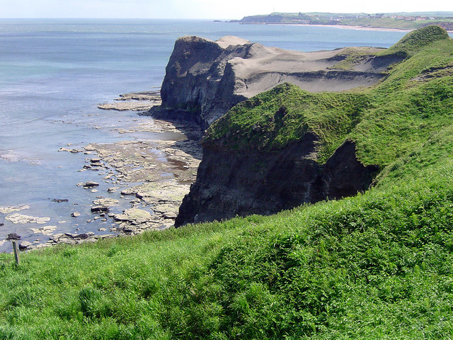
Keldhowe Point is a prominent headland located on the east coast of Yorkshire, England. Situated in the North York Moors National Park, it offers stunning views of the North Sea and the surrounding rugged coastline. This coastal feature is a popular attraction for tourists and nature enthusiasts alike.

The point is formed by the erosion of the surrounding cliffs, which have been shaped over millions of years by the continuous pounding of the sea. The exposed rock formations showcase the geological history of the area, providing a glimpse into the past.

The headland is characterized by its steep cliffs, rising to an impressive height of approximately 50 meters (164 feet) above sea level. These cliffs are composed of layers of sedimentary rock, displaying various colors and textures, adding to the scenic beauty of the site.

Keldhowe Point is also known for its diverse wildlife. The surrounding coastal habitat supports a wide range of species, including seabirds such as gulls, puffins, and cormorants. Visitors may also spot seals basking on the nearby rocks or swimming in the waters below.

The headland is easily accessible, with a well-maintained footpath leading to a viewing platform at the edge of the cliffs. From here, visitors can take in the breathtaking panoramic views of the North Sea, the coastline, and the picturesque countryside.

Keldhowe Point offers a unique opportunity to experience the raw beauty of Yorkshire's coastline and immerse oneself in the natural wonders of this stunning coastal feature.

If you have any feedback on the listing, please let us know in the comments section below.

Keldhowe Point Images

Images are sourced within 2km of 54.519247/-0.68216276 or Grid Reference NZ8514. Thanks to Geograph Open Source API. All images are credited.

Sandsend Alum Quarries Extract from the Historic England Research Records:

Summary : The remains of three post medieval alum quarries at Sandsend. Alum was principally used in the textile industry as a fixing agent for clothing dyes. It was also used by tanners to produce supple leather. After the shale had been quarried it was then heaped into large mounds, fired and left to smoulder for up to nine months. The shale was then tipped into leaching tanks where it was left to soak in water. The solution, containing aluminium sulphate was then drained off and ran along stone or wooden conduits known as liquor troughs to the alum house. Here the water was boiled away from the solution in evaporating pans. An alkali, derived from human urine or burnt kelp, was added to cause precipitation of the alum crystals. The crystals were then bagged and transported for sale. The burnt shale left in the leaching pits was either disposed of nearby to form enormous shale tips or thrown in to the sea. Quarrying at Sandsend moved from south to north along the coastal cliffs. The earliest quarry was Gaytrees, opened in 1733, followed by Ness End and finally Deep Grove. The quarry probably contains significant archaeological remains of buildings, pits, cisterns and parts of the wooden liquor trough also survive within a rock cut channel. From 1811 to 1933 cementstone was also mined within the quarries. The Middlesborough to Whitby railway was being constructed through the disused alum quarries by 1874.

More information : NZ 859138. Alum quarries at Sandsend Ness in operation from c1613 - 1880. Remains clearly visible. The alum house was on the site of Sandsend station at NZ 860 129 (NZ 81 SE 496).

The monument includes remains of the alum quarries and associated features on the coastal cliffs north of Sandsend. As well as the quarries, the monument also includes structures used for initial processing and transport of the alum. There are three discrete quarries within the monument, extending northwards along the coast for 1km. The earliest quarry, which was working from 1733, was the closest to Sandsend at Gaytrees. The other two, at Ness End and Deep Grove, were excavated later as the extraction progressed along the coast. The quarries were cut into the east and north east-facing coastal cliffs where alum bearing shales were exposed. Once the cliffs were cut back, processing of the alum was carried out on the enlarging quarry floors. The first stage of processing was calcination, remains of which survive as areas of burnt shale, particularly on the sea edge of the central quarry. The next stage was steeping which occurred in stone lined pits, some of which survive throughout the quarry floor. A mid-19th century map shows steeping pits located in the Deep Grove quarry. In the later use of the site the raw liquor thus produced was stored and then sent to the nearby alum house by timber channels known as liquor troughs, part of which survive within a stone tunnel. Remains of other structures such as workshops, offices, stores and a laboratory survive on the quarry floor. Remains of other structures are thought to survive below ground level.

At the northern quarry, Deep Grove, cement stone was also extracted from mines and processed at a mill south of Sandsend. Cement stone was mined from 1811 to 1933 and overlapped the last 50 or so years of alum production. A now disused railway line was built through the length of the monument after the quarries went out of use. This was the Middlesborough to Whitby line which was completed in 1883 and closed in 1958. Embankments, cuttings and supporting walls associated with the railway still survive within the monument.

A number of features are excluded from the scheduling; these are the surface of the old railway line and the trail markers; although the ground beneath these features is included.

The remains of post medieval alum quarry is visible as earthworks on air photographs, centred at NZ 8582 1376.

The remains of three post medieval alum quarries at Sandsend. Alum was principally used in the textile industry as a fixing agent for clothing dyes. It was also used by tanners to produce supple leather. Quarrying at Sandsend moved from south to north along the coastal cliffs. The earliest quarry was Gaytrees, opened in 1733, the next Ness End and the last Deep Grove; Deep Grove closed before 1874. The quarry probably contains significant archaeological remains of buildings, pits, cisterns and parts of the wooden liquor trough also survive within a rock cut channel. From 1811 to 1933 cementstone was also mined within the quarries. The Middlesborough to Whitby railway was being constructed through the disused alum quarries by 1874.

Heritagegateway.org.uk. (2012). Heritage Gateway - Results. [online] Available at: <span class="nowrap"><a title="https://www.heritagegateway.org.uk/Gateway/Results_Single.aspx?uid=1118514&resourceID=19191" rel="nofollow ugc noopener" href="https://www.heritagegateway.org.uk/Gateway/Results_Single.aspx?uid=1118514&resourceID=19191">Link</a><img style="margin-left:2px;" alt="External link" title="External link - shift click to open in new window" src="https://s1.geograph.org.uk/img/external.png" width="10" height="10"/></span> [Accessed 11 Dec. 2021].
Sandsend Alum Quarries
Extract from the Historic England Research Records: Summary : The remains of three post medieval alum quarries at Sandsend. Alum was principally used in the textile industry as a fixing agent for clothing dyes. It was also used by tanners to produce supple leather. After the shale had been quarried it was then heaped into large mounds, fired and left to smoulder for up to nine months. The shale was then tipped into leaching tanks where it was left to soak in water. The solution, containing aluminium sulphate was then drained off and ran along stone or wooden conduits known as liquor troughs to the alum house. Here the water was boiled away from the solution in evaporating pans. An alkali, derived from human urine or burnt kelp, was added to cause precipitation of the alum crystals. The crystals were then bagged and transported for sale. The burnt shale left in the leaching pits was either disposed of nearby to form enormous shale tips or thrown in to the sea. Quarrying at Sandsend moved from south to north along the coastal cliffs. The earliest quarry was Gaytrees, opened in 1733, followed by Ness End and finally Deep Grove. The quarry probably contains significant archaeological remains of buildings, pits, cisterns and parts of the wooden liquor trough also survive within a rock cut channel. From 1811 to 1933 cementstone was also mined within the quarries. The Middlesborough to Whitby railway was being constructed through the disused alum quarries by 1874. More information : NZ 859138. Alum quarries at Sandsend Ness in operation from c1613 - 1880. Remains clearly visible. The alum house was on the site of Sandsend station at NZ 860 129 (NZ 81 SE 496). The monument includes remains of the alum quarries and associated features on the coastal cliffs north of Sandsend. As well as the quarries, the monument also includes structures used for initial processing and transport of the alum. There are three discrete quarries within the monument, extending northwards along the coast for 1km. The earliest quarry, which was working from 1733, was the closest to Sandsend at Gaytrees. The other two, at Ness End and Deep Grove, were excavated later as the extraction progressed along the coast. The quarries were cut into the east and north east-facing coastal cliffs where alum bearing shales were exposed. Once the cliffs were cut back, processing of the alum was carried out on the enlarging quarry floors. The first stage of processing was calcination, remains of which survive as areas of burnt shale, particularly on the sea edge of the central quarry. The next stage was steeping which occurred in stone lined pits, some of which survive throughout the quarry floor. A mid-19th century map shows steeping pits located in the Deep Grove quarry. In the later use of the site the raw liquor thus produced was stored and then sent to the nearby alum house by timber channels known as liquor troughs, part of which survive within a stone tunnel. Remains of other structures such as workshops, offices, stores and a laboratory survive on the quarry floor. Remains of other structures are thought to survive below ground level. At the northern quarry, Deep Grove, cement stone was also extracted from mines and processed at a mill south of Sandsend. Cement stone was mined from 1811 to 1933 and overlapped the last 50 or so years of alum production. A now disused railway line was built through the length of the monument after the quarries went out of use. This was the Middlesborough to Whitby line which was completed in 1883 and closed in 1958. Embankments, cuttings and supporting walls associated with the railway still survive within the monument. A number of features are excluded from the scheduling; these are the surface of the old railway line and the trail markers; although the ground beneath these features is included. The remains of post medieval alum quarry is visible as earthworks on air photographs, centred at NZ 8582 1376. The remains of three post medieval alum quarries at Sandsend. Alum was principally used in the textile industry as a fixing agent for clothing dyes. It was also used by tanners to produce supple leather. Quarrying at Sandsend moved from south to north along the coastal cliffs. The earliest quarry was Gaytrees, opened in 1733, the next Ness End and the last Deep Grove; Deep Grove closed before 1874. The quarry probably contains significant archaeological remains of buildings, pits, cisterns and parts of the wooden liquor trough also survive within a rock cut channel. From 1811 to 1933 cementstone was also mined within the quarries. The Middlesborough to Whitby railway was being constructed through the disused alum quarries by 1874. Heritagegateway.org.uk. (2012). Heritage Gateway - Results. [online] Available at: LinkExternal link [Accessed 11 Dec. 2021].
Lythe, shop The benchmark is cut into the north face of a left cornerstone of the village shop.
Lythe, shop
The benchmark is cut into the north face of a left cornerstone of the village shop.
Lythe, shop There is a benchmark cut into the north face of a left cornerstone of the village shop, below the finger post,
Lythe, shop
There is a benchmark cut into the north face of a left cornerstone of the village shop, below the finger post,
Lythe, Corner Cottage The benchmark is cut into the roadside wall of Corner Cottage, just below the down pipe.
Lythe, Corner Cottage
The benchmark is cut into the roadside wall of Corner Cottage, just below the down pipe.
Lythe, Corner Cottage There is a benchmark cut into the roadside wall of Corner Cottage, just below the black downpipe.
Lythe, Corner Cottage
There is a benchmark cut into the roadside wall of Corner Cottage, just below the black downpipe.
Lythe, St Oswald's church The benchmark is cut into a north facing buttress of the church.
Lythe, St Oswald's church
The benchmark is cut into a north facing buttress of the church.
Lythe, St Oswald's church There is a benchmark cut into a north facing buttress of the church.
Lythe, St Oswald's church
There is a benchmark cut into a north facing buttress of the church.
Lythe, roadside wall This stretch of wall is just beyond the lower churchyard gate of St Oswald's. The benchmark is cut into the lowest course of stone.
Lythe, roadside wall
This stretch of wall is just beyond the lower churchyard gate of St Oswald's. The benchmark is cut into the lowest course of stone.
Lythe, St Oswald's lower gate This is the lower churchyard gate of St Oswald's. There is a benchmark cut into the roadside wall, just beyond the gate. It is cut into the lowest course of stone.
Lythe, St Oswald's lower gate
This is the lower churchyard gate of St Oswald's. There is a benchmark cut into the roadside wall, just beyond the gate. It is cut into the lowest course of stone.
North Yorkshire farmland Harvested fields to the sea side
North Yorkshire farmland
Harvested fields to the sea side
Harvested field near Lythe
Bench near St Oswald's Church
Sea wall, Sandsend Sandsend Ness is the headland beyond the bay
Sea wall, Sandsend
Sandsend Ness is the headland beyond the bay
Sandsend Beck Reaching the shore below the A174.
Sandsend Beck
Reaching the shore below the A174.
Sandsend Stores All you need for the beach here
Sandsend Stores
All you need for the beach here
East Coast Path at Sandsend
Sandsend Beck Two becks reach the sea at Sandsend, the East Row Beck and the Sandsend Beck, seen here from under the bridge that carries the A174 Northwards.
Sandsend Beck
Two becks reach the sea at Sandsend, the East Row Beck and the Sandsend Beck, seen here from under the bridge that carries the A174 Northwards.
Show me another place!

Keldhowe Point is located at Grid Ref: NZ8514 (Lat: 54.519247, Lng: -0.68216276)

Division: North Riding

Administrative County: North Yorkshire

District: Scarborough

Police Authority: North Yorkshire

What 3 Words

///amphibian.mavericks.hotspot. Near Whitby, North Yorkshire

Related Wikis

Sandsend Ness

Sandsend Ness is an old alum quarrying site close to Whitby in North Yorkshire, England. Beneath extensive deposits of grey pyritic shale a thin band of...

Church of St Oswald, Lythe

The Church of St Oswald, Lythe, is the parish church for the village of Lythe, 4 miles (6.4 km) west, north west of Whitby in North Yorkshire, England...
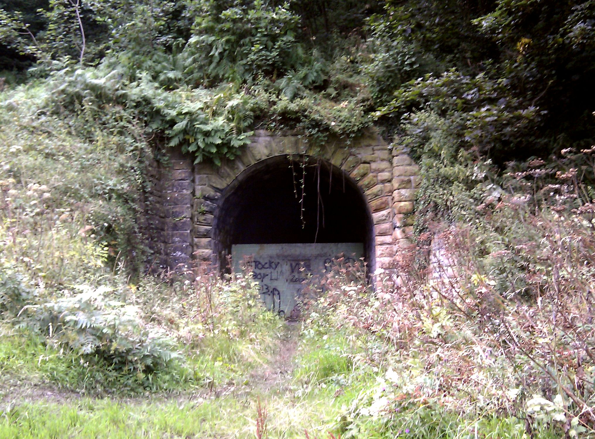
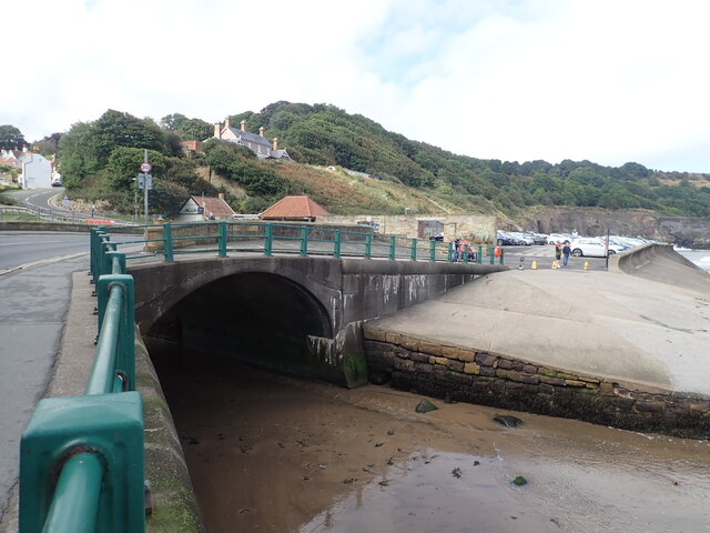
Sandsend Tunnel

Sandsend Tunnel is a tunnel on the former Whitby, Redcar and Middlesbrough Union Railway that was opened in 1883 and closed in 1958. The rail line that...

Lythe

Lythe is a small village and large civil parish, in North Yorkshire, England, situated near Whitby within the North York Moors National Park. The name...
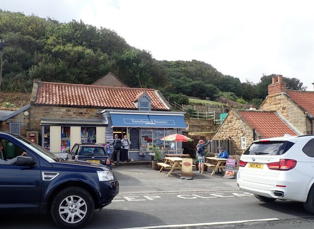
Nearby Amenities

Located within 500m of 54.519247,-0.68216276
Source: PGS
Lat/Long: 54.5160408/-0.6780443
Source: PGS
Lat/Long: 54.5163895/-0.6785593
Source: PGS
Lat/Long: 54.5167383/-0.6790742
Source: PGS
Lat/Long: 54.5172365/-0.6797609
Source: PGS
Lat/Long: 54.5178842/-0.6806192
Source: PGS
Lat/Long: 54.5185318/-0.6808767
Source: PGS
Lat/Long: 54.5191296/-0.68122
Source: PGS
Lat/Long: 54.5196278/-0.6821641
Source: PGS
Lat/Long: 54.5200762/-0.6832799
Source: PGS
Lat/Long: 54.5201758/-0.6843957
Source: PGS
Lat/Long: 54.5203253/-0.6863699
Source: PGS
Lat/Long: 54.5205245/-0.6874857
Source: PGS
Lat/Long: 54.5209231/-0.6881723
Source: PGS
Lat/Long: 54.5211223/-0.6888589
Hiking: yes
Information: guidepost
Operator: Cleveland Way
Tourism: information
Lat/Long: 54.5190384/-0.6885693
Bench
Backrest: no
Colour: gray
Material: wood
Seats: 3
Lat/Long: 54.5189456/-0.6885308
The data included in this document is from www.openstreetmap.org. The data is made available under ODbL.

Have you been to Keldhowe Point?

Leave your review of Keldhowe Point below (or comments, questions and feedback).