White Stones

Coastal Feature, Headland, Point in Yorkshire Scarborough

England

White Stones

Looking towards Kettleness From the Cleveland Way near Runswick Bay.
Looking towards Kettleness Credit: T Eyre

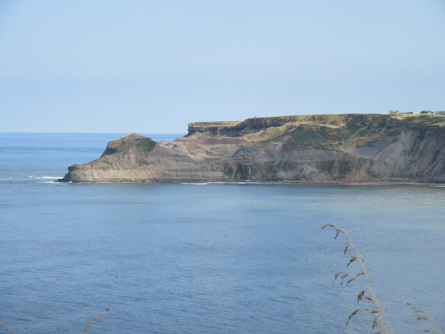
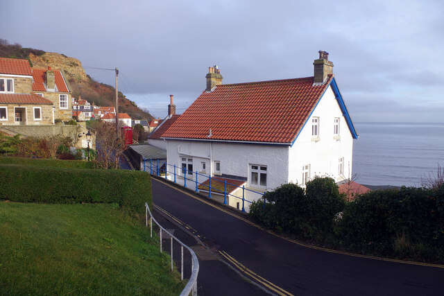
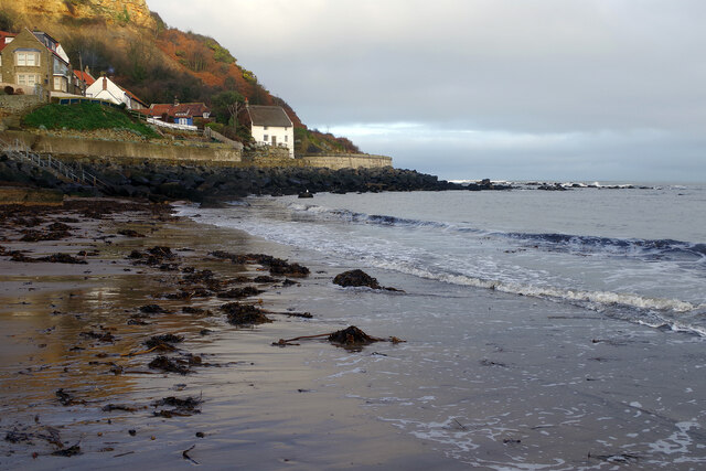
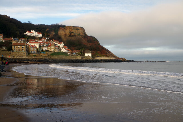
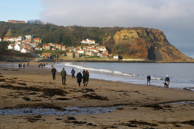
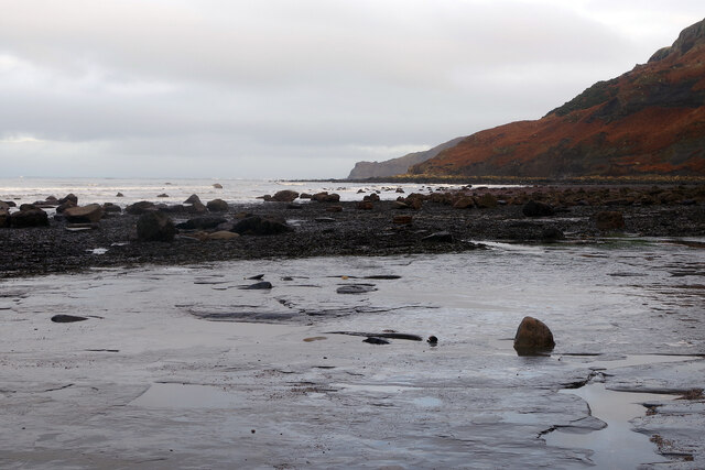
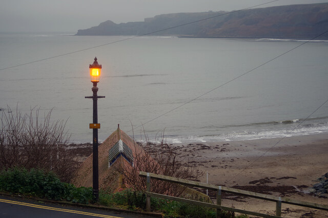
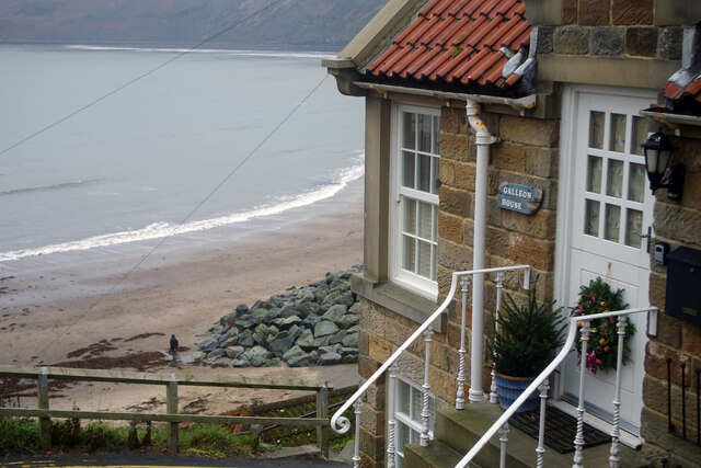
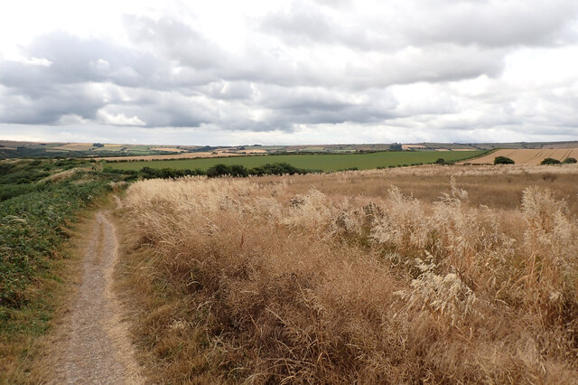
White Stones is a prominent coastal feature located in Yorkshire, England. It is a headland that juts out into the North Sea, forming a distinct point along the coastline. Situated near the town of Scarborough, White Stones offers breathtaking views of the surrounding area and is a popular destination for tourists and locals alike.

The headland is characterized by its large, white limestone rocks that give it its name. These rocks have been eroded over time by the relentless force of the sea, sculpting them into unique shapes and formations. The contrast between the white stones and the deep blue waters of the North Sea creates a striking visual spectacle.

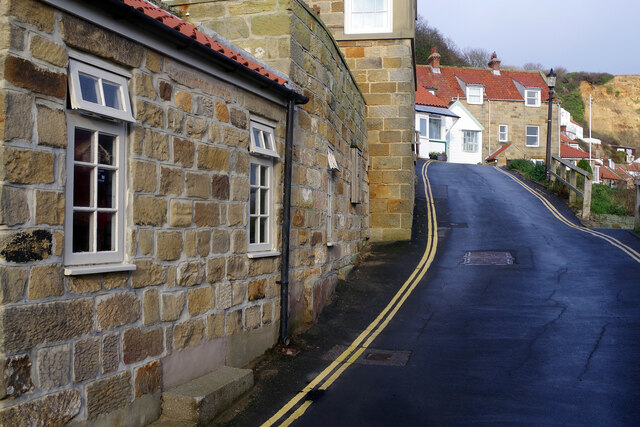
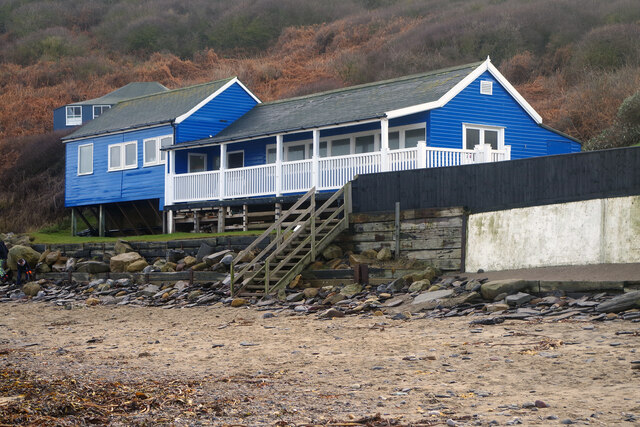
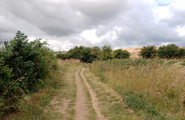
White Stones is easily accessible by foot and offers a range of activities for visitors. The headland is a perfect spot for picnics, with its grassy slopes providing ample space for relaxation and enjoyment. Additionally, it is a haven for wildlife enthusiasts, as the area is home to a variety of bird species, including puffins, gannets, and cormorants.

For those seeking adventure, White Stones offers opportunities for coastal walks and hikes. The headland is part of the Cleveland Way National Trail, which stretches for 109 miles along the Yorkshire coast. This allows visitors to explore the stunning coastal scenery and enjoy the fresh sea air.

Overall, White Stones is a captivating coastal feature that showcases the natural beauty of Yorkshire's coastline. Whether it is for a leisurely picnic, birdwatching, or a scenic hike, White Stones offers a memorable experience for all who visit.

If you have any feedback on the listing, please let us know in the comments section below.

White Stones Images

Images are sourced within 2km of 54.528391/-0.73210535 or Grid Reference NZ8215. Thanks to Geograph Open Source API. All images are credited.

Looking towards Kettleness From the Cleveland Way near Runswick Bay.
Looking towards Kettleness
From the Cleveland Way near Runswick Bay.
Runswick Bay Sailing Club Next to Calais Beck.
Runswick Bay Sailing Club
Next to Calais Beck.
Runswick Bay Public Comveniences The Car Park in Bank Top Lane.
Runswick Bay Public Comveniences
The Car Park in Bank Top Lane.
Lane up from the beach at Runswick Bay The lane becomes steep as it heads for the upper part of the village. The entrance to a public car park (pay and display in summer, free in winter) can be seen on the left; this is the only facility for visitors but there are also car parks for residents and members of the sailing club. Parking is not allowed on the road, enforced with double yellow lines.
Lane up from the beach at Runswick Bay
The lane becomes steep as it heads for the upper part of the village. The entrance to a public car park (pay and display in summer, free in winter) can be seen on the left; this is the only facility for visitors but there are also car parks for residents and members of the sailing club. Parking is not allowed on the road, enforced with double yellow lines.
Runswick Bay A former fishing village, now very much a holiday destination (many of the properties here are holiday lets), the village at Runswick Bay huddles around the north end of the beach. It was in fact relocated to this site in 1682 after the original village was destroyed in a landslip. This is one of the best-loved locations on the Yorkshire coast.
Runswick Bay
A former fishing village, now very much a holiday destination (many of the properties here are holiday lets), the village at Runswick Bay huddles around the north end of the beach. It was in fact relocated to this site in 1682 after the original village was destroyed in a landslip. This is one of the best-loved locations on the Yorkshire coast.
Runswick Bay This narrow lane passes through the lower village above the beach. The Royal Hotel, actually the village pub, is just ahead on the left (but out of shot).
Runswick Bay
This narrow lane passes through the lower village above the beach. The Royal Hotel, actually the village pub, is just ahead on the left (but out of shot).
Runswick Bay: Kayaks and Rescue Boat Station A number of colourful kayaks are stored here just above the beach and behind them is the Runswick Bay Rescue Boat Station. This inshore facility operates independently of the RNLI and was established in 1982 after the lifeboat was moved to Staithes.
Runswick Bay: Kayaks and Rescue Boat Station
A number of colourful kayaks are stored here just above the beach and behind them is the Runswick Bay Rescue Boat Station. This inshore facility operates independently of the RNLI and was established in 1982 after the lifeboat was moved to Staithes.
Runswick Bay Showing the north end of the beach where the village tumbles down to the sea.
Runswick Bay
Showing the north end of the beach where the village tumbles down to the sea.
Runswick Bay Beach The tide is out making it easy to walk the full length of the beach. Runswick Bay village can be seen in the background.
Runswick Bay Beach
The tide is out making it easy to walk the full length of the beach. Runswick Bay village can be seen in the background.
Runswick Bay Beach and Sailing Club Runswick Bay Sailing Club was formed in 1953, becoming the Beach and Sailing Club in 1998. This is the clubhouse, at the back of the beach about half a mile from the village.
Runswick Bay Beach and Sailing Club
Runswick Bay Sailing Club was formed in 1953, becoming the Beach and Sailing Club in 1998. This is the clubhouse, at the back of the beach about half a mile from the village.
Runswick Bay Beach The water in the foreground comes from the Calais Beck which empties into Runswick Bay here. To the right of that a small horse and a very large dog enjoy themselves on the sand.
Runswick Bay Beach
The water in the foreground comes from the Calais Beck which empties into Runswick Bay here. To the right of that a small horse and a very large dog enjoy themselves on the sand.
Runswick Bay Beach Horses, dogs and people are out and about just after Christmas on this fine beach.
Runswick Bay Beach
Horses, dogs and people are out and about just after Christmas on this fine beach.
Runswick Bay Beach Runswick Bay was named by the Sunday Times as its beach of the year for 2020, describing it as close to perfection. Plenty of people are blowing the Christmas cobwebs off in this view taken the day after Boxing Day. In the background is Runswick Bay village.
Runswick Bay Beach
Runswick Bay was named by the Sunday Times as its beach of the year for 2020, describing it as close to perfection. Plenty of people are blowing the Christmas cobwebs off in this view taken the day after Boxing Day. In the background is Runswick Bay village.
Runswick Bay Beach The sand runs out towards the south-eastern end of the beach, giving way to flat rocks as the coastline heads round towards Kettle Ness.
Runswick Bay Beach
The sand runs out towards the south-eastern end of the beach, giving way to flat rocks as the coastline heads round towards Kettle Ness.
Runswick Bay Light is rapidly fading on a December afternoon but the glow of the street lamp opposite the Royal Hotel seems comforting. The building below the road is the Rescue Boat Station.
Runswick Bay
Light is rapidly fading on a December afternoon but the glow of the street lamp opposite the Royal Hotel seems comforting. The building below the road is the Rescue Boat Station.
Galleon House, Runswick Bay Galleon House is used as a holiday cottage occupying an enviable position adjacent to the Royal Hotel pub and with a panoramic sea view.
Galleon House, Runswick Bay
Galleon House is used as a holiday cottage occupying an enviable position adjacent to the Royal Hotel pub and with a panoramic sea view.
The Cleveland Way at Lingrow Cliffs The Cleveland Way runs 110 miles (177 km) between Helmsley and the Brigg at Filey, skirting the North York Moors National Park. Its highest point is at Urra Moor, 1,489 ft (454 m).
The Cleveland Way at Lingrow Cliffs
The Cleveland Way runs 110 miles (177 km) between Helmsley and the Brigg at Filey, skirting the North York Moors National Park. Its highest point is at Urra Moor, 1,489 ft (454 m).
Show me another place!

White Stones is located at Grid Ref: NZ8215 (Lat: 54.528391, Lng: -0.73210535)

Division: North Riding

Administrative County: North Yorkshire

District: Scarborough

Police Authority: North Yorkshire

What 3 Words

///belonging.starts.forgiving. Near Whitby, North Yorkshire

Related Wikis

Hob Holes

The Hob Holes are caves in the cliffs of Runswick Bay, Scarborough, England which resulted from mining for jet – fossilised wood which is valuable as a...

Kettleness

Kettleness, is a hamlet in the Scarborough District of North Yorkshire, England. The settlement only consists of half-a-dozen houses, but up until the...

Kettleness railway station

Kettleness was a railway station on the Whitby, Redcar and Middlesbrough Union Railway from 1883 to 1958 serving the remote village of Kettleness. The...

Runswick Bay Lifeboat Station

Runswick Bay Lifeboat Station was a Royal National Lifeboat Institution (RNLI) lifeboat station located in Runswick Bay in North Yorkshire, England. The...

Runswick Bay

Runswick Bay is a bay in the Scarborough Borough of North Yorkshire, England. It is also the name of a village located on the western edge of the bay...

Goldsborough, Scarborough

Goldsborough is a small hamlet in the civil parish of Lythe, North Yorkshire, England within the North York Moors National Park. It is situated a few miles...

RAF Goldsborough

Royal Air Force Goldsborough or more simply RAF Goldsborough is a former Royal Air Force station located in North Yorkshire, England. == History == It...
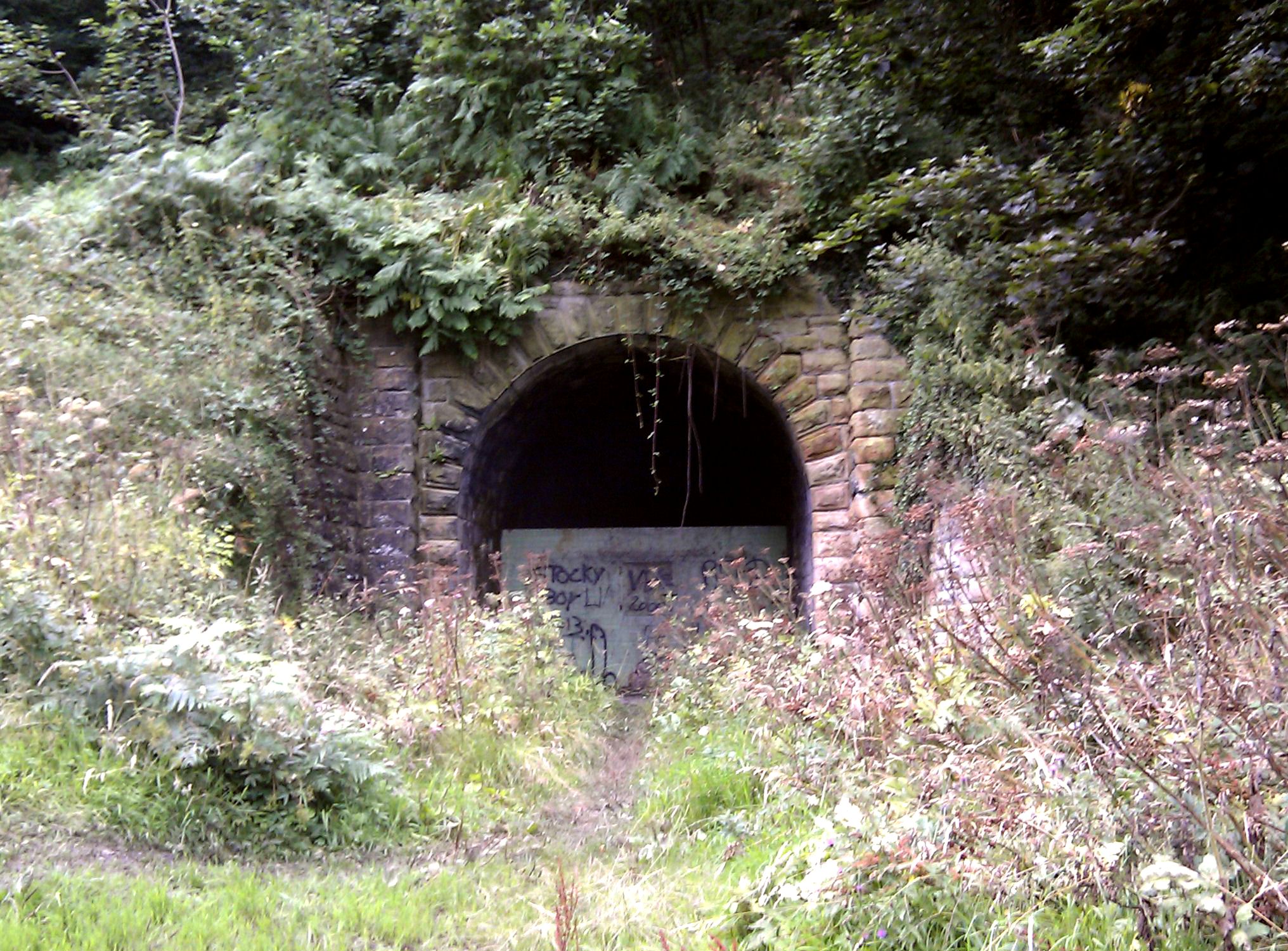
Sandsend Tunnel

Sandsend Tunnel is a tunnel on the former Whitby, Redcar and Middlesbrough Union Railway that was opened in 1883 and closed in 1958. The rail line that...

Nearby Amenities

Located within 500m of 54.528391,-0.73210535
Source: PGS
Lat/Long: 54.5306362/-0.7259378
Source: PGS
Lat/Long: 54.5305366/-0.7271394
Source: PGS
Lat/Long: 54.5302875/-0.7279977
Source: PGS
Lat/Long: 54.5299389/-0.7285986
Source: PGS
Lat/Long: 54.5289895/-0.729618
Source: PGS
Lat/Long: 54.5282735/-0.7303473
Source: PGS
Lat/Long: 54.5278906/-0.7312335
Source: PGS
Lat/Long: 54.5277471/-0.7333063
Source: PGS
Lat/Long: 54.5275457/-0.7340552
Source: PGS
Lat/Long: 54.5274529/-0.7351863
Source: PGS
Lat/Long: 54.5275737/-0.7382261
Source: PGS
Lat/Long: 54.5276929/-0.7395393
Barrier: stile
Source: GPS
Lat/Long: 54.526425/-0.73826
Barrier: stile
Lat/Long: 54.5244626/-0.728648
Barrier: stile
Lat/Long: 54.5242702/-0.7313409
Barrier: stile
Lat/Long: 54.5241871/-0.7346656
The data included in this document is from www.openstreetmap.org. The data is made available under ODbL.

Have you been to White Stones?

Leave your review of White Stones below (or comments, questions and feedback).