Shure Taings

Coastal Feature, Headland, Point in Shetland

Scotland

Shure Taings

It must be somewhere tropical: Norwick Blue skies, azure seas, palm trees, exotic birds, passing cruise liners? It must be somewhere tropical? But it's actually a migrant Bee-eater on Unst in Shetland with the Faroe ferry Norrona passing in the background.
It must be somewhere tropical: Norwick Credit: Mike Pennington

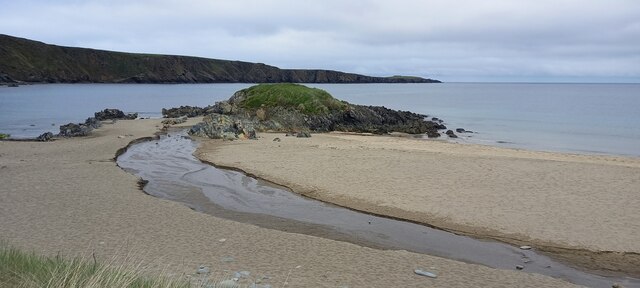
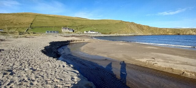
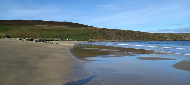
Shure Taings is a prominent coastal feature located in the Shetland Islands, an archipelago in Scotland. It is classified as a headland, also known as a point, due to its distinct geographical formation and its position extending out into the sea.

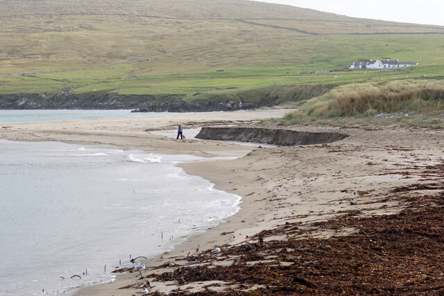
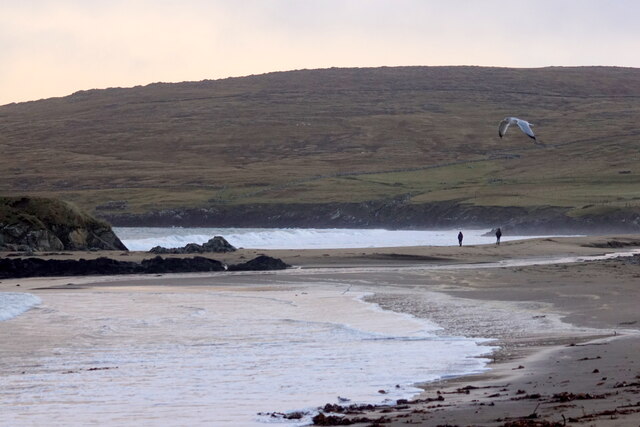
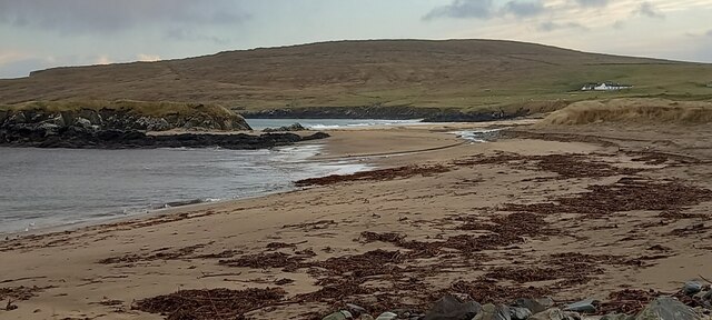
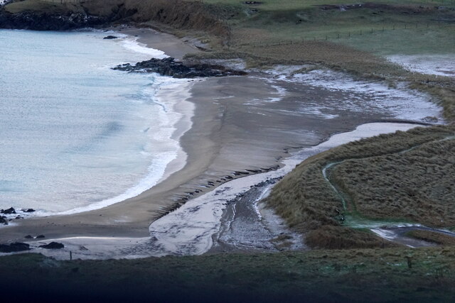
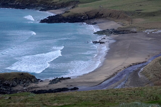
Situated on the eastern coast of the Shetland mainland, Shure Taings boasts breathtaking views of the North Sea and its surrounding coastline. It is characterized by its rugged cliffs, which rise steeply from the water, providing a dramatic and picturesque landscape. The headland is composed mainly of rocky outcrops and boulders, adding to its natural beauty and charm.

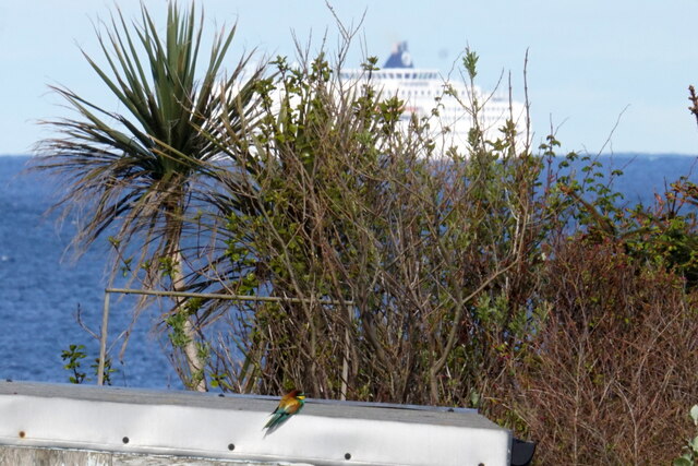
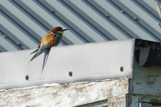
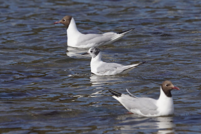
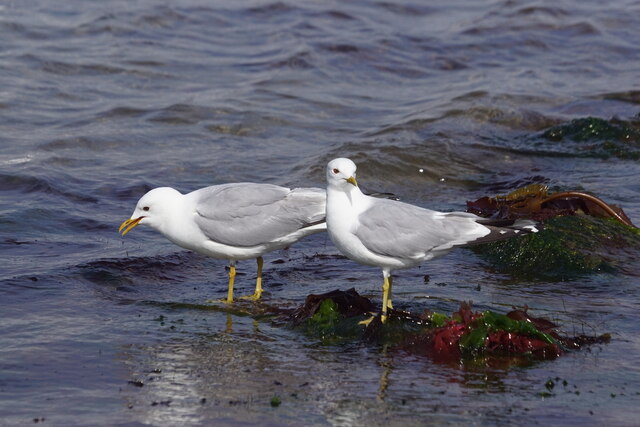
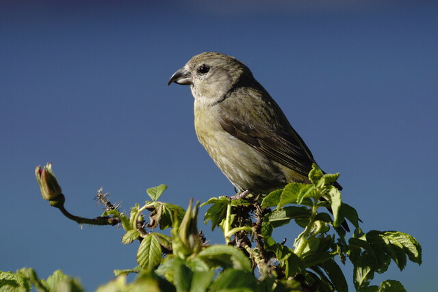
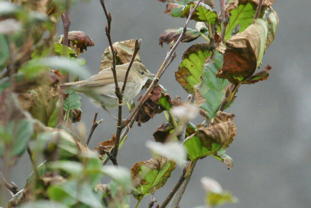
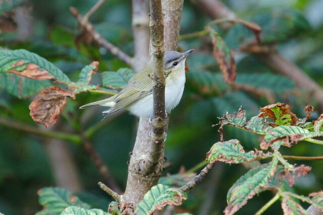
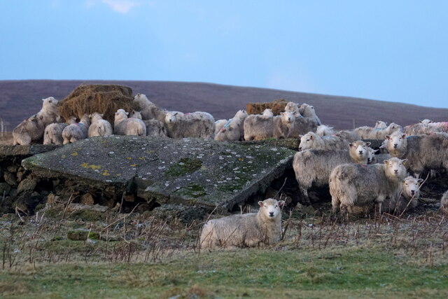
The area around Shure Taings is known for its rich wildlife, making it a popular spot for nature enthusiasts and birdwatchers. Visitors can often spot various seabirds such as puffins, guillemots, and razorbills nesting along the cliffs. Seals are also commonly seen basking on the rocks, adding to the diversity of the local fauna.

In addition to its natural allure, Shure Taings holds historical significance. The headland is believed to have been utilized as a lookout point in ancient times, serving as a vantage point for monitoring the sea and potential threats. The remains of old structures, possibly used for defensive purposes, can still be found in the vicinity, providing a glimpse into the area's past.

Overall, Shure Taings is a captivating coastal feature that combines stunning geological formations, abundant wildlife, and a touch of history. It is a must-visit destination for those seeking awe-inspiring views and a connection to the natural wonders of the Shetland Islands.

If you have any feedback on the listing, please let us know in the comments section below.

Shure Taings Images

Images are sourced within 2km of 60.805948/-0.80125909 or Grid Reference HP6514. Thanks to Geograph Open Source API. All images are credited.

It must be somewhere tropical: Norwick Blue skies, azure seas, palm trees, exotic birds, passing cruise liners? It must be somewhere tropical? But it's actually a migrant Bee-eater on Unst in Shetland with the Faroe ferry Norrona passing in the background.
It must be somewhere tropical: Norwick
Blue skies, azure seas, palm trees, exotic birds, passing cruise liners? It must be somewhere tropical? But it's actually a migrant Bee-eater on Unst in Shetland with the Faroe ferry Norrona passing in the background.
European Bee-eater (Merops apiaster), Norwick A rare bird this far north, this was the fifth seen on Unst.
European Bee-eater (Merops apiaster), Norwick
A rare bird this far north, this was the fifth seen on Unst.
Bonaparte's Gull (Chroicocephalus philadelphia) and Black-headed Gulls (Chroicocephalus ridibundus), Norwick Bonaparte's Gull is a rare visitor from America, here visiting its transatlantic cousins.
Bonaparte's Gull (Chroicocephalus philadelphia) and Black-headed Gulls (Chroicocephalus ridibundus), Norwick
Bonaparte's Gull is a rare visitor from America, here visiting its transatlantic cousins.
Common Gulls (Larus canus), Baltasound
Burn of Norwick on Norwick beach
Common Crossbill (Loxia curvirostra), Norwick
Holsens, Norwick, and low cloud over the Ward of Norwick
The ever-changing profile of Norwick beach The burn now flows well north of the Taing again.
The ever-changing profile of Norwick beach
The burn now flows well north of the Taing again.
Burn of Norwick on Norwick beach This is about as far north as the burn has ever flowed in at least 30 years.
Burn of Norwick on Norwick beach
This is about as far north as the burn has ever flowed in at least 30 years.
Norwick beach
Norwick beach
Blyth's Reed Warbler (Acrocephalus dumetorum), Norwick A subtly different species, once very rare in Britain, now an annual scarce migrant in Shetland.
Blyth's Reed Warbler (Acrocephalus dumetorum), Norwick
A subtly different species, once very rare in Britain, now an annual scarce migrant in Shetland.
Red-eyed Vireo (Vireo olivaceous), Norwick A very rare visitor from North America. This was the first one ever seen in Shetland.
Red-eyed Vireo (Vireo olivaceous), Norwick
A very rare visitor from North America. This was the first one ever seen in Shetland.
Black-headed Bunting (Emberiza melanocephala), Norwick Normally found in SE Europe, but occasionally found in Britain.
Black-headed Bunting (Emberiza melanocephala), Norwick
Normally found in SE Europe, but occasionally found in Britain.
North end of Norwick beach
Norwick beach from Braehead
Sheep at feeders, Inner Skaw
Show me another place!

Shure Taings is located at Grid Ref: HP6514 (Lat: 60.805948, Lng: -0.80125909)

Unitary Authority: Shetland Islands

Police Authority: Highlands and Islands

What 3 Words

///conveys.this.unspoiled. Near Haroldswick, Shetland Islands

Related Wikis

Saxa Vord distillery

Saxa Vord distillery is a Scotch whisky and gin distillery on the island of Unst, part of the Shetland islands. The distillery takes its name from its...

Valhalla Brewery

The Valhalla Brewery in Unst, Shetland, Scotland, was the northernmost brewery in the United Kingdom. It was opened by the husband and wife team Sonny...

Skaw, Unst

Skaw is a settlement in the Scottish archipelago of Shetland, located on the island of Unst. It is located north of Haroldswick on a peninsula in the northeast...

SaxaVord Spaceport

SaxaVord Spaceport, previously known as Shetland Space Centre, is a planned spaceport to be located on the Lamba Ness peninsula on Unst, the most northerly...

Haroldswick

Haroldswick or Harold's Wick (Old Norse: Haraldsvík, 'Harald's bay'), is on Unst, Shetland Islands, Scotland, and is one of the most northerly settlements...

RAF Saxa Vord

Remote Radar Head Saxa Vord or RRH Saxa Vord (aka RAF Saxa Vord), is a Royal Air Force radar station located on the island of Unst, the most northern of...

Holm of Skaw

The Holm of Skaw is a small islet off the northeast coast of the island of Unst. It is just northeast of the settlement of Skaw. The island is 57 feet...

Burrafirth

Burrafirth links (Old Norse: Borgarfjorðr, meaning "the fjord with a castle") is a strip of land with a few houses on the island of Unst, Shetland, Scotland...

Nearby Amenities

Located within 500m of 60.805948,-0.80125909
Norwick
Name Sco: Norweik
Place: hamlet
Lat/Long: 60.8049693/-0.8051812
Post Box
Operator: Royal Mail
Ref: ZE2 19
Lat/Long: 60.8034859/-0.8072833
Passing Place
Lat/Long: 60.8073811/-0.8061322
Passing Place
Lat/Long: 60.8093604/-0.8066537
Power: pole
Lat/Long: 60.803848/-0.8070472
Power: pole
Lat/Long: 60.8035772/-0.807699
North Unst War Memorial
Historic: memorial
Material: stone
Memorial: war_memorial
Note: recorded as https://www.iwm.org.uk/memorials/item/memorial/8846
Start Date: 25 June 1922
Lat/Long: 60.8046143/-0.8041115
Power: pole
Lat/Long: 60.8045554/-0.8063727
Power: pole
Lat/Long: 60.8042957/-0.8058832
Power: pole
Lat/Long: 60.8040027/-0.8053897
Power: pole
Lat/Long: 60.803669/-0.8047634
Power: pole
Lat/Long: 60.8033288/-0.8041545
Power: pole
Lat/Long: 60.803075/-0.8037013
Power: pole
Lat/Long: 60.8031882/-0.8030562
Power: pole
Lat/Long: 60.8033269/-0.8020718
Power: pole
Lat/Long: 60.8034485/-0.8013718
Power: pole
Lat/Long: 60.8047798/-0.8067711
Bus Stop
Bus: yes
Public Transport: platform
Lat/Long: 60.8090502/-0.8053883
Waste Basket
Lat/Long: 60.809047/-0.8053319
Power: pole
Lat/Long: 60.8028939/-0.8031438
Power: pole
Lat/Long: 60.8042581/-0.8054337
The data included in this document is from www.openstreetmap.org. The data is made available under ODbL.

Have you been to Shure Taings?

Leave your review of Shure Taings below (or comments, questions and feedback).