Kirkaton

Settlement in Shetland

Scotland

Kirkaton

It must be somewhere tropical: Norwick Blue skies, azure seas, palm trees, exotic birds, passing cruise liners? It must be somewhere tropical? But it's actually a migrant Bee-eater on Unst in Shetland with the Faroe ferry Norrona passing in the background.
It must be somewhere tropical: Norwick Credit: Mike Pennington

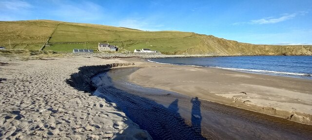
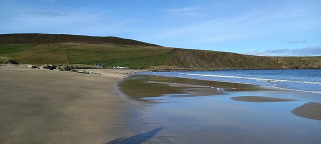
Kirkaton is a picturesque village located in the Shetland Islands, an archipelago situated off the north coast of mainland Scotland. Nestled along the east coast of the island of Burra, Kirkaton is known for its stunning natural beauty and rich cultural heritage.

The village is home to a small population of around 300 residents, who enjoy a close-knit community atmosphere. Kirkaton is characterized by its charming white-washed houses, traditional stone cottages, and narrow winding streets, which give it a quaint and timeless feel.

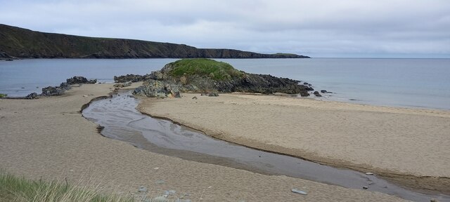
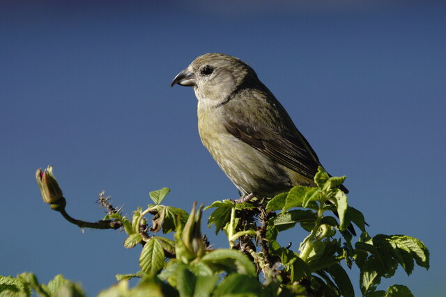
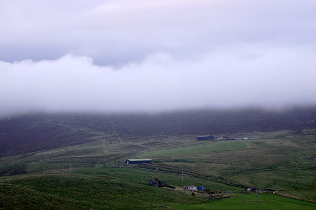
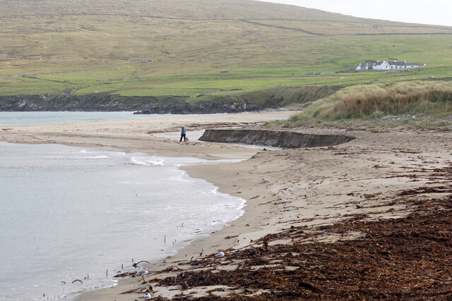
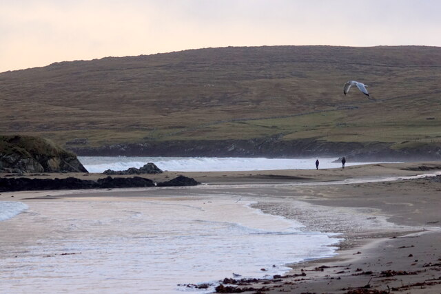
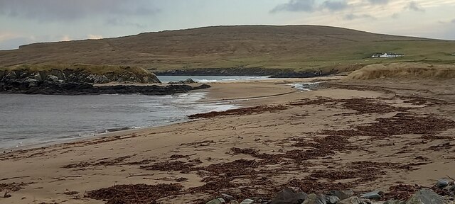
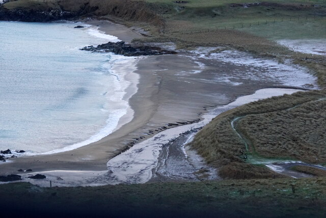
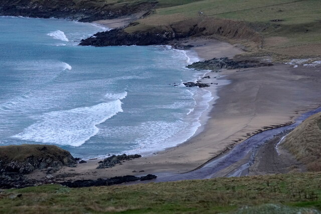
Surrounded by rolling hills and rugged coastline, Kirkaton offers breathtaking views of the North Sea and the nearby islands. The village is an ideal destination for nature lovers, offering numerous walking trails and opportunities for wildlife spotting. Visitors can explore the scenic coastline, which is dotted with cliffs, sea stacks, and sandy beaches.

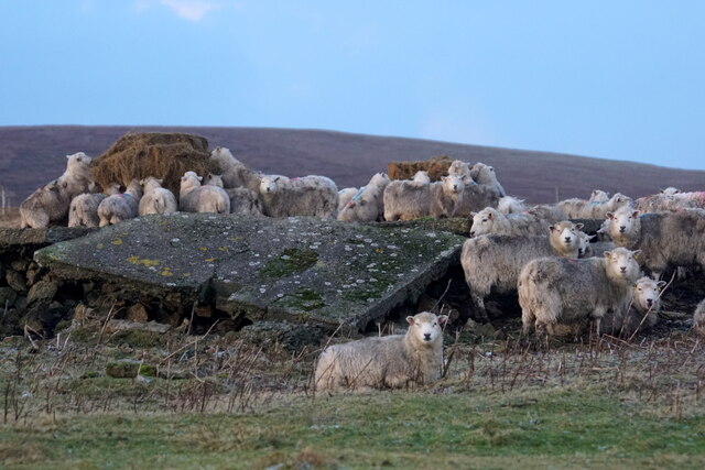
Historically, Kirkaton has strong connections to the fishing industry, with many locals relying on the sea for their livelihood. The village hosts an annual regatta, which celebrates this maritime heritage and features traditional boat races and other nautical activities.

In terms of amenities, Kirkaton offers a range of facilities including a village hall, a primary school, a post office, and a local shop. The village is well connected to the rest of Shetland, with regular bus services to Lerwick, the capital of the islands.

Overall, Kirkaton is a captivating village that showcases the beauty of the Shetland Islands, making it a must-visit destination for those seeking tranquility, natural splendor, and a glimpse into traditional island life.

If you have any feedback on the listing, please let us know in the comments section below.
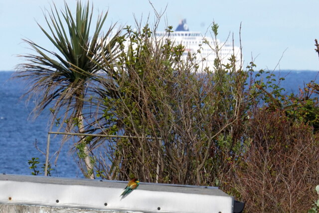
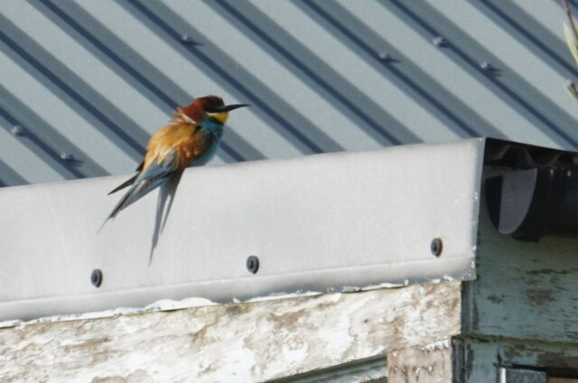
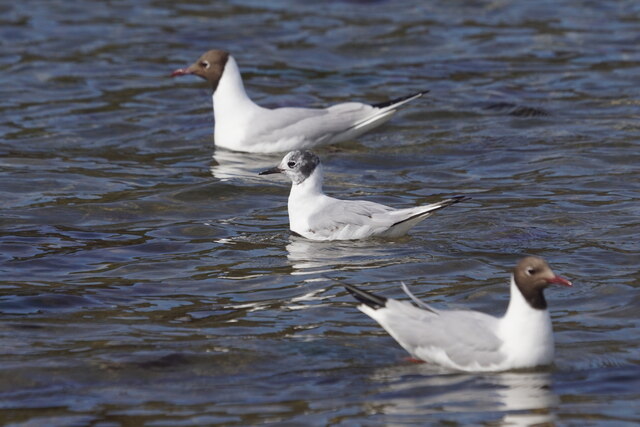
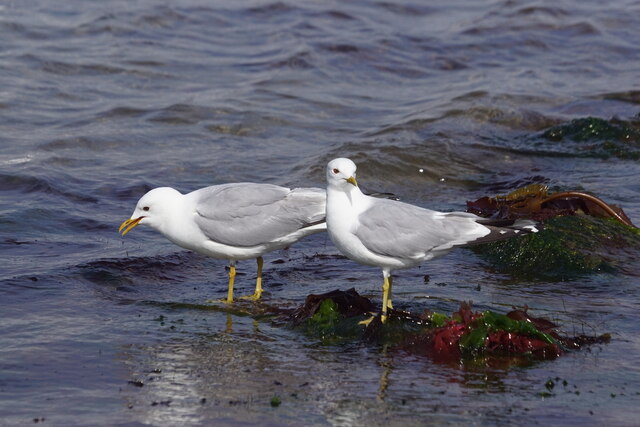
Kirkaton Images

Images are sourced within 2km of 60.803614/-0.8074108 or Grid Reference HP6514. Thanks to Geograph Open Source API. All images are credited.

It must be somewhere tropical: Norwick Blue skies, azure seas, palm trees, exotic birds, passing cruise liners? It must be somewhere tropical? But it's actually a migrant Bee-eater on Unst in Shetland with the Faroe ferry Norrona passing in the background.
It must be somewhere tropical: Norwick
Blue skies, azure seas, palm trees, exotic birds, passing cruise liners? It must be somewhere tropical? But it's actually a migrant Bee-eater on Unst in Shetland with the Faroe ferry Norrona passing in the background.
European Bee-eater (Merops apiaster), Norwick A rare bird this far north, this was the fifth seen on Unst.
European Bee-eater (Merops apiaster), Norwick
A rare bird this far north, this was the fifth seen on Unst.
Bonaparte's Gull (Chroicocephalus philadelphia) and Black-headed Gulls (Chroicocephalus ridibundus), Norwick Bonaparte's Gull is a rare visitor from America, here visiting its transatlantic cousins.
Bonaparte's Gull (Chroicocephalus philadelphia) and Black-headed Gulls (Chroicocephalus ridibundus), Norwick
Bonaparte's Gull is a rare visitor from America, here visiting its transatlantic cousins.
Common Gulls (Larus canus), Baltasound
Burn of Norwick on Norwick beach
Common Crossbill (Loxia curvirostra), Norwick
Holsens, Norwick, and low cloud over the Ward of Norwick
The ever-changing profile of Norwick beach The burn now flows well north of the Taing again.
The ever-changing profile of Norwick beach
The burn now flows well north of the Taing again.
Burn of Norwick on Norwick beach This is about as far north as the burn has ever flowed in at least 30 years.
Burn of Norwick on Norwick beach
This is about as far north as the burn has ever flowed in at least 30 years.
Norwick beach
Norwick beach
Blyth's Reed Warbler (Acrocephalus dumetorum), Norwick A subtly different species, once very rare in Britain, now an annual scarce migrant in Shetland.
Blyth's Reed Warbler (Acrocephalus dumetorum), Norwick
A subtly different species, once very rare in Britain, now an annual scarce migrant in Shetland.
Red-eyed Vireo (Vireo olivaceous), Norwick A very rare visitor from North America. This was the first one ever seen in Shetland.
Red-eyed Vireo (Vireo olivaceous), Norwick
A very rare visitor from North America. This was the first one ever seen in Shetland.
Black-headed Bunting (Emberiza melanocephala), Norwick Normally found in SE Europe, but occasionally found in Britain.
Black-headed Bunting (Emberiza melanocephala), Norwick
Normally found in SE Europe, but occasionally found in Britain.
North end of Norwick beach
Norwick beach from Braehead
Sheep at feeders, Inner Skaw
Show me another place!

Kirkaton is located at Grid Ref: HP6514 (Lat: 60.803614, Lng: -0.8074108)

Unitary Authority: Shetland Islands

Police Authority: Highlands and Islands

What 3 Words

///disengage.fetch.resembles. Near Haroldswick, Shetland Islands

Related Wikis

Saxa Vord distillery

Saxa Vord distillery is a Scotch whisky and gin distillery on the island of Unst, part of the Shetland islands. The distillery takes its name from its...

Valhalla Brewery

The Valhalla Brewery in Unst, Shetland, Scotland, was the northernmost brewery in the United Kingdom. It was opened by the husband and wife team Sonny...

Haroldswick

Haroldswick or Harold's Wick (Old Norse: Haraldsvík, 'Harald's bay'), is on Unst, Shetland Islands, Scotland, and is one of the most northerly settlements...

Skaw, Unst

Skaw is a settlement in the Scottish archipelago of Shetland, located on the island of Unst. It is located north of Haroldswick on a peninsula in the northeast...

SaxaVord Spaceport

SaxaVord Spaceport, previously known as Shetland Space Centre, is a planned spaceport to be located on the Lamba Ness peninsula on Unst, the most northerly...

RAF Saxa Vord

Remote Radar Head Saxa Vord or RRH Saxa Vord (aka RAF Saxa Vord), is a Royal Air Force radar station located on the island of Unst, the most northern of...

Holm of Skaw

The Holm of Skaw is a small islet off the northeast coast of the island of Unst. It is just northeast of the settlement of Skaw. The island is 57 feet...

Burrafirth

Burrafirth links (Old Norse: Borgarfjorðr, meaning "the fjord with a castle") is a strip of land with a few houses on the island of Unst, Shetland, Scotland...

Nearby Amenities

Located within 500m of 60.803614,-0.8074108
Norwick
Name Sco: Norweik
Place: hamlet
Lat/Long: 60.8049693/-0.8051812
Post Box
Operator: Royal Mail
Ref: ZE2 19
Lat/Long: 60.8034859/-0.8072833
Passing Place
Lat/Long: 60.8048447/-0.8159044
Passing Place
Lat/Long: 60.8073811/-0.8061322
Power: pole
Lat/Long: 60.8040299/-0.816443
Power: pole
Lat/Long: 60.8043138/-0.8162874
Power: pole
Lat/Long: 60.8043792/-0.8155713
Power: pole
Lat/Long: 60.803848/-0.8070472
Power: pole
Lat/Long: 60.8035772/-0.807699
Power: pole
Lat/Long: 60.8035521/-0.8156143
North Unst War Memorial
Historic: memorial
Material: stone
Memorial: war_memorial
Note: recorded as https://www.iwm.org.uk/memorials/item/memorial/8846
Start Date: 25 June 1922
Lat/Long: 60.8046143/-0.8041115
Power: pole
Lat/Long: 60.8045554/-0.8063727
Power: pole
Lat/Long: 60.8042957/-0.8058832
Power: pole
Lat/Long: 60.8040027/-0.8053897
Power: pole
Lat/Long: 60.803669/-0.8047634
Power: pole
Lat/Long: 60.8033288/-0.8041545
Power: pole
Lat/Long: 60.803075/-0.8037013
Power: pole
Lat/Long: 60.8031882/-0.8030562
Power: pole
Lat/Long: 60.8033269/-0.8020718
Power: pole
Lat/Long: 60.8034485/-0.8013718
Power: pole
Lat/Long: 60.8029631/-0.8091984
Power: pole
Lat/Long: 60.8022742/-0.8089409
Power: pole
Lat/Long: 60.8016619/-0.8087022
Power: pole
Lat/Long: 60.8031188/-0.8148284
Power: pole
Lat/Long: 60.8026347/-0.8139701
Power: pole
Lat/Long: 60.8021715/-0.8131493
Power: pole
Lat/Long: 60.8016717/-0.8122723
Power: pole
Lat/Long: 60.8013733/-0.8117197
Power: pole
Lat/Long: 60.8010318/-0.8122937
Power: pole
Lat/Long: 60.800634/-0.8129026
Power: pole
Lat/Long: 60.8047798/-0.8067711
Power: pole
Lat/Long: 60.8028939/-0.8031438
Power: pole
Lat/Long: 60.8042581/-0.8054337
Power: pole
Lat/Long: 60.8044268/-0.8149378
Power: pole
Lat/Long: 60.804537/-0.8136898
Power: pole
Lat/Long: 60.8046167/-0.8127197
Power: pole
Lat/Long: 60.8046847/-0.81198
Power: pole
Lat/Long: 60.8049803/-0.8116325
Power: pole
Lat/Long: 60.8019822/-0.8107924
Power: pole
Lat/Long: 60.8024198/-0.8100813
The data included in this document is from www.openstreetmap.org. The data is made available under ODbL.

Have you been to Kirkaton?

Leave your review of Kirkaton below (or comments, questions and feedback).