Dempster's Geo

Coastal Feature, Headland, Point in Shetland

Scotland

Dempster's Geo

Winyadepla east shore. Two prehistoric stone built enclosures, east shore of Winyadepla, Fetlar.
Winyadepla east shore. Credit: Robert Sandison

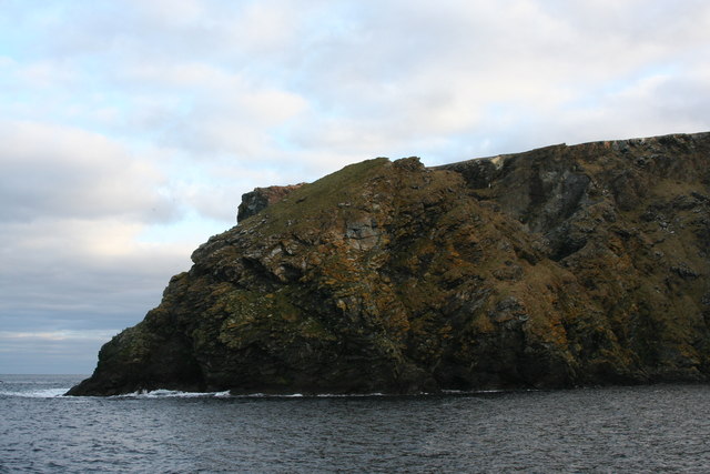
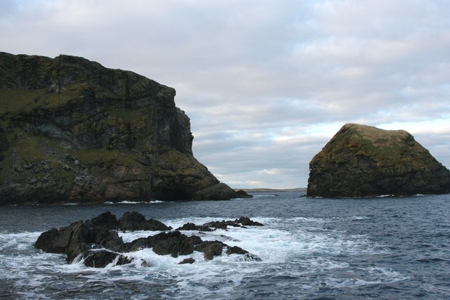
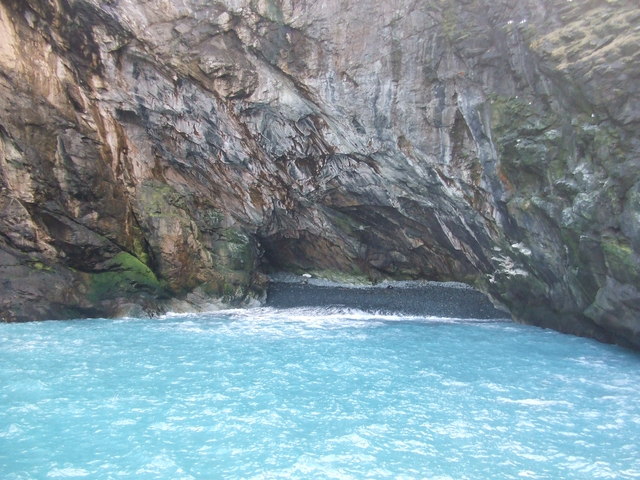
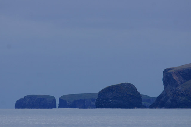
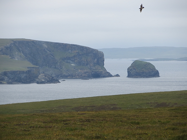
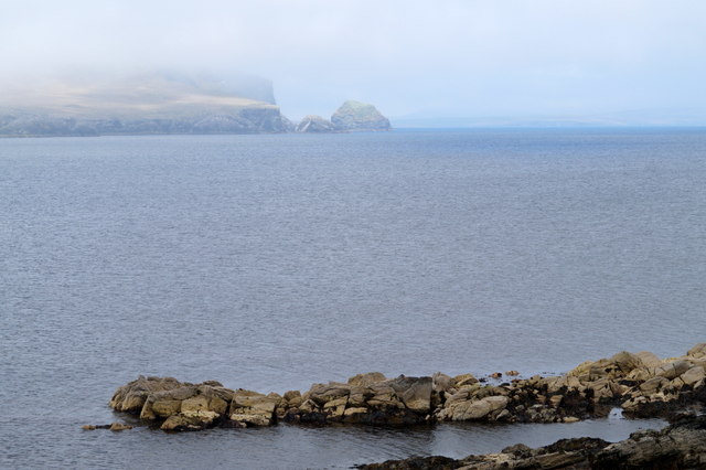
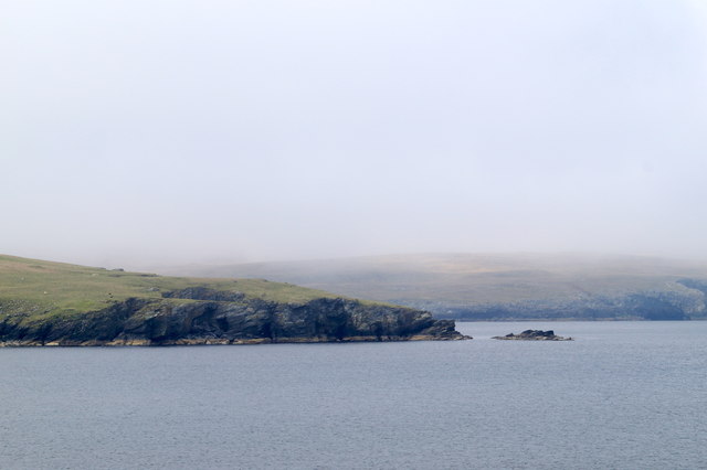
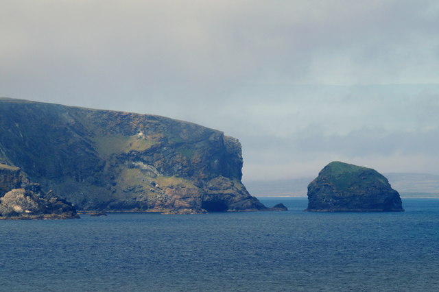
Dempster's Geo is a prominent coastal feature located in the Shetland Islands, situated off the northern coast of Scotland. It is classified as a headland or point, jutting out into the North Sea. The geo itself is formed by a combination of geological processes, including erosion and the deposition of sediment.

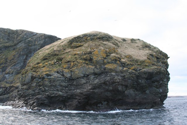
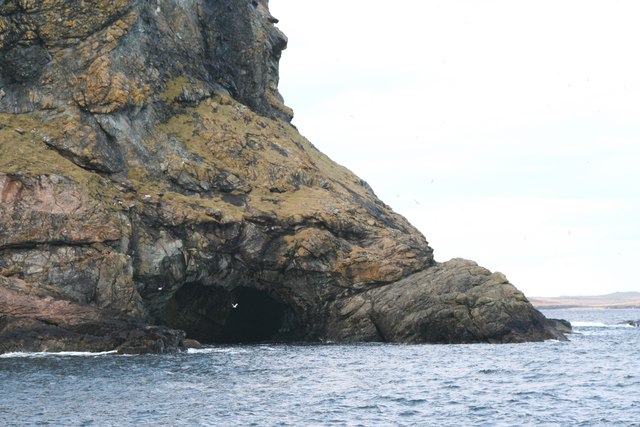
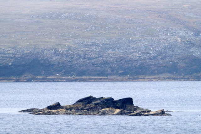
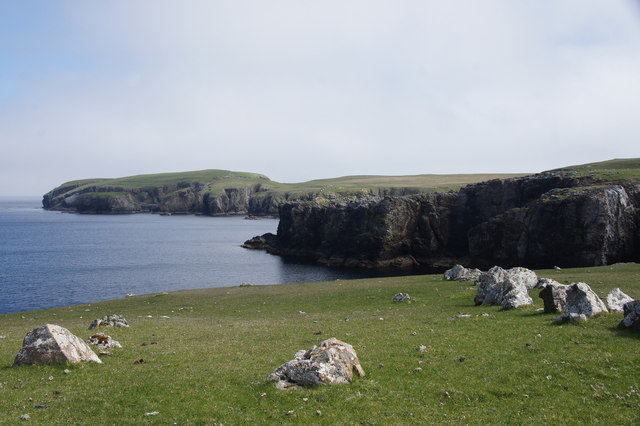
Dempster's Geo is characterized by its rugged and rocky terrain, with steep cliffs and jagged rock formations that stretch out into the sea. The cliffs are composed of various types of rock, including sandstone and shale, which have been weathered and shaped by the relentless force of the waves over time.

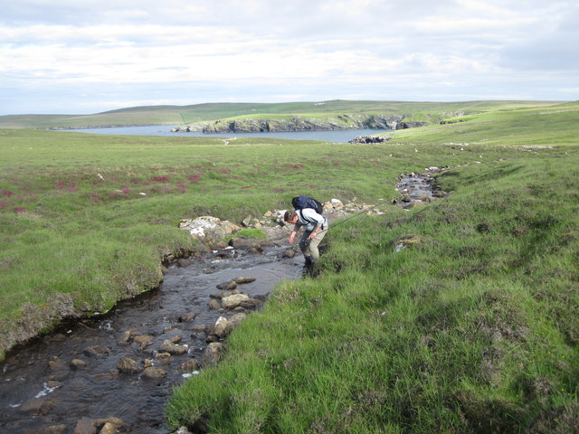
The geo offers breathtaking views of the surrounding landscape, with the deep blue sea crashing against the cliffs and the sound of seabirds echoing through the air. It is also a popular spot for birdwatchers, as it is home to a diverse range of bird species, including puffins, gannets, and fulmars.

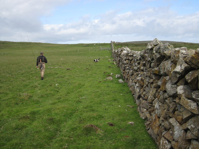
Access to Dempster's Geo is relatively easy, with a footpath leading down to the edge of the cliffs. However, caution must be exercised when exploring the area, as the cliffs can be unstable and dangerous, particularly during stormy weather.

Overall, Dempster's Geo is a stunning coastal feature that showcases the raw beauty and power of nature. Its unique geological formations, rich wildlife, and dramatic views make it a must-visit destination for nature enthusiasts and photographers alike.

If you have any feedback on the listing, please let us know in the comments section below.

Dempster's Geo Images

Images are sourced within 2km of 60.614793/-0.82361112 or Grid Reference HU6492. Thanks to Geograph Open Source API. All images are credited.

Winyadepla east shore. Two prehistoric stone built enclosures, east shore of Winyadepla, Fetlar.
Winyadepla east shore.
Two prehistoric stone built enclosures, east shore of Winyadepla, Fetlar.
Stack of Birrier
Stack of Birrier
The Clett
The Clett
Skerry off Filla Wick, with natural arch at base of Busta Pund and the Clett in the background
Natural Arch at base of Busta Pund
Geo between Stack of Birrier and Busta Pund.The sea was a beautiful blue colour.
The Clett, off Busta Pund, Fetlar The Clett is the nearest stack. Beyond is Strandburgh Ness and the holm of Outer Brough.
The Clett, off Busta Pund, Fetlar
The Clett is the nearest stack. Beyond is Strandburgh Ness and the holm of Outer Brough.
Substantial dry stone wall dividing Fetlar domains An unusually substantial wall still fully functional on the east side of Fetlar. The gap in the wall on the skyline is the route to the Well of Health and Loch Winyadepla.
Substantial dry stone wall dividing Fetlar domains
An unusually substantial wall still fully functional on the east side of Fetlar. The gap in the wall on the skyline is the route to the Well of Health and Loch Winyadepla.
Stream running from Grutinpunds to Mongirsdale on Fetlar The stream runs into a ruined settlement, Well of Health, an idyllic spot. The headland in the distance is the Ness of Gruting. This tiny stream is full of wild brown trout.
Stream running from Grutinpunds to Mongirsdale on Fetlar
The stream runs into a ruined settlement, Well of Health, an idyllic spot. The headland in the distance is the Ness of Gruting. This tiny stream is full of wild brown trout.
Life in the shallow Waters of Cruss This is the lowest in the chain of shallow lochans atop the hill to the east of Houbie on Fetlar. All appear too shallow to hold much life but all three of the larger lochans had a pair of red-throated divers and this one evidently holds good brown trout.
Life in the shallow Waters of Cruss
This is the lowest in the chain of shallow lochans atop the hill to the east of Houbie on Fetlar. All appear too shallow to hold much life but all three of the larger lochans had a pair of red-throated divers and this one evidently holds good brown trout.
Preparing to fish on the Loch of Winyadepla, Fetlar Looking towards the shallows at the southern tip of this shallow loch. The western shore has a large colony of Bonxies (Great Skuas) whose guano can trigger algal blooms in warm seasons.
Preparing to fish on the Loch of Winyadepla, Fetlar
Looking towards the shallows at the southern tip of this shallow loch. The western shore has a large colony of Bonxies (Great Skuas) whose guano can trigger algal blooms in warm seasons.
The Clett Blue Banks of Fetlar around Busta Hill seen from Baa-neeps on the east of the island.
The Clett
Blue Banks of Fetlar around Busta Hill seen from Baa-neeps on the east of the island.
Sands at Litla, Gruting, Fetlar
Tonga of Croosmel, Wick of Gruting, Fetlar Clett Stack in the distance.
Tonga of Croosmel, Wick of Gruting, Fetlar
Clett Stack in the distance.
Ness of Gruting, Fetlar
Sea Skerry, off Lambigarth, Ness of Gruting, Fetlar
The Clett and Busta Pund, Fetlar Taken from Strand on the east side of the Wick of Gruting.
The Clett and Busta Pund, Fetlar
Taken from Strand on the east side of the Wick of Gruting.
Strandburgh Ness from Hesta Ness, Fetlar
Show me another place!

Dempster's Geo is located at Grid Ref: HU6492 (Lat: 60.614793, Lng: -0.82361112)

Unitary Authority: Shetland Islands

Police Authority: Highlands and Islands

What 3 Words

///wrenching.never.village. Near Houbie, Shetland Islands

Related Wikis

Haltadans

Haltadans, also known as Fairy Ring or Haltadans stone circle, is a stone circle on the island of Fetlar in Shetland, Scotland. This site is a ring of...

Funzie Girt

Funzie Girt (; Scots: Funyie Girt "Finns' dyke") is an ancient dividing wall that was erected from north to south across the island of Fetlar in Shetland...

Fetlar

Fetlar (Scots: Fetlar) is one of the North Isles of Shetland, Scotland, with a usually resident population of 61 at the time of the 2011 census. Its main...

Haaf Gruney

Haaf Gruney is a small island in the north east of the Shetland Islands. == Geography and geology == The island is between Unst and Fetlar which are to...

Urie Lingey

For other islands with similar names, see Linga (disambiguation) Urie Lingey is one of the Shetland Islands. It is between Fetlar and Unst, and Yell is...

Hamars Ness

Hamars Ness is a headland on the island of Fetlar in Shetland, Scotland. The name is from the Old Norse Hamarsnes meaning "craggy headland". A ro-ro ferry...

Brough Lodge

Brough Lodge is a 19th-century Gothic mansion on Fetlar, one of the Shetland Islands, in northern Scotland. Built by the Nicolson family, who were responsible...

Uyea, Unst

Uyea (Scots: Uyea) is an uninhabited island, lying south of Unst in Shetland, Scotland. == History == The island was inhabited as early as the Bronze Age...

Have you been to Dempster's Geo?

Leave your review of Dempster's Geo below (or comments, questions and feedback).