Virva

Bay in Shetland

Scotland

Virva

Everland with Ness of Gruting in the distance
Everland with Ness of Gruting in the distance Credit: Ken Craig

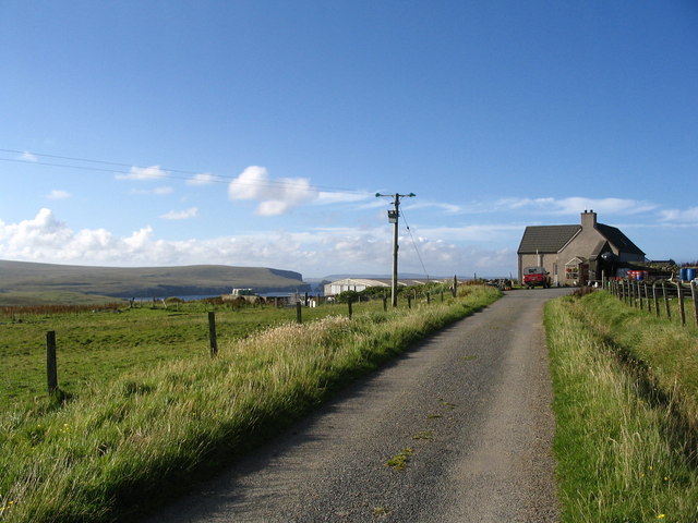
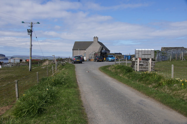
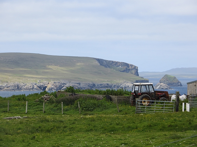
Virva is a small bay located on the western coast of the Shetland Islands in Scotland. It is nestled between the larger bays of Quendale and Gruting Voe. The bay is characterized by its breathtaking natural beauty and rugged coastline.

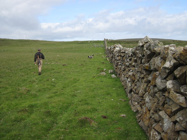
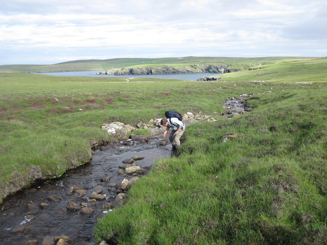
The area surrounding Virva is primarily comprised of rolling green hills, rocky cliffs, and pristine sandy beaches. The bay itself is sheltered, making it an ideal spot for boating and water activities. The crystal-clear waters of the bay are teeming with marine life, making it a popular destination for both locals and tourists interested in fishing and snorkeling.

Virva is also known for its diverse bird population, attracting birdwatchers from around the world. The bay is home to a variety of seabirds, including puffins, guillemots, and razorbills. Visitors can often spot these fascinating creatures nesting on the nearby cliffs or diving into the water in search of food.

The bay is relatively secluded, offering a peaceful and tranquil atmosphere. It is a perfect spot for those seeking a relaxing getaway or a chance to immerse themselves in nature. The nearby coastline provides stunning panoramic views, especially during sunrise and sunset.

Overall, Virva is a hidden gem on the Shetland Islands, offering natural beauty, wildlife, and a sense of serenity to all who visit.

If you have any feedback on the listing, please let us know in the comments section below.

Virva Images

Images are sourced within 2km of 60.607484/-0.82356659 or Grid Reference HU6492. Thanks to Geograph Open Source API. All images are credited.

Everland with Ness of Gruting in the distance
Winyadepla east shore. Two prehistoric stone built enclosures, east shore of Winyadepla, Fetlar.
Winyadepla east shore.
Two prehistoric stone built enclosures, east shore of Winyadepla, Fetlar.
Cruss Waters Fetlar, Cruss Waters, from the air 600 feet.
Cruss Waters
Fetlar, Cruss Waters, from the air 600 feet.
Upper reaches of the Burn of Feal, Fetlar Looking across to the hillside of Rooin.
Upper reaches of the Burn of Feal, Fetlar
Looking across to the hillside of Rooin.
Planticrubs, Burn of Feal, Fetlar Planticrubs or planticrues were small square enclosures used for setting seedlings before they were planted out in rigs.
Planticrubs, Burn of Feal, Fetlar
Planticrubs or planticrues were small square enclosures used for setting seedlings before they were planted out in rigs.
Feelie dyke above Burn of Feal, Fetlar A feelie dyke is an earth dyke, here presumably denoting a previous field system.
Feelie dyke above Burn of Feal, Fetlar
A feelie dyke is an earth dyke, here presumably denoting a previous field system.
Farm at Aith
Farm at Aith
Line of planticrubs For a full explanation of these miniature "walled gardens", see <a href="https://www.geograph.org.uk/photo/3271563">HU6489 : Line of planticrubs</a>.
Line of planticrubs
For a full explanation of these miniature "walled gardens", see HU6489 : Line of planticrubs.
Still and Vord Hill from Houll, Funzie
Everland The end of the road on Fetlar.
Everland
The end of the road on Fetlar.
Still from Aithbank
Still from Aithbank
Substantial dry stone wall dividing Fetlar domains An unusually substantial wall still fully functional on the east side of Fetlar. The gap in the wall on the skyline is the route to the Well of Health and Loch Winyadepla.
Substantial dry stone wall dividing Fetlar domains
An unusually substantial wall still fully functional on the east side of Fetlar. The gap in the wall on the skyline is the route to the Well of Health and Loch Winyadepla.
Stream running from Grutinpunds to Mongirsdale on Fetlar The stream runs into a ruined settlement, Well of Health, an idyllic spot. The headland in the distance is the Ness of Gruting. This tiny stream is full of wild brown trout.
Stream running from Grutinpunds to Mongirsdale on Fetlar
The stream runs into a ruined settlement, Well of Health, an idyllic spot. The headland in the distance is the Ness of Gruting. This tiny stream is full of wild brown trout.
Life in the shallow Waters of Cruss This is the lowest in the chain of shallow lochans atop the hill to the east of Houbie on Fetlar. All appear too shallow to hold much life but all three of the larger lochans had a pair of red-throated divers and this one evidently holds good brown trout.
Life in the shallow Waters of Cruss
This is the lowest in the chain of shallow lochans atop the hill to the east of Houbie on Fetlar. All appear too shallow to hold much life but all three of the larger lochans had a pair of red-throated divers and this one evidently holds good brown trout.
Preparing to fish on the Loch of Winyadepla, Fetlar Looking towards the shallows at the southern tip of this shallow loch. The western shore has a large colony of Bonxies (Great Skuas) whose guano can trigger algal blooms in warm seasons.
Preparing to fish on the Loch of Winyadepla, Fetlar
Looking towards the shallows at the southern tip of this shallow loch. The western shore has a large colony of Bonxies (Great Skuas) whose guano can trigger algal blooms in warm seasons.
Still View up the Aith Burn towards Still.
Still
View up the Aith Burn towards Still.
Everland A rare example of a farm on the north side of Fetlar with a view towards Busta Hill and The Clett.
Everland
A rare example of a farm on the north side of Fetlar with a view towards Busta Hill and The Clett.
Ruined house at Strand, Fetlar
Show me another place!

Virva is located at Grid Ref: HU6492 (Lat: 60.607484, Lng: -0.82356659)

Unitary Authority: Shetland Islands

Police Authority: Highlands and Islands

What 3 Words

///swims.estuaries.improve. Near Houbie, Shetland Islands

Related Wikis

Haltadans

Haltadans, also known as Fairy Ring or Haltadans stone circle, is a stone circle on the island of Fetlar in Shetland, Scotland. This site is a ring of...

Fetlar

Fetlar (Scots: Fetlar) is one of the North Isles of Shetland, Scotland, with a usually resident population of 61 at the time of the 2011 census. Its main...

Funzie Girt

Funzie Girt (; Scots: Funyie Girt "Finns' dyke") is an ancient dividing wall that was erected from north to south across the island of Fetlar in Shetland...

Urie Lingey

For other islands with similar names, see Linga (disambiguation) Urie Lingey is one of the Shetland Islands. It is between Fetlar and Unst, and Yell is...

Haaf Gruney

Haaf Gruney is a small island in the north east of the Shetland Islands. == Geography and geology == The island is between Unst and Fetlar which are to...

Brough Lodge

Brough Lodge is a 19th-century Gothic mansion on Fetlar, one of the Shetland Islands, in northern Scotland. Built by the Nicolson family, who were responsible...

Hamars Ness

Hamars Ness is a headland on the island of Fetlar in Shetland, Scotland. The name is from the Old Norse Hamarsnes meaning "craggy headland". A ro-ro ferry...

Sound Gruney

For other islands with similar names, see Gruney (disambiguation) Sound Gruney is one of the Shetland islands. It lies about 1.5 kilometres (0.93 mi)...

Nearby Amenities

Located within 500m of 60.607484,-0.82356659
Mongirsdale
Place: locality
Lat/Long: 60.6081584/-0.8299724
The data included in this document is from www.openstreetmap.org. The data is made available under ODbL.

Have you been to Virva?

Leave your review of Virva below (or comments, questions and feedback).