South Tonga

Coastal Feature, Headland, Point in Shetland

Scotland

South Tonga

Ruined crofthouse on the Ness of Ramnageo
Ruined crofthouse on the Ness of Ramnageo Credit: Mike Pennington

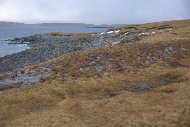
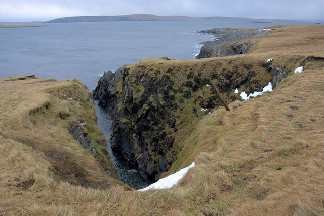
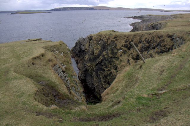
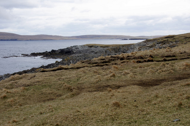
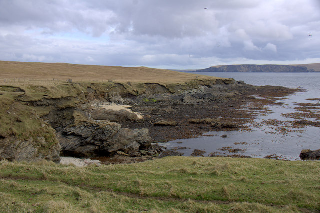
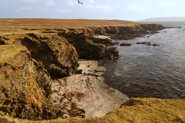
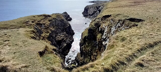
South Tonga, located in the Shetland Islands, is a prominent coastal feature known for its stunning headland and point. Situated on the southernmost tip of the main island of the Shetland archipelago, South Tonga offers breathtaking views of the North Sea and the surrounding rugged coastline.

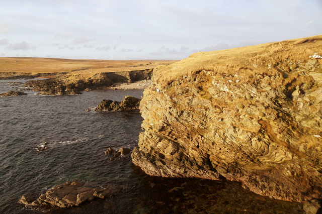
This coastal feature is characterized by its towering cliffs that reach heights of up to 200 feet, providing a dramatic backdrop to the crashing waves below. The cliffs are composed of sedimentary rocks, primarily sandstone and shale, which showcase distinct layers formed over millions of years.

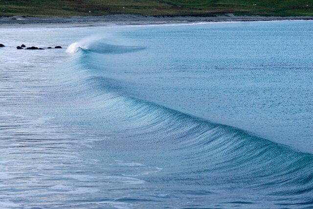
South Tonga's headland extends into the sea, forming a natural barrier that protects the neighboring coastline from the full force of the ocean's currents and tides. This geographical formation creates a sheltered bay, providing a safe haven for local wildlife, including seabirds, seals, and various marine species.

The point of South Tonga marks the southernmost tip of the island, offering visitors panoramic vistas of the surrounding seascape. On a clear day, one can see the distant islands dotting the horizon, adding to the allure of this coastal feature.

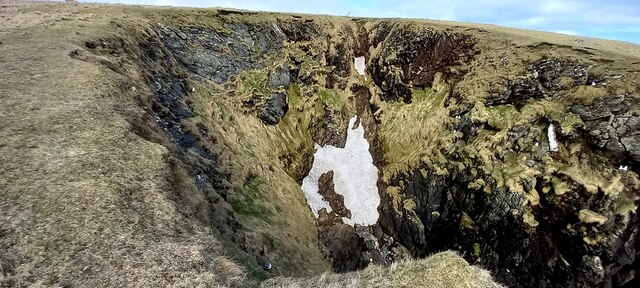
Hikers and nature enthusiasts are drawn to South Tonga for its challenging coastal trails, which wind their way along the cliffs and provide unparalleled views of the rugged coastline. The area is also popular for birdwatching, as several species, such as puffins and fulmars, nest along the cliffs during the breeding season.

Overall, South Tonga in the Shetland Islands is a captivating coastal feature characterized by its towering cliffs, protective headland, and stunning point. It is a must-visit destination for those seeking to immerse themselves in the natural beauty of the Shetland archipelago.

If you have any feedback on the listing, please let us know in the comments section below.

South Tonga Images

Images are sourced within 2km of 60.693118/-0.84635537 or Grid Reference HP6301. Thanks to Geograph Open Source API. All images are credited.

Ruined crofthouse on the Ness of Ramnageo
Ness of Ramnageo A ruined planticrub (shelter for growing crops) on the Ness; Fetlar is in the distance.
Ness of Ramnageo
A ruined planticrub (shelter for growing crops) on the Ness; Fetlar is in the distance.
Beaches on the west of the Ness of Ramnageo The ruined croft at Littlegarth can just be seen in the distance.
Beaches on the west of the Ness of Ramnageo
The ruined croft at Littlegarth can just be seen in the distance.
Beach on Ness of Ramnageo Looking towards Fetlar.
Beach on Ness of Ramnageo
Looking towards Fetlar.
Wick of Fauld from Ramnageo Looking towards Littlegarth.
Wick of Fauld from Ramnageo
Looking towards Littlegarth.
Ness of Ramnageo Looking out towards Wedder Holm, with Fetlar in the distance.
Ness of Ramnageo
Looking out towards Wedder Holm, with Fetlar in the distance.
Scranklings, Ness of Ramnageo This unusual piece of coastline along the east side of the Ness of Ramnageo has the strangely appropriate-sounding name of Scranklings, according to the 1:10,000 map.
Scranklings, Ness of Ramnageo
This unusual piece of coastline along the east side of the Ness of Ramnageo has the strangely appropriate-sounding name of Scranklings, according to the 1:10,000 map.
Stubbi Geos, Ramnageo I had always assumed that at least one of these geos was the eponymous Ramnageo ('Raven's geo') but according to the map they are named Stubbi Geos.
Stubbi Geos, Ramnageo
I had always assumed that at least one of these geos was the eponymous Ramnageo ('Raven's geo') but according to the map they are named Stubbi Geos.
Wester Stubbi Geo, Ness of Ramnageo Looking south towards Fetlar, with Haaf Gruney on the left and Wedder Hom on the right.
Wester Stubbi Geo, Ness of Ramnageo
Looking south towards Fetlar, with Haaf Gruney on the left and Wedder Hom on the right.
Easter Stubbi Geo, Ness of Ramnageo The top of the cliff is in one gridsquare, but the bottom of the cliff is in the next.
Easter Stubbi Geo, Ness of Ramnageo
The top of the cliff is in one gridsquare, but the bottom of the cliff is in the next.
Stubbi Geos, Ramnageo, Muness
Scranklings, Ness of Ramnageo, Muness
Gorse Geos, Ness of Ramnageo, Muness
Gorse Geos, Ramnageo
Corbie Geo, Ramnageo
East Stubbi Geo, Ramnageo, Uyeasound Note the snow hanging on from 10 days ago.
East Stubbi Geo, Ramnageo, Uyeasound
Note the snow hanging on from 10 days ago.
West Stubbi, Ramnageo, Uyeasound
Proto-wave, Easting
Proto-wave, Easting
Show me another place!

South Tonga is located at Grid Ref: HP6301 (Lat: 60.693118, Lng: -0.84635537)

Unitary Authority: Shetland Islands

Police Authority: Highlands and Islands

What 3 Words

///relief.noted.mild. Near Uyeasound, Shetland Islands

Related Wikis

Muness Castle

Muness Castle is located on Unst, which is one of the Shetland Islands of Scotland. The castle is 3 kilometres (1.9 mi) east of the village of Uyeasound...

Mailand, Shetland

Mailand is a hamlet in the Shetland Islands. It is on the island of Unst, the northernmost of the inhabited British Isles, near its southern coast. �...

Clivocast

Clivocast is a settlement on the island of Unst in the Shetland Islands, Scotland at 60.67°N 00.90°W / 60.67; -00.90 or grid reference HP6000 and is situated...

Haaf Gruney

Haaf Gruney is a small island in the north east of the Shetland Islands. == Geography and geology == The island is between Unst and Fetlar which are to...

Nearby Amenities

Located within 500m of 60.693118,-0.84635537
Muness
Place: hamlet
Lat/Long: 60.6894284/-0.8494232
Passing Place
Lat/Long: 60.6891088/-0.8498616
Barrier: cattle_grid
Lat/Long: 60.6899189/-0.8511387
Power: pole
Lat/Long: 60.6892754/-0.8501724
Power: pole
Lat/Long: 60.6896387/-0.8501377
Power: pole
Lat/Long: 60.6899583/-0.8501029
Power: pole
Lat/Long: 60.6897092/-0.8493533
The data included in this document is from www.openstreetmap.org. The data is made available under ODbL.

Have you been to South Tonga?

Leave your review of South Tonga below (or comments, questions and feedback).