Lamba Geo
Coastal Feature, Headland, Point in Shetland
Scotland
Lamba Geo

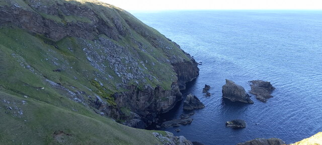
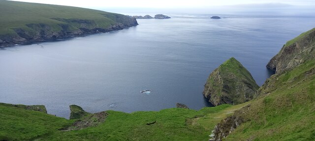
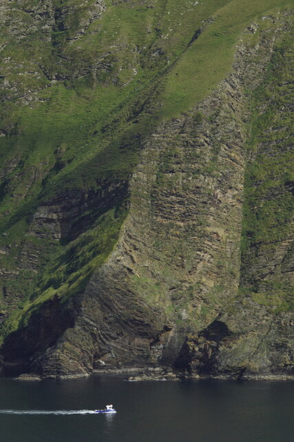
Lamba Geo is a prominent coastal feature located on the northern coast of Shetland, Scotland. It is classified as a headland or a point, characterized by its rugged cliffs, rocky terrain, and stunning views of the surrounding North Sea.
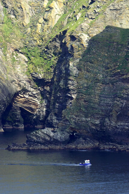
Situated near the village of Sandwick, Lamba Geo is a popular spot for nature enthusiasts and hikers due to its breathtaking landscapes and diverse wildlife. The headland offers panoramic vistas of the sea, with its dramatic cliffs towering over the crashing waves below. These cliffs are composed of layered sandstone and shale, giving them a distinctive appearance and providing a glimpse into the geological history of the area.
The coastal area around Lamba Geo is rich in biodiversity, with numerous seabird colonies nesting on its cliffs, including fulmars, guillemots, and kittiwakes. Visitors may also catch sight of seals basking on the rocks or dolphins swimming offshore.
Access to Lamba Geo is relatively straightforward, with a path leading from the nearby road to the headland. The walk to the point is moderately challenging, but the effort is rewarded by the awe-inspiring scenery and the opportunity to explore the rugged coastline.
Lamba Geo is not only a natural wonder but also holds historical significance. The surrounding area contains archaeological remains, including Iron Age forts and Viking settlements, providing evidence of human habitation in the region for centuries.
Overall, Lamba Geo is a captivating coastal feature that showcases the beauty of Shetland's rugged coastline, offering a unique blend of natural wonders and cultural heritage for visitors to experience and appreciate.
If you have any feedback on the listing, please let us know in the comments section below.
Lamba Geo Images
Images are sourced within 2km of 60.83807/-0.84279326 or Grid Reference HP6317. Thanks to Geograph Open Source API. All images are credited.


Lamba Geo is located at Grid Ref: HP6317 (Lat: 60.83807, Lng: -0.84279326)
Unitary Authority: Shetland Islands
Police Authority: Highlands and Islands
What 3 Words
///radiating.reactions.playful. Near Haroldswick, Shetland Islands
Nearby Locations
Related Wikis

RAF Saxa Vord
Remote Radar Head Saxa Vord or RRH Saxa Vord (aka RAF Saxa Vord), is a Royal Air Force radar station located on the island of Unst, the most northern of...

Hermaness
Hermaness is the northernmost headland of Unst, the most northerly inhabited island of Shetland, Scotland. It consists of huge sea cliffs and moorland...

Out Stack
Out Stack or Ootsta is an island in Shetland, Scotland and the northernmost point of both Scotland and the British Isles. It lies 600 m (2,000 ft) northeast...

Muckle Flugga
Muckle Flugga () is a small rocky island north of Unst in the Shetland Islands, Scotland. It is often described as the northernmost point of the British...

Skaw, Unst
Skaw is a settlement in the Scottish archipelago of Shetland, located on the island of Unst. It is located north of Haroldswick on a peninsula in the northeast...

Holm of Skaw
The Holm of Skaw is a small islet off the northeast coast of the island of Unst. It is just northeast of the settlement of Skaw. The island is 57 feet...

Burrafirth
Burrafirth links (Old Norse: Borgarfjorðr, meaning "the fjord with a castle") is a strip of land with a few houses on the island of Unst, Shetland, Scotland...

SaxaVord Spaceport
SaxaVord Spaceport, previously known as Shetland Space Centre, is a planned spaceport to be located on the Lamba Ness peninsula on Unst, the most northerly...
Nearby Amenities
Located within 500m of 60.83807,-0.84279326Have you been to Lamba Geo?
Leave your review of Lamba Geo below (or comments, questions and feedback).