Corbie Geo

Coastal Feature, Headland, Point in Shetland

Scotland

Corbie Geo

Sunset over Uyea
Sunset over Uyea Credit: Mike Pennington

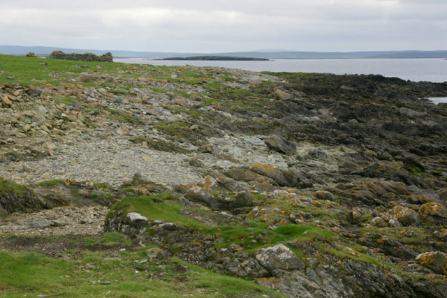
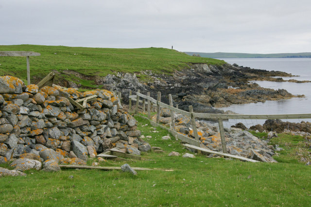
Corbie Geo is a coastal feature located in Shetland, an archipelago off the northeast coast of Scotland. Specifically, it is situated on the mainland of Shetland, close to the village of Scalloway. Corbie Geo is classified as a headland or point, protruding out into the sea and forming a distinctive and prominent feature along the coastline.

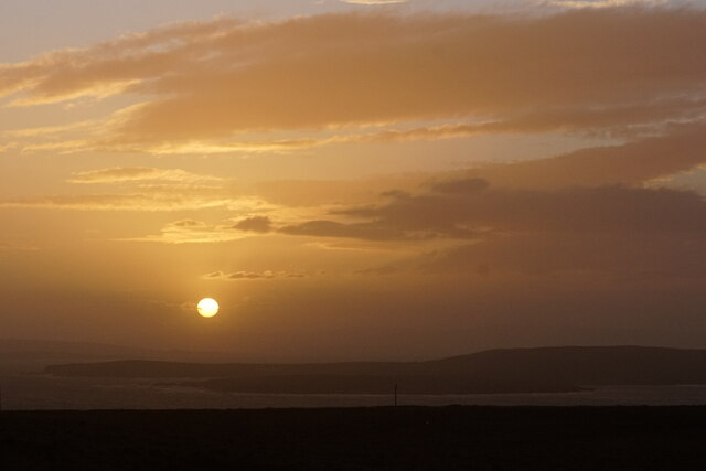
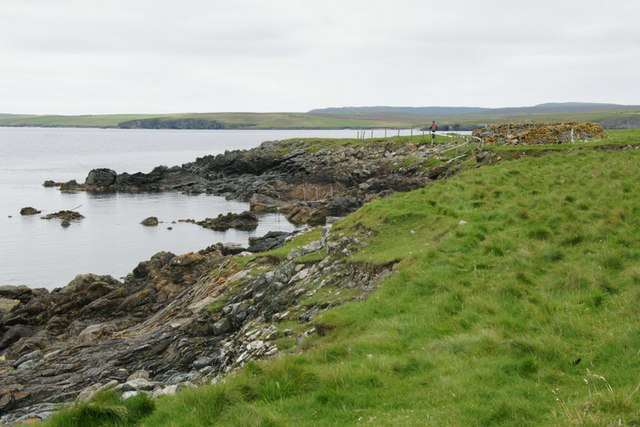
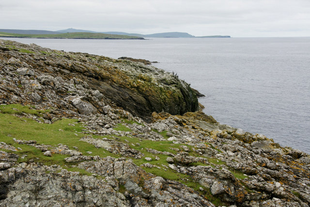
The headland is characterized by its rugged and rocky terrain, with steep cliffs descending into the North Sea. The cliffs are formed from layers of sedimentary rock, showcasing the geologic history of the region. The coastline surrounding Corbie Geo is exposed to the full force of the Atlantic Ocean, resulting in dramatic wave action and erosion over time.

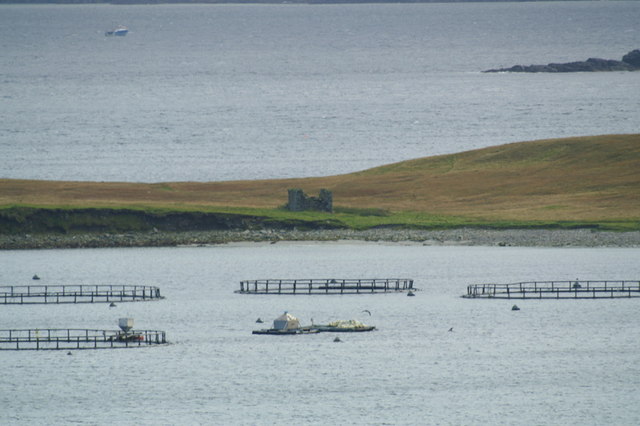
The area is renowned for its stunning natural beauty, attracting visitors and nature enthusiasts. The cliffs of Corbie Geo offer breathtaking panoramic views of the surrounding sea and coastline, making it a popular spot for photography and bird-watching. The location is home to a variety of seabird species, including guillemots, razorbills, and puffins, which nest in the cliffs during the breeding season.

Access to Corbie Geo is relatively straightforward, with a well-maintained footpath leading to the headland. However, visitors are advised to exercise caution due to the steep and potentially unstable cliffs. It is recommended to wear appropriate footwear and stay on designated paths for safety.

Overall, Corbie Geo is a spectacular coastal feature in Shetland, offering an opportunity to witness the raw power of the sea and immerse oneself in the natural beauty of the region.

If you have any feedback on the listing, please let us know in the comments section below.

Corbie Geo Images

Images are sourced within 2km of 60.678102/-0.8617203 or Grid Reference HU6299. Thanks to Geograph Open Source API. All images are credited.

Sunset over Uyea
Sunset over Uyea
Ruined crofthouse on the Ness of Ramnageo
Ness of Ramnageo A ruined planticrub (shelter for growing crops) on the Ness; Fetlar is in the distance.
Ness of Ramnageo
A ruined planticrub (shelter for growing crops) on the Ness; Fetlar is in the distance.
Beaches on the west of the Ness of Ramnageo The ruined croft at Littlegarth can just be seen in the distance.
Beaches on the west of the Ness of Ramnageo
The ruined croft at Littlegarth can just be seen in the distance.
Coastline below Littlegarth Uyea isle is in the distance.
Coastline below Littlegarth
Uyea isle is in the distance.
Cliffs at Littlegarth Fulmars are beginning to return to ledges left empty for most of the winter.
Cliffs at Littlegarth
Fulmars are beginning to return to ledges left empty for most of the winter.
Wick of Fauld Looking across the wick from Littlegarth towards Ramnageo.
Wick of Fauld
Looking across the wick from Littlegarth towards Ramnageo.
Beach on Ness of Ramnageo Looking towards Fetlar.
Beach on Ness of Ramnageo
Looking towards Fetlar.
Wick of Fauld from Ramnageo Looking towards Littlegarth.
Wick of Fauld from Ramnageo
Looking towards Littlegarth.
Tur Ness, Uyea Isle The ruined building on Tur Ness, with salmon cages in the foreground and a small boat in the background.
Tur Ness, Uyea Isle
The ruined building on Tur Ness, with salmon cages in the foreground and a small boat in the background.
Uyea Isle from Clivocast Uyea Hall protrudes above the horizon. The TV mast on Lambhoga on Fetlar is in the background.
Uyea Isle from Clivocast
Uyea Hall protrudes above the horizon. The TV mast on Lambhoga on Fetlar is in the background.
Vailan, Haaf Gruney The landing place for the island.
Vailan, Haaf Gruney
The landing place for the island.
Landward Taing, Haaf Gruney Closest to Unst.
Landward Taing, Haaf Gruney
Closest to Unst.
North coast of Haaf Gruney This beach is used as a nursery beach by Grey Seals in autumn. The ruined house at the far end of the beach was a shelter used by chromate miners working at the quarry, but there were no permanent homes on the island.
North coast of Haaf Gruney
This beach is used as a nursery beach by Grey Seals in autumn. The ruined house at the far end of the beach was a shelter used by chromate miners working at the quarry, but there were no permanent homes on the island.
Vailan, Haaf Gruney Small stone shelter above the landing place.
Vailan, Haaf Gruney
Small stone shelter above the landing place.
Uyea isle from Ramnageo The ruined haa on the left and the farmhouse on the right are just over the top of the hill and in the adjoining gridsquare.
Uyea isle from Ramnageo
The ruined haa on the left and the farmhouse on the right are just over the top of the hill and in the adjoining gridsquare.
Uyea isle from Ramnageo
Ness of Ramnageo Looking out towards Wedder Holm, with Fetlar in the distance.
Ness of Ramnageo
Looking out towards Wedder Holm, with Fetlar in the distance.
Show me another place!

Corbie Geo is located at Grid Ref: HU6299 (Lat: 60.678102, Lng: -0.8617203)

Unitary Authority: Shetland Islands

Police Authority: Highlands and Islands

What 3 Words

///phantom.fuse.rooks. Near Uyeasound, Shetland Islands

Related Wikis

Muness Castle

Muness Castle is located on Unst, which is one of the Shetland Islands of Scotland. The castle is 3 kilometres (1.9 mi) east of the village of Uyeasound...

Haaf Gruney

Haaf Gruney is a small island in the north east of the Shetland Islands. == Geography and geology == The island is between Unst and Fetlar which are to...

Uyea, Unst

Uyea (Scots: Uyea) is an uninhabited island, lying south of Unst in Shetland, Scotland. == Etymology == The Norn word for an island is øy so Uyea (pronounced...

Clivocast

Clivocast is a settlement on the island of Unst in the Shetland Islands, Scotland at 60.67°N 00.90°W / 60.67; -00.90 or grid reference HP6000 and is situated...

Nearby Amenities

Located within 500m of 60.678102,-0.8617203
Ramnageo
Is In: Scotland, GB
Place: hamlet
Lat/Long: 60.6795167/-0.8551921
Passing Place
Lat/Long: 60.678806/-0.865563
Power: pole
Lat/Long: 60.6795042/-0.8570285
Power: pole
Lat/Long: 60.6799455/-0.8580933
Power: pole
Lat/Long: 60.6803947/-0.858906
Power: pole
Lat/Long: 60.6811982/-0.8605459
Power: pole
Lat/Long: 60.6807788/-0.8596423
Power: pole
Lat/Long: 60.68158/-0.8613509
Power: pole
Lat/Long: 60.6819451/-0.8620912
Power: pole
Lat/Long: 60.6823969/-0.8630621
The data included in this document is from www.openstreetmap.org. The data is made available under ODbL.

Have you been to Corbie Geo?

Leave your review of Corbie Geo below (or comments, questions and feedback).