Iron Geo
Coastal Feature, Headland, Point in Shetland
Scotland
Iron Geo

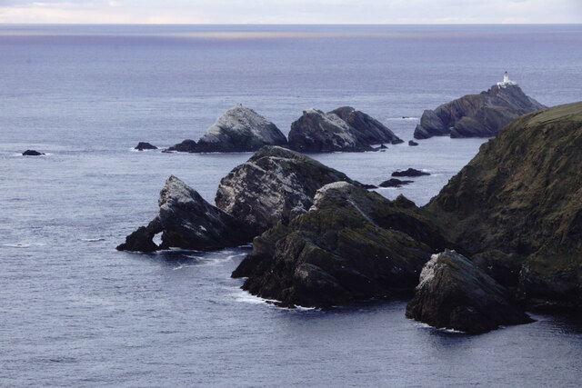
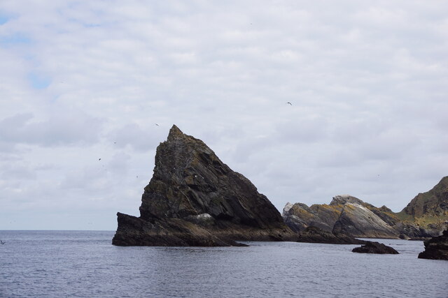
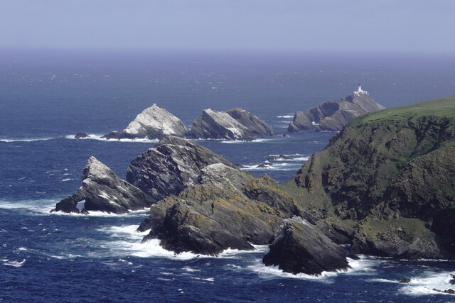
Iron Geo is a prominent coastal feature located in the Shetland Islands, off the north coast of Scotland. It is classified as a headland, or a raised area of land that extends into the sea, forming a distinctive point. The name "Iron Geo" is derived from the Old Norse word "geirr," meaning spear or point, due to its sharp and rocky formation.
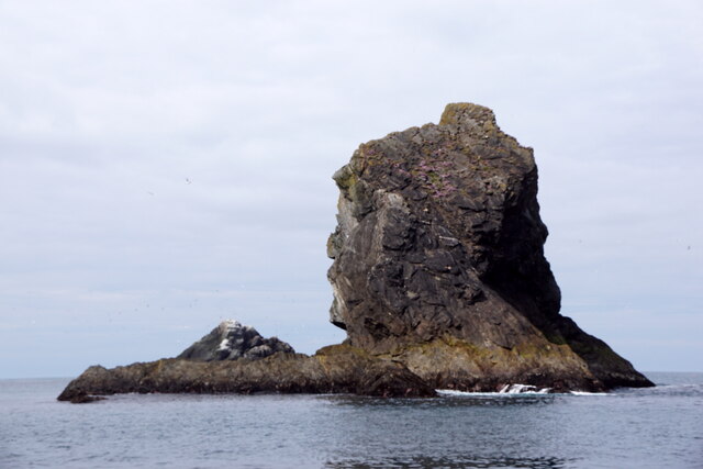
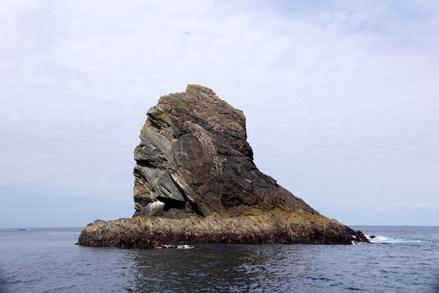
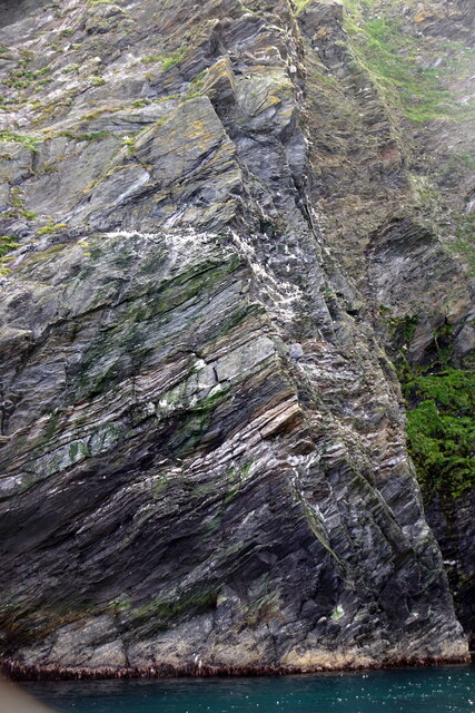
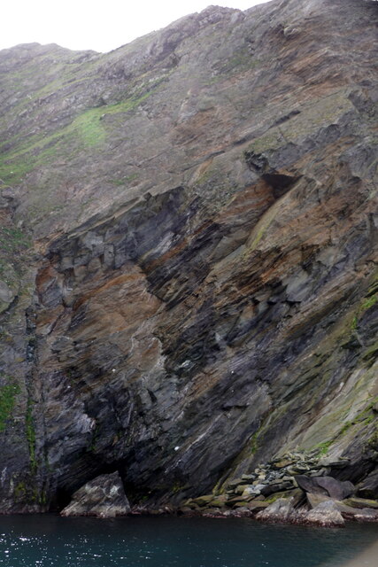
Situated on the west coast of Shetland, Iron Geo stands tall, overlooking the North Atlantic Ocean. It is characterized by its steep cliffs, which are composed of rugged rock formations, primarily consisting of basalt and granite. These cliffs exhibit striking features, such as vertical columns and jagged edges, sculpted over centuries by the relentless force of the sea.
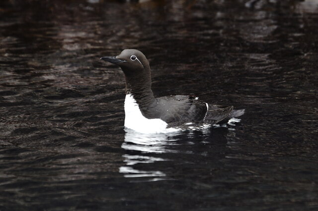
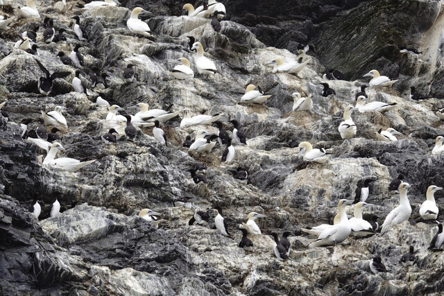
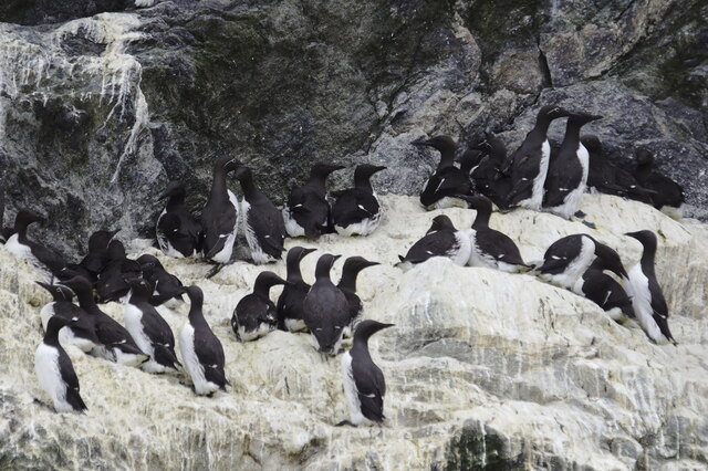
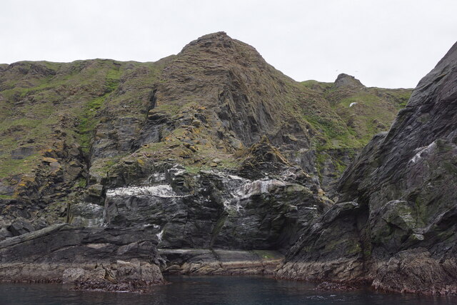
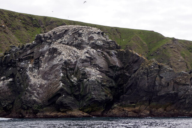
Iron Geo offers breathtaking views of the surrounding landscape, including the vast expanse of the ocean and the neighboring islands. The headland serves as a prominent landmark for sailors and fishermen, indicating their proximity to the Shetland Islands. It also provides a habitat for various seabird species, such as puffins, gannets, and fulmars, making it a popular spot for birdwatching.
The area surrounding Iron Geo is renowned for its rich marine life, with seals and porpoises often spotted in the waters below. The headland is also a favored destination for hikers and nature enthusiasts, who can explore the coastal trails and take in the spectacular scenery.
Overall, Iron Geo is a striking coastal feature and headland in Shetland, offering visitors a glimpse of the rugged beauty and diverse wildlife that the archipelago is known for.
If you have any feedback on the listing, please let us know in the comments section below.
Iron Geo Images
Images are sourced within 2km of 60.835854/-0.86833293 or Grid Reference HP6117. Thanks to Geograph Open Source API. All images are credited.


Iron Geo is located at Grid Ref: HP6117 (Lat: 60.835854, Lng: -0.86833293)
Unitary Authority: Shetland Islands
Police Authority: Highlands and Islands
What 3 Words
///perfectly.mavericks.decoding. Near Haroldswick, Shetland Islands
Nearby Locations
Related Wikis

Hermaness
Hermaness is the northernmost headland of Unst, the most northerly inhabited island of Shetland, Scotland. It consists of huge sea cliffs and moorland...

RAF Saxa Vord
Remote Radar Head Saxa Vord or RRH Saxa Vord (aka RAF Saxa Vord), is a Royal Air Force radar station located on the island of Unst, the most northern of...

Muckle Flugga
Muckle Flugga () is a small rocky island north of Unst in the Shetland Islands, Scotland. It is often described as the northernmost point of the British...

Out Stack
Out Stack or Ootsta is an island in Shetland, Scotland and the northernmost point of both Scotland and the British Isles. It lies 600 m (2,000 ft) northeast...

Burrafirth
Burrafirth links (Old Norse: Borgarfjorðr, meaning "the fjord with a castle") is a strip of land with a few houses on the island of Unst, Shetland, Scotland...

Skaw, Unst
Skaw is a settlement in the Scottish archipelago of Shetland, located on the island of Unst. It is located north of Haroldswick on a peninsula in the northeast...

Saxa Vord distillery
Saxa Vord distillery is a Scotch whisky and gin distillery on the island of Unst, part of the Shetland islands. The distillery takes its name from its...

Valhalla Brewery
The Valhalla Brewery in Unst, Shetland, Scotland, was the northernmost brewery in the United Kingdom. It was opened by the husband and wife team Sonny...
Nearby Amenities
Located within 500m of 60.835854,-0.86833293Have you been to Iron Geo?
Leave your review of Iron Geo below (or comments, questions and feedback).