Rett Geo

Coastal Feature, Headland, Point in Shetland

Scotland

Rett Geo

Rams Ness The south-western tip of Lambhoga.
Rams Ness Credit: Mike Pennington

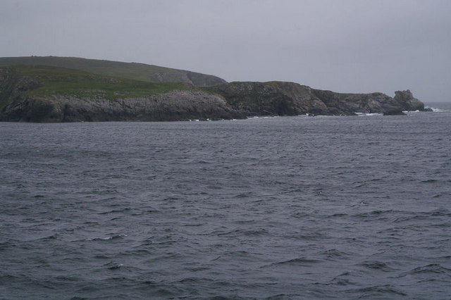
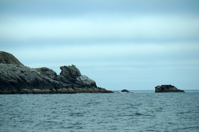
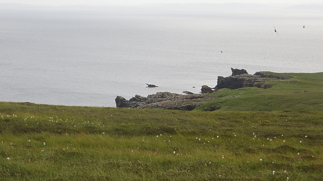
Rett Geo is a prominent coastal feature located in Shetland, Scotland. It is a headland that juts out into the North Sea, forming a distinct point along the rugged coastline. The word "geo" is a Shetlandic term used to describe a narrow inlet or cove, often formed by the erosion of a softer rock layer between harder rock formations. Rett Geo is characterized by its steep cliffs and rocky shoreline, which provide a stunning backdrop against the crashing waves of the sea.

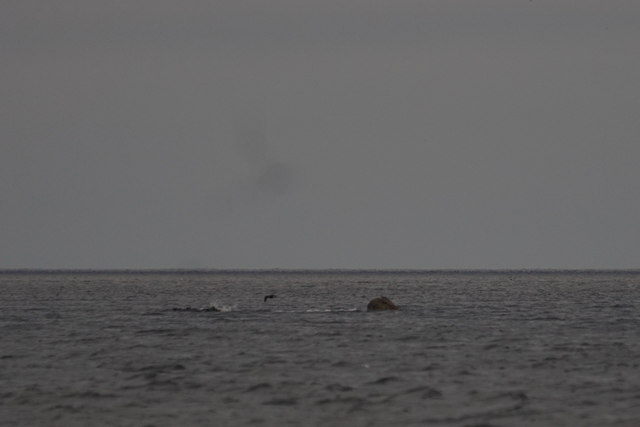
The headland offers breathtaking panoramic views of the surrounding landscape, with its towering cliffs and dramatic rock formations. The rugged terrain of Rett Geo is home to a diverse range of marine life, making it a popular spot for birdwatchers and nature enthusiasts. Visitors can often spot seabirds such as puffins, guillemots, and razorbills nesting on the cliffs, as well as seals and occasionally dolphins swimming in the waters below.

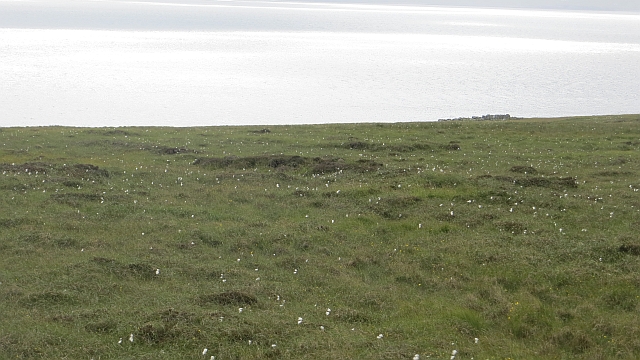
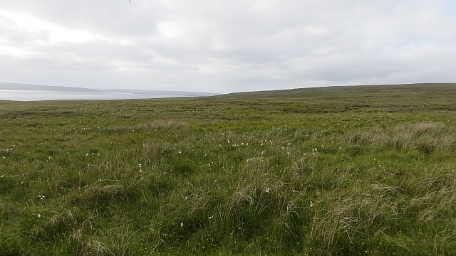
Access to Rett Geo is relatively easy, with a well-maintained footpath leading to the headland. The path meanders through picturesque coastal heathland, offering glimpses of wildflowers and other native vegetation along the way. Once at Rett Geo, visitors can explore the rocky beach at the base of the cliffs, take in the stunning views, or simply enjoy the tranquility of the surroundings.

Overall, Rett Geo is a captivating coastal feature that showcases the raw beauty of Shetland's coastline. Its rugged cliffs, diverse wildlife, and breathtaking views make it a must-visit destination for nature lovers and those seeking to immerse themselves in the natural wonders of the region.

If you have any feedback on the listing, please let us know in the comments section below.

Rett Geo Images

Images are sourced within 2km of 60.575098/-0.91065165 or Grid Reference HU5988. Thanks to Geograph Open Source API. All images are credited.

Rams Ness The south-western tip of Lambhoga.
Rams Ness
The south-western tip of Lambhoga.
Tiny rock off Rams Ness, Fetlar
Rams Ness, Fetlar
Rams Ness, Fetlar
Outer Dale, Lambhoga, Fetlar
Horn of Ramsness, Fetlar
Small rock off the Horn of Ramsness, Fetlar
Looking north from path up to Lamb Hoga There is a very good track from the car park beside Fetlar Kirk up onto Lamb Hoga with views to Out Skerries, Bressay and across the whole of Fetlar.  I had assumed that Lamb Hoga would be pronounced as written but oh no, it's pronounced as a single word "Lahmuga" with the stress on the first sylable "Lahm".
Looking north from path up to Lamb Hoga
There is a very good track from the car park beside Fetlar Kirk up onto Lamb Hoga with views to Out Skerries, Bressay and across the whole of Fetlar. I had assumed that Lamb Hoga would be pronounced as written but oh no, it's pronounced as a single word "Lahmuga" with the stress on the first sylable "Lahm".
The Peat Road The bogs of Lamb Hoga provided Fetlar with high quality fuel. Every year, islanders would move to the peninsula to cast and dry peats. The fuel was then taken off via this road or by boat across to Aith for the eastern side of the island.
 The beach at Tresta is in the background along with Vord Hill.
The Peat Road
The bogs of Lamb Hoga provided Fetlar with high quality fuel. Every year, islanders would move to the peninsula to cast and dry peats. The fuel was then taken off via this road or by boat across to Aith for the eastern side of the island. The beach at Tresta is in the background along with Vord Hill.
Peat Road, Lamb Hoga The route which was used to carry winter fuel off the bogs of Lamb Hoga up to the 1950s.
Peat Road, Lamb Hoga
The route which was used to carry winter fuel off the bogs of Lamb Hoga up to the 1950s.
Bog, Lamb Hoga The west side of Gillis Field which was the source of Fetlar's peat. The moorland is now home to many bonxies and they were pretty mean today.
Bog, Lamb Hoga
The west side of Gillis Field which was the source of Fetlar's peat. The moorland is now home to many bonxies and they were pretty mean today.
Bog, Lamb Hoga Above Rams Ness on the southwest corner of Fetlar. This was the source of much of the island's peat and folk moved here to peat houses for two weeks every year to gather the winter fuel. The peat houses were simple bothies.
Bog, Lamb Hoga
Above Rams Ness on the southwest corner of Fetlar. This was the source of much of the island's peat and folk moved here to peat houses for two weeks every year to gather the winter fuel. The peat houses were simple bothies.
Shore of Lamb Hoga Near Rams Ness, Fetlar.
Shore of Lamb Hoga
Near Rams Ness, Fetlar.
The Dale A shallow reentrant on the boggy Lamb Hoga plateau. There is a view over the Wick of Tresta towards Aithbank where peats cut here were once landed.
The Dale
A shallow reentrant on the boggy Lamb Hoga plateau. There is a view over the Wick of Tresta towards Aithbank where peats cut here were once landed.
The Peat Road Lamb Hoga was the source of Fetlar's peat and this was one of the ways the peat was carried to the crofts. Much of the peat was taken out by boat and landed at Airthbank.
The Peat Road
Lamb Hoga was the source of Fetlar's peat and this was one of the ways the peat was carried to the crofts. Much of the peat was taken out by boat and landed at Airthbank.
Mires of Helliersness Peat bogs on Lamb Hoga
Mires of Helliersness
Peat bogs on Lamb Hoga
Bogs, Lamb Hoga Above Rams Ness on the southwest corner of Fetlar. This was the source of much of the island's peat and folk moved here to peat houses for two weeks every year to gather the winter fuel. Peat was taken out by boat.
Bogs, Lamb Hoga
Above Rams Ness on the southwest corner of Fetlar. This was the source of much of the island's peat and folk moved here to peat houses for two weeks every year to gather the winter fuel. Peat was taken out by boat.
Bogs, Lamb Hoga The source of much of Fetlar's peat. Lamb Hoga contrasts with the centre and east of the island in being covered by blanket bog and having low soil fertility.
Bogs, Lamb Hoga
The source of much of Fetlar's peat. Lamb Hoga contrasts with the centre and east of the island in being covered by blanket bog and having low soil fertility.
Gillis Field Triangulation pillar amongst the bogs.
Gillis Field
Triangulation pillar amongst the bogs.
Show me another place!

Rett Geo is located at Grid Ref: HU5988 (Lat: 60.575098, Lng: -0.91065165)

Unitary Authority: Shetland Islands

Police Authority: Highlands and Islands

What 3 Words

///occupations.sprinter.awaiting. Near Houbie, Shetland Islands

Related Wikis

Fetlar

Fetlar (Scots: Fetlar) is one of the North Isles of Shetland, Scotland, with a usually resident population of 61 at the time of the 2011 census. Its main...

Brough Lodge

Brough Lodge is a 19th-century Gothic mansion on Fetlar, one of the Shetland Islands, in northern Scotland. Built by the Nicolson family, who were responsible...

Haltadans

Haltadans, also known as Fairy Ring or Haltadans stone circle, is a stone circle on the island of Fetlar in Shetland, Scotland. This site is a ring of...

Funzie Girt

Funzie Girt (; Scots: Funyie Girt "Finns' dyke") is an ancient dividing wall that was erected from north to south across the island of Fetlar in Shetland...

Hascosay

Hascosay (Scots: Hascosay; Old Norse "Hafskotsey") is a small island lying between Yell and Fetlar in the Shetland Islands, Scotland. == Geography and... ==

Hamars Ness

Hamars Ness is a headland on the island of Fetlar in Shetland, Scotland. The name is from the Old Norse Hamarsnes meaning "craggy headland". A ro-ro ferry...

Urie Lingey

For other islands with similar names, see Linga (disambiguation) Urie Lingey is one of the Shetland Islands. It is between Fetlar and Unst, and Yell is...

Aywick

Aywick is a small settlement on the east side of Yell, an island forming part of the Shetland Islands north of Scotland.The naturalist Bobby Tulloch was...

Have you been to Rett Geo?

Leave your review of Rett Geo below (or comments, questions and feedback).