Bresdale

Valley in Shetland

Scotland

Bresdale

Outer Dale, Lambhoga, Fetlar
Outer Dale, Lambhoga, Fetlar Credit: Mike Pennington

Bresdale, also known as Bressay, is a small island located in the Shetland archipelago, off the northeast coast of Scotland. Situated to the east of the Shetland mainland, Bresdale is separated by the narrow Bressay Sound. The island covers an area of approximately 11 square kilometers.

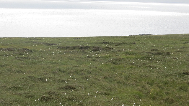
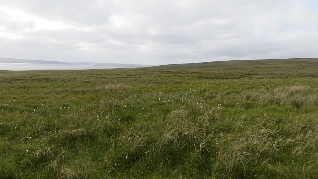
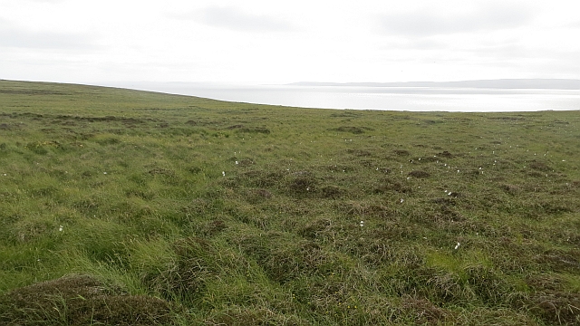
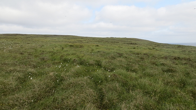
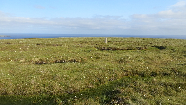
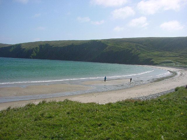
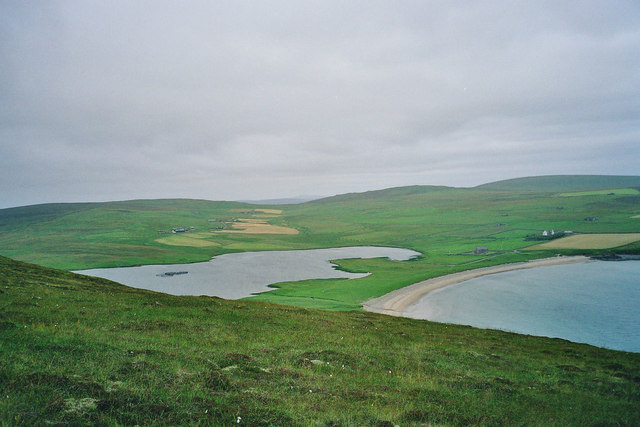
Bresdale is characterized by its diverse landscape, composed of rolling hills, heather moorland, rugged cliffs, and beautiful sandy beaches. The island's highest point, the Ward of Bressay, reaches 226 meters above sea level, offering stunning panoramic views of the surrounding area.

The island is home to a small population of around 400 residents who mainly live in the village of Bressay. The village features a picturesque harbor, a primary school, a community hall, and a local shop. Bressay also has a lighthouse, located at the southern tip of the island, which was built in 1858 and is now automated.

Bresdale is known for its rich historical heritage, with evidence of human occupation dating back thousands of years. The island is home to several archaeological sites, including the Iron Age fort at Cruester and the Pictish broch at the Bard. Visitors can also explore the fascinating Bressay Heritage Centre, which showcases the island's past through displays of artifacts and exhibitions.

Accessible by a short ferry ride from Lerwick, the capital of the Shetland Islands, Bresdale offers visitors a peaceful retreat amidst stunning natural beauty and a glimpse into the island's intriguing history.

If you have any feedback on the listing, please let us know in the comments section below.

Bresdale Images

Images are sourced within 2km of 60.579468/-0.91150828 or Grid Reference HU5988. Thanks to Geograph Open Source API. All images are credited.

Outer Dale, Lambhoga, Fetlar
Looking north from path up to Lamb Hoga There is a very good track from the car park beside Fetlar Kirk up onto Lamb Hoga with views to Out Skerries, Bressay and across the whole of Fetlar.  I had assumed that Lamb Hoga would be pronounced as written but oh no, it's pronounced as a single word "Lahmuga" with the stress on the first sylable "Lahm".
Looking north from path up to Lamb Hoga
There is a very good track from the car park beside Fetlar Kirk up onto Lamb Hoga with views to Out Skerries, Bressay and across the whole of Fetlar. I had assumed that Lamb Hoga would be pronounced as written but oh no, it's pronounced as a single word "Lahmuga" with the stress on the first sylable "Lahm".
The Peat Road The bogs of Lamb Hoga provided Fetlar with high quality fuel. Every year, islanders would move to the peninsula to cast and dry peats. The fuel was then taken off via this road or by boat across to Aith for the eastern side of the island.
 The beach at Tresta is in the background along with Vord Hill.
The Peat Road
The bogs of Lamb Hoga provided Fetlar with high quality fuel. Every year, islanders would move to the peninsula to cast and dry peats. The fuel was then taken off via this road or by boat across to Aith for the eastern side of the island. The beach at Tresta is in the background along with Vord Hill.
Peat Road, Lamb Hoga The route which was used to carry winter fuel off the bogs of Lamb Hoga up to the 1950s.
Peat Road, Lamb Hoga
The route which was used to carry winter fuel off the bogs of Lamb Hoga up to the 1950s.
Bog, Lamb Hoga The west side of Gillis Field which was the source of Fetlar's peat. The moorland is now home to many bonxies and they were pretty mean today.
Bog, Lamb Hoga
The west side of Gillis Field which was the source of Fetlar's peat. The moorland is now home to many bonxies and they were pretty mean today.
Bog, Lamb Hoga Above Rams Ness on the southwest corner of Fetlar. This was the source of much of the island's peat and folk moved here to peat houses for two weeks every year to gather the winter fuel. The peat houses were simple bothies.
Bog, Lamb Hoga
Above Rams Ness on the southwest corner of Fetlar. This was the source of much of the island's peat and folk moved here to peat houses for two weeks every year to gather the winter fuel. The peat houses were simple bothies.
The Dale A shallow reentrant on the boggy Lamb Hoga plateau. There is a view over the Wick of Tresta towards Aithbank where peats cut here were once landed.
The Dale
A shallow reentrant on the boggy Lamb Hoga plateau. There is a view over the Wick of Tresta towards Aithbank where peats cut here were once landed.
The Peat Road Lamb Hoga was the source of Fetlar's peat and this was one of the ways the peat was carried to the crofts. Much of the peat was taken out by boat and landed at Airthbank.
The Peat Road
Lamb Hoga was the source of Fetlar's peat and this was one of the ways the peat was carried to the crofts. Much of the peat was taken out by boat and landed at Airthbank.
Mires of Helliersness Peat bogs on Lamb Hoga
Mires of Helliersness
Peat bogs on Lamb Hoga
Bogs, Lamb Hoga Above Rams Ness on the southwest corner of Fetlar. This was the source of much of the island's peat and folk moved here to peat houses for two weeks every year to gather the winter fuel. Peat was taken out by boat.
Bogs, Lamb Hoga
Above Rams Ness on the southwest corner of Fetlar. This was the source of much of the island's peat and folk moved here to peat houses for two weeks every year to gather the winter fuel. Peat was taken out by boat.
Bogs, Lamb Hoga The source of much of Fetlar's peat. Lamb Hoga contrasts with the centre and east of the island in being covered by blanket bog and having low soil fertility.
Bogs, Lamb Hoga
The source of much of Fetlar's peat. Lamb Hoga contrasts with the centre and east of the island in being covered by blanket bog and having low soil fertility.
Gillis Field Triangulation pillar amongst the bogs.
Gillis Field
Triangulation pillar amongst the bogs.
Gillis Field Triangulation pillar on Lamb Hoga.
Gillis Field
Triangulation pillar on Lamb Hoga.
Gillis Field The higher parts of Lamb Hoga. The peninsula was the source of Fetlar's peat.
Gillis Field
The higher parts of Lamb Hoga. The peninsula was the source of Fetlar's peat.
SW of Tresta towards Silda Wick Looking across the inland end of the Wick of Tresta
SW of Tresta towards Silda Wick
Looking across the inland end of the Wick of Tresta
Papil Water Taken from Fitsyi Field on Lamb Hoga, with Stackaberg (centre) and Vord Hill (right) in the distance.
Papil Water
Taken from Fitsyi Field on Lamb Hoga, with Stackaberg (centre) and Vord Hill (right) in the distance.
Tresta beach, Fetlar The beach at Tresta on Fetlar.
Tresta beach, Fetlar
The beach at Tresta on Fetlar.
Tresta beach, Fetlar One of the longest sandy beaches in Shetland.
Tresta beach, Fetlar
One of the longest sandy beaches in Shetland.
Show me another place!

Bresdale is located at Grid Ref: HU5988 (Lat: 60.579468, Lng: -0.91150828)

Unitary Authority: Shetland Islands

Police Authority: Highlands and Islands

What 3 Words

///refrain.built.fools. Near Houbie, Shetland Islands

Related Wikis

Fetlar

Fetlar (Scots: Fetlar) is one of the North Isles of Shetland, Scotland, with a usually resident population of 61 at the time of the 2011 census. Its main...

Brough Lodge

Brough Lodge is a 19th-century Gothic mansion on Fetlar, one of the Shetland Islands, in northern Scotland. Built by the Nicolson family, who were responsible...

Haltadans

Haltadans, also known as Fairy Ring or Haltadans stone circle, is a stone circle on the island of Fetlar in Shetland, Scotland. This site is a ring of...

Funzie Girt

Funzie Girt (; Scots: Funyie Girt "Finns' dyke") is an ancient dividing wall that was erected from north to south across the island of Fetlar in Shetland...

Hascosay

Hascosay (Scots: Hascosay; Old Norse "Hafskotsey") is a small island lying between Yell and Fetlar in the Shetland Islands, Scotland. == Geography and... ==

Hamars Ness

Hamars Ness is a headland on the island of Fetlar in Shetland, Scotland. The name is from the Old Norse Hamarsnes meaning "craggy headland". A ro-ro ferry...

Urie Lingey

For other islands with similar names, see Linga (disambiguation) Urie Lingey is one of the Shetland Islands. It is between Fetlar and Unst, and Yell is...

Aywick

Aywick is a small settlement on the east side of Yell, an island forming part of the Shetland Islands north of Scotland.The naturalist Bobby Tulloch was...

Have you been to Bresdale?

Leave your review of Bresdale below (or comments, questions and feedback).