Sand Geo

Coastal Feature, Headland, Point in Shetland

Scotland

Sand Geo

Skaw Taing, Whalsay Out Skerries in the distance.
Skaw Taing, Whalsay Credit: Mike Pennington

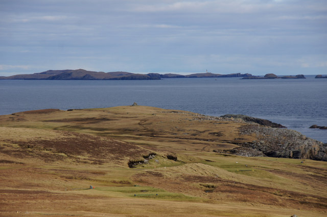
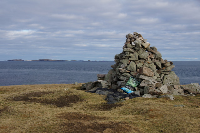
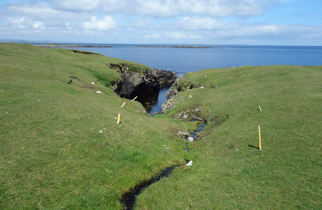
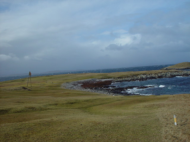
Sand Geo is a prominent coastal feature located on the island of Shetland, Scotland. It is classified as a headland or point, extending out into the North Sea. The geo is situated on the eastern side of Shetland, approximately 3 miles south of the town of Lerwick.

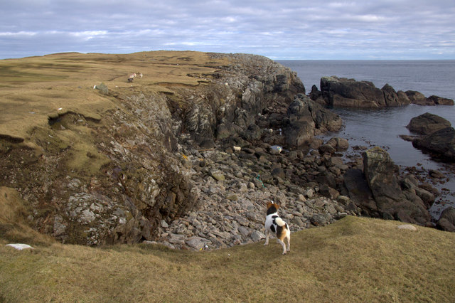
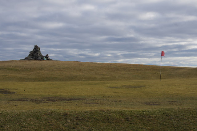
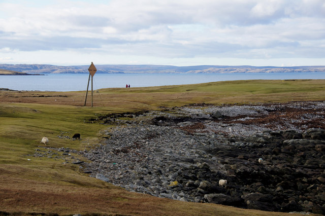
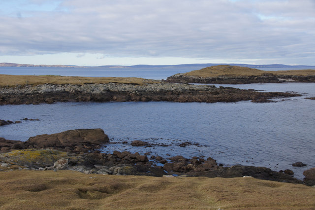
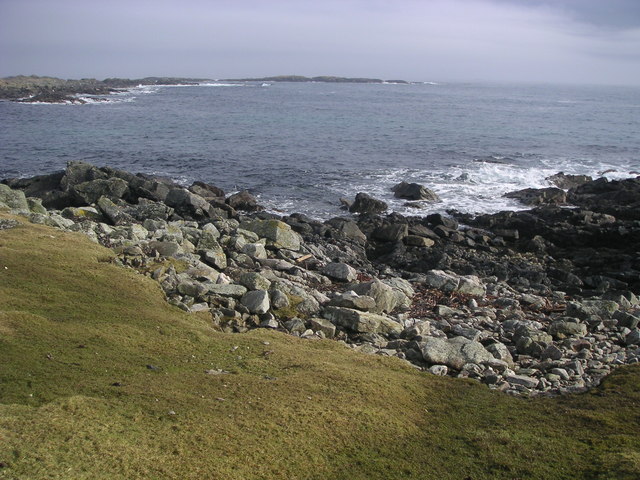
Sand Geo is characterized by its distinctive sandy beach, which stretches for about 200 meters. The beach is composed of fine golden sand and is surrounded by rocky cliffs, adding to the area's natural beauty. The cliffs rise to heights of up to 30 meters and are made up of sedimentary rocks, showcasing layers of different colors and textures.

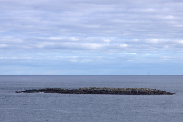
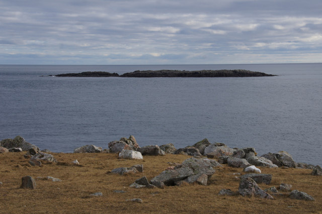
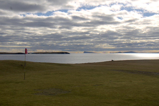
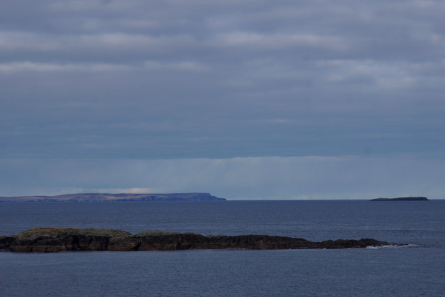
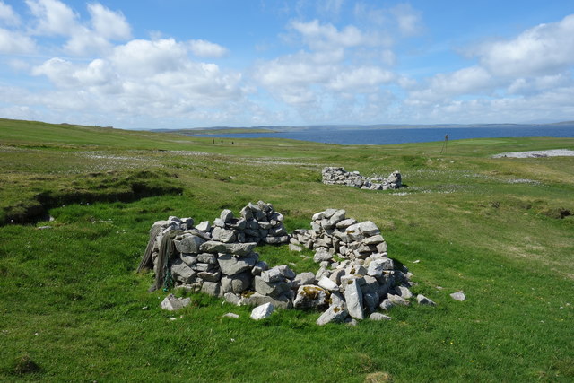
The geo provides an ideal vantage point to observe the rugged coastline and the vast expanse of the North Sea. It is a popular spot for both locals and visitors, who come to enjoy the stunning views and the tranquility of the surrounding landscape.

The area surrounding Sand Geo is home to a diverse range of wildlife, including seabirds, seals, and occasionally even dolphins and whales. The beach is an important nesting site for various bird species, making it a haven for birdwatchers.

Access to Sand Geo is relatively easy, with a well-maintained footpath leading from the nearby road down to the beach. The geo is also a starting point for several coastal walks, providing opportunities for exploration and discovery along the Shetland coastline.

Overall, Sand Geo is a breathtaking coastal feature that offers a combination of sandy beach, dramatic cliffs, and abundant wildlife, making it a must-visit destination for nature enthusiasts and those seeking a serene coastal experience.

If you have any feedback on the listing, please let us know in the comments section below.

Sand Geo Images

Images are sourced within 2km of 60.382005/-0.91782993 or Grid Reference HU5966. Thanks to Geograph Open Source API. All images are credited.

Skaw Taing, Whalsay Out Skerries in the distance.
Skaw Taing, Whalsay
Out Skerries in the distance.
Nacka Skerry, off Skaw, Whalsay
Millsie Geo, Skaw, Whalsay
Nacka Skerry from Skaw, Whalsay
Cairn at Skaw Taing, Whalsay Out Skerries in the background.
Cairn at Skaw Taing, Whalsay
Out Skerries in the background.
Outermost green on the Skaw golf course, Whalsay Noss and Bressay on the horizon.
Outermost green on the Skaw golf course, Whalsay
Noss and Bressay on the horizon.
Cairn and golf green at Skaw Taing, Whalsay
Outer Holm of Skaw, Whalsay In the distance, Fetlar on the left and Muckle Skerry on the right.
Outer Holm of Skaw, Whalsay
In the distance, Fetlar on the left and Muckle Skerry on the right.
Easter Netlar, Skaw, Whalsay The pole marks the point where the sub-sea electricity cable leaves for Out Skerries.
Easter Netlar, Skaw, Whalsay
The pole marks the point where the sub-sea electricity cable leaves for Out Skerries.
View across Easter Netlar to Sponger Point and Inner Holm of Skaw
Planticrubs near the Sea Old enclosures for vegetable cultivation.
Planticrubs near the Sea
Old enclosures for vegetable cultivation.
Golf by the Sea The golf ball loss on this course must be considerable. Just walking around the edge we were finding balls all over the place in streams and rock pools. That's not counting the ones that have sunk in a bog or are rolling around on the sea bed.
This is the northernmost point of Whalsay, with the Inner Holm of Skaw beyond.
Golf by the Sea
The golf ball loss on this course must be considerable. Just walking around the edge we were finding balls all over the place in streams and rock pools. That's not counting the ones that have sunk in a bog or are rolling around on the sea bed. This is the northernmost point of Whalsay, with the Inner Holm of Skaw beyond.
Small Stream at Pundsi Geo Another water hazard for the golfers on Whalsay Golf Course, this rivulet drains a small pond right out on the headland. It's a tiny catchment, can't be more than a few hundred square metres, but it's flowing nicely.
Small Stream at Pundsi Geo
Another water hazard for the golfers on Whalsay Golf Course, this rivulet drains a small pond right out on the headland. It's a tiny catchment, can't be more than a few hundred square metres, but it's flowing nicely.
Nacka Skerry, Whalsay
Nista, Whalsay
Nista, Whalsay
Skaw Taing, Whalsay, Shetland The 11th green on the Whalsay Golf Club with the cairn at Skaw Taing behind and the islands of Out Skerries on the skyline.
Skaw Taing, Whalsay, Shetland
The 11th green on the Whalsay Golf Club with the cairn at Skaw Taing behind and the islands of Out Skerries on the skyline.
Easter Netlar, Whalsay, Shetland The small bay of Easter Netlar, with the marker pole showing where the electricity  cable to the Out Skerries goes into the sea.
Easter Netlar, Whalsay, Shetland
The small bay of Easter Netlar, with the marker pole showing where the electricity cable to the Out Skerries goes into the sea.
Rocky beach at Easter Netlar, Whalsay.
Show me another place!

Sand Geo is located at Grid Ref: HU5966 (Lat: 60.382005, Lng: -0.91782993)

Unitary Authority: Shetland Islands

Police Authority: Highlands and Islands

What 3 Words

///endlessly.galloping.shots. Near Symbister, Shetland Islands

Related Wikis

Skaw, Whalsay

Skaw is a village in the extreme northeast of Whalsay in the parish of Nesting in the Shetland Islands of Scotland. It is mainly a crofting area. Whalsay...

Inner Holm of Skaw

The Inner Holm of Skaw is a small, uninhabited islet off the northern tip of the island of Whalsay, in the Shetland Islands of Scotland, north of the village...

Whalsay Airstrip

Whalsay Airstrip is located at the village of Skaw in the northern end of the island of Whalsay, Shetland, Scotland. It is the only airfield serving the...

Outer Holm of Skaw

The Outer Holm of Skaw is a small, uninhabited islet, a rock outlier off the northeast coast of the island of Whalsay, in the Shetland Islands of Scotland...

Nista

Nista is a small islet of the Shetland Islands of Scotland, situated roughly 2 kilometres (1.2 mi) east off the coast of Whalsay. It lies to the north...

West Loch of Skaw

West Loch of Skaw is a loch of northern-central Whalsay, Shetland Islands, Scotland, to the southwest of the village of Skaw, Whalsay. == References ==

Standing Stones of Yoxie

The Standing Stones of Yoxie is a Neolithic site in the parish of Nesting on the northeastern coast of Whalsay, in the Shetland islands of Scotland. It...

Benie Hoose

Benie Hoose, also Bunyie Hoose, is a Neolithic site in the parish of Nesting, northeastern Whalsay, in the Shetland Islands of Scotland. It is located...

Nearby Amenities

Located within 500m of 60.382005,-0.91782993
Power: pole
Lat/Long: 60.3808959/-0.9162441
Power: pole
Lat/Long: 60.3806258/-0.9173121
Power: pole
Lat/Long: 60.3803308/-0.9184888
Power: pole
Lat/Long: 60.3800262/-0.9196823
Power: pole
Lat/Long: 60.3797382/-0.9207894
Power: pole
Lat/Long: 60.3794129/-0.9220498
Power: pole
Lat/Long: 60.3792806/-0.923352
The data included in this document is from www.openstreetmap.org. The data is made available under ODbL.

Have you been to Sand Geo?

Leave your review of Sand Geo below (or comments, questions and feedback).