South Bratta Geo
Coastal Feature, Headland, Point in Shetland
Scotland
South Bratta Geo

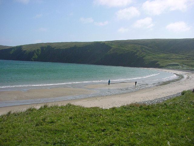
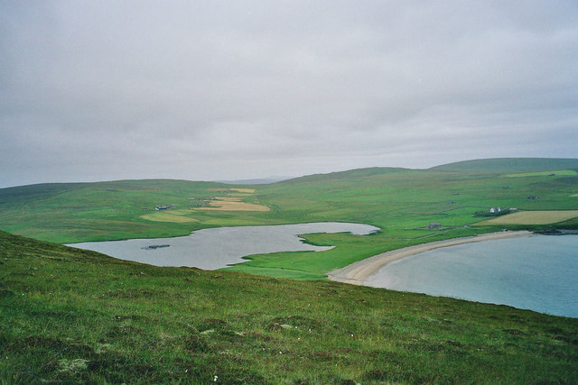
South Bratta Geo, located in the Shetland Islands, is a picturesque coastal feature renowned for its dramatic cliffs and stunning natural beauty. Situated on the west coast of Shetland, this headland juts out into the North Sea, offering breathtaking views of the surrounding landscape.
The cliffs of South Bratta Geo rise majestically from the ocean, reaching impressive heights of up to 200 feet. Composed mainly of sedimentary rocks, these cliffs showcase stunning geological formations, including layers of sandstone and shale. The erosion caused by the relentless pounding of the waves has carved intricate patterns and caves into the rock face, adding to the area's allure.
Visitors to South Bratta Geo can enjoy a leisurely stroll along the cliff-top path, which offers panoramic vistas of the sea and the rugged coastline. The area is a haven for birdwatchers, with various seabirds nesting on the cliffs, including puffins, guillemots, and fulmars. The crashing waves and bracing sea air make it an ideal spot for nature enthusiasts and photographers seeking to capture the wild and untamed beauty of the Shetland Islands.
Due to its exposed location, South Bratta Geo can be subject to strong winds and rough seas, making it essential for visitors to exercise caution. However, its remote and unspoiled nature only adds to its charm, providing a truly immersive experience in the wild and untamed beauty of the Shetland coastline.
Overall, South Bratta Geo is a captivating coastal feature that showcases the raw power and beauty of nature. Its towering cliffs, stunning geological formations, and diverse wildlife make it a must-visit destination for those seeking a unique and awe-inspiring experience in the Shetland Islands.
If you have any feedback on the listing, please let us know in the comments section below.
South Bratta Geo Images
Images are sourced within 2km of 60.588331/-0.9193334 or Grid Reference HU5989. Thanks to Geograph Open Source API. All images are credited.


South Bratta Geo is located at Grid Ref: HU5989 (Lat: 60.588331, Lng: -0.9193334)
Unitary Authority: Shetland Islands
Police Authority: Highlands and Islands
What 3 Words
///regulate.unpainted.unwanted. Near Houbie, Shetland Islands
Nearby Locations
Related Wikis

Brough Lodge
Brough Lodge is a 19th-century Gothic mansion on Fetlar, one of the Shetland Islands, in northern Scotland. Built by the Nicolson family, who were responsible...

Fetlar
Fetlar (Scots: Fetlar) is one of the North Isles of Shetland, Scotland, with a usually resident population of 61 at the time of the 2011 census. Its main...

Haltadans
Haltadans, also known as Fairy Ring or Haltadans stone circle, is a stone circle on the island of Fetlar in Shetland, Scotland. This site is a ring of...

Hascosay
Hascosay (Scots: Hascosay; Old Norse "Hafskotsey") is a small island lying between Yell and Fetlar in the Shetland Islands, Scotland. == Geography and... ==

Funzie Girt
Funzie Girt (; Scots: Funyie Girt "Finns' dyke") is an ancient dividing wall that was erected from north to south across the island of Fetlar in Shetland...

Hamars Ness
Hamars Ness is a headland on the island of Fetlar in Shetland, Scotland. The name is from the Old Norse Hamarsnes meaning "craggy headland". A ro-ro ferry...

Urie Lingey
For other islands with similar names, see Linga (disambiguation) Urie Lingey is one of the Shetland Islands. It is between Fetlar and Unst, and Yell is...

Aywick
Aywick is a small settlement on the east side of Yell, an island forming part of the Shetland Islands north of Scotland.The naturalist Bobby Tulloch was...
Have you been to South Bratta Geo?
Leave your review of South Bratta Geo below (or comments, questions and feedback).