Head of Bresdale

Coastal Feature, Headland, Point in Shetland

Scotland

Head of Bresdale

Outer Dale, Lambhoga, Fetlar
Outer Dale, Lambhoga, Fetlar Credit: Mike Pennington

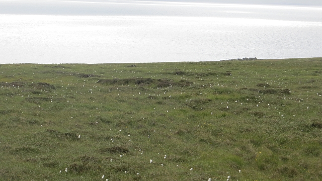
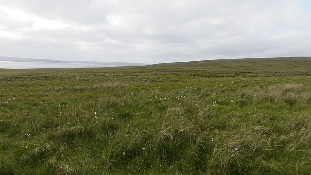
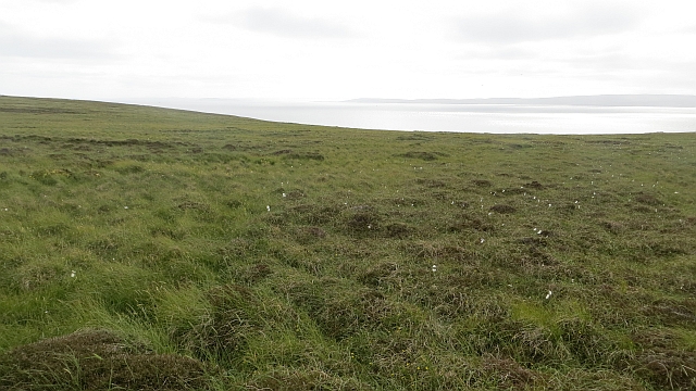
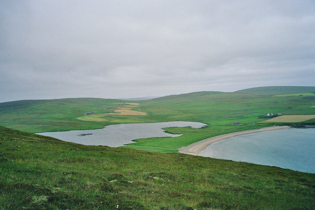
Head of Bresdale is a prominent coastal feature located on the northeastern coast of Shetland, a group of islands in Scotland. It is a headland that stretches out into the North Sea, forming a distinct point that juts out from the surrounding landscape.

The headland is characterized by its rugged and dramatic cliffs, which rise steeply from the sea, reaching heights of up to 100 meters in some areas. These cliffs are composed of layers of sedimentary rocks, including sandstone and shale, which have been shaped by erosion over millions of years. The constant battering of the waves against the cliffs has resulted in the formation of sea caves, arches, and stacks along the shoreline.

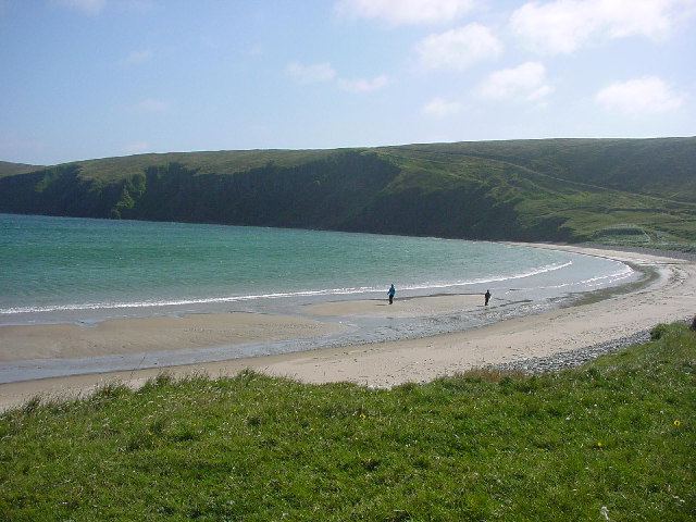
Head of Bresdale offers breathtaking views of the surrounding coastline and the vast expanse of the North Sea. On clear days, it is possible to see the distant outlines of other Shetland islands, such as Muckle Roe and Fetlar. The headland is also a popular spot for birdwatchers, as it provides an ideal vantage point for observing a variety of seabirds, including puffins, guillemots, and fulmars.

Access to Head of Bresdale is relatively easy, with a well-maintained footpath leading from the nearby village of Bressay. The headland is a designated nature reserve, managed by local conservation organizations, and visitors are encouraged to follow designated paths to minimize disruption to the fragile coastal ecosystem.

Overall, Head of Bresdale is a stunning and significant coastal feature in Shetland, known for its dramatic cliffs, panoramic views, and diverse birdlife.

If you have any feedback on the listing, please let us know in the comments section below.

Head of Bresdale Images

Images are sourced within 2km of 60.580902/-0.91328512 or Grid Reference HU5989. Thanks to Geograph Open Source API. All images are credited.

Outer Dale, Lambhoga, Fetlar
Looking north from path up to Lamb Hoga There is a very good track from the car park beside Fetlar Kirk up onto Lamb Hoga with views to Out Skerries, Bressay and across the whole of Fetlar.  I had assumed that Lamb Hoga would be pronounced as written but oh no, it's pronounced as a single word "Lahmuga" with the stress on the first sylable "Lahm".
Looking north from path up to Lamb Hoga
There is a very good track from the car park beside Fetlar Kirk up onto Lamb Hoga with views to Out Skerries, Bressay and across the whole of Fetlar. I had assumed that Lamb Hoga would be pronounced as written but oh no, it's pronounced as a single word "Lahmuga" with the stress on the first sylable "Lahm".
The Peat Road The bogs of Lamb Hoga provided Fetlar with high quality fuel. Every year, islanders would move to the peninsula to cast and dry peats. The fuel was then taken off via this road or by boat across to Aith for the eastern side of the island.
 The beach at Tresta is in the background along with Vord Hill.
The Peat Road
The bogs of Lamb Hoga provided Fetlar with high quality fuel. Every year, islanders would move to the peninsula to cast and dry peats. The fuel was then taken off via this road or by boat across to Aith for the eastern side of the island. The beach at Tresta is in the background along with Vord Hill.
Peat Road, Lamb Hoga The route which was used to carry winter fuel off the bogs of Lamb Hoga up to the 1950s.
Peat Road, Lamb Hoga
The route which was used to carry winter fuel off the bogs of Lamb Hoga up to the 1950s.
Bog, Lamb Hoga The west side of Gillis Field which was the source of Fetlar's peat. The moorland is now home to many bonxies and they were pretty mean today.
Bog, Lamb Hoga
The west side of Gillis Field which was the source of Fetlar's peat. The moorland is now home to many bonxies and they were pretty mean today.
Bog, Lamb Hoga Above Rams Ness on the southwest corner of Fetlar. This was the source of much of the island's peat and folk moved here to peat houses for two weeks every year to gather the winter fuel. The peat houses were simple bothies.
Bog, Lamb Hoga
Above Rams Ness on the southwest corner of Fetlar. This was the source of much of the island's peat and folk moved here to peat houses for two weeks every year to gather the winter fuel. The peat houses were simple bothies.
The Dale A shallow reentrant on the boggy Lamb Hoga plateau. There is a view over the Wick of Tresta towards Aithbank where peats cut here were once landed.
The Dale
A shallow reentrant on the boggy Lamb Hoga plateau. There is a view over the Wick of Tresta towards Aithbank where peats cut here were once landed.
The Peat Road Lamb Hoga was the source of Fetlar's peat and this was one of the ways the peat was carried to the crofts. Much of the peat was taken out by boat and landed at Airthbank.
The Peat Road
Lamb Hoga was the source of Fetlar's peat and this was one of the ways the peat was carried to the crofts. Much of the peat was taken out by boat and landed at Airthbank.
Mires of Helliersness Peat bogs on Lamb Hoga
Mires of Helliersness
Peat bogs on Lamb Hoga
Bogs, Lamb Hoga Above Rams Ness on the southwest corner of Fetlar. This was the source of much of the island's peat and folk moved here to peat houses for two weeks every year to gather the winter fuel. Peat was taken out by boat.
Bogs, Lamb Hoga
Above Rams Ness on the southwest corner of Fetlar. This was the source of much of the island's peat and folk moved here to peat houses for two weeks every year to gather the winter fuel. Peat was taken out by boat.
SW of Tresta towards Silda Wick Looking across the inland end of the Wick of Tresta
SW of Tresta towards Silda Wick
Looking across the inland end of the Wick of Tresta
Papil Water Taken from Fitsyi Field on Lamb Hoga, with Stackaberg (centre) and Vord Hill (right) in the distance.
Papil Water
Taken from Fitsyi Field on Lamb Hoga, with Stackaberg (centre) and Vord Hill (right) in the distance.
Tresta beach, Fetlar The beach at Tresta on Fetlar.
Tresta beach, Fetlar
The beach at Tresta on Fetlar.
The Old Manse, Tresta, Fetlar The old manse has a tree-filled garden and is just above the kirk which is between the Wick of Tresta and Papil Water. The peninsula of Lambhoga is in the distance.
The Old Manse, Tresta, Fetlar
The old manse has a tree-filled garden and is just above the kirk which is between the Wick of Tresta and Papil Water. The peninsula of Lambhoga is in the distance.
The Old Manse, Tresta, Fetlar From the Tresta beach car park, showing the sycamores in the garden.
The Old Manse, Tresta, Fetlar
From the Tresta beach car park, showing the sycamores in the garden.
Tresta beach, Fetlar One of the longest sandy beaches in Shetland.
Tresta beach, Fetlar
One of the longest sandy beaches in Shetland.
Garths of Tresta, Fetlar A creel boat off the small headland to the east of Tresta beach.
Garths of Tresta, Fetlar
A creel boat off the small headland to the east of Tresta beach.
Peat-track from Lambhoga to Tresta, Fetlar The track visible passing through the dunes at the far end of Tresta beach, before heading at an angle up the side of the hill of Fitsyi Field was used by ponies bringing peats from the Lamb Hoga peninsula back to Tresta and other townships.
Peat-track from Lambhoga to Tresta, Fetlar
The track visible passing through the dunes at the far end of Tresta beach, before heading at an angle up the side of the hill of Fitsyi Field was used by ponies bringing peats from the Lamb Hoga peninsula back to Tresta and other townships.
Show me another place!

Head of Bresdale is located at Grid Ref: HU5989 (Lat: 60.580902, Lng: -0.91328512)

Unitary Authority: Shetland Islands

Police Authority: Highlands and Islands

What 3 Words

///driving.lakeside.goofy. Near Houbie, Shetland Islands

Related Wikis

Fetlar

Fetlar is one of the North Isles of Shetland, Scotland, with a usually resident population of 61 at the time of the 2011 census. Its main settlement is...

Brough Lodge

Brough Lodge is a 19th-century Gothic mansion on Fetlar, one of the Shetland Islands, in northern Scotland. Built by the Nicolson family, who were responsible...

Haltadans

Haltadans, also known as Fairy Ring or Haltadans stone circle, is a stone circle on the island of Fetlar in Shetland, Scotland. This site is a ring of...

Funzie Girt

Funzie Girt (; Scots: Funyie Girt "Finns' dyke") is an ancient dividing wall that was erected from north to south across the island of Fetlar in Shetland...

Have you been to Head of Bresdale?

Leave your review of Head of Bresdale below (or comments, questions and feedback).