Sandy Geos
Coastal Feature, Headland, Point in Shetland
Scotland
Sandy Geos
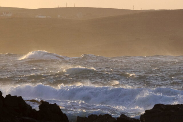
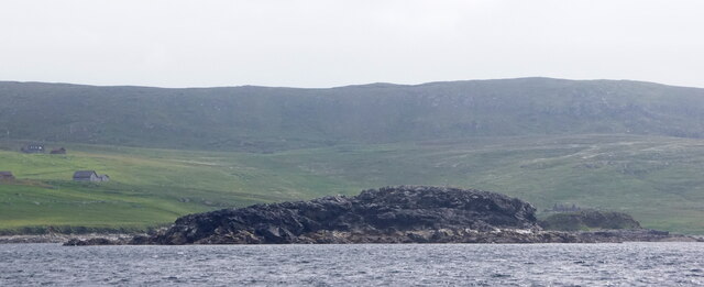
Sandy Geos is a prominent coastal feature located on the island of Shetland, which is part of Scotland. It is specifically categorized as a headland or a point, as it juts out into the North Sea, forming a distinctive and visually striking landform.
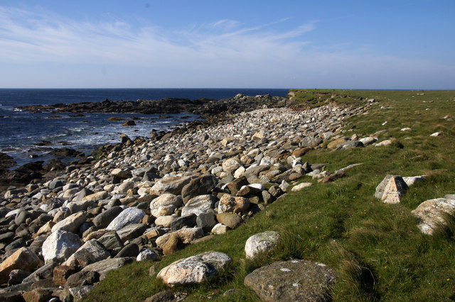
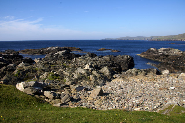
Sandy Geos is characterized by its sandy beaches and steep cliffs, which add to its beauty and appeal. The headland stretches for approximately 1 kilometer along the coastline, providing a picturesque view of the surrounding waters and landscape. The sandy beaches offer a lovely spot for relaxation, beachcombing, and enjoying the natural scenery.
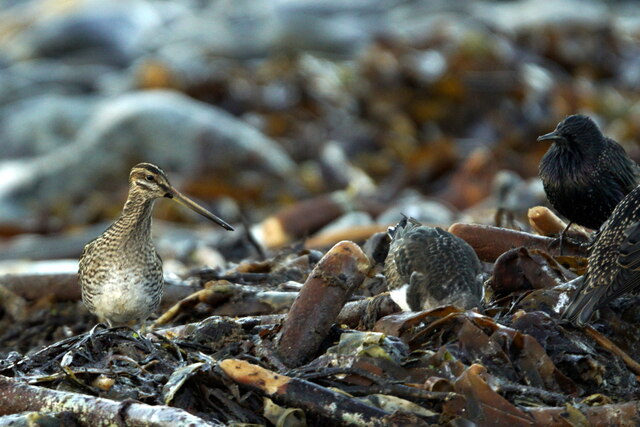
The headland is also home to a variety of wildlife, including seabirds such as fulmars, guillemots, and puffins. It serves as an important breeding ground for these species, making it a popular destination for birdwatching enthusiasts.
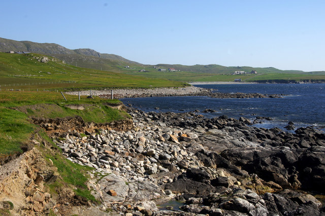
Access to Sandy Geos is relatively easy, with a well-maintained footpath leading visitors to the headland from the nearby coastal village. There are also parking facilities available for those arriving by car.
Furthermore, Sandy Geos is a site of geological significance, as it showcases the unique rock formations and layers that are found in the region. These geological features provide valuable insights into the area's geological history and contribute to its scientific importance.
Overall, Sandy Geos is a captivating coastal feature that offers visitors a combination of natural beauty, wildlife viewing opportunities, and geological interest. Its sandy beaches, steep cliffs, and diverse ecosystem make it a must-visit destination for nature lovers and geology enthusiasts alike.
If you have any feedback on the listing, please let us know in the comments section below.
Sandy Geos Images
Images are sourced within 2km of 60.726378/-0.96194332 or Grid Reference HP5605. Thanks to Geograph Open Source API. All images are credited.


Sandy Geos is located at Grid Ref: HP5605 (Lat: 60.726378, Lng: -0.96194332)
Unitary Authority: Shetland Islands
Police Authority: Highlands and Islands
What 3 Words
///clues.adjusting.motion. Near Uyeasound, Shetland Islands
Nearby Locations
Related Wikis

Brough Holm
Brough Holm is a small island off Unst, in the North Isles of Shetland. It is off Westing, which as the name implies is on the west coast of Unst. The...

Society of Our Lady of the Isles
The Society of Our Lady of the Isles (SOLI) is a small Anglican religious order for women, founded in the late 20th century. It is located in Shetland...

St Olaf's Church, Unst
St Olaf's Church, Unst is a ruined medieval church located on the island of Unst, in Shetland, Scotland, UK. The church was built in the Celtic style,...

Cullivoe
Cullivoe (Old Norse: Kollavágr - Bay of Kolli), is a village on Yell in the Shetland Islands. It is in the north east of the island, near Bluemull Sound...

Belmont House, Shetland
Belmont House is a neo classical Georgian Country House Estate on the island of Unst, the most northerly of the Shetland Islands, [United Kingdom] and...
Unst
Unst (; Scots: Unst; Norn: Ønst) is one of the North Isles of the Shetland Islands, Scotland. It is the northernmost of the inhabited British Isles and...

1992 New Year's Day Storm
The New Year's Day Storm (Norwegian: Nyttårsorkanen), known in Scotland as the 'Hogmanay Hurricane', was an intense European windstorm that affected much...
Belmont, Shetland
Belmont is a settlement and ferry terminal in southern Unst in the Shetland Islands. The ferry crosses from here to Gutcher in Yell and to Hamars Ness...
Nearby Amenities
Located within 500m of 60.726378,-0.96194332Have you been to Sandy Geos?
Leave your review of Sandy Geos below (or comments, questions and feedback).