Whale Geo

Coastal Feature, Headland, Point in Shetland

Scotland

Whale Geo

Killer Whales (Orcinus orca) passing Gutcher Taken from Belmont on Unst.
Killer Whales (Orcinus orca) passing Gutcher Credit: Mike Pennington

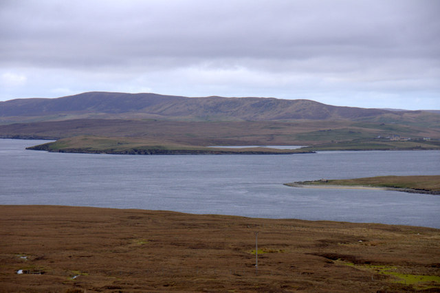
Whale Geo is a prominent coastal feature located in Shetland, a group of islands in Scotland. This geographical formation is a headland that extends into the North Sea, forming a distinctive point that juts out into the water. It is situated on the eastern coast of the Shetland Mainland, near the village of Sumburgh.

Whale Geo derives its name from its unique shape, resembling the profile of a whale when viewed from a distance. The headland is characterized by steep cliffs that rise dramatically from the sea, providing a striking coastal scenery. The rugged and rocky shoreline is interspersed with small coves and inlets, adding to the area's natural beauty.

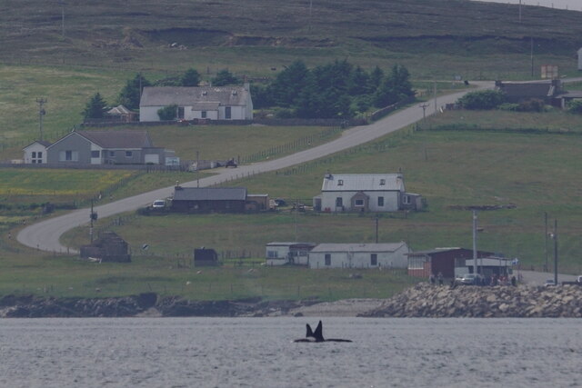
The location of Whale Geo makes it an ideal spot for birdwatching and wildlife observation. The cliffs provide nesting sites for various seabirds, including puffins, guillemots, and razorbills. Visitors can witness these magnificent creatures perched on the ledges or diving into the sea in search of food. Additionally, whales and dolphins can often be spotted swimming near the headland, making it a popular destination for marine animal enthusiasts.

The surrounding area of Whale Geo is also steeped in history. Archaeological sites, such as ancient settlements and burial grounds, can be found nearby, offering a glimpse into the region's past. The headland's strategic location has also made it an important landmark for navigation throughout history.

In conclusion, Whale Geo in Shetland is a captivating coastal feature characterized by its distinctive headland and point, resembling a whale's profile. With its stunning cliffs, diverse birdlife, and historical significance, it offers a unique and memorable experience for visitors.

If you have any feedback on the listing, please let us know in the comments section below.
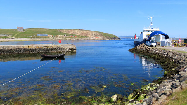
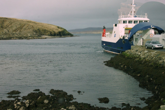
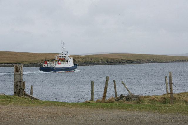
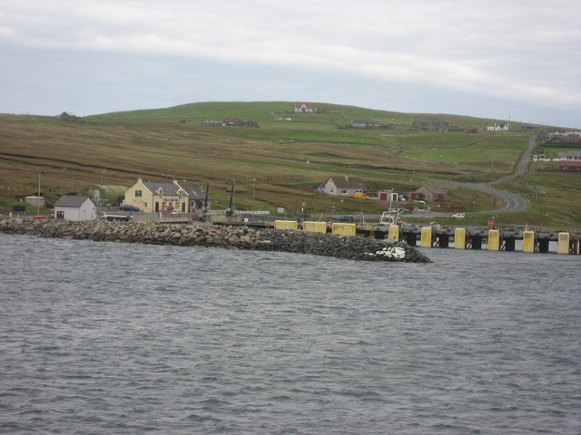
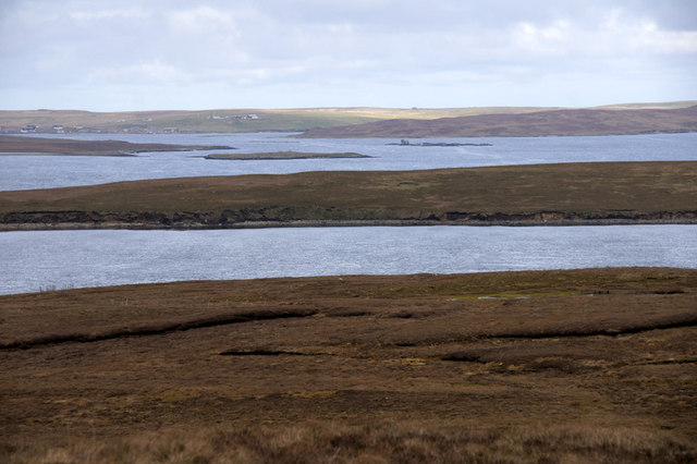
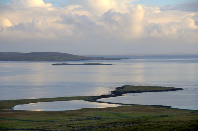
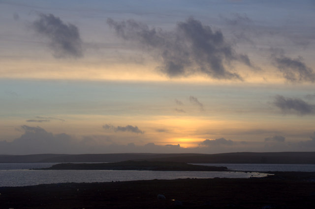
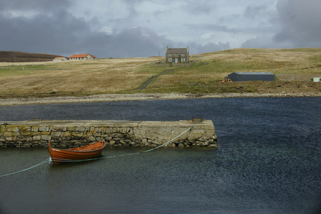
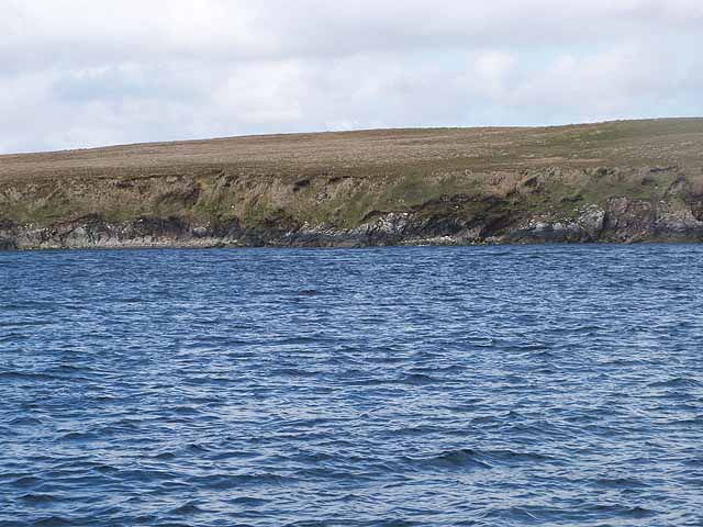
Whale Geo Images

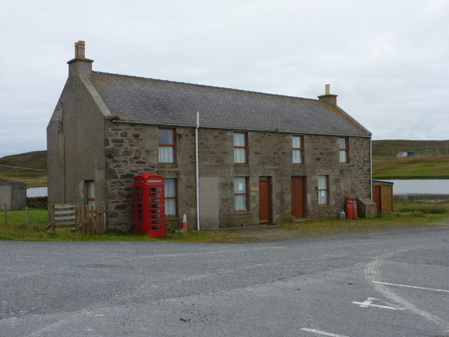
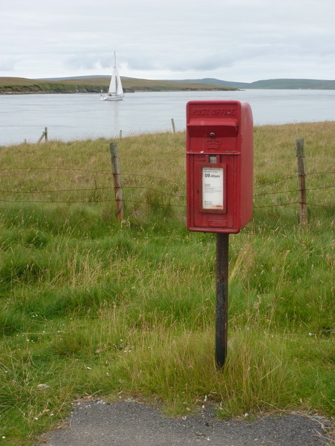
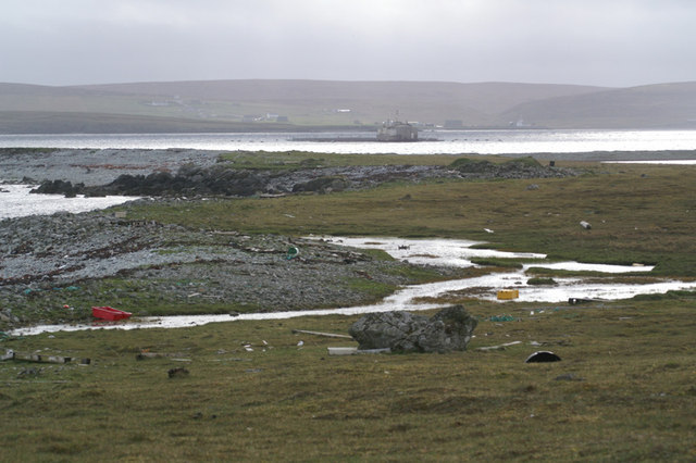
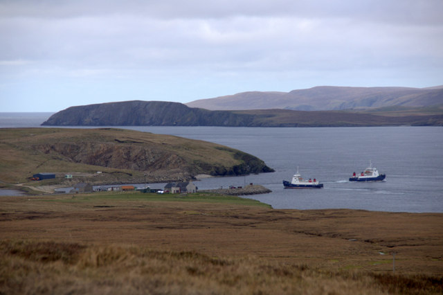
Images are sourced within 2km of 60.662565/-0.97005352 or Grid Reference HU5698. Thanks to Geograph Open Source API. All images are credited.

Killer Whales (Orcinus orca) passing Gutcher Taken from Belmont on Unst.
Killer Whales (Orcinus orca) passing Gutcher
Taken from Belmont on Unst.
MV Merete Chris at Gutcher quarry The Danish-registered ship, which is apparently a suction dredger, taking on rocks from the Gutcher quarry, using a grab on a crane on a vehicle which has been placed on the deck. There is not quay or pier here, the ship has just come as close inshore as it can.
MV Merete Chris at Gutcher quarry
The Danish-registered ship, which is apparently a suction dredger, taking on rocks from the Gutcher quarry, using a grab on a crane on a vehicle which has been placed on the deck. There is not quay or pier here, the ship has just come as close inshore as it can.
Loch of Heogland and Gallow Hill
Heogland from Point of Burkwell
Gutcher pier, Yell Gutcher ferry terminal, from where the ferry connecting Yell with Unst operates. The Head of Gutcher lies across the Wick of Gutcher. Yell, Shetland
Gutcher pier, Yell
Gutcher ferry terminal, from where the ferry connecting Yell with Unst operates. The Head of Gutcher lies across the Wick of Gutcher. Yell, Shetland
MV Bigga at Gutcher The Bluemull Sound ferry awaiting its departure.
MV Bigga at Gutcher
The Bluemull Sound ferry awaiting its departure.
Ferry departing Gutcher for Fetlar
Wick of Gutcher
Wick of Gutcher
Gutcher: the old post office The telephone box is a clue but not definite proof that this was once a post office - but it was; see <a href="https://www.geograph.org.uk/photo/628286">HU5499 : Gutcher</a>. The postbox has been moved across the road since the closure of the post office in 2006 (see <a href="https://www.geograph.org.uk/photo/2632515">HU5499 : Gutcher: postbox № ZE2 95</a>).
Gutcher: the old post office
The telephone box is a clue but not definite proof that this was once a post office - but it was; see HU5499 : Gutcher. The postbox has been moved across the road since the closure of the post office in 2006 (see HU5499 : Gutcher: postbox № ZE2 95).
Gutcher: postbox № ZE2 95 This postbox has been moved across the road from <a href="https://www.geograph.org.uk/photo/2632507">HU5499 : Gutcher: the old post office</a> since the closure of the post office. It is emptied at 9:45am daily except Sunday.

See <a href="https://www.geograph.org.uk/photo/628286">HU5499 : Gutcher</a> for a picture of the operational post office with the postbox outside.
Gutcher: postbox № ZE2 95
This postbox has been moved across the road from HU5499 : Gutcher: the old post office since the closure of the post office. It is emptied at 9:45am daily except Sunday. See HU5499 : Gutcher for a picture of the operational post office with the postbox outside.
Narrow strip of land between Loch of Heogland and the sea Looking across towards Yell.
Narrow strip of land between Loch of Heogland and the sea
Looking across towards Yell.
Ferries at Gutcher MV Bigga and MV Geira exchanging positions at Gutcher ferry terminal on Yell. In the background is Unst, with the headland of Blue Mull and the ridge of Valla Field.
Ferries at Gutcher
MV Bigga and MV Geira exchanging positions at Gutcher ferry terminal on Yell. In the background is Unst, with the headland of Blue Mull and the ridge of Valla Field.
View across Bluemull Sound from the Hill of Gutcher Yell in the foreground, the north end of Linga in the sound and Unst in the distance, with Loch of Belmont in the centre and the Valla Field ridge in the background.
View across Bluemull Sound from the Hill of Gutcher
Yell in the foreground, the north end of Linga in the sound and Unst in the distance, with Loch of Belmont in the centre and the Valla Field ridge in the background.
View to Uyeasound from the Hill of Gutcher Looking from Yell in the foreground and across Linga to the Holm of Heogland off the coast of Unst. Uyea Sound, separating Uyea from Unst, is beyond Heogland, and the settlement of Uyeasound is visible on the far left.
View to Uyeasound from the Hill of Gutcher
Looking from Yell in the foreground and across Linga to the Holm of Heogland off the coast of Unst. Uyea Sound, separating Uyea from Unst, is beyond Heogland, and the settlement of Uyeasound is visible on the far left.
Heogland from Gallow Hill The Loch of Heogland and the Holm of Heogland. In the background is the island of Sound Gruney and the west end of Fetlar.
Heogland from Gallow Hill
The Loch of Heogland and the Holm of Heogland. In the background is the island of Sound Gruney and the west end of Fetlar.
Sunset behind Holm of Heogland
Boat tied up at Gutcher pier
West coast of Linga Uninhabited island at the south end of Bluemull Sound between Yell and Unst (but nearer to Yell).
West coast of Linga
Uninhabited island at the south end of Bluemull Sound between Yell and Unst (but nearer to Yell).
Show me another place!

Whale Geo is located at Grid Ref: HU5698 (Lat: 60.662565, Lng: -0.97005352)

Unitary Authority: Shetland Islands

Police Authority: Highlands and Islands

What 3 Words

///restriction.skis.following. Near Gutcher, Shetland Islands

Nearby Locations

Salt Skerries Whale Geo

Related Wikis

Linga, Bluemull Sound

Linga is a very small uninhabited island in the Bluemull Sound, Shetland, Scotland. It is one of many islands in Shetland called Linga. It has an area...

North Isles

The North Isles are the northern islands of the Shetland Islands, Scotland. The main islands in the group are Yell, Unst and Fetlar. Sometimes the islands...

Gutcher

Gutcher is a settlement on the northeast coast of Yell in the Shetland islands. From here, rollon/roll off ferry services to Belmont on Unst and Hamars...

Belmont, Shetland

Belmont is a settlement and ferry terminal in southern Unst in the Shetland Islands. The ferry crosses from here to Gutcher in Yell and to Hamars Ness...

Sound Gruney

For other islands with similar names, see Gruney (disambiguation) Sound Gruney is one of the Shetland islands. It lies about 1.5 kilometres (0.93 mi)...

Burra Ness Broch

Burra Ness Broch is an iron-age broch located on the east coast of the island of Yell, Shetland, Scotland. == Location == Burra Ness Broch (grid reference...

Bluemull Sound

Bluemull Sound is the strait between Unst and Yell in Shetland's North Isles. A ferry service crosses it regularly. Cullivoe is on the Yell side, and the...

Belmont House, Shetland

Belmont House is a neo classical Georgian Country House Estate on the island of Unst, the most northerly of the Shetland Islands, [United Kingdom] and...

Have you been to Whale Geo?

Leave your review of Whale Geo below (or comments, questions and feedback).