Virdi Taing

Coastal Feature, Headland, Point in Shetland

Scotland

Virdi Taing

Road west of Brough Lodge The B9088 drops down to the pier at Ugasta on the west coast of Fetlar.
Road west of Brough Lodge Credit: Oliver Dixon

Virdi Taing is a prominent coastal feature located in the Shetland Islands, Scotland. It is classified as a headland or point due to its distinct geographical characteristics.

Situated on the western coast of the main Shetland island, Virdi Taing stands tall and offers breathtaking views of the surrounding landscape. It is positioned near the village of Voe, which is known for its picturesque setting and vibrant fishing industry.

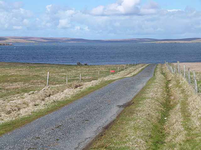
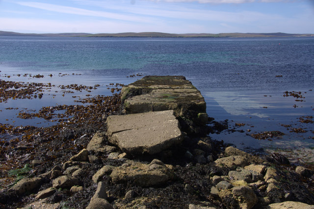
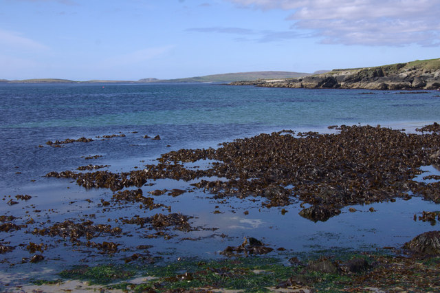
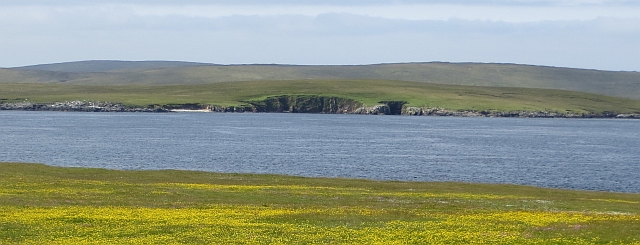
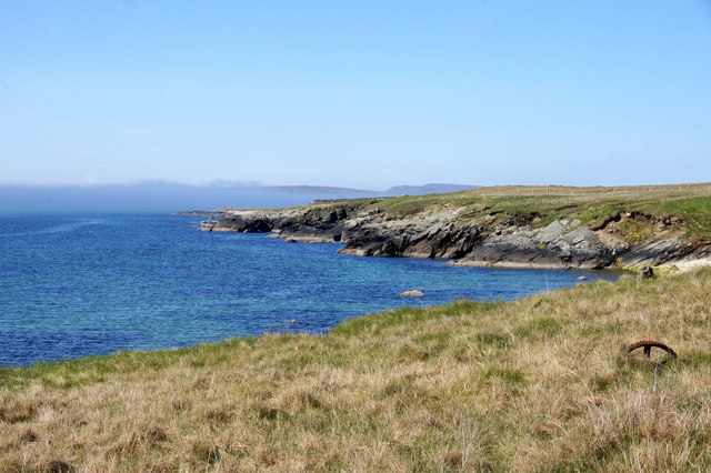
Virdi Taing is characterized by its rugged cliffs, which rise sharply from the North Atlantic Ocean. The cliffs are composed of sedimentary rock formations, showcasing various layers of geological history. The exposed rock face displays an array of colors, ranging from shades of gray to reddish-brown.

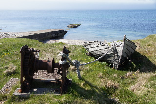
The headland also features a narrow strip of pebble beach at its base, which provides a stark contrast to the towering cliffs above. This beach is often used by locals and tourists alike for recreational activities such as beachcombing, picnicking, and birdwatching.

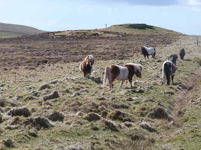
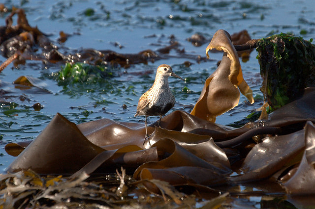
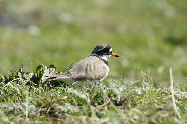
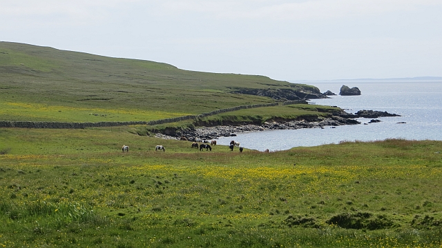
The area surrounding Virdi Taing is abundant in wildlife, making it a popular spot for nature enthusiasts. Seabirds such as puffins, guillemots, and kittiwakes can be observed nesting on the cliffs during the breeding season. Additionally, seals and otters are known to frequent the waters around the headland, adding to its natural charm.

Overall, Virdi Taing is a magnificent coastal feature that showcases the raw beauty of the Shetland Islands. Its dramatic cliffs, picturesque beach, and diverse wildlife make it a must-visit destination for those exploring this remote and captivating region of Scotland.

If you have any feedback on the listing, please let us know in the comments section below.

Virdi Taing Images

Images are sourced within 2km of 60.616767/-0.97281055 or Grid Reference HU5693. Thanks to Geograph Open Source API. All images are credited.

Road west of Brough Lodge The B9088 drops down to the pier at Ugasta on the west coast of Fetlar.
Road west of Brough Lodge
The B9088 drops down to the pier at Ugasta on the west coast of Fetlar.
Shetland ponies below Sugil
The Tower at Brough Lodge A Victorian folly overlooking the west coast of Fetlar.
The Tower at Brough Lodge
A Victorian folly overlooking the west coast of Fetlar.
Dunlin (Calidris alpina) on the beach at Ugasta by Brough Lodge Dunlin breed quite commonly on moorland in Shetland. This is either a local bird feeding on the shore or a late migrant still heading north.
Dunlin (Calidris alpina) on the beach at Ugasta by Brough Lodge
Dunlin breed quite commonly on moorland in Shetland. This is either a local bird feeding on the shore or a late migrant still heading north.
Ringed Plover (Charadrius hiaticula) at Ugasta by Brough Lodge Ringed Plovers breed quite commonly in Shetland, most often in coastal habitats.
Ringed Plover (Charadrius hiaticula) at Ugasta by Brough Lodge
Ringed Plovers breed quite commonly in Shetland, most often in coastal habitats.
Dilapidated pier at Ugasta, near Brough Lodge
Beach at Ugasta, near Brough Lodge
Fetlar: signpost to Funzie Looking along the western side of the island, while the road heads east across to Funzie (pronounced Finnie) on the B9088.
Fetlar: signpost to Funzie
Looking along the western side of the island, while the road heads east across to Funzie (pronounced Finnie) on the B9088.
Brough Lodge Folly The oval-shaped tower in the grounds may have been contemporary with the manor house, or it may have been built slightly later. It is another example of a folly-type structure, even though it occupies the site of an actual Iron Age broch, and it originally had three storeys, joined to the land by a footbridge which has now disintegrated. It was used at one stage as an astronomical observatory, which contained a large telescope, and the lens for the instrument has been preserved at Fetlar Interpretive Centre.
Brough Lodge Folly
The oval-shaped tower in the grounds may have been contemporary with the manor house, or it may have been built slightly later. It is another example of a folly-type structure, even though it occupies the site of an actual Iron Age broch, and it originally had three storeys, joined to the land by a footbridge which has now disintegrated. It was used at one stage as an astronomical observatory, which contained a large telescope, and the lens for the instrument has been preserved at Fetlar Interpretive Centre.
Old boat, Ugasta Hauled up near Ugasta Pier.
Old boat, Ugasta
Hauled up near Ugasta Pier.
Ugasta pier Not in the best state of repair.
Ugasta pier
Not in the best state of repair.
Flower meadow near Brough Lodge Some old machinery rusts quietly amongst the flowers.
Flower meadow near Brough Lodge
Some old machinery rusts quietly amongst the flowers.
Crags, Punds Geo View from Fetlar to a small crag on the coast of Hascosay.
Crags, Punds Geo
View from Fetlar to a small crag on the coast of Hascosay.
Ponies near Sand of Sand East coast of Fetlar.
Ponies near Sand of Sand
East coast of Fetlar.
Fetlar road junction The road from the ferry joins the B9088 near Brough Lodge.
Fetlar road junction
The road from the ferry joins the B9088 near Brough Lodge.
Disintegrating flit boat at Brough Lodge pier, Fetlar
Disintegrating pier and flit boat, Brough Lodge, Fetlar
Coastline at Ugasta, Brough Lodge, Fetlar
Show me another place!

Virdi Taing is located at Grid Ref: HU5693 (Lat: 60.616767, Lng: -0.97281055)

Unitary Authority: Shetland Islands

Police Authority: Highlands and Islands

What 3 Words

///reporters.squeaks.enigma. Near Gutcher, Shetland Islands

Nearby Locations

Virdi Taing

Related Wikis

Hascosay

Hascosay (Scots: Hascosay; Old Norse "Hafskotsey") is a small island lying between Yell and Fetlar in the Shetland Islands, Scotland. == Geography and... ==

Brough Lodge

Brough Lodge is a 19th-century Gothic mansion on Fetlar, one of the Shetland Islands, in northern Scotland. Built by the Nicolson family, who were responsible...

Hamars Ness

Hamars Ness is a headland on the island of Fetlar in Shetland, Scotland. The name is from the Old Norse Hamarsnes meaning "craggy headland". A ro-ro ferry...

Burra Ness Broch

Burra Ness Broch is an iron-age broch located on the east coast of the island of Yell, Shetland, Scotland. == Location == Burra Ness Broch (grid reference...

Urie Lingey

For other islands with similar names, see Linga (disambiguation) Urie Lingey is one of the Shetland Islands. It is between Fetlar and Unst, and Yell is...

Basta, Shetland

Basta is a hamlet on the island of Yell in the Shetland islands of Scotland. It is on the shores of Basta Voe and is in the parish of Yell. == References... ==

Sound Gruney

For other islands with similar names, see Gruney (disambiguation) Sound Gruney is one of the Shetland islands. It lies about 1.5 kilometres (0.93 mi)...

Mid Yell

Mid Yell is a coastal settlement on the island of Yell, the second largest of Shetland Islands, Scotland. Mid Yell, the largest settlement on the island...

Nearby Amenities

Located within 500m of 60.616767,-0.97281055
Ele: 28
Natural: peak
Lat/Long: 60.6143548/-0.9742781
The data included in this document is from www.openstreetmap.org. The data is made available under ODbL.

Have you been to Virdi Taing?

Leave your review of Virdi Taing below (or comments, questions and feedback).