Mansie's Geo
Coastal Feature, Headland, Point in Shetland
Scotland
Mansie's Geo

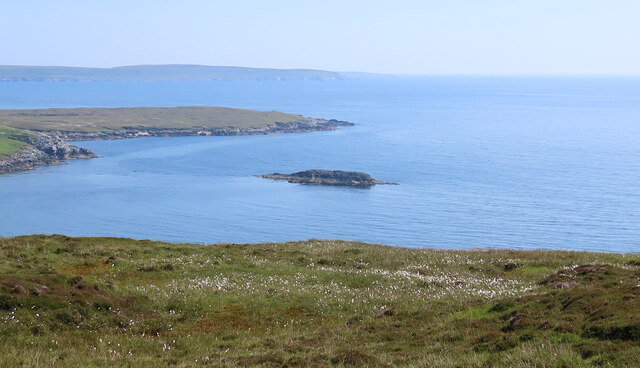
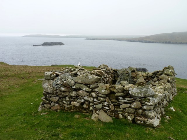
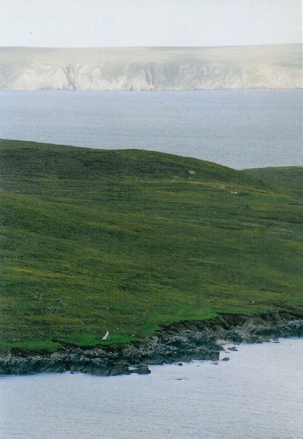
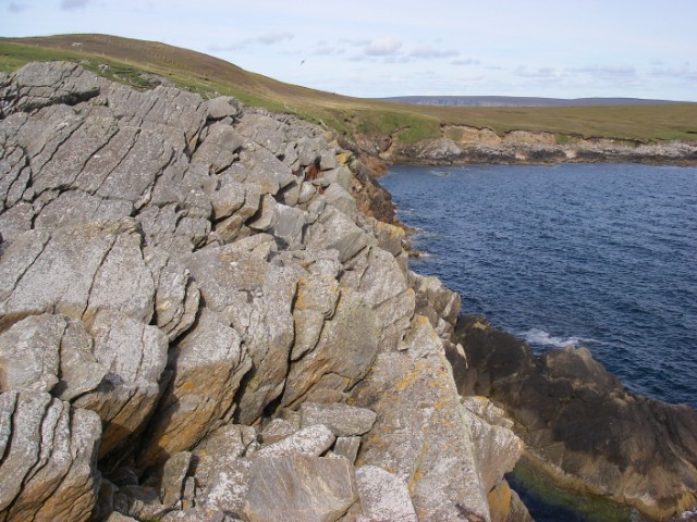
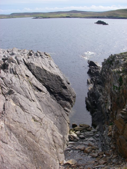
Mansie's Geo is a prominent coastal feature located in the Shetland Islands, an archipelago in Scotland, United Kingdom. It is classified as a headland, which is a narrow piece of land jutting out into the sea. Mansie's Geo specifically refers to a point or promontory that extends into the North Sea on the south coast of the Shetland Mainland.
This headland is characterized by steep cliffs that rise dramatically from the sea, reaching heights of up to 150 meters (492 feet) in some areas. The cliffs are composed of sedimentary rocks, mainly sandstone and shale, which showcase layers formed over millions of years. These rocks often display vibrant colors due to the presence of different minerals.
Mansie's Geo offers breathtaking panoramic views of the surrounding coastline and the vast expanse of the North Sea. The rugged and jagged cliffs provide habitats for numerous seabirds, including puffins, guillemots, and fulmars. The area is also home to a variety of marine life, such as seals, dolphins, and even occasional sightings of whales.
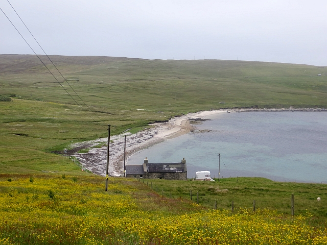
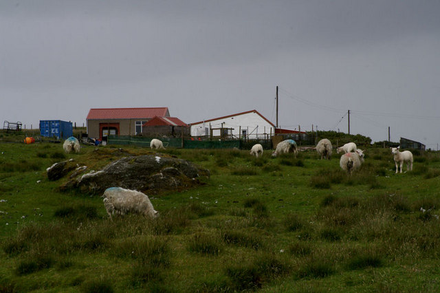
Access to Mansie's Geo is limited to footpaths along the cliff tops, as the area is quite remote and inaccessible by vehicles. However, its natural beauty and unique geological features make it a popular destination for hikers, birdwatchers, and nature enthusiasts.
Overall, Mansie's Geo is a remarkable headland in the Shetland Islands, offering stunning coastal views, diverse wildlife, and a glimpse into the geological history of the region.
If you have any feedback on the listing, please let us know in the comments section below.
Mansie's Geo Images
Images are sourced within 2km of 60.54908/-1.0139735 or Grid Reference HU5485. Thanks to Geograph Open Source API. All images are credited.


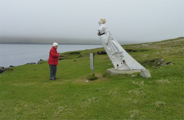

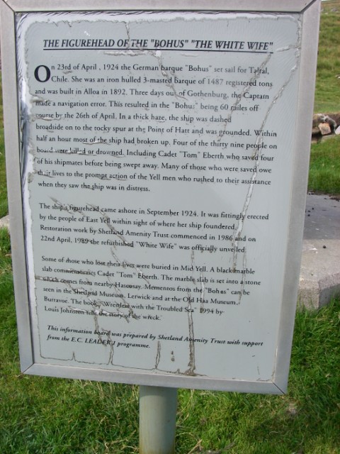
![Figurehead of the "White Wife" According to local tradition (and thus published many times) The White Wife (or White Lady) of Otterswick is said to be a German lady.
According to her life records we have to say that Bertha is a British girl or more correctly a Scottish girl, &quot;born in Grangemouth of German parents&quot;.
She was the figurehead of the steel barque Bertha built in 1892 by Grangemouth Dockyard Co., Grangemouth, as yard no. 163. Her dimensions were: 74,11×11,70×6,88 metres [248&#039;2&quot;×38&#039;4&quot;×22&#039;4&quot;] and with a tonnage of 1653 GRT (1499 NRT and 2600 DWT). She was launched at the shipyard of Grangemouth Dockyard Co. for Joh. H. Soost, Hamburg on July 6th, 1892 and assigned the official German signal RJQD.
She was named after Bertha, the eldest daughter of Joh. H. Soost, and this should be the proper name of The White Lady.
In 1899 she was sold to Captain M. Dietrich, Hamburg, and thereafter changed hands several times. In her great days until 1912 she did a lot of long distance runs such as 1904 from Lizard Point to Seattle in 154 days, 1906 from Lizard Point to Sydney in 117 days and again in 1909 in 114 days or in 1910 from Sydney to Falmouth f/o in 129 days.
In 1912 she was sold to Sweden changed hands several times and ended up with Förnyade Ångfartygs AB Viking, Gothenburg, for SEK 500.000. She was then renamed Bohus and assigned the official Swedish Reg. No. 5903 and signal KBCV. Captain at that time was Mr Ragnar Erik Nyberg, Stockholm. Bertha was bound to the Baltic Sea, mostly sailing in Swedish and Finnish waters.](https://s0.geograph.org.uk/photos/60/69/606956_9287ed4c.jpg)
Mansie's Geo is located at Grid Ref: HU5485 (Lat: 60.54908, Lng: -1.0139735)
Unitary Authority: Shetland Islands
Police Authority: Highlands and Islands
What 3 Words
///breeding.tulip.bleaching. Near Ulsta, Shetland Islands
Nearby Locations
Related Wikis

Aywick
Aywick is a small settlement on the east side of Yell, an island forming part of the Shetland Islands north of Scotland.The naturalist Bobby Tulloch was...

Otterswick
Otterswick is a hamlet on the island of Yell in the Shetland Islands, on the inlet of Otters Wick. It is on the east side of the island. There is also...

Gossabrough
Gossabrough is a coastal hamlet, wick and ness on the southeast side of the island of Yell, Shetland, Scotland. The Wick of Gossabrough lies between the...

Burra Voe
Burra Voe (Old Norse: Borgavagr, Broch Bay) is sheltered bay (voe) at the southeast corner of the island of Yell. The village of Burravoe (HU525795) is...

Burravoe
Burravoe is a community on the north shore of Burra Voe, in the south-east part of the island of Yell in the Shetland Islands, Scotland. The name Burravoe...

Mid Yell
Mid Yell is a coastal settlement on the island of Yell, the second largest of Shetland Islands, Scotland. Mid Yell, the largest settlement on the island...

Old Haa Museum
The Old Haa of Brough in located in Burravoe, Yell, Shetland, Scotland. Built for Robert Tyrie, a merchant, in 1672, houses the local museum for Burravoe...
Hascosay
Hascosay (Scots: Hascosay; Old Norse "Hafskotsey") is a small island lying between Yell and Fetlar in the Shetland Islands, Scotland. == Geography and... ==
Have you been to Mansie's Geo?
Leave your review of Mansie's Geo below (or comments, questions and feedback).