Hamar
Coastal Feature, Headland, Point in Shetland
Scotland
Hamar

Hamar is a prominent coastal feature located on the island of Shetland, Scotland. Situated on the eastern coast, Hamar is primarily known for its impressive headland and distinctive point that stretches out into the North Sea.
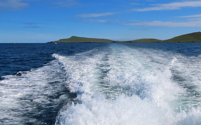
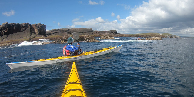
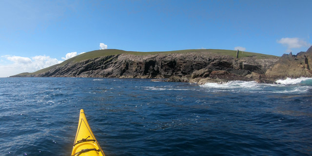
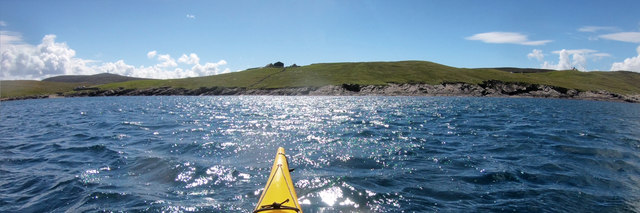
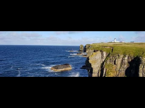
The headland at Hamar is a rugged and rocky formation, characterized by steep cliffs that provide stunning panoramic views of the surrounding area. These cliffs, which reach heights of up to 100 meters, are composed of sandstone and shale, contributing to the area's unique geological features. The headland is home to a variety of bird species, including puffins, fulmars, and guillemots, making it a popular spot for birdwatching enthusiasts.
At the tip of the headland, Hamar boasts a distinct point that juts out into the sea. This point, known as Hamar Ness, offers a picturesque setting with its dramatic rock formations and crashing waves. The point serves as a natural barrier, protecting the coastline from the relentless power of the North Sea.
Hamar is easily accessible by road, with a well-maintained coastal path leading visitors to the headland. The area surrounding Hamar is largely uninhabited, providing a sense of tranquility and solitude. On clear days, the views from Hamar extend for miles, allowing visitors to appreciate the beauty of the surrounding landscapes and the vastness of the North Sea.
Overall, Hamar is a captivating coastal feature that showcases the raw, untamed beauty of Shetland's eastern coast. Its impressive headland and striking point make it a must-visit destination for nature lovers and those seeking to immerse themselves in the rugged charm of the Scottish coastline.
If you have any feedback on the listing, please let us know in the comments section below.
Hamar Images
Images are sourced within 2km of 60.153063/-1.0486206 or Grid Reference HU5241. Thanks to Geograph Open Source API. All images are credited.


Hamar is located at Grid Ref: HU5241 (Lat: 60.153063, Lng: -1.0486206)
Unitary Authority: Shetland Islands
Police Authority: Highlands and Islands
What 3 Words
///hats.committed.tributes. Near Lerwick, Shetland Islands
Nearby Locations
Related Wikis

Broch of Cullingsburgh
The Broch of Cullingsburgh is an Iron Age broch located in the Shetland islands. == Location == Located on Bressay, off the east coast of mainland Shetland...

Voe of Cullingsburgh
Voe of Cullingsburgh is a large sea loch off the Shetland island of Bressay, voe meaning "sea inlet" in Shetland dialect. The local spelling of the name...
Isle of Noss
The Isle of Noss or Noss (Scots: Noss) is a small, previously inhabited island in Shetland, Scotland. Noss is separated from the island of Bressay by the...

Bressay
Bressay is a populated island in the Shetland archipelago of Scotland. == Geography and geology == Bressay lies due south of Whalsay, west of the Isle...
Related Videos

Hike to Noss Ferry - Bressay, Shetland #hike #hiking #ocean
We spent the day exploring Bressay Island in Shetland, Scotland. The hike from the parking lot to the Noss Ferry is about a quarter ...


Bressay parkrun, Event #159, 6th August 2022
Bressay in the Shetland Islands is the most northerly parkrun in the UK. A short ferry ride from the main town of Lerwick is just the ...
Noss Head On Visit To East Coast Of Caithness North Highlands Of Scotland
Tour Scotland travel video clip, with Scottish music, of Noss Head, located above cliffs about three miles North East of Wick, ...
Nearby Amenities
Located within 500m of 60.153063,-1.0486206Have you been to Hamar?
Leave your review of Hamar below (or comments, questions and feedback).