Geo of the Roonack
Coastal Feature, Headland, Point in Shetland
Scotland
Geo of the Roonack

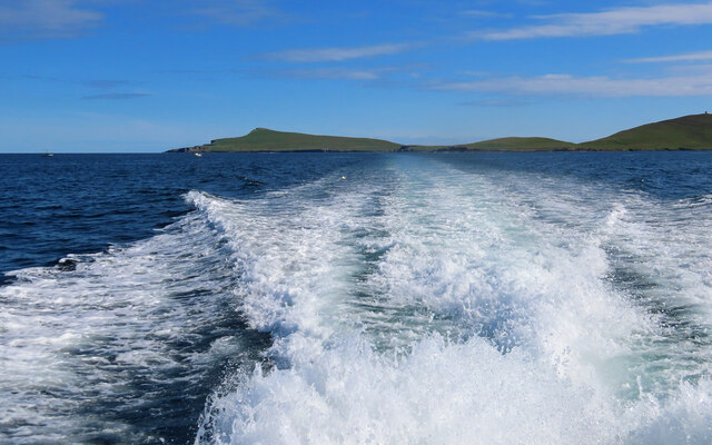
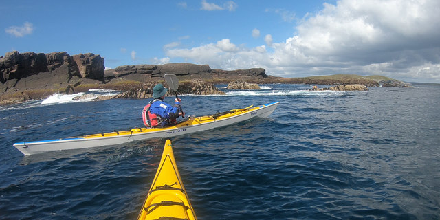
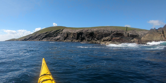
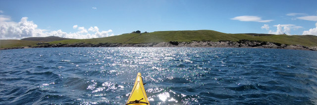
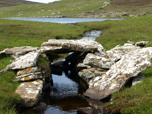
Geo of the Roonack is a prominent coastal feature located in the Shetland Islands, an archipelago in Scotland. Known as a headland or point, it extends into the North Sea and is situated on the western coast of the mainland. The geo, a local term for a narrow inlet or cove, is characterized by its rugged cliffs and rocky shoreline.
The cliffs of Geo of the Roonack rise steeply from the sea, reaching heights of up to 50 meters in some areas. The exposed rock faces display a variety of geological formations, including layers of sedimentary rock and occasional outcrops of igneous rock. These formations provide valuable insights into the geological history of the region.
The coastal area surrounding Geo of the Roonack is home to diverse flora and fauna. The cliffs provide nesting sites for seabirds such as puffins, fulmars, and kittiwakes, while the surrounding waters are inhabited by various marine species including seals, dolphins, and porpoises. The intertidal zone is rich in marine life, with an abundance of seaweed, shellfish, and small crustaceans.
The geo is a popular destination for nature enthusiasts, hikers, and birdwatchers who are drawn to its stunning coastal scenery and the opportunity to observe the local wildlife. Visitors can explore the area on foot, following coastal paths that offer panoramic views of the sea and the surrounding cliffs. It is important to note that caution should be exercised when visiting Geo of the Roonack due to the steep and potentially unstable cliffs.
In summary, Geo of the Roonack is a notable headland and coastal feature in the Shetland Islands. Its rugged cliffs, diverse wildlife, and scenic beauty make it a captivating destination for nature enthusiasts and those seeking to immerse themselves in the natural wonders of this remote corner of Scotland.
If you have any feedback on the listing, please let us know in the comments section below.
Geo of the Roonack Images
Images are sourced within 2km of 60.155296/-1.0506817 or Grid Reference HU5241. Thanks to Geograph Open Source API. All images are credited.


Geo of the Roonack is located at Grid Ref: HU5241 (Lat: 60.155296, Lng: -1.0506817)
Unitary Authority: Shetland Islands
Police Authority: Highlands and Islands
What 3 Words
///scouted.utensil.vineyard. Near Lerwick, Shetland Islands
Nearby Locations
Related Wikis

Broch of Cullingsburgh
The Broch of Cullingsburgh is an Iron Age broch located in the Shetland islands. == Location == Located on Bressay, off the east coast of mainland Shetland...

Voe of Cullingsburgh
Voe of Cullingsburgh is a large sea loch off the Shetland island of Bressay, voe meaning "sea inlet" in Shetland dialect. The local spelling of the name...

Bressay
Bressay (Scots: Bressa) is a populated island in the Shetland archipelago of Scotland. == Geography and geology == Bressay lies due south of Whalsay, west...
Isle of Noss
The Isle of Noss or Noss (Scots: Noss) is a small, previously inhabited island in Shetland, Scotland. Noss is separated from the island of Bressay by the...

Holm of Noss
The Holm of Noss or Cradle Holm is an uninhabited islet of the Shetland Islands. It is about 48m at its highest point. == Geography and geology == It is...
Bressay transmitting station
Bressay transmitting station is a broadcasting transmission facility for the Shetland Islands, located on the isle of Bressay, owned and operated by Arqiva...

Gardie House
Gardie House is an 18th-century estate house on Bressay in Shetland, Scotland. Located opposite Lerwick, across the Bressay Sound, Gardie is described...
Lerwick and Bressay Parish Church
Lerwick and Bressay Parish Church is the largest Church of Scotland congregation in Shetland, serving the islands' capital Lerwick and the surrounding...
Related Videos

Hike to Noss Ferry - Bressay, Shetland #hike #hiking #ocean
We spent the day exploring Bressay Island in Shetland, Scotland. The hike from the parking lot to the Noss Ferry is about a quarter ...

Gannets Bomb Diving - 11th April 2019
Wonderful display of Gannets Bomb Diving during first Seabirds-and-Seals boat tour of the 2019 Season, they put on a wonderful ...

Windy Shetland between Bressay and Noss
Windy Shetland between Bressay and Noss Things to do in Shetland Life Through My Lens.
Nearby Amenities
Located within 500m of 60.155296,-1.0506817Have you been to Geo of the Roonack?
Leave your review of Geo of the Roonack below (or comments, questions and feedback).