Kofi Geo
Coastal Feature, Headland, Point in Shetland
Scotland
Kofi Geo

Kofi Geo is a prominent coastal feature located in Shetland, Scotland. It is specifically classified as a headland or point, jutting out into the North Sea. This geological formation is characterized by its steep cliffs and rugged terrain, providing breathtaking views of the surrounding landscape.
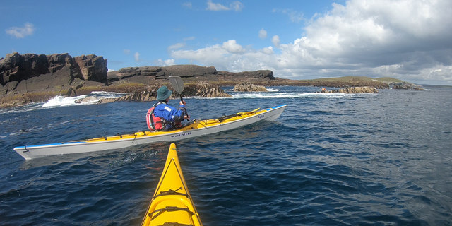
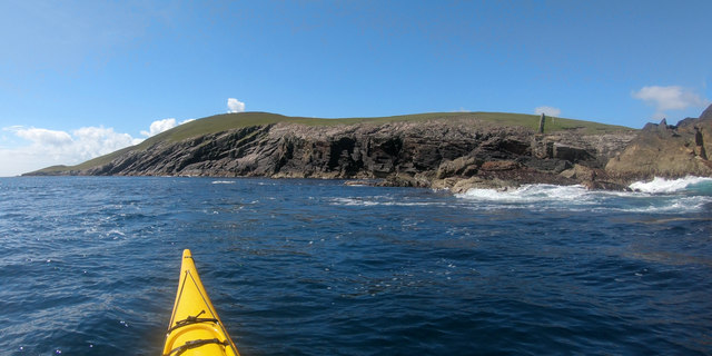
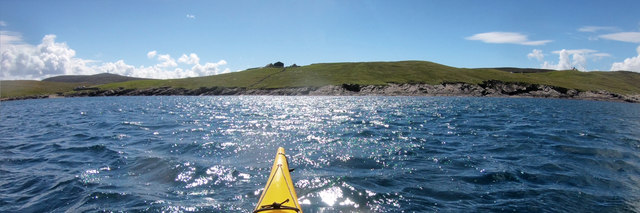
Situated on the eastern coast of Shetland, Kofi Geo is known for its dramatic coastal scenery, with towering cliffs rising up to 150 feet above sea level. These cliffs are composed of sedimentary rock formations, displaying layers of sandstone, shale, and limestone, which have been shaped by millions of years of erosion by wind and sea.
The headland is accessible via a coastal path that winds along the cliff edge, offering visitors the opportunity to explore its diverse flora and fauna. Kofi Geo is home to a variety of seabirds such as puffins, guillemots, and fulmars, which nest on the cliff ledges during the breeding season. In addition, seals and otters can often be spotted in the surrounding waters.
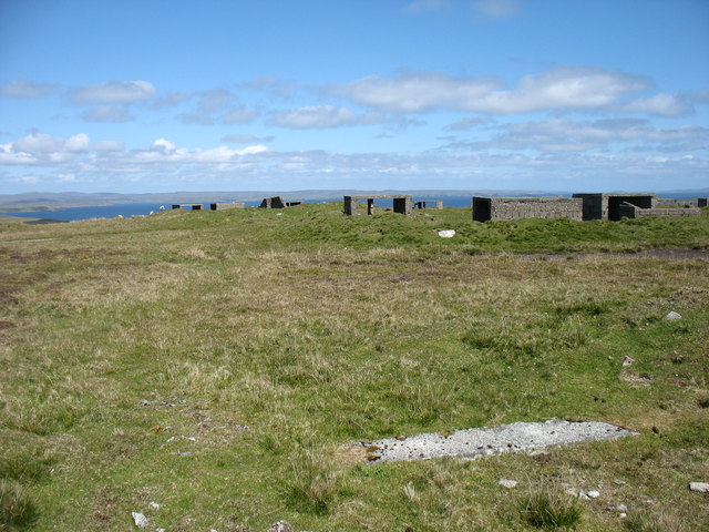
The area surrounding Kofi Geo is also of historical significance, with archaeological evidence pointing to human habitation dating back thousands of years. Ancient settlements and artifacts have been discovered in the vicinity, providing insights into the lives of the early inhabitants of the region.
Overall, Kofi Geo in Shetland is a captivating coastal feature that offers both stunning natural beauty and a glimpse into the rich history of the area. Whether it's for nature enthusiasts, birdwatchers, or those interested in archaeology, this headland is a must-visit destination for anyone exploring the Shetland Islands.
If you have any feedback on the listing, please let us know in the comments section below.
Kofi Geo Images
Images are sourced within 2km of 60.161729/-1.0575409 or Grid Reference HU5242. Thanks to Geograph Open Source API. All images are credited.


Kofi Geo is located at Grid Ref: HU5242 (Lat: 60.161729, Lng: -1.0575409)
Unitary Authority: Shetland Islands
Police Authority: Highlands and Islands
What 3 Words
///slant.verve.nagging. Near Lerwick, Shetland Islands
Nearby Locations
Related Wikis

Broch of Cullingsburgh
The Broch of Cullingsburgh is an Iron Age broch located in the Shetland islands. == Location == Located on Bressay, off the east coast of mainland Shetland...

Voe of Cullingsburgh
Voe of Cullingsburgh is a large sea loch off the Shetland island of Bressay, voe meaning "sea inlet" in Shetland dialect. The local spelling of the name...

Bressay
Bressay (Scots: Bressa) is a populated island in the Shetland archipelago of Scotland. == Geography and geology == Bressay lies due south of Whalsay, west...
Isle of Noss
The Isle of Noss or Noss (Scots: Noss) is a small, previously inhabited island in Shetland, Scotland. Noss is separated from the island of Bressay by the...

Gardie House
Gardie House is an 18th-century estate house on Bressay in Shetland, Scotland. Located opposite Lerwick, across the Bressay Sound, Gardie is described...
Bressay transmitting station
Bressay transmitting station is a broadcasting transmission facility for the Shetland Islands, located on the isle of Bressay, owned and operated by Arqiva...

Holm of Noss
The Holm of Noss or Cradle Holm is an uninhabited islet of the Shetland Islands. It is about 48m at its highest point. == Geography and geology == It is...
Lerwick and Bressay Parish Church
Lerwick and Bressay Parish Church is the largest Church of Scotland congregation in Shetland, serving the islands' capital Lerwick and the surrounding...
Nearby Amenities
Located within 500m of 60.161729,-1.0575409Have you been to Kofi Geo?
Leave your review of Kofi Geo below (or comments, questions and feedback).