Glachon

Coastal Feature, Headland, Point in Shetland

Scotland

Glachon

Lunna Holm
Lunna Holm Credit: Mike Pennington

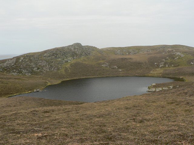
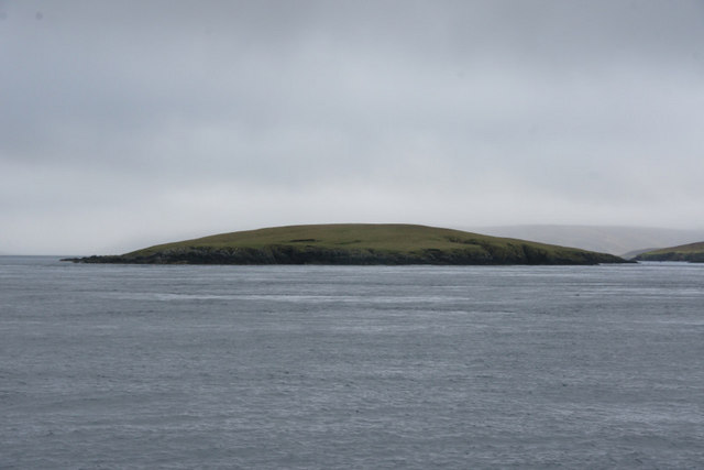
Glachon is a coastal feature located in the Shetland Islands, an archipelago situated off the northeast coast of Scotland. Specifically, it is a prominent headland and point that lies on the western coast of the mainland. Glachon is characterized by its rugged and rocky terrain, with steep cliffs that rise up from the sea.

The headland is surrounded by the North Atlantic Ocean, providing stunning panoramic views of the surrounding waters and neighboring islands. Its strategic location makes it a popular spot for birdwatching, as it serves as a nesting site for various seabird species such as fulmars, puffins, and razorbills. The area also attracts seals, who can often be seen basking on the nearby rocks.

Glachon is known for its rich biodiversity, both on land and in the water. The coastal waters surrounding the headland are home to a diverse range of marine life, including various species of fish, crustaceans, and mollusks. The rocky shores are adorned with vibrant seaweed and algae, adding to the area's natural beauty.

Due to its unique geological features and ecological importance, Glachon has been designated as a Site of Special Scientific Interest (SSSI). This status ensures that it is protected and preserved for future generations to appreciate and study. Visitors to Glachon can enjoy hiking along the coastal paths, taking in the breathtaking views and immersing themselves in the untamed beauty of this coastal gem.

If you have any feedback on the listing, please let us know in the comments section below.

Glachon Images

Images are sourced within 2km of 60.441693/-1.051373 or Grid Reference HU5273. Thanks to Geograph Open Source API. All images are credited.

Lunna Holm
Lunna Holm
Lunna Holm
Lunna Holm
Ward of Outrabister Triangulation point on top of hill with views to north
Ward of Outrabister
Triangulation point on top of hill with views to north
Loch of the Ward This small loch lies in the col between Ward of Outrabister and Hill of State.
Loch of the Ward
This small loch lies in the col between Ward of Outrabister and Hill of State.
Ruin It isn't clear what this ruin was. Perhaps a sheep fank?
Ruin
It isn't clear what this ruin was. Perhaps a sheep fank?
Lunna Holm from Land Taing This is the very tip of the peninsula that runs north-east from Lunna.
Lunna Holm from Land Taing
This is the very tip of the peninsula that runs north-east from Lunna.
Pebble beach To the north across the water is Burravoe.
Pebble beach
To the north across the water is Burravoe.
Quidan Ness This is the coast near Mill Loch, looking towards Quidan Ness.
Quidan Ness
This is the coast near Mill Loch, looking towards Quidan Ness.
Ruined mill This is the remains of the small Norse mill that, presumably, gave Mill Loch its name.
Ruined mill
This is the remains of the small Norse mill that, presumably, gave Mill Loch its name.
Lunna Holm The light on the holm off the end of Lunna Ness. Taken from one of the Yell Sound ferries on a North Isles cruise.
Lunna Holm
The light on the holm off the end of Lunna Ness. Taken from one of the Yell Sound ferries on a North Isles cruise.
Lunna Holm The small lighthouse on the left, and a haul-out of seals on the right.
Lunna Holm
The small lighthouse on the left, and a haul-out of seals on the right.
Lunna Holm Showing the small lighthouse on the north end of the island, at the southern entry into Yell Sound.
Lunna Holm
Showing the small lighthouse on the north end of the island, at the southern entry into Yell Sound.
Lunna Holm From the north. Taken from a diverted inter-island ferry on its way to Vidlin.
Lunna Holm
From the north. Taken from a diverted inter-island ferry on its way to Vidlin.
Longa Skerry, Lunna According to the map, only the central part is above water at high tide. Lunna Ness is in the background.
Longa Skerry, Lunna
According to the map, only the central part is above water at high tide. Lunna Ness is in the background.
Longa Skerry, Lunna The south end of Lunna Holm is in the background.
Longa Skerry, Lunna
The south end of Lunna Holm is in the background.
Longa Skerry, Lunna Lunna Holm and its lighthouse are in the background.
Longa Skerry, Lunna
Lunna Holm and its lighthouse are in the background.
Swarta Skerry, Lunna A large dog otter was curled up asleep on the nearer skerry.
Swarta Skerry, Lunna
A large dog otter was curled up asleep on the nearer skerry.
Swarta Skerry, Lunna Lunna Ness is in the background.
Swarta Skerry, Lunna
Lunna Ness is in the background.
Show me another place!

Glachon is located at Grid Ref: HU5273 (Lat: 60.441693, Lng: -1.051373)

Unitary Authority: Shetland Islands

Police Authority: Highlands and Islands

What 3 Words

///cats.seeing.saddens. Near Ulsta, Shetland Islands

Related Wikis

Lunna Holm

Lunna Holm is a small island near Lunna Ness (Mainland, Shetland), in the Shetland Islands. It is 27 metres (89 ft) at its highest point. == Lighthouse... ==

Lunna Ness

Lunna Ness is a peninsula in the north east of Mainland, Shetland, Scotland , in the parish of Lunnasting near Vidlin. The island of Lunna Holm is nearby...

Fish Holm

Fish Holm is a small island, 1.5 miles (2.4 km) east of Mainland, Shetland. It is near the village of Mossbank. It is 20 metres (66 ft) at its highest...

Orfasay

Orfasay (Old Norse: Orfyrisey, meaning "tidal island") is one of the Shetland Islands. == Geography == Orfasay is a tidal island in Yell Sound, connected...

Have you been to Glachon?

Leave your review of Glachon below (or comments, questions and feedback).