Cluve of the Hamur
Coastal Feature, Headland, Point in Shetland
Scotland
Cluve of the Hamur
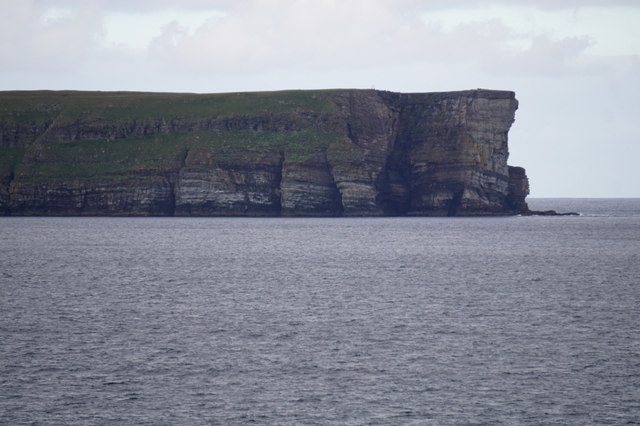
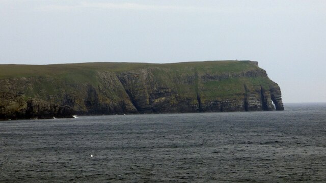
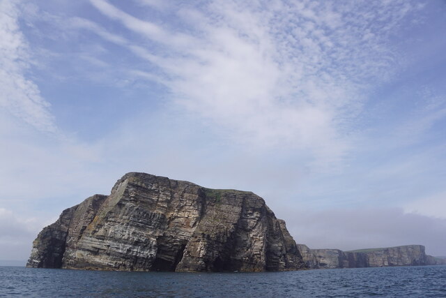
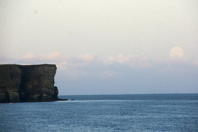
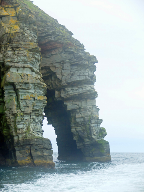
Cluve of the Hamur is a prominent coastal feature located in the Shetland Islands, Scotland. This headland, also known as a point, is situated on the west coast of the Mainland, the largest island in the Shetland archipelago.
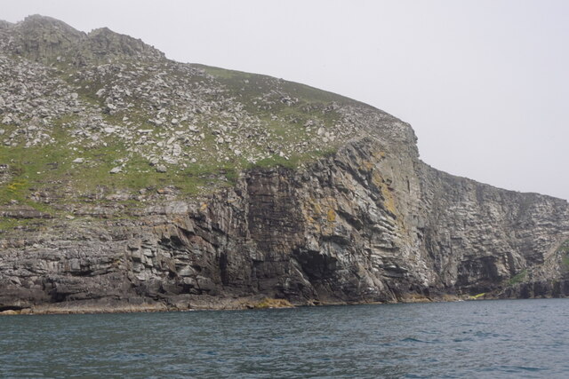
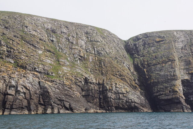
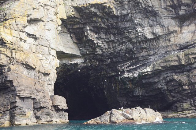
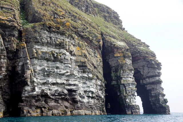
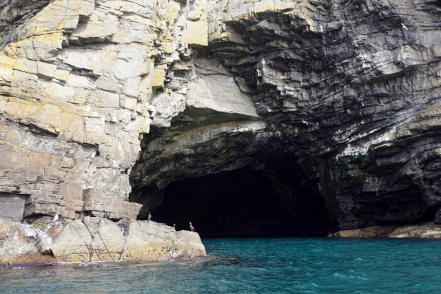
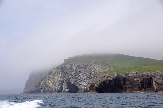
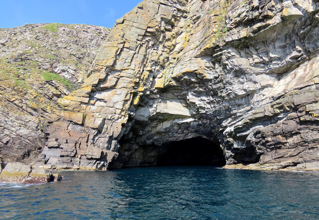
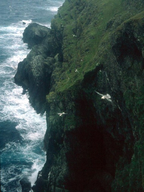
Cluve of the Hamur is characterized by its rugged and dramatic cliffs, which rise steeply from the sea to a height of approximately 200 meters (656 feet). These cliffs are composed of sandstone and provide stunning panoramic views of the surrounding coastal landscape.
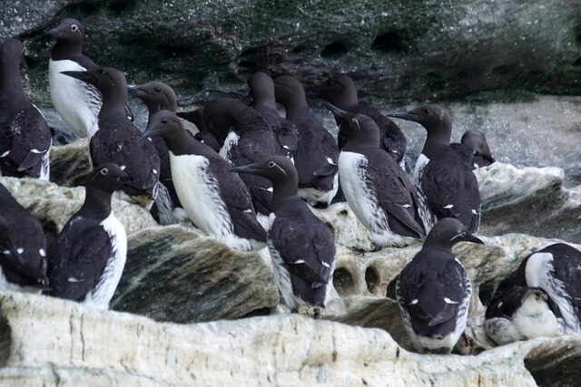
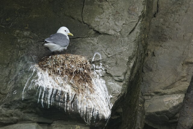
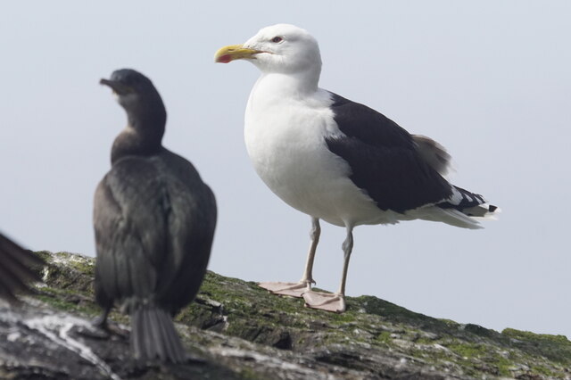
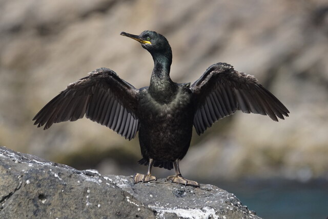
The headland is a popular destination for nature enthusiasts and hikers due to its unique geology and diverse wildlife. The cliffs of Cluve of the Hamur are home to numerous seabird colonies, including puffins, guillemots, and razorbills. Visitors can observe these fascinating creatures in their natural habitat, particularly during the breeding season.
In addition to its wildlife, Cluve of the Hamur also offers visitors the opportunity to explore its archaeological significance. The headland features a number of ancient structures, including the remains of Iron Age settlements and defensive structures. These archaeological sites provide valuable insights into the island's past and attract history enthusiasts from around the world.
Overall, Cluve of the Hamur is a captivating coastal feature in the Shetland Islands, offering a unique blend of natural beauty, wildlife, and historical significance. Whether you are interested in hiking, birdwatching, or exploring archaeological sites, this headland is sure to impress.
If you have any feedback on the listing, please let us know in the comments section below.
Cluve of the Hamur Images
Images are sourced within 2km of 60.109709/-1.0737958 or Grid Reference HU5136. Thanks to Geograph Open Source API. All images are credited.
Cluve of the Hamur is located at Grid Ref: HU5136 (Lat: 60.109709, Lng: -1.0737958)
Unitary Authority: Shetland Islands
Police Authority: Highlands and Islands
What 3 Words
///outwit.severe.functions. Near Lerwick, Shetland Islands
Nearby Locations
Related Wikis

Bressay transmitting station
Bressay transmitting station is a broadcasting transmission facility for the Shetland Islands, located on the isle of Bressay, owned and operated by Arqiva...

Holm of Noss
The Holm of Noss or Cradle Holm is an uninhabited islet of the Shetland Islands. It is about 48m at its highest point. == Geography and geology == It is...

Bressay
Bressay (Scots: Bressa) is a populated island in the Shetland archipelago of Scotland. == Geography and geology == Bressay lies due south of Whalsay, west...
Isle of Noss
The Isle of Noss or Noss (Scots: Noss) is a small, previously inhabited island in Shetland, Scotland. Noss is separated from the island of Bressay by the...

Broch of Cullingsburgh
The Broch of Cullingsburgh is an Iron Age broch located in the Shetland islands. == Location == Located on Bressay, off the east coast of mainland Shetland...
Lerwick and Bressay Parish Church
Lerwick and Bressay Parish Church is the largest Church of Scotland congregation in Shetland, serving the islands' capital Lerwick and the surrounding...
Voe of Cullingsburgh
Voe of Cullingsburgh is a large sea loch off the Shetland island of Bressay, voe meaning "sea inlet" in Shetland dialect. The local spelling of the name...

Gardie House
Gardie House is an 18th-century estate house on Bressay in Shetland, Scotland. Located opposite Lerwick, across the Bressay Sound, Gardie is described...
Nearby Amenities
Located within 500m of 60.109709,-1.0737958Have you been to Cluve of the Hamur?
Leave your review of Cluve of the Hamur below (or comments, questions and feedback).