Hole of Bugars

Sea, Estuary, Creek in Shetland

Scotland

Hole of Bugars

Bard Head Taken from the Marco Polo cruise ship on the way out of Lerwick.
Bard Head Credit: Ian S

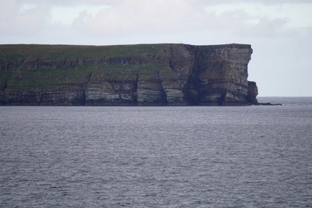
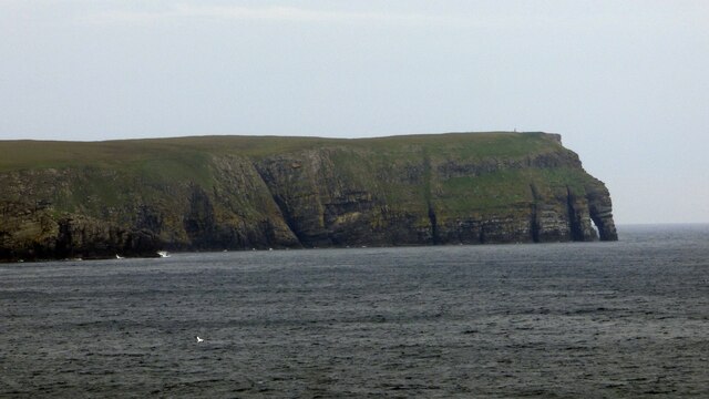
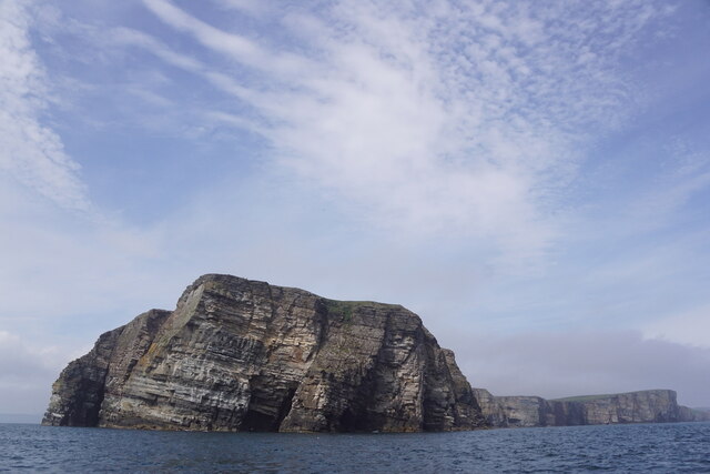
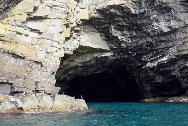
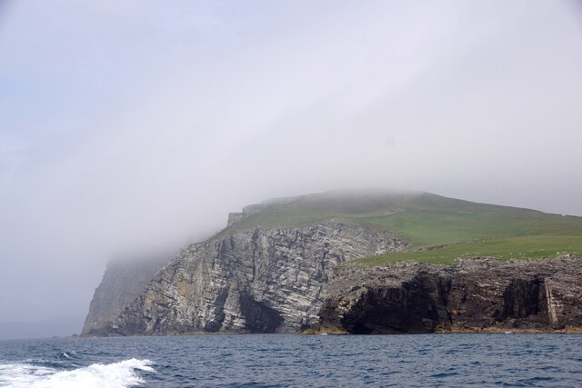
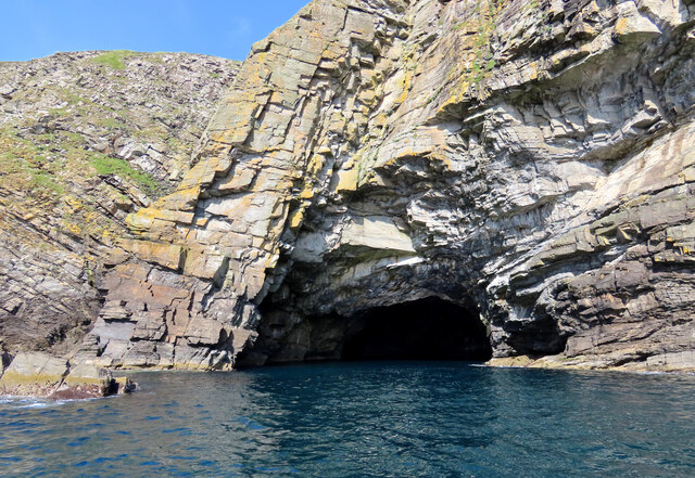
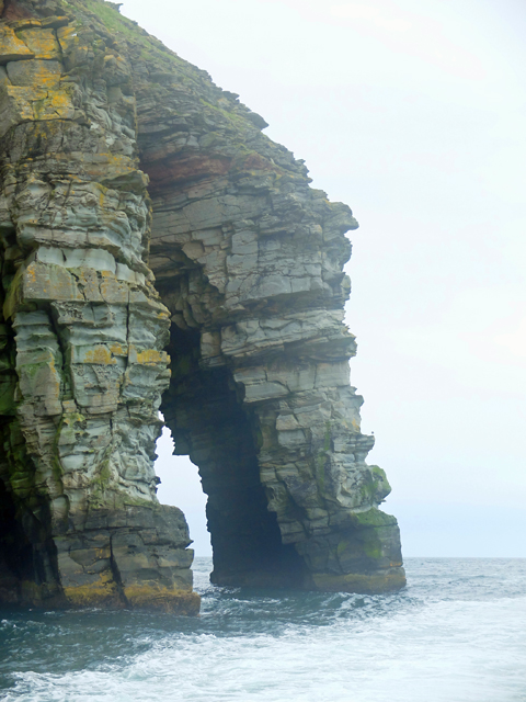
Hole of Bugars is a small and picturesque sea inlet located in the Shetland Islands, an archipelago off the northeast coast of Scotland. Situated on the east coast of Mainland, the largest island in the Shetlands, this natural feature is known for its stunning beauty and unique geological formations.

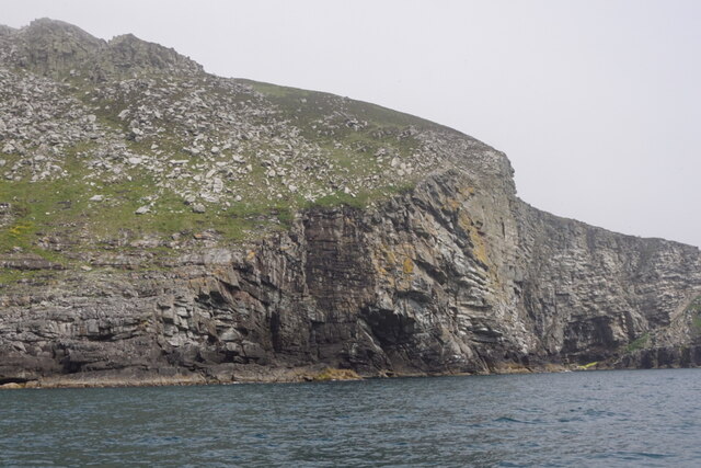
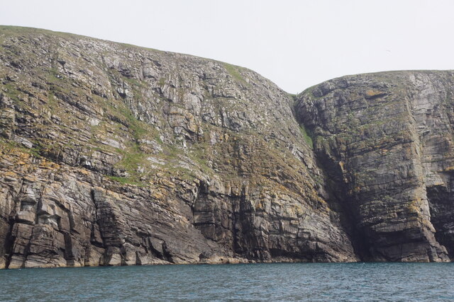
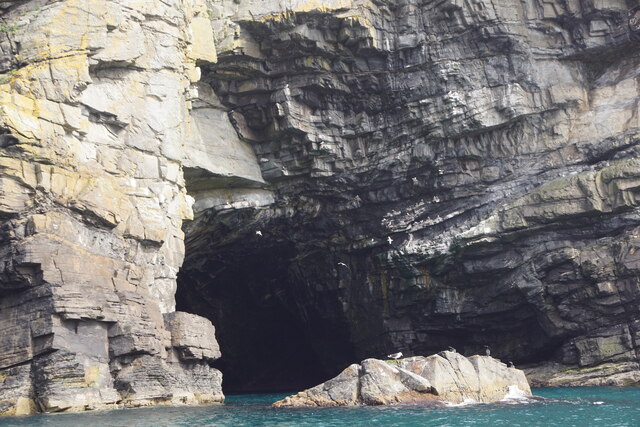
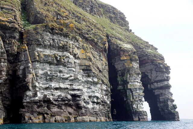
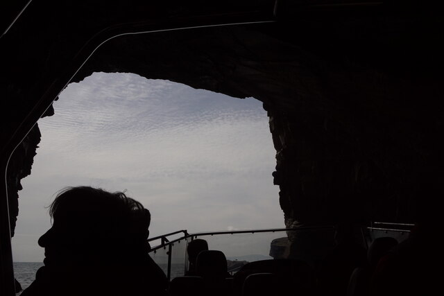
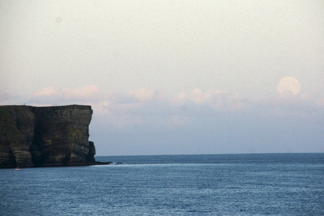
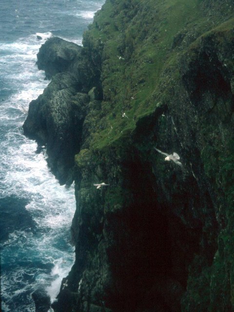
The Hole of Bugars is a sea inlet that stretches inland for approximately 500 meters, forming a narrow and winding creek. It is surrounded by steep cliffs, providing a dramatic backdrop to the serene waters below. The entrance to the inlet is marked by a rocky outcrop, which acts as a natural barrier against the force of the North Sea waves.

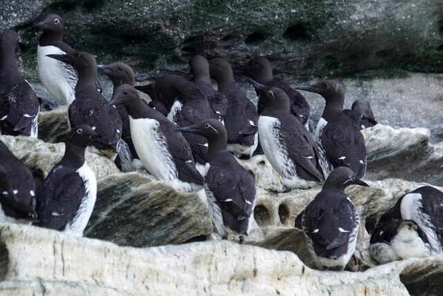
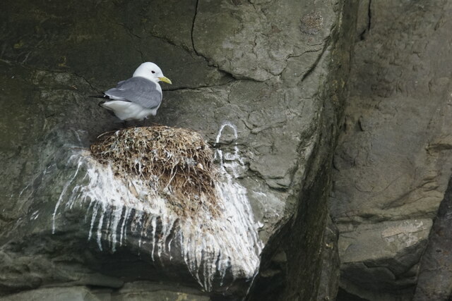
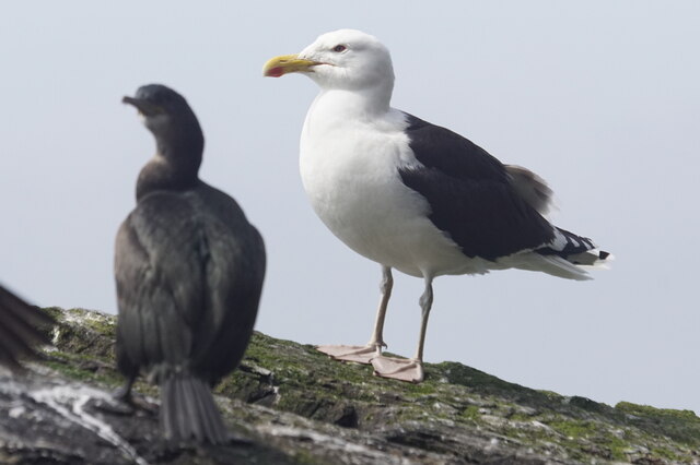
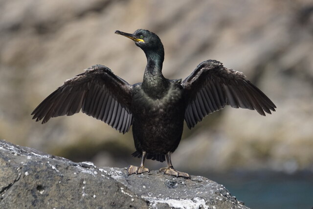
At high tide, the water in the Hole of Bugars can reach a depth of around 10 meters, offering a safe haven for various marine species. The crystal-clear waters are home to an abundance of fish, seals, and seabirds, making it a popular spot for wildlife enthusiasts and birdwatchers.

Access to the Hole of Bugars is relatively easy, with a small car park located nearby. From there, visitors can follow a short footpath that leads to a viewing point overlooking the inlet. The surrounding area offers breathtaking coastal walks and stunning views of the rugged Shetland landscape.

Overall, the Hole of Bugars is a hidden gem in the Shetland Islands, offering visitors a chance to immerse themselves in the natural beauty and tranquility of this remote corner of Scotland.

If you have any feedback on the listing, please let us know in the comments section below.

Hole of Bugars Images

Images are sourced within 2km of 60.11152/-1.0708666 or Grid Reference HU5136. Thanks to Geograph Open Source API. All images are credited.

Bard Head Taken from the Marco Polo cruise ship on the way out of Lerwick.
Bard Head
Taken from the Marco Polo cruise ship on the way out of Lerwick.
Bard Head View from the Lerwick to Aberdeen Ferry.
Bard Head
View from the Lerwick to Aberdeen Ferry.
Mills of the Ord, Bressay, from the sea
Coastline at the Orkneyman's Cave, the Bard, Bressay
Orkneyman's Cave, the Bard, Bressay Although labelled as the Cave of the Bard on OS maps, this is the name by which everyone in Shetland knows it.
Orkneyman's Cave, the Bard, Bressay
Although labelled as the Cave of the Bard on OS maps, this is the name by which everyone in Shetland knows it.
The Giant's Leg, The Bard, Bressay
Bard Head, Bressay, from the sea
In the Orkneyman's Cave, Bard Head, Bressay, looking out
Orkneyman's Cave, Bard Head, Bressay Labelled as Cave of the Bard on the map, but no-one locally uses that name.
Orkneyman's Cave, Bard Head, Bressay
Labelled as Cave of the Bard on the map, but no-one locally uses that name.
Mills of the Ord, Bressay, from the sea
Guillemot (Uria aalge), Bard Head, Bressay
Kittiwake (Rissa tridactyla), Bard Head, Bressay
Great Black-backed Gull (Larus marinus), Bard Head, Bressay
Shag (Gulusus aristotelis), Bard Head, Bressay
The Orkneyman's Cave, Bressay Known locally as the Orkneyman's Cave*, this is the Cave of the Bard on the headland of the same name, Bressay, Shetland.

*A popular myth is that this cave was used as a hiding place for a man from Orkney evading a press-gang; although his boat is said to have washed away in a storm, he managed to climb the cliffs onto Bressay and make his escape.
The Orkneyman's Cave, Bressay
Known locally as the Orkneyman's Cave*, this is the Cave of the Bard on the headland of the same name, Bressay, Shetland. *A popular myth is that this cave was used as a hiding place for a man from Orkney evading a press-gang; although his boat is said to have washed away in a storm, he managed to climb the cliffs onto Bressay and make his escape.
Bard Head, Bressay Taken from about 3.5 km to the west, from the Aberdeen ferry. A full moon is just rising.
Bard Head, Bressay
Taken from about 3.5 km to the west, from the Aberdeen ferry. A full moon is just rising.
The Giant's Leg A sea arch at the end of Bard Head, the most southerly point of Bressay.
The Giant's Leg
A sea arch at the end of Bard Head, the most southerly point of Bressay.
Fulmars wheel in the up-draught on the cliffs of Bressay
Show me another place!

Hole of Bugars is located at Grid Ref: HU5136 (Lat: 60.11152, Lng: -1.0708666)

Unitary Authority: Shetland Islands

Police Authority: Highlands and Islands

What 3 Words

///nanny.bond.newsprint. Near Lerwick, Shetland Islands

Related Wikis

Bressay transmitting station

Bressay transmitting station is a broadcasting transmission facility for the Shetland Islands, located on the isle of Bressay, owned and operated by Arqiva...

Holm of Noss

The Holm of Noss or Cradle Holm is an uninhabited islet of the Shetland Islands. It is about 48m at its highest point. == Geography and geology == It is...

Bressay

Bressay (Scots: Bressa) is a populated island in the Shetland archipelago of Scotland. == Geography and geology == Bressay lies due south of Whalsay, west...

Isle of Noss

The Isle of Noss or Noss (Scots: Noss) is a small, previously inhabited island in Shetland, Scotland. Noss is separated from the island of Bressay by the...

Broch of Cullingsburgh

The Broch of Cullingsburgh is an Iron Age broch located in the Shetland islands. == Location == Located on Bressay, off the east coast of mainland Shetland...

Lerwick and Bressay Parish Church

Lerwick and Bressay Parish Church is the largest Church of Scotland congregation in Shetland, serving the islands' capital Lerwick and the surrounding...

Voe of Cullingsburgh

Voe of Cullingsburgh is a large sea loch off the Shetland island of Bressay, voe meaning "sea inlet" in Shetland dialect. The local spelling of the name...

Gardie House

Gardie House is an 18th-century estate house on Bressay in Shetland, Scotland. Located opposite Lerwick, across the Bressay Sound, Gardie is described...

Nearby Amenities

Located within 500m of 60.11152,-1.0708666
Source: bing
Lat/Long: 60.1081888/-1.0756136
Source: bing
Lat/Long: 60.111891/-1.0706079
Source: bing
Lat/Long: 60.1135873/-1.0689374
Source: bing
Lat/Long: 60.1150538/-1.0695944
Source: bing
Lat/Long: 60.1076991/-1.0744763
Source: bing
Lat/Long: 60.1078003/-1.0747457
Source: bing
Lat/Long: 60.1079139/-1.0749568
Source: bing
Lat/Long: 60.1079798/-1.0751847
Source: bing
Lat/Long: 60.1080611/-1.0752972
Source: bing
Lat/Long: 60.1081656/-1.0737965
Source: bing
Lat/Long: 60.108255/-1.0757643
Source: bing
Lat/Long: 60.108283/-1.0738397
Source: bing
Lat/Long: 60.1084008/-1.0755054
Source: bing
Lat/Long: 60.1084064/-1.0742449
Source: bing
Lat/Long: 60.1084513/-1.0746951
Source: bing
Lat/Long: 60.1084793/-1.0752803
Source: bing
Lat/Long: 60.1085133/-1.0743315
Source: bing
Lat/Long: 60.1085747/-1.0747739
Source: bing
Lat/Long: 60.1086455/-1.0741865
Source: bing
Lat/Long: 60.1086719/-1.0739655
Source: bing
Lat/Long: 60.1086742/-1.0751506
Source: bing
Lat/Long: 60.1093342/-1.0744748
Source: bing
Lat/Long: 60.1095881/-1.0746737
Source: bing
Lat/Long: 60.1099384/-1.0729609
Source: bing
Lat/Long: 60.1099909/-1.0739622
Source: bing
Lat/Long: 60.11006/-1.073106
Source: bing
Lat/Long: 60.1101248/-1.0747993
Source: bing
Lat/Long: 60.1105641/-1.0730532
Source: bing
Lat/Long: 60.111083/-1.0725751
Source: bing
Lat/Long: 60.1113472/-1.0725714
Source: bing
Lat/Long: 60.1114242/-1.0726126
Source: bing
Lat/Long: 60.1117216/-1.0724693
Source: bing
Lat/Long: 60.1117335/-1.0726842
Source: bing
Lat/Long: 60.1120046/-1.072364
Source: bing
Lat/Long: 60.1120111/-1.0724773
Source: bing
Lat/Long: 60.1121235/-1.0712802
Source: bing
Lat/Long: 60.1123235/-1.0700798
Source: bing
Lat/Long: 60.1142252/-1.0697538
Source: bing
Lat/Long: 60.1154465/-1.0705496
Source: bing
Lat/Long: 60.1158728/-1.0704302
Source: bing
Lat/Long: 60.110009/-1.0741798
Source: bing
Lat/Long: 60.1100371/-1.0743655
Source: bing
Lat/Long: 60.1100735/-1.0743486
Source: bing
Lat/Long: 60.1100876/-1.0746244
Source: bing
Lat/Long: 60.110124/-1.0746863
Source: bing
Lat/Long: 60.1101549/-1.0745737
Source: bing
Lat/Long: 60.1104185/-1.0730375
Source: bing
Lat/Long: 60.110525/-1.0729868
Source: bing
Lat/Long: 60.1109485/-1.0727055
Source: bing
Lat/Long: 60.1110775/-1.072683
Source: bing
Lat/Long: 60.1118009/-1.0711354
Source: bing
Lat/Long: 60.1118262/-1.0710848
Source: bing
Lat/Long: 60.1118318/-1.0708428
Source: bing
Lat/Long: 60.1118374/-1.0709272
Source: bing
Lat/Long: 60.1118374/-1.071006
Source: bing
Lat/Long: 60.1118374/-1.0712705
Source: bing
Lat/Long: 60.111843/-1.0706853
Source: bing
Lat/Long: 60.1118486/-1.0715744
Source: bing
Lat/Long: 60.1118514/-1.0717207
Source: bing
Lat/Long: 60.1118542/-1.0708597
Source: bing
Lat/Long: 60.1118626/-1.0707584
Source: bing
Lat/Long: 60.1118626/-1.0710116
Source: bing
Lat/Long: 60.111871/-1.0720246
Source: bing
Lat/Long: 60.1118879/-1.0707472
Source: bing
Lat/Long: 60.1118963/-1.07167
Source: bing
Lat/Long: 60.1119019/-1.071051
Source: bing
Lat/Long: 60.1119299/-1.0720921
Source: bing
Lat/Long: 60.1119495/-1.0710342
Source: bing
Lat/Long: 60.111958/-1.0711523
Source: bing
Lat/Long: 60.111958/-1.0712255
Source: bing
Lat/Long: 60.1119804/-1.072244
Source: bing
Lat/Long: 60.1119832/-1.0710904
Source: bing
Lat/Long: 60.1119969/-1.0712198
Source: bing
Lat/Long: 60.1120173/-1.0713159
Source: bing
Lat/Long: 60.1121229/-1.0711372
Source: bing
Lat/Long: 60.1121429/-1.0711349
Source: bing
Lat/Long: 60.1121606/-1.0711551
Source: bing
Lat/Long: 60.1122052/-1.0708805
Source: bing
Lat/Long: 60.1122054/-1.071118
Source: bing
Lat/Long: 60.1122062/-1.0710636
Source: bing
Lat/Long: 60.1122121/-1.0710725
Source: bing
Lat/Long: 60.1122379/-1.070598
Source: bing
Lat/Long: 60.1122389/-1.0708984
Source: bing
Lat/Long: 60.1122597/-1.0705821
Source: bing
Lat/Long: 60.1122617/-1.0705483
Source: bing
Lat/Long: 60.1123063/-1.0704588
Source: bing
Lat/Long: 60.1123103/-1.0705463
Source: bing
Lat/Long: 60.1123301/-1.0704488
Source: bing
Lat/Long: 60.112422/-1.0701239
Source: bing
Lat/Long: 60.1124739/-1.0700705
Source: bing
Lat/Long: 60.112523/-1.0700874
Source: bing
Lat/Long: 60.1125286/-1.0700508
Source: bing
Lat/Long: 60.112558/-1.0698932
Source: bing
Lat/Long: 60.1125594/-1.070062
Source: bing
Lat/Long: 60.1126141/-1.0699073
Source: bing
Lat/Long: 60.1126239/-1.0697497
Source: bing
Lat/Long: 60.1127111/-1.0697197
Source: bing
Lat/Long: 60.1127643/-1.0697422
Source: bing
Lat/Long: 60.1127784/-1.0696634
Source: bing
Lat/Long: 60.1129938/-1.0692792
Source: bing
Lat/Long: 60.1130896/-1.0692526
Source: bing
Lat/Long: 60.1132018/-1.0692751
Source: bing
Lat/Long: 60.1133616/-1.06914
Source: bing
Lat/Long: 60.1134233/-1.06914
Source: bing
Lat/Long: 60.1135197/-1.0690535
Source: bing
Lat/Long: 60.1135355/-1.0689881
Source: bing
Lat/Long: 60.1136042/-1.0689842
Source: bing
Lat/Long: 60.1136279/-1.0689563
Source: bing
Lat/Long: 60.1136488/-1.0691597
Source: bing
Lat/Long: 60.1136515/-1.0689901
Source: bing
Lat/Long: 60.1136627/-1.0691392
Source: bing
Lat/Long: 60.1136655/-1.0690548
Source: bing
Lat/Long: 60.1136893/-1.0692343
Source: bing
Lat/Long: 60.1136985/-1.0692273
Source: bing
Lat/Long: 60.1137237/-1.0692146
Source: bing
Lat/Long: 60.1137251/-1.0692735
Source: bing
Lat/Long: 60.1137281/-1.0691939
Source: bing
Lat/Long: 60.1138114/-1.0693372
Source: bing
Lat/Long: 60.1138391/-1.0692834
Source: bing
Lat/Long: 60.1139066/-1.0693418
Source: bing
Lat/Long: 60.1139846/-1.0694644
Source: bing
Lat/Long: 60.1140817/-1.0696713
Source: bing
Lat/Long: 60.1141095/-1.0697827
Source: bing
Lat/Long: 60.1143962/-1.0698579
Source: bing
Lat/Long: 60.1147271/-1.0698128
Source: bing
Lat/Long: 60.1148112/-1.0696215
Source: bing
Lat/Long: 60.1150598/-1.070256
Source: bing
Lat/Long: 60.1150654/-1.0704305
Source: bing
Lat/Long: 60.115085/-1.0703179
Source: bing
Lat/Long: 60.1151477/-1.0698241
Source: bing
Lat/Long: 60.1151635/-1.0702223
Source: bing
Lat/Long: 60.1151691/-1.0705824
Source: bing
Lat/Long: 60.1151869/-1.0700604
Source: bing
Lat/Long: 60.1152785/-1.0702898
Source: bing
Lat/Long: 60.1153402/-1.0702898
Source: bing
Lat/Long: 60.1153664/-1.0702293
Source: bing
Lat/Long: 60.1156828/-1.070487
Source: bing
Lat/Long: 60.1156934/-1.0705374
Source: bing
Lat/Long: 60.1157411/-1.0705374
Source: bing
Lat/Long: 60.1157531/-1.0705007
Source: bing
Lat/Long: 60.1158265/-1.0698083
Source: bing
Lat/Long: 60.1158422/-1.0697742
Source: bing
Lat/Long: 60.115874/-1.0697924
Source: bing
Lat/Long: 60.11588/-1.0698362
Source: bing
Lat/Long: 60.1158879/-1.0703136
Source: bing
Lat/Long: 60.1159038/-1.0699078
Source: bing
Lat/Long: 60.1159332/-1.0698745
Source: bing
Lat/Long: 60.1159335/-1.0701067
Source: bing
Lat/Long: 60.1159709/-1.0700257
Source: bing
Lat/Long: 60.1159791/-1.0702102
The data included in this document is from www.openstreetmap.org. The data is made available under ODbL.

Have you been to Hole of Bugars?

Leave your review of Hole of Bugars below (or comments, questions and feedback).